
Invermoriston, Inverness, Highland
- Land size
- 3 acres
- Dwelling size
- 2,351 sq ft
Key Features
- 20 pitch camping site
- Set in over 3 Acres of land.
- Ecofriendly
- High quality shower block
- Adjacent to Loch Ness
- 4 Bedroom Detached Bungalow
- 4 Eco Glamping Units with planning permission for a further 6 Geodomes
Description
A rare and exciting opportunity has arisen to acquire an established, family run, eco-friendly Camping and Glamping business close to the shores of Loch Ness. Set in an area of outstanding natural beauty in the Scottish Highlands where Tourism is one of the main industries, Inver Coille ltd is surrounded by woodland and covers an area of over 3 acres. With a 4 bedroom detached house the acquisition of Inver Coille would make a wonderful and lifestyle opportunity.
Situation
Inver Coille Ltd is conveniently situated 4 miles from Fort Augustus and 2 miles from Invermoriston just off the A82 which follows the shores of Loch Ness. It has its own bus stop at the entrance to the site with a convenient Citylink bus service. All amenities are available nearby as well as numerous pubs and restaurants to choose from.
Inverness, the capital of the Highlands is just over 30 miles away and is well served by a good bus and rail network as well as an airport which is the main gateway for travellers to the Highlands.
This beautiful and scenic area is world famous due to its link with Loch Ness and boasts an exceptional number of visitors every year. It is an ideal base in which to explore this famous body of water and the many attractions surrounding it.
There is direct access from the site to the Great Glen Way which runs immediately behind it. This provides the site with a continuous stream of walkers, cyclists and kayakers requiring a stop off point along the 73 mile route.
BusinessInver Coille Ltd is a successful family run Camping and Glamping business which has been run by the current owners for a number of years. The business consists of 4 eco-friendly glamping units, a dedicated camping area and a shower and toilet block. There is planning permission for the erection of a further 6 pods.
It prides itself on providing an eco-friendly, getting back to nature, get away from it all break for all the family in accommodation and facilities which are of a high standard and it opens between April and end of October each year.
Custom is gathered through their website, a number of direct marketing sites and through passing trade. The A82 is close by and the Great Glen Way passes directly behind the site and with a steady stream of visitors along these routes, especially in the high season, ‘drop in’ customers are an important part of the business.
The business is run by the owners without the assistance of any staff. It is open from Easter through to the end of October
The Property
The bungalow has 4 bedrooms, 2 reception rooms, 2 fitted kitchens,1 bathroom, 1 shower room, 2 kitchens, 2 utility rooms, a double garage and is surrounded by an extensive garden with a large vegetable growing area featuring raised beds, to the rear. It benefits from mains electricity and a private water supply and drainage system.
It has bio-mass central heating with a wood pellet boiler situated in the garage. This boiler is currently on the Ofgem non-domestic Renewable Heat Incentive Scheme which commenced in 2014 for 20 years; this will be passed on to the new owner. Additional heating is available through the 2 wood burners in each reception room with the larger wood burner having the capability to heat radiators and provide hot water.
The water supply to the bungalow and the camping/glamping area comes from a burn situated to the north of the site. The water passes through a UV filtration system and is tested on an annual basis by Highland Council’s Environment Health Department.
One of the double garages is currently being used as a storage facility and the other is being used as a workshop. There is a one bedroom apartment situated on top of the garages with a sitting room, kitchen and bathroom. Currently used as staff accommodation, there is potential to use this as additional holiday accommodation subject to necessary statutory permissions.
External
Inver Coille is situated on a 3-acre site with a large entrance of the A82. The main house is towards the front to the property and the camping and glamping site at the rear. The property is surrounded by woodland and has access to the Great Glen Way at the rear. The business consists of 5 eco-friendly glamping units which are located in a semi-circular style with the camping area in the middle. There is outdoor seating and fire pits.
There is a shower and toilet block adjacent to the reception area and onsite shop which sells a variety of essential items. There is planning permission for the erection of a further 6 pods.
There is a double garage and car park with space for approx. 14 cars.
Map Location
Property details
- Tenure
- Freehold
- Council Tax Band
- Ask Agent
- Date Posted
- 2026-11-06
Market Value Analysis
Compared with 3 Camping Land listings in Scotland (1+ acres).
Energy Performance Certificate
Energy Efficiency Rating
Based on UK Energy Performance Certificate standards (EU Directive 2002/91/EC)
View official EPC certificate ↗
Running costs are one side. Planning activity, flood history and ground risks for this location are in the full report.
Property Brochure
Seen the details? The full report adds the independent checks: planning activity, flood history, heritage and ground.
Utilities & Restrictions
Utilities
- Electricity
- Ask Agent
- Water
- Ask Agent
- Heating
- Ask Agent
- Broadband
- Ask Agent
- Sewerage
- Ask Agent
Rights & Restrictions
- Public Rights of Way
- Ask Agent
- Private Rights of Way
- Ask Agent
- Listed Property
- Ask Agent
- Restrictions
- Ask Agent
Listed status, conservation areas and planning constraints for this location are in the full report.
Property Features
- Accessibility
- Ask Agent
- Parking
- Ask Agent
- Garden
- Ask Agent
Beyond the particulars: planning activity, flood history, heritage and ground risks, checked for this exact spot.
Connectivity
Broadband
Fastest speed available at this postcode
10 Gbps
Gigabit full fibre · available to 10% of premises
Suitable for
- 4K streaming on every screen
- Full-time home working
- Online gaming & big downloads
Mobile signal
Predicted 4G and 5G signal; indoor signal depends on building materials.
Ofcom Connected Nations postcode-level predictions. Speeds and signal are modelled, not measured, and vary between addresses and providers.
Signal is the easy part. Planning activity, flood history and protected designations here are in the full report.
Nearest Schools
Primary
- Kilchuimen Primary School4 miles
- Pupils
- 48
- Type
- Non-denominational
- Stratherrick Primary School8.2 miles
- Pupils
- 15
- Type
- Non-denominational
- Balnain Primary School10 miles
- Pupils
- 14
- Type
- Non-denominational
- Invergarry Primary School11 miles
- Pupils
- 22
- Type
- Non-denominational
- Glenurquhart Primary School11 miles
- Pupils
- 145
- Type
- Non-denominational
Secondary
- Kilchuimen Academy4 miles
- Pupils
- 47
- Type
- Non-denominational
- Glen Urquhart High School11 miles
- Pupils
- 209
- Type
- Non-denominational
- Kingussie High School23 miles
- Pupils
- 417
- Type
- Non-denominational
- Inverness Royal Academy23 miles
- Pupils
- 1,351
- Type
- Non-denominational
- Charleston Academy24 miles
- Pupils
- 746
- Type
- Non-denominational
Distances are straight-line from the advertised location. Source: the national school registers (DfE, Welsh Government, Scottish Government) and Ofsted.
Schools are just the start: planning activity, heritage and any flood history here are in the full report.
Amenities
Supermarket
GP surgery
Pharmacy
Straight-line distances from the advertised location. Sources: NHS records, Geolytix supermarket locations, OS Open Greenspace and the national trails registers.
The area stacks up? Now check the location itself: planning nearby, protected designations and past flooding.
Getting Around
Nearest station
Nearest bus stop
Typical drive times
Straight-line distances from the advertised location; drive times are typical free-flow times over OpenStreetMap road data, so allow more at peak. Public transport locations from DfT NaPTAN.
Easy to reach matters. So do planning activity, flood history and ground risks: all in the full report.
Flood Risk
SEPA open data, checked around the advertised map pin for the listed acreage. The map pin for this listing is approximate, so these readings describe the surrounding area. Provided by LandSale, not the listing agent, and not part of the agent's particulars. Risk varies across a holding, so verify before committing.
Rivers and the sea
Surface water
Not at the pin: mapped about 30 metres away.
These bandings are the summary. Where this location sits on the flood maps, plus planning activity, heritage and ground risks, is in the full report.
Important notice: Information, maps and tags on this page are drawn from the advertising agent's marketing materials or generated automatically. LandSale has not verified them. Relying on these details is at your own risk, always carry out independent checks before committing to a purchase.
LandSale full disclaimer
Marketing information only - not formal particulars. The details on this website are provided for general guidance and do not constitute an offer or contract. Neither LandSale nor the advertising estate/land agent accepts responsibility for any inaccuracy.
1. Source of information
- Listing content: Core description, asking price, tenure, measurements, photographs and planning history originate from the marketing materials of the advertising estate or land agent. LandSale does not author this content and cannot guarantee its accuracy.
- Automated tags & categorisation: Property type, land-use class, acreage bands and similar labels may be applied by machine-learning models. They are intended as a helpful guide only and may not reflect the property's legal status or permitted use.
- Third-party & enriched data layers: Maps, boundary outlines, planning designations, soil reports, broadband coverage and other environmental or location-based insights are licensed from external suppliers. Such data are supplied “as is", may be incomplete or out of date and are subject to change without notice.
2. Verification required
Prospective purchasers must verify critical matters, including but not limited to planning permission, title boundaries, public rights of way, environmental constraints, acreage, services, access and VAT status, through their own inspections, specialist surveys, legal advisers and the selling agent before relying on the information or entering into any contract.
3. No warranty or liability
LandSale gives no warranty, express or implied, as to the accuracy, completeness or fitness for any particular purpose of the information displayed. LandSale shall not be liable for any loss, damage, cost or expense arising directly or indirectly from any use of or reliance on such information, save where liability may not be excluded by law.
4. Updates & feedback
If you believe any detail on this listing is inaccurate, please let us know. We will investigate and, where appropriate, update the listing or notify the agent.
© LandSale | Version 1.3 - August 2026
Similar properties for sale
- Price
- Guide Price£745,000
- Size
- 3 acres
Added on 04/09/2026Commercial Land
- Price
- Guide Price£400,000
- Size
- 7 acres
Added on 25/09/2026Building Plot
- Price
- Offers Over£495,000
- Size
- 3 acres
Losset Farm, Losset Road, Alyth, PH11, Angus and Perthshire Glens, Perth and Kinross PH11 Scotland
Added on 29/01/2026Redevelopment Land
- Price
- Offers Over£695,000
- Size
- 2.89 acres
Added on 21/10/2026Camping Land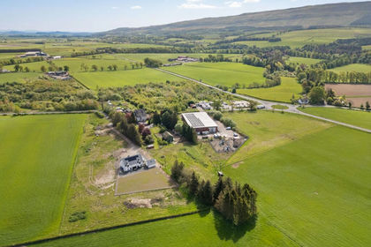
- Price
- Guide Price£395,000
Station House, Kippen, FK8, Stirling and Strathallan, Stirling FK8 Scotland
Added on 28/01/2026Building Plot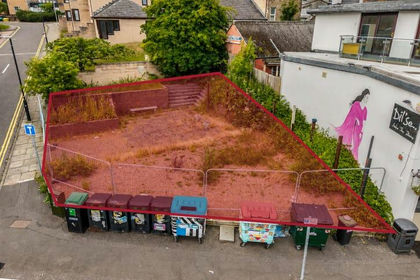
- Price
- Offers Over£425,000
Perth Road, Dundee, Dundee, DD2, Dundee Central, Dundee City DD1 Scotland
Added on 16/07/2026Development Land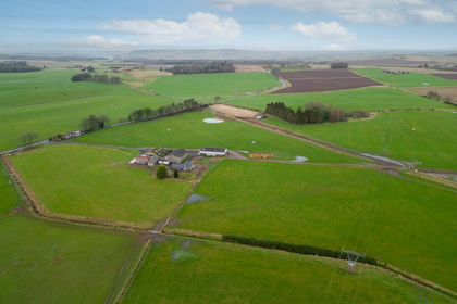
- Price
- Offers Over£598,000
- Size
- 10 acres
Kirkbuddo, Forfar, DD8, Arbroath and Broughty Ferry, Angus DD8 Scotland
Added on 29/01/2026Redevelopment Land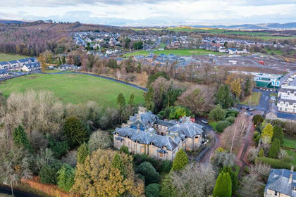
- Price
- Offers Over£770,000
Added on 29/01/2026Development Land
- Price
- Offers Over£425,000
- Size
- 1.48 acres
Residential Land, Thistle Avenue, Grangemouth, FK3, Alloa and Grangemouth, Falkirk FK3 Scotland
Added on 29/01/2026Development Land
- Price
- Offers Over£595,000
- Size
- 3.5 acres
Greenfield, Glenmavis, Airdrie, Airdrie and Shotts, North Lanarkshire ML6 Scotland
Added on 29/01/2026Commercial Land