
South Holmes Copse, Land on the south-east side of the Straight Mile, Ampfield, Romsey, Hampshire, SO51
- Land size
- 34 acres
Key Features
- TO BE SOLD BY TERRA FIRMA AUCTIONS 20TH NOVEMBER (UNLESS SOLD PRIOR)
- VIEWINGS TO BE ARRANGED BY APPOINTMENT PLEASE.
- OPEN TO A VARIETY OF USAGES AND FUTURE POTENTIAL SUBJECT TO ANY REQUIRED PERMISSIONS.
- AUCTION LEGAL PACK EMAILED BY REQUEST
- OVERSEAS BUYERS WELCOME
- DISUSED QUARRY ON SITE
- 34 ACRES OF PRIVATE LAND. NO PUBLIC ACCESS OR RIGHTS OF WAY.
- FREEHOLD
- VACANT POSSESSION
Description
OVERVIEW
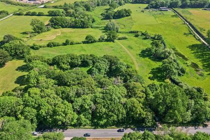
A rare and opportunity to acquire South Holmes Copse. 34-acres of private woodland. Set in an enviable position between the vibrant market town of Romsey and the historic cathedral city of Winchester. Freehold. Vacant possession.
KEY FEATURES
Prime Location: Situated on the desirable "Straight Mile" stretch of Ampfield.
34 Acres of Private Woodland.
Offering variety of usages and future opportunities, subject to any required permission.
Direct Vehicle Access and Right of Way from the "Straight Mile"
Freehold.
Vacant Possession.
HISTORICAL SIGNIFICANCE
History enthusiasts will appreciate the property's role in World War II history. In the lead-up to D-Day in June 1944, South Holmes Copse was transformed into Marshalling Area Camp C14. Capable of accommodating over 2,700 troops and 400 vehicles under its dense natural tree cover, the camp served as a final, secure briefing and transit zone for troops embarking from Southampton Docks. Today, the 34 acres offer a serene and private sanctuary embedded in a rich historical landscape.
LOCATION & AMENITIES
Romsey (approx. 3 miles): A bustling market town featuring the historic 10th-century Romsey Abbey, independent boutiques, cafes, and supermarkets.
Winchester (approx. 8 miles): Offering world-class dining, cultural landmarks, top-tier schooling, and direct mainline rail links to London Waterloo (approx. 60 mins).
Southampton & Transport: Fast connection via the A3090 and M27/M3 motorway network, with Southampton Airport within easy reach.
Leisure & Countryside: Ideally located for outdoor activities including walking, riding, and country pursuits across the Test Valley and nearby Sir Harold Hillier Gardens.
VIEWINGS & ENQUIRIES
Strictly by appointment with the Terra Firma Auctions
Local Authority: Test Valley Borough Council
Key Investment Features
• Immediate Exchange: This is an Unconditional Lot. Contracts exchange immediately at the fall of the hammer. The purchaser is legally bound to buy, and the vendor is legally bound to sell.
• Securing the Sale: The successful highest bidder is required to pay a 10% deposit upon the fall of the hammer.
• Pre-Auction Offers Welcome: The seller invites early offers prior to the auction date. Please note that all standard auction terms, deposits, and buyer fees still apply to pre-auction sales.
Requirements for Pre-Auction Offers
To submit an early offer, you must complete our online auction registration and provide:
1. Two forms of valid identification (ID).
2. Certified proof of funds/ability to purchase.
Legal & Additional Fees
• Buyer Fees: Potential auction fees may be payable by the highest bidder. Please inspect the Special Conditions within the official legal pack for a breakdown of these costs.
• Legal Pack: Available to download completely free of charge email . Any additional completion costs will be listed here.
• Taxes: Stamp Duty Land Tax (SDLT) and/or government taxes are not included in the legal pack. Buyers must conduct their own financial due diligence.
Important Information
• Disclaimer: All dimensions and measurements are approximate. These particulars are intended as a general guide only. Intending purchasers must not rely on them as statements of fact and are strongly advised to consult their own surveyor, solicitor, or independent professionals before committing to expenditure.
Map Location
Property details
- Tenure
- Ask Agent
- Council Tax Band
- Ask Agent
- Date Posted
- 2026-10-29
Market Value Analysis
Compared with 12 Woodland listings in South East England (25+ acres).
Utilities & Restrictions
Utilities
- Electricity
- Ask Agent
- Water
- Ask Agent
- Heating
- Ask Agent
- Broadband
- Ask Agent
- Sewerage
- Ask Agent
Rights & Restrictions
- Public Rights of Way
- Ask Agent
- Private Rights of Way
- Ask Agent
- Listed Property
- Ask Agent
- Restrictions
- Ask Agent
Listed status, conservation areas and planning constraints for this location are in the full report.
Property Features
- Accessibility
- Ask Agent
- Parking
- Ask Agent
- Garden
- Garden
Beyond the particulars: planning activity, flood history, heritage and ground risks, checked for this exact spot.
Connectivity
Broadband
Fastest speed available at this postcode
80 Mbps
Superfast · available to 94% of premises
Suitable for
- HD streaming
- Video calls
- Web & social
Mobile signal
Predicted 4G and 5G signal; indoor signal depends on building materials.
Ofcom Connected Nations postcode-level predictions. Speeds and signal are modelled, not measured, and vary between addresses and providers.
Signal is the easy part. Planning activity, flood history and protected designations here are in the full report.
Nearest Schools
Primary
- Braishfield Primary School1.3 milesNo Ofsted rating
- Ages
- 4 to 11
- Pupils
- 103
- Type
- Community school
- Cupernham Junior School1.3 milesNo Ofsted rating
- Ages
- 7 to 11
- Pupils
- 343
- Type
- Community school
- Cupernham Infant School1.3 milesOfsted: Good *
- Ages
- 4 to 7
- Pupils
- 246
- Type
- Community school
- Halterworth Primary School1.5 milesOfsted: Good
- Ages
- 4 to 11
- Pupils
- 437
- Type
- Academy converter
- Romsey Primary School & Nursery1.8 milesOfsted: Good
- Ages
- 3 to 11
- Pupils
- 301
- Type
- Community school
Secondary
- The Mountbatten School1.7 milesNo Ofsted rating
- Ages
- 11 to 16
- Pupils
- 1,474
- Type
- Academy converter
- The Romsey School2.4 milesNo Ofsted rating
- Ages
- 11 to 16
- Pupils
- 1,176
- Type
- Academy converter
- The Toynbee School3.8 milesNo Ofsted rating
- Ages
- 11 to 16
- Pupils
- 1,107
- Type
- Community school
- Thornden School3.9 milesOfsted report card · Jun 2026
- Ages
- 11 to 16
- Pupils
- 1,440
- Type
- Academy converter
- Crestwood Community School4.5 milesNo Ofsted rating
- Ages
- 11 to 16
- Pupils
- 1,478
- Type
- Community school
* Latest graded judgement covers quality of education only; no overall grade was issued under the 2024-25 inspection framework.
Distances are straight-line from the advertised location. Source: the national school registers (DfE, Welsh Government, Scottish Government) and Ofsted.
Schools are just the start: sold prices nearby, planning activity and any flood history are in the full report.
Amenities
Supermarket
GP surgery
Pharmacy
Hospital
Green space
Straight-line distances from the advertised location. Sources: NHS records, Geolytix supermarket locations, OS Open Greenspace and the national trails registers.
The area stacks up? Now check the location itself: planning nearby, protected designations and past flooding.
Getting Around
Nearest station
Nearest bus stop
Typical drive times
Straight-line distances from the advertised location; drive times are typical free-flow times over OpenStreetMap road data, so allow more at peak. Public transport locations from DfT NaPTAN.
Easy to reach matters. So do planning activity, flood history and ground risks: all in the full report.
Flood Risk
Environment Agency open data, checked around the advertised map pin for the listed acreage. Long-term risk counts flood defences; the planning map's flood zones do not. Provided by LandSale, not the listing agent, and not part of the agent's particulars. Risk varies across a holding, so verify before committing.
Rivers and the sea
Planning map: Flood Zone 1.
Surface water
Not at the pin: mapped about 80 metres away.
These bandings are the summary. Where this location sits on the flood maps, plus planning activity, heritage and ground risks, is in the full report.
Important notice: Information, maps and tags on this page are drawn from the advertising agent's marketing materials or generated automatically. LandSale has not verified them. Relying on these details is at your own risk, always carry out independent checks before committing to a purchase.
LandSale full disclaimer
Marketing information only - not formal particulars. The details on this website are provided for general guidance and do not constitute an offer or contract. Neither LandSale nor the advertising estate/land agent accepts responsibility for any inaccuracy.
1. Source of information
- Listing content: Core description, asking price, tenure, measurements, photographs and planning history originate from the marketing materials of the advertising estate or land agent. LandSale does not author this content and cannot guarantee its accuracy.
- Automated tags & categorisation: Property type, land-use class, acreage bands and similar labels may be applied by machine-learning models. They are intended as a helpful guide only and may not reflect the property's legal status or permitted use.
- Third-party & enriched data layers: Maps, boundary outlines, planning designations, soil reports, broadband coverage and other environmental or location-based insights are licensed from external suppliers. Such data are supplied “as is", may be incomplete or out of date and are subject to change without notice.
2. Verification required
Prospective purchasers must verify critical matters, including but not limited to planning permission, title boundaries, public rights of way, environmental constraints, acreage, services, access and VAT status, through their own inspections, specialist surveys, legal advisers and the selling agent before relying on the information or entering into any contract.
3. No warranty or liability
LandSale gives no warranty, express or implied, as to the accuracy, completeness or fitness for any particular purpose of the information displayed. LandSale shall not be liable for any loss, damage, cost or expense arising directly or indirectly from any use of or reliance on such information, save where liability may not be excluded by law.
4. Updates & feedback
If you believe any detail on this listing is inaccurate, please let us know. We will investigate and, where appropriate, update the listing or notify the agent.
© LandSale | Version 1.3 - August 2026
Similar properties for sale
- Price
- Guide Price£400,000
- Size
- 9.49 acres
Eden, Milford Road, Everton, Lymington, Hordle, Hampshire SO41 England
Added on 02/06/2026Equestrian property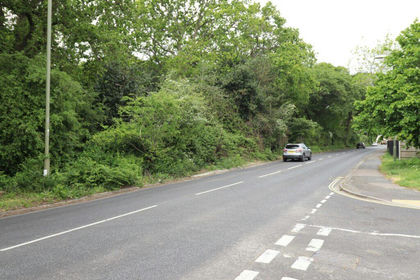
- Price
- £345,000
- Size
- 11 acres
Added on 04/08/2026Woodland
- Price
- Guide Price£350,000
- Size
- 46.67 acres
Land South of the A37, Charminster, Dorchester, Charminster, Dorset DT2 England
Added on 13/10/2026Agricultural Land
- Price
- Guide Price£475,000
- Size
- 48.54 acres
Added on 29/01/2026Arable Land
- Price
- Guide Price£275,000
- Size
- 9.14 acres
St Anne's, Bristol, BS4, Bristol East, Bristol, City of BS4 England
Added on 29/01/2026Woodland
- Price
- Guide Price£290,000
- Size
- 25.74 acres
Ashcott, Bridgwater, Somerset, Ashcott, Somerset TA7 England
Added on 29/01/2026Arable Land
- Price
- Guide Price£550,000
- Size
- 2.55 acres
Shirley Church Road, Croydon, CR0, Croydon East, Croydon CR0 England
Added on 04/06/2026Woodland
- Price
- Guide Price£500,000
- Size
- 2.55 acres
Shirley Church Road, Croydon, CR0, Croydon East, Croydon CR0 England
Added on 25/08/2026Woodland
- Price
- Guide Price£295,000
- Size
- 18.46 acres
LAND OFF EAST LANE Bedmond WD5, Abbots Langley, Hertfordshire WD5 England
Added on 07/10/2026Undeveloped Land
- Price
- Guide Price£295,000
- Size
- 39.89 acres
Boars Head Road, Crowborough, Crowborough, East Sussex TN3 England
Added on 21/10/2026Woodland