Thrandeston Road, Mellis, Eye
- Land size
- 2.35 acres
- Bedrooms
- 4
- Bathrooms
- 3
Key Features
- Exceptional Grade II listed period house in 2.35 acres
- Beautifully presented in glorious private setting beside Mellis Common
- Four bedrooms, studio annexe and stunning mature grounds
- Spacious kitchen/dining room with Rayburn and utility room
- Two large reception rooms with Inglenook fireplaces and wood-burning stoves
- Principal bedroom with dressing area and en-suite shower room
- Superb detached studio annexe with shower room and WC
- Mature gardens, orchard, woodland and productive vegetable plot
- Gated driveway, extensive parking and spacious double garage
- Convenient for Diss station and highly regarded local schools
Description
A truly exceptional Grade II Listed detached period house, occupying an idyllic and highly secluded position on the edge of Mellis Common. Set within approximately 2.35 acres (STS) of beautifully maintained grounds, The Glebe offers a rare combination of historic charm, practical family living and outstanding outdoor space, all whilst enjoying a peaceful setting at the heart of this highly regarded village community.
Constructed with an unusually wide timber-framed structure, the property provides accommodation that is notably more spacious than is often associated with period thatched homes. Over the years, the cottage has been sympathetically updated and meticulously maintained, preserving its wealth of original character whilst providing the comforts expected of modern living. Exposed timbers, impressive inglenook fireplaces, mullioned windows and traditional features are found throughout, creating a home of immense warmth and personality.
There is a large access hatch at the end of the hallway - a completely concealed opening panel that opens up into the walk in wardrobe. Particularly noteworthy is the magnificent kitchen/dining room, which forms the heart of the home and provides a superb space for both everyday family life and entertaining. Fitted with an extensive range of shaker-style cabinetry beneath granite work surfaces, the kitchen is complemented by a high-quality Rayburn, which serves as the property's principal cooking appliance whilst also providing domestic hot water and central heating. Beyond the kitchen, a generous utility room offers excellent additional storage and workspace.
The principal reception rooms are equally impressive, with both the drawing room and dining room centred around beautifully preserved inglenook fireplaces, each housing quality-certified wood-burning stoves. These wonderful rooms perfectly showcase the property's rich history whilst providing comfortable and inviting living spaces.
Arranged over the first floor are four well-proportioned bedrooms, including a spacious principal suite featuring a walk-in wardrobe and en-suite shower room. The remaining bedrooms are served by a well-appointed family bathroom.
A particularly valuable feature of the property is the detached studio annexe, complete with power, heating, shower room and WC. Currently utilised as a studio, it offers excellent flexibility for guest accommodation, home working, hobbies or multi generational living, subject to any necessary consents.
Outside - The grounds are a remarkable feature of the property and have been carefully developed and maintained over many years. Beautifully established formal gardens surround the house providing a haven for wildlife, complemented by extensive lawns, mature planting, a productive vegetable garden, former moat/pond, orchard and areas of established woodland. The orchard incorporates a variety of mature fruit trees, whilst the working vegetable plot is served by a substantial Rhino greenhouse and large workshop/shed.
Approached via a long gated gravel driveway, the property enjoys excellent privacy and secure parking for numerous vehicles. A spacious double garage provides further storage and benefits from partially boarded loft and eaves space. All in about 2.35 acres.
Location - Despite its wonderfully secluded setting, The Glebe remains highly accessible. The village offers a strong sense of community and lies within the catchment area for highly regarded schools in Mellis and Eye. Mainline rail services to London Liverpool Street can be accessed from Diss, approximately five miles away, with journey times of around 1 hour 25 minutes.
The property enjoys a unique relationship with its natural surroundings. Located adjacent to the historic Mellis Common, an area renowned for its wildlife, history and excellent network of countryside walks, the surrounding landscape is largely protected and managed by Suffolk Wildlife Trust. A picturesque pond positioned to the front of the property is also maintained by the Trust, adding further to the tranquil setting and attracting an abundance of wildlife throughout the year.
Services - Mains electricity, drainage and water. Heating - Oil boiler
Council Tax: Mid Suffolk Band: G
Broadband speed: Up to 1000 mbps available (Source Ofcom)
Mobile phone signal for: EE, Three, Vodafone and O2 (Source Ofcom)
Flood Risk: Very Low Risk (Source Gov.uk)
Map Location
Property details
- Tenure
- Freehold
- Council Tax Band
- G
- Date Posted
- 2026-10-26
Market Value Analysis
Compared with 1,122 Homes with Land listings in East Anglia (1+ acres).
Energy Performance Certificate
Energy Efficiency Rating
Based on UK Energy Performance Certificate standards (EU Directive 2002/91/EC)
Running costs are one side. Planning activity, flood history and ground risks for this location are in the full report.
Utilities & Restrictions
Utilities
- Electricity
- Mains
- Water
- Mains
- Heating
- Oil Heating
- Broadband
- Ask Agent
- Sewerage
- Mains
Rights & Restrictions
- Public Rights of Way
- Ask Agent
- Private Rights of Way
- Ask Agent
- Listed Property
- Ask Agent
- Restrictions
- Ask Agent
Listed status, conservation areas and planning constraints for this location are in the full report.
Property Features
- Accessibility
- Ask Agent
- Parking
- Garage
- Garden
- Garden
Beyond the particulars: planning activity, flood history, heritage and ground risks, checked for this exact spot.
Connectivity
Broadband
Fastest speed available at this postcode
1.8 Gbps
Gigabit full fibre · available to 78% of premises
Suitable for
- 4K streaming on every screen
- Full-time home working
- Online gaming & big downloads
Mobile signal
Predicted 4G and 5G signal; indoor signal depends on building materials.
Ofcom Connected Nations postcode-level predictions. Speeds and signal are modelled, not measured, and vary between addresses and providers.
Signal is the easy part. Planning activity, flood history and protected designations here are in the full report.
Nearest Schools
Primary
- Mellis Church of England Primary School252 metresNo Ofsted rating
- Ages
- 5 to 11
- Pupils
- 147
- Type
- Academy converter
- Faith
- Church of England
- Wortham Primary School2.1 milesOfsted: Outstanding *
- Ages
- 5 to 11
- Pupils
- 100
- Type
- Academy converter
- Palgrave Church of England Primary School2.5 milesOfsted: Good
- Ages
- 5 to 11
- Pupils
- 85
- Type
- Academy converter
- Faith
- Church of England
- St Peter and St Paul Church of England Primary School, Eye2.7 milesOfsted: Good
- Ages
- 3 to 11
- Pupils
- 200
- Type
- Academy converter
- Faith
- Church of England
- Gislingham Church of England Primary School2.8 milesOfsted: Good
- Ages
- 5 to 11
- Pupils
- 144
- Type
- Academy converter
- Faith
- Church of England
Secondary
- Hartismere School2 milesOfsted: Good *
- Ages
- 11 to 18
- Pupils
- 1,062
- Type
- Academy converter
- Diss High School3.6 milesNo Ofsted rating
- Ages
- 11 to 18
- Pupils
- 877
- Type
- Academy converter
- Stradbroke High School7.8 milesNo Ofsted rating
- Ages
- 11 to 16
- Pupils
- 353
- Type
- Academy converter
- Debenham High School8.1 milesOfsted: Good
- Ages
- 11 to 16
- Pupils
- 714
- Type
- Academy converter
- Faith
- Church of England
- Stowupland High School9.5 milesOfsted: Requires improvement
- Ages
- 11 to 18
- Pupils
- 846
- Type
- Academy converter
* Latest graded judgement covers quality of education only; no overall grade was issued under the 2024-25 inspection framework.
Distances are straight-line from the advertised location. Source: the national school registers (DfE, Welsh Government, Scottish Government) and Ofsted.
Schools are just the start: sold prices nearby, planning activity and any flood history are in the full report.
Amenities
Supermarket
GP surgery
Pharmacy
Hospital
Green space
Straight-line distances from the advertised location. Sources: NHS records, Geolytix supermarket locations, OS Open Greenspace and the national trails registers.
The area stacks up? Now check the location itself: planning nearby, protected designations and past flooding.
Getting Around
Nearest station
Nearest bus stop
Typical drive times
Straight-line distances from the advertised location; drive times are typical free-flow times over OpenStreetMap road data, so allow more at peak. Public transport locations from DfT NaPTAN.
Easy to reach matters. So do planning activity, flood history and ground risks: all in the full report.
Flood Risk
Environment Agency open data, checked around the advertised map pin for the listed acreage. Long-term risk counts flood defences; the planning map's flood zones do not. Provided by LandSale, not the listing agent, and not part of the agent's particulars. Risk varies across a holding, so verify before committing.
Rivers and the sea
Planning map: Flood Zone 1.
Surface water
Not at the pin: mapped about 10 metres away.
These bandings are the summary. Where this location sits on the flood maps, plus planning activity, heritage and ground risks, is in the full report.
Important notice: Information, maps and tags on this page are drawn from the advertising agent's marketing materials or generated automatically. LandSale has not verified them. Relying on these details is at your own risk, always carry out independent checks before committing to a purchase.
LandSale full disclaimer
Marketing information only - not formal particulars. The details on this website are provided for general guidance and do not constitute an offer or contract. Neither LandSale nor the advertising estate/land agent accepts responsibility for any inaccuracy.
1. Source of information
- Listing content: Core description, asking price, tenure, measurements, photographs and planning history originate from the marketing materials of the advertising estate or land agent. LandSale does not author this content and cannot guarantee its accuracy.
- Automated tags & categorisation: Property type, land-use class, acreage bands and similar labels may be applied by machine-learning models. They are intended as a helpful guide only and may not reflect the property's legal status or permitted use.
- Third-party & enriched data layers: Maps, boundary outlines, planning designations, soil reports, broadband coverage and other environmental or location-based insights are licensed from external suppliers. Such data are supplied “as is", may be incomplete or out of date and are subject to change without notice.
2. Verification required
Prospective purchasers must verify critical matters, including but not limited to planning permission, title boundaries, public rights of way, environmental constraints, acreage, services, access and VAT status, through their own inspections, specialist surveys, legal advisers and the selling agent before relying on the information or entering into any contract.
3. No warranty or liability
LandSale gives no warranty, express or implied, as to the accuracy, completeness or fitness for any particular purpose of the information displayed. LandSale shall not be liable for any loss, damage, cost or expense arising directly or indirectly from any use of or reliance on such information, save where liability may not be excluded by law.
4. Updates & feedback
If you believe any detail on this listing is inaccurate, please let us know. We will investigate and, where appropriate, update the listing or notify the agent.
© LandSale | Version 1.3 - August 2026
Similar properties for sale
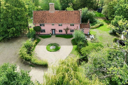
- Price
- Guide Price£795,000
- Size
- 1.71 acres
Added on 09/10/2026House with Land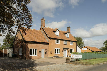
- Price
- Offers in Excess of£850,000
- Size
- 2 acres
Norwich Road, Brome, IP23, Brome and Oakley, Suffolk IP23 England
Added on 25/05/2026House with Land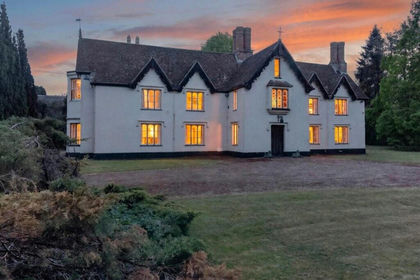
- Price
- Guide Price£900,000
- Size
- 2 acres
Added on 03/07/2026Country Home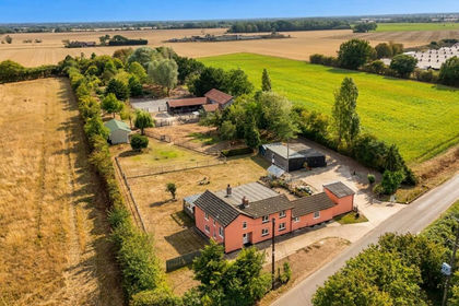
- Price
- Offers in Excess of£850,000
- Size
- 6 acres
New Delight Road, Rickinghall, Diss, Rickinghall Superior, Suffolk IP22 England
Added on 26/09/2026Smallholding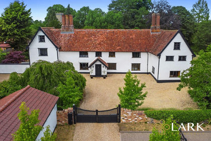
- Price
- Guide Price£1,000,000
- Size
- 1.59 acres
Added on 09/06/2026Historic House
- Price
- Guide Price£795,000
- Size
- 1.1 acres
Added on 19/08/2026Barn Conversion
- Price
- Guide Price£750,000
- Size
- 2.8 acres
Added on 31/07/2026House with Land
- Price
- Guide Price£700,000
- Size
- 1.3 acres
Added on 21/10/2026House with Land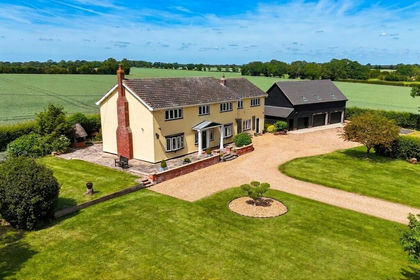
- Price
- Guide Price£850,000
- Size
- 1 acres
Added on 26/09/2026House with Land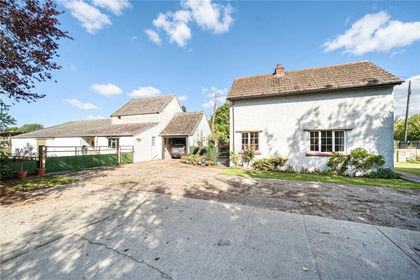
- Price
- Offers in Excess of£750,000
- Size
- 4.02 acres
Broad Road, Bacton, Stowmarket, Suffolk, IP14, Bacton, Suffolk IP14 England
Added on 29/01/2026House with Land