Hurdon Farmhouse and Buildings, Launceston, Cornwall, PL15
- Land size
- 6.75 acres
- Bedrooms
- 10
- Bathrooms
- 6
Description
A highly attractive, substantial Grade II listed 6/7 bedroom farmhouse, a range of traditional and modern barns, 3-bedroom cottage in need of renovation and orchard located in a private yet accessible setting.
Occupying a peaceful and sheltered position on the southern edge of Launceston surrounded by farmland, Hurdon Farm offers a rare balance of privacy and everyday convenience. Approached via a private, tree lined driveway, the property enjoys a quiet rural setting while remaining within walking distance of the town’s amenities.
In all extending to 6.75 acres.
HISTORY
The earliest record of Hurdon goes back to the reign of Edward 1 and connects it to the nearby, and then relatively newly constructed, Launceston Castle – when there is record in 1284 of Robert de Hurdyn being contracted to remain in and defend the castle at the expense of the lord along with his “Iron Helmet and Danish Hatchet”. By 1350 there is reference to The Manor of Hurdyn and it remained as a manor farm with fishing rights and a mill, steadily growing in acreage over the following centuries.
The farm has been carefully managed and tended by three generations of the same family for the past 130 years, including the relatively recent diversification into farmhouse Bed & Breakfast, a successful enterprise that had a dedicated following of visitors who returned year after year to spend summers at the idyllic working farm, including Mary Berry who visited regularly with her young family in the 1980s.
PROPERTY
The principal Grade II listed farmhouse extends to approximately 3,825 sq ft and offers six/seven bedrooms, any with ensuites or dressing rooms, two reception rooms, a substantial kitchen, utility and pantry area and a large cellar. The house, which was formerly utilised as high quality Bed & Breakfast accommodation, occupies an elevated and slightly offset position from the main yard, allowing it to enjoy open views across the surrounding land and countryside, with a strong sense of separation from the working areas of the property.
A further three-bedroom detached cottage sits close to the farmhouse within a courtyard and, while capable of independent use, naturally forms part of the main residential grouping. Whilst located close to the house, privacy is created by virtue of a wonderful small walled garden. In need of renovation, Hurdon Farm Cottage provides the perfect opportunity for multigenerational living, staff accommodation or a holiday let venture.
Surrounding the courtyard are an extensive range of traditional and modern farm buildings, including a large Grade II listed threshing barn, further listed stone courtyards and a series of portal framed structures, providing a high level of utility and flexibility for agricultural, equestrian storage or leisure purposes, subject to requirements and consents.
A historic orchard, extending to 2.30 acres that would benefit from reinvigoration, lies to the rear of the farmhouse and offers opportunity for further integration into the residential setting by selective removal of various pole barns and sheds.
Additional land is available by negotiation.
130.45 acres of farmland and woodland, along with two further cottages are being advertised and are available as part of a larger farm sale.
LOCATION
The property is situated on the southern edge of the historic market town of Launceston, enjoying a peaceful and private setting that combines the benefits of countryside living with exceptional convenience. Launceston offers a comprehensive range of everyday amenities, schooling and leisure facilities, as well as industrial estate services, while the nearby A30 provides excellent connectivity to all parts of Cornwall and Devon as well as the wider southwest.
The historic and popular market town of Tavistock, located at the foothills of Dartmoor with its range of independent shops and well-respected private schooling, is a 30 minute drive through the picturesque countryside of the Cornwall/Devon border. Truro, Exeter and Taunton are within easy reach, each with a further range of facilities, employment opportunities, transport links and schooling.
AMENITIES
Launceston provides a comprehensive range of amenities including independent shops, supermarkets, cafés, pubs and weekly markets, alongside Coronation Park, leisure facilities and Launceston Castle. The town is well-served by primary and secondary schools and benefits from excellent road connectivity via the nearby A30.
METHOD OF SALE
Offered for sale by private treaty.
TENURE & POSSESSION
The property is being offered for sale with vacant possession on completion.
LISTING STATUS
The farmhouse, threshing barn, former pigsties, cider barn and stables, garden gazebo and the gate piers at the front of the house are all Grade II listed, reflecting the historic and architectural significance of the core buildings and features within the estate.
It is understood that Historic England have incorrectly identified the listing location of the threshing barn, with the current listing plan marking an alternative barn; however, this is believed to be inaccurate and clarification is recommended.
SERVICES
Heating - Oil and Solid Fuel.
Water - Mains.
Electricity - Mains.
Drainage - Private, shared between the Farmhouse and Cottage.
Mobile Coverage - Most networks provide good signal outdoors, some networks provide good or variable indoors (see Ofcom website for more information).
Broadband - Standard and Ultrafast available (see Ofcom website for more information).
WAYLEAVES EASEMENTS & RIGHTS OF WAY
Appropriate easements will be granted to allow for the use and maintenance of water supply pipes serving properties if the farmhouse is sold separately to the land.
The seller will reserve a general right to lay, connect into and use services that run over the property, for the benefit any retained land.
SPORTING TIMBER & MINERAL RIGHTS
Sporting and Timber rights are included. Mineral rights are excluded.
EPC RATINGS
Hurdon Farmhouse - Band E.
Hurdon Farm Cottage - Band G.
LOCAL AUTHORITY
Cornwall Council
New County Hall
Treyew Road
Truro
TR1 3AY
VIEWINGS
Viewings strictly by appointment with the agent.
DIRECTIONS
From the A30, take the exit for the Pennygillam Industrial Estate. At the roundabout, take the exit onto Link Road and continue for approximately 1 mile. As the road turns left 90 degrees, turn right onto Hurdon Road, a small country road. The entrance to Hurdon Farm will then be found on the right-hand side after approximately half a mile.
WHAT3WORDS
///gymnasium.renders.nerves
Map Location
Property details
- Tenure
- Freehold
- Council Tax Band
- TBC
- Date Posted
- 2026-10-26
Market Value Analysis
Compared with 437 Homes with Land listings in South West England (5+ acres).
Utilities & Restrictions
Utilities
- Electricity
- Ask Agent
- Water
- Ask Agent
- Heating
- Ask Agent
- Broadband
- Ask Agent
- Sewerage
- Ask Agent
Rights & Restrictions
- Public Rights of Way
- Ask Agent
- Private Rights of Way
- Ask Agent
- Listed Property
- Ask Agent
- Restrictions
- Ask Agent
Listed status, conservation areas and planning constraints for this location are in the full report.
Property Features
- Accessibility
- Ask Agent
- Parking
- Parking Available
- Garden
- Garden
Beyond the particulars: planning activity, flood history, heritage and ground risks, checked for this exact spot.
Connectivity
Broadband
Fastest speed available at this postcode
1.8 Gbps
Gigabit full fibre
Suitable for
- 4K streaming on every screen
- Full-time home working
- Online gaming & big downloads
Fixed wireless access may also be an option here.
Mobile signal
Predicted 4G and 5G signal; indoor signal depends on building materials.
Ofcom Connected Nations postcode-level predictions. Speeds and signal are modelled, not measured, and vary between addresses and providers.
Signal is the easy part. Planning activity, flood history and protected designations here are in the full report.
Nearest Schools
Primary
- Launceston Primary School901 metresOfsted: Good
- Ages
- 4 to 11
- Pupils
- 101
- Type
- Free schools
- Windmill Hill Academy1 mileNo Ofsted rating
- Ages
- 2 to 11
- Pupils
- 162
- Type
- Academy converter
- St Catherine's CofE Primary School1 mileNo Ofsted rating
- Ages
- 2 to 11
- Pupils
- 222
- Type
- Academy converter
- Faith
- Church of England
- South Petherwin Community Primary School1.8 milesOfsted: Good
- Ages
- 4 to 11
- Pupils
- 114
- Type
- Foundation school
- St Stephens Community Academy1.9 milesOfsted: Good
- Ages
- 2 to 11
- Pupils
- 199
- Type
- Academy converter
Secondary
- Launceston College988 metresOfsted: Good
- Ages
- 11 to 18
- Pupils
- 1,205
- Type
- Academy converter
- Callington Community College8.1 milesOfsted: Good
- Ages
- 11 to 18
- Pupils
- 887
- Type
- Academy converter
- Tavistock College10 milesOfsted: Requires improvement
- Ages
- 11 to 18
- Pupils
- 1,200
- Type
- Academy converter
- Liskeard School and Community College12 milesNo Ofsted rating
- Ages
- 11 to 18
- Pupils
- 1,115
- Type
- Academy converter
- Holsworthy Community College13 milesNo Ofsted rating
- Ages
- 11 to 16
- Pupils
- 551
- Type
- Academy converter
Distances are straight-line from the advertised location. Source: the national school registers (DfE, Welsh Government, Scottish Government) and Ofsted.
Schools are just the start: sold prices nearby, planning activity and any flood history are in the full report.
Amenities
Supermarket
GP surgery
Pharmacy
Hospital
Green space
Straight-line distances from the advertised location. Sources: NHS records, Geolytix supermarket locations, OS Open Greenspace and the national trails registers.
The area stacks up? Now check the location itself: planning nearby, protected designations and past flooding.
Getting Around
Nearest station
Nearest bus stop
Typical drive times
Straight-line distances from the advertised location; drive times are typical free-flow times over OpenStreetMap road data, so allow more at peak. Public transport locations from DfT NaPTAN.
Easy to reach matters. So do planning activity, flood history and ground risks: all in the full report.
Flood Risk
Environment Agency open data, checked around the advertised map pin for the listed acreage. Long-term risk counts flood defences; the planning map's flood zones do not. Provided by LandSale, not the listing agent, and not part of the agent's particulars. Risk varies across a holding, so verify before committing.
Rivers and the sea
Planning map: Flood Zone 1.
Surface water
Not at the pin: mapped about 30 metres away.
These bandings are the summary. Where this location sits on the flood maps, plus planning activity, heritage and ground risks, is in the full report.
Important notice: Information, maps and tags on this page are drawn from the advertising agent's marketing materials or generated automatically. LandSale has not verified them. Relying on these details is at your own risk, always carry out independent checks before committing to a purchase.
LandSale full disclaimer
Marketing information only - not formal particulars. The details on this website are provided for general guidance and do not constitute an offer or contract. Neither LandSale nor the advertising estate/land agent accepts responsibility for any inaccuracy.
1. Source of information
- Listing content: Core description, asking price, tenure, measurements, photographs and planning history originate from the marketing materials of the advertising estate or land agent. LandSale does not author this content and cannot guarantee its accuracy.
- Automated tags & categorisation: Property type, land-use class, acreage bands and similar labels may be applied by machine-learning models. They are intended as a helpful guide only and may not reflect the property's legal status or permitted use.
- Third-party & enriched data layers: Maps, boundary outlines, planning designations, soil reports, broadband coverage and other environmental or location-based insights are licensed from external suppliers. Such data are supplied “as is", may be incomplete or out of date and are subject to change without notice.
2. Verification required
Prospective purchasers must verify critical matters, including but not limited to planning permission, title boundaries, public rights of way, environmental constraints, acreage, services, access and VAT status, through their own inspections, specialist surveys, legal advisers and the selling agent before relying on the information or entering into any contract.
3. No warranty or liability
LandSale gives no warranty, express or implied, as to the accuracy, completeness or fitness for any particular purpose of the information displayed. LandSale shall not be liable for any loss, damage, cost or expense arising directly or indirectly from any use of or reliance on such information, save where liability may not be excluded by law.
4. Updates & feedback
If you believe any detail on this listing is inaccurate, please let us know. We will investigate and, where appropriate, update the listing or notify the agent.
© LandSale | Version 1.3 - August 2026
Similar properties for sale
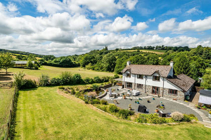
- Price
- Guide Price£850,000
- Size
- 3.52 acres
Newmills, Launceston, St. Thomas the Apostle Rural, Cornwall PL15 England
Added on 29/01/2026House with Land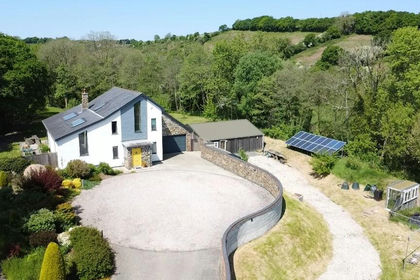
- Price
- £950,000
- Size
- 5.8 acres
Beals Mill, Callington, Cornwall, Stokeclimsland, Cornwall PL17 England
Added on 29/01/2026House with Land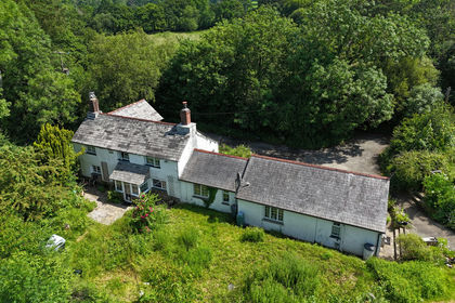
- Price
- Guide Price£1,000,000
- Size
- 33 acres
St Giles-on-the-Heath, Launceston, Devon, PL15, St. Giles on the Heath, Devon PL15 England
Added on 08/09/2026House with Land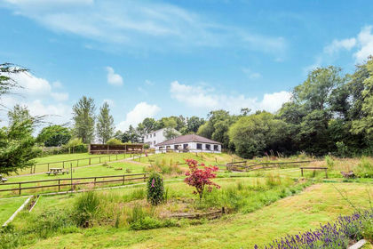
- Price
- Guide Price£999,000
- Size
- 19 acres
Otterside, North Petherwin, Launceston, North Petherwin, Cornwall PL15 England
Added on 29/01/2026House with Land
- Price
- Guide Price£925,000
- Size
- 7 acres
Added on 10/05/2026Smallholding
- Price
- Offers in Region of£825,000
- Size
- 3.2 acres
Added on 08/08/2026House with Land
- Price
- £1,100,000
- Size
- 8 acres
Added on 24/07/2026House with Land
- Price
- Guide Price£860,000
- Size
- 10.91 acres
Added on 01/05/2026Equestrian property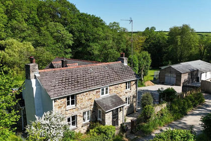
- Price
- Guide Price£975,000
- Size
- 6 acres
Golberdon, Callington, PL17, Linkinhorne, Cornwall PL17 England
Added on 30/05/2026House with Land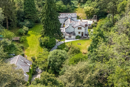
- Price
- £1,100,000
- Size
- 5.9 acres
Added on 25/08/2026House with Land