Plot 1, Ruthwell Station, Dumfries
- Land size
- 0.12 acres
Key Features
- Residential Building Plot in Ruthwell Station
- Offers in the Region of £75'000
- Approximately 0.125 Acres (506m²)
- Planning Permission in Principle Granted
- Permission for One Single-Storey Dwellinghouse
- Opportunity to Create a Bespoke Detached Bungalow
- Approximately 13.9m Frontage and 36.5m Depth
- Provision Required for Off-Road Parking and Turning
- Attractive Village Setting with Countryside Nearby
- Convenient Access to Dumfries and Annan
Description
An exciting opportunity to acquire a residential building plot extending to approximately 0.125 acres (506m²), situated within the charming rural village of Ruthwell Station, surrounded by the attractive Dumfries and Galloway countryside.
Enjoying a pleasant position between established residential properties, the plot benefits from planning permission in principle for the erection of a single-storey dwellinghouse, granted by Dumfries and Galloway Council on 8 January 2025 under reference 24/1599/PIP.
The relatively level, enclosed plot measures approximately 13.9 metres across its roadside frontage and extends some 36.5 metres in depth, offering the opportunity to create an individually designed home with private garden grounds and off-road parking.
The planning conditions provide for a single-storey dwelling with its principal elevation facing the B725, together with a minimum of two off-road parking spaces and a suitable vehicle turning area. The indicative site layout also makes provision for private drainage arrangements, with the final design, layout, access, landscaping and drainage subject to further planning approval.
For those dreaming of building their own home, the site presents an appealing opportunity to create a modern detached bungalow, designed around individual preferences and lifestyle requirements. The accompanying CGI illustrations demonstrate one potential design concept and are provided for inspiration only.
Ruthwell Station offers the appeal of peaceful village living, with established homes, surrounding greenery and the wider countryside providing an attractive setting. The location combines the enjoyment of a quieter rural lifestyle with access to Dumfries, Annan and the wider region.
Whether looking to create a comfortable home for retirement, downsize into a bespoke bungalow or simply enjoy the satisfaction of building a home from the ground up, this is an excellent opportunity to turn those aspirations into reality.
Planning Permission - Planning permission in principle was granted by Dumfries and Galloway Council on 8 January 2025 under application reference 24/1599/PIP for the erection of one dwellinghouse on land situated between Ashlyn and Braeside, Ruthwell Station.
The permission specifies that the proposed dwelling must be single-storey, with its principal elevation facing the B725 and the roof ridge running parallel to neighbouring properties in a south-west
orth-east direction.
The indicative layout, access and foul drainage arrangements are required to be generally in accordance with drawing L01 Revision B, received by the Council on 16 December 2024.
Further applications for approval of matters specified in conditions are required before development can commence. These include the final design, layout, external appearance, landscaping, access arrangements and drainage.
Under the terms of the permission, applications for approval of the specified matters must be submitted within three years of 8 January 2025, with development required to commence within five years of that date, subject to the applicable planning conditions.
Purchasers should satisfy themselves regarding the planning conditions and any subsequent approvals.
Plot Size & Boundaries - The building plot occupies a relatively level, rectangular area of land, enclosed by established boundary fencing and positioned between neighbouring residential properties.
Based on the dimensions indicated on the submitted planning drawing, the plot extends to approximately 506m² (0.125 acres), with a roadside frontage of approximately 13.935 metres, a rear boundary of 13.755 metres and side boundaries measuring approximately 36.730 metres and 36.472 metres.
The site offers the potential to accommodate a single-storey dwellinghouse, together with private garden grounds, off-road parking and associated landscaping, subject to the necessary detailed approvals.
All measurements are approximate and have been derived from the planning information supplied. The precise site area and legal boundaries have not been independently verified and should be confirmed against the title documentation or an appropriate survey.
Access, Parking & Drainage - The site benefits from direct roadside frontage onto the B725, with the proposed access arrangements subject to detailed approval.
The planning permission requires provision within the site for a minimum of two off-road parking spaces, together with a hardstanding turning area sufficient to allow vehicles to enter and leave the public road in forward gear.
The Council's accompanying roads guidance specifies that the first five metres of the access should be surfaced in bituminous material, or another agreed surface, with appropriate drainage arrangements and a maximum gradient of 8%.
The indicative planning layout identifies proposed private foul drainage arrangements towards the rear of the plot.
The final access design, parking layout, surface water management and foul drainage arrangements will require further consideration and approval as part of the development process.
Services & Utilities - Prospective purchasers should make their own enquiries regarding the availability, location, capacity and cost of connecting essential services, including electricity, mains water and telecommunications.
The availability of service connections at the site boundary has not been independently confirmed, and no representation is made that utilities are currently connected to the plot.
The planning documentation identifies indicative private foul drainage arrangements, although the final system, its suitability, installation requirements and any necessary consents remain subject to further assessment and approval.
Purchasers should obtain confirmation directly from the relevant utility providers and suitably qualified contractors regarding connection feasibility, installation costs and any associated requirements before committing to development.
Planning Documents & Further Information - The relevant planning application is registered with Dumfries and Galloway Council under reference 24/1599/PIP.
The planning documentation includes the decision notice dated 8 January 2025 and the indicative site/block plan, drawing L01 Revision B.
The documents provide information regarding the approved principle of development, indicative site arrangement, access, parking, drainage and conditions attached to the permission.
Copies of the available planning documents can be requested through Hunters Dumfries or accessed through the Council's planning application records.
Interested parties are strongly encouraged to review the complete planning documentation and seek appropriate professional advice regarding the proposed development before submitting an offer.
Proposed Development – Illustrative Designs - The accompanying CGI images, architectural illustrations, indicative floor plans and proposed bungalow designs have been created solely for marketing and illustrative purposes, to demonstrate one possible way in which the building plot could be developed.
These illustrations are entirely conceptual and do not represent an approved architectural design, a confirmed building specification or a guarantee of what can be constructed on the site.
Any dimensions, floor areas, room layouts, building heights, external finishes, positioning, parking arrangements and landscaping shown are indicative only. They have not been independently verified by a qualified architect, surveyor or planning professional and should not be relied upon when assessing the development potential of the plot.
Planning permission in principle has been granted for the erection of one single-storey dwellinghouse. However, the specific bungalow designs illustrated have not been submitted for or granted detailed planning approval.
Prospective purchasers will be responsible for appointing their own architect or suitably qualified designer to prepare appropriate plans and specifications, taking account of the site's dimensions, boundaries, planning conditions, access requirements, drainage arrangements and all relevant building regulations.
The final design, size, layout and positioning of any proposed dwelling will be subject to the necessary approvals from Dumfries and Galloway Council and other relevant authorities.
These images are intended to inspire prospective purchasers and demonstrate the potential opportunity to create a bespoke home. They should not be interpreted as confirmation that the particular designs, dimensions or layouts illustrated are achievable or permissible.
The sale relates to the vacant building plot only. No dwellinghouse, construction works or building package is included in the asking price.
Cgi Images & Artist's Impressions–Important - IMPORTANT NOTICE – AI-GENERATED CGI IMAGES AND ARTIST'S IMPRESSIONS
Certain images contained within these marketing particulars have been digitally generated using artificial intelligence (AI) and computer-generated imagery (CGI).
These illustrations are intended solely to demonstrate how a potential residential development might appear on the site.
NO DWELLINGHOUSE HAS BEEN CONSTRUCTED ON THE PLOT.
The bungalow designs, architectural features, building dimensions, positioning, driveway, vehicles, landscaping and garden arrangements depicted are conceptual and must not be interpreted as approved architectural drawings or an exact representation of what can be constructed.
Planning permission has been granted in principle for one single-storey dwellinghouse only. The specific bungalow designs illustrated have not received detailed planning approval.
Some illustrative images may also contain digitally generated or altered representations of surrounding land, buildings and landscape features. These should not be relied upon as accurate representations of the existing surroundings.
Purchasers must satisfy themselves regarding the suitability of the site for their intended development, including building dimensions, boundaries, access, drainage and all necessary planning and building consents.
Original site photographs and the relevant planning documentation should be consulted when assessing the property.
Map Location
Property details
- Tenure
- Freehold
- Council Tax Band
- Ask Agent
- Date Posted
- 2026-10-22
Utilities & Restrictions
Utilities
- Electricity
- Mains
- Water
- Mains
- Heating
- Oil Heating
- Broadband
- Fibre (FTTC)
- Sewerage
- Mains
Rights & Restrictions
- Public Rights of Way
- Ask Agent
- Private Rights of Way
- Ask Agent
- Listed Property
- Ask Agent
- Restrictions
- Yes
Listed status, conservation areas and planning constraints for this location are in the full report.
Property Features
- Accessibility
- Ask Agent
- Parking
- Driveway
- Garden
- Garden
Beyond the particulars: planning activity, flood history, heritage and ground risks, checked for this exact spot.
Connectivity
Broadband
Fastest speed available at this postcode
1.8 Gbps
Gigabit full fibre
Suitable for
- 4K streaming on every screen
- Full-time home working
- Online gaming & big downloads
Mobile signal
Predicted 4G and 5G signal; indoor signal depends on building materials.
Ofcom Connected Nations postcode-level predictions. Speeds and signal are modelled, not measured, and vary between addresses and providers.
Signal is the easy part. Planning activity, flood history and protected designations here are in the full report.
Nearest Schools
Primary
- Carrutherstown School1.5 miles
- Pupils
- 34
- Type
- Non-denominational
- Cummertrees School4.2 miles
- Pupils
- 33
- Type
- Non-denominational
- Collin School5.5 miles
- Pupils
- 41
- Type
- Non-denominational
- Hightae School5.6 miles
- Pupils
- 14
- Type
- Non-denominational
- St Mungo School5.7 miles
- Pupils
- 44
- Type
- Non-denominational
Secondary
- Annan Academy6.7 miles
- Pupils
- 971
- Type
- Non-denominational
- St Joseph's College7.9 miles
- Pupils
- 961
- Type
- Roman Catholic
- Dumfries High School8 miles
- Pupils
- 748
- Type
- Non-denominational
- Lockerbie Academy8.4 miles
- Pupils
- 767
- Type
- Non-denominational
- Dumfries Academy8.5 miles
- Pupils
- 608
- Type
- Non-denominational
Distances are straight-line from the advertised location. Source: the national school registers (DfE, Welsh Government, Scottish Government) and Ofsted.
Schools are just the start: planning activity, heritage and any flood history here are in the full report.
Amenities
Supermarket
GP surgery
Pharmacy
Walking trail
Straight-line distances from the advertised location. Sources: NHS records, Geolytix supermarket locations, OS Open Greenspace and the national trails registers.
The area stacks up? Now check the location itself: planning nearby, protected designations and past flooding.
Getting Around
Nearest station
Nearest bus stop
Typical drive times
Straight-line distances from the advertised location; drive times are typical free-flow times over OpenStreetMap road data, so allow more at peak. Public transport locations from DfT NaPTAN.
Easy to reach matters. So do planning activity, flood history and ground risks: all in the full report.
Flood Risk
SEPA open data, checked around the advertised map pin for the listed acreage. The map pin for this listing marks the postcode area rather than the exact location, so these readings describe the surrounding area. Provided by LandSale, not the listing agent, and not part of the agent's particulars. Risk varies across a holding, so verify before committing.
Rivers and the sea
Surface water
These bandings are the summary. Where this location sits on the flood maps, plus planning activity, heritage and ground risks, is in the full report.
Important notice: Information, maps and tags on this page are drawn from the advertising agent's marketing materials or generated automatically. LandSale has not verified them. Relying on these details is at your own risk, always carry out independent checks before committing to a purchase.
LandSale full disclaimer
Marketing information only - not formal particulars. The details on this website are provided for general guidance and do not constitute an offer or contract. Neither LandSale nor the advertising estate/land agent accepts responsibility for any inaccuracy.
1. Source of information
- Listing content: Core description, asking price, tenure, measurements, photographs and planning history originate from the marketing materials of the advertising estate or land agent. LandSale does not author this content and cannot guarantee its accuracy.
- Automated tags & categorisation: Property type, land-use class, acreage bands and similar labels may be applied by machine-learning models. They are intended as a helpful guide only and may not reflect the property's legal status or permitted use.
- Third-party & enriched data layers: Maps, boundary outlines, planning designations, soil reports, broadband coverage and other environmental or location-based insights are licensed from external suppliers. Such data are supplied “as is", may be incomplete or out of date and are subject to change without notice.
2. Verification required
Prospective purchasers must verify critical matters, including but not limited to planning permission, title boundaries, public rights of way, environmental constraints, acreage, services, access and VAT status, through their own inspections, specialist surveys, legal advisers and the selling agent before relying on the information or entering into any contract.
3. No warranty or liability
LandSale gives no warranty, express or implied, as to the accuracy, completeness or fitness for any particular purpose of the information displayed. LandSale shall not be liable for any loss, damage, cost or expense arising directly or indirectly from any use of or reliance on such information, save where liability may not be excluded by law.
4. Updates & feedback
If you believe any detail on this listing is inaccurate, please let us know. We will investigate and, where appropriate, update the listing or notify the agent.
© LandSale | Version 1.3 - August 2026
Similar properties for sale

- Price
- Offers in Excess of£100,000
Added on 29/01/2026Development Land- Price
- Offers in Excess of£100,000
Added on 28/01/2026Development Land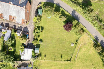
- Price
- Offers Over£75,000
Added on 22/06/2026Building Plot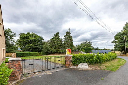
- Price
- Offers Over£80,000
Added on 29/01/2026Building Plot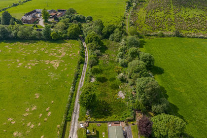
- Price
- Offers Over£100,000
- Size
- 0.34 acres
Development site at Gilnockie Station, Canonbie, DG14, Canonbie, Dumfries and Galloway DG14 Scotland
Added on 22/06/2026Building Plot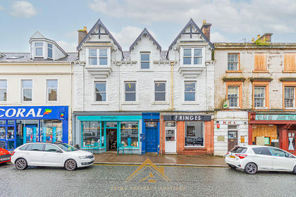
- Price
- Guide Price£65,000
189 King Street, Castle Douglas, DG7, Dumfries and Galloway, Dumfries and Galloway DG7 Scotland
Added on 04/06/2026Development Land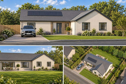 Added on 18/09/2026Self Build Plot
 Added on 23/07/2026Development Land
- Price
- Guide Price£80,000
Main Road, Great Clifton, CA14, Great Clifton, Cumberland CA14 England
Added on 12/10/2026Building Plot
- Price
- Guide Price£60,000
Added on 29/01/2026Building Plot