House Site, East Lynn of Inverourie, Avonside
- Land size
- 0.08 acres
Key Features
- A rare opportunity to acquire a picturesque, development plot
- Plot Size: Approx. 0.08 Acres / 313 m²
- Historic Structure: Retains impressive traditional stone walling and hearth/gable end footprint
- Ideal subject for restoration or custom build opportunity (subject to planning)
- Set in the heart of Avonside, within the Cairngorms National Park
- View the title boundary on ScotLIS, Scotland's Land Information Service
- Search for the Title number: BNF7073
- What3Words Location: ///suspends.scouts.bedroom
Description
A rare opportunity to acquire a picturesque development plot nestled amidst the dramatic landscapes of the Cairngorms National Park, this unique rural plot offers an extraordinary opportunity to create a bespoke highland home. Extending to approximately 0.08 acres (313 square metres), the site is steeped in character, featuring the, stone-built ruins of a historic cottage. Surrounded by native birch and rowan trees, the plot enjoys an exceptional degree of peace, privacy, and seclusion. Sweeping views stretch out across the picturesque Strathavon countryside, capturing the timeless beauty of the Scottish Highlands. Planning & Development Potential: There are currently no active or historical planning applications in place for the site, providing a clean slate for the incoming purchaser. This allows an exciting chance to work with the local planning authorities (Moray Council) to design a bespoke residential project that harmonises modern living with the rich heritage of the existing historic structure. Services & Access: There are currently no services directly on site, though mains electricity lines run adjacent to the plot. Prospective buyers will need to make their own arrangements for utility provisions: drainage will be to a private septic tank, water supply is anticipated to be via a private source such as a borehole, and purchasers will be responsible for all connection works and costs. Access to the property is provided via a shared access track.
Avonside - Avonside, nestled in the heart of Glenlivet, is a truly enchanting locale. This serene corner of Scotland is as renowned for its sweeping landscapes as it is for its sense of peace and tranquillity.
Glenlivet itself is a place of timeless beauty, home to rolling hills, verdant valleys, and picturesque waterways. Here, the river Avon gently weaves its way through the land, lending Avonside its distinctive name and character. This tranquil waterside setting affords Avonside an atmospheric charm that is both captivating and restorative.
The community in Avonside is as warm as the scenery is beautiful. It's a place where neighbours become friends, and the rhythm of life is dictated by the changing seasons and the abundant local wildlife. Whether you're watching the morning mists lift from the valley or admiring a spectacular sunset over the Cairngorms, life in Avonside is a constant celebration of nature's spectacle.
Transport Links - Located in the heart of the Highlands, Glenlivet offers a number of convenient travel options for local, regional, and international travel.
Road: Glenlivet is well-connected via road with the A95, a major route running through Speyside, providing easy access to both Aberdeen to the east and Inverness to the west.
Air: The nearest airports are Inverness Airport (approximately 56 miles away) and Aberdeen International Airport (approximately 59 miles away), offering both domestic and international flights.
Rail: The nearest railway station is Aviemore (around 31 miles away), which is on the main line from Inverness to London, providing connections to major cities across the UK.
Public Transport: There are regular bus services that run through Glenlivet connecting it to neighbouring towns and villages.
For schooling, Glenlivet falls within the Moray Council area, which provides a comprehensive education system. Primary education is available at Glenlivet Primary School, a small but well-regarded school located right in Glenlivet. For secondary education, pupils typically attend Speyside High School in Aberlour, which is approximately 14 miles away and offers a broad curriculum.
For further education, the University of the Highlands and Islands offers a range of courses and has several campuses throughout the Highlands, with the nearest being in Elgin and Inverness. Other universities in Aberdeen and Dundee are available.
Home Report - There is no requirement for a home report.
Land Registry Information - A preview of the title boundary can be found by visiting ScotLIS, Scotland's Land Information Service, and typing the Title number in the search box.
Please visit:
Search: BNF7073
Planning - There are currently no active or historical planning applications on record for the site. Prospective purchasers are advised to make their own inquiries with the local planning authority (Moray Council) regarding development possibilities and permissions.
Services - There are currently no active services on site. Mains electricity power lines run adjacent to the site servicing neighbouring properties. Water supply is anticipated to be via a private borehole, and drainage via a private septic tank system. Purchasers will be responsible for connection to the electrical supply, provision of a private water supply, and installation of a septic tank. Purchasers should satisfy themselves on service provision, suitability, and connection costs prior to purchase. Access to the plot is via a shared access track.
Entry - By mutual agreement.
Price - Offers in the region of £40,000 are invited
Viewings And Offers - Viewing is strictly by arrangement with and all offers to be submitted to:-Masson Cairns
Strathspey House
Grantown on Spey
Moray
PH26 3EQ
Tel:
Fax:
Email:
What Three Words Location - What Three Words Location: ///suspends.scouts.bedroom
Copyright Information - All media content produced by Masson Cairns Ltd, including but not limited to images, videos, graphics and written materials, remains the property of Masson Cairns Ltd and is protected by copyright law. No part of this content may be reproduced, distributed, modified or used in any form without the prior express written permission of Masson Cairns Ltd. Masson Cairns Ltd may use digital editing tools, including Photoshop and artificial intelligence tools, to enhance the quality, lighting, clarity or presentation of photographic and video material. Any such enhancements are intended to improve visual presentation only and are not intended to materially misrepresent the property, its condition, layout, features or surroundings. Unauthorised use of this material is strictly prohibited and may result in legal action.
Map Location
Property details
- Tenure
- Freehold
- Council Tax Band
- Ask Agent
- Date Posted
- 2026-10-21
Utilities & Restrictions
Utilities
- Electricity
- Ask Agent
- Water
- Ask Agent
- Heating
- Ask Agent
- Broadband
- Ask Agent
- Sewerage
- Ask Agent
Rights & Restrictions
- Public Rights of Way
- Ask Agent
- Private Rights of Way
- Ask Agent
- Listed Property
- Ask Agent
- Restrictions
- Ask Agent
Listed status, conservation areas and planning constraints for this location are in the full report.
Property Features
- Accessibility
- Ask Agent
- Parking
- Ask Agent
- Garden
- Ask Agent
Beyond the particulars: planning activity, flood history, heritage and ground risks, checked for this exact spot.
Connectivity
Broadband
Fastest speed available at this postcode
3 Mbps
Under 10 Mbps here
Suitable for
- Basic browsing & email
Mobile signal
Predicted 4G and 5G signal; indoor signal depends on building materials.
Ofcom Connected Nations postcode-level predictions. Speeds and signal are modelled, not measured, and vary between addresses and providers.
Signal is the easy part. Planning activity, flood history and protected designations here are in the full report.
Nearest Schools
Primary
- Glenlivet Primary School3.2 miles
- Pupils
- 16
- Type
- Non-denominational
- Tomintoul Primary School4.9 miles
- Pupils
- 29
- Type
- Non-denominational
- Grantown Primary School7.5 miles
- Pupils
- 203
- Type
- Non-denominational
- Abernethy Primary School9.6 miles
- Pupils
- 89
- Type
- Non-denominational
- Knockando Primary School10 miles
- Pupils
- 44
- Type
- Non-denominational
Secondary
- Grantown Grammar School7.3 miles
- Pupils
- 362
- Type
- Non-denominational
- Speyside High School12 miles
- Pupils
- 395
- Type
- Non-denominational
- Forres Academy21 miles
- Pupils
- 821
- Type
- Non-denominational
- Elgin High School22 miles
- Pupils
- 842
- Type
- Non-denominational
- Milne's High School23 miles
- Pupils
- 477
- Type
- Non-denominational
Distances are straight-line from the advertised location. Source: the national school registers (DfE, Welsh Government, Scottish Government) and Ofsted.
Schools are just the start: planning activity, heritage and any flood history here are in the full report.
Amenities
Supermarket
GP surgery
Pharmacy
Straight-line distances from the advertised location. Sources: NHS records, Geolytix supermarket locations, OS Open Greenspace and the national trails registers.
The area stacks up? Now check the location itself: planning nearby, protected designations and past flooding.
Getting Around
Nearest station
Nearest bus stop
Typical drive times
Straight-line distances from the advertised location; drive times are typical free-flow times over OpenStreetMap road data, so allow more at peak. Public transport locations from DfT NaPTAN.
Easy to reach matters. So do planning activity, flood history and ground risks: all in the full report.
Flood Risk
SEPA open data, checked around the advertised map pin for the listed acreage. Provided by LandSale, not the listing agent, and not part of the agent's particulars. Risk varies across a holding, so verify before committing.
Rivers and the sea
Not at the pin: mapped about 10 metres away.
Surface water
These bandings are the summary. Where this location sits on the flood maps, plus planning activity, heritage and ground risks, is in the full report.
Important notice: Information, maps and tags on this page are drawn from the advertising agent's marketing materials or generated automatically. LandSale has not verified them. Relying on these details is at your own risk, always carry out independent checks before committing to a purchase.
LandSale full disclaimer
Marketing information only - not formal particulars. The details on this website are provided for general guidance and do not constitute an offer or contract. Neither LandSale nor the advertising estate/land agent accepts responsibility for any inaccuracy.
1. Source of information
- Listing content: Core description, asking price, tenure, measurements, photographs and planning history originate from the marketing materials of the advertising estate or land agent. LandSale does not author this content and cannot guarantee its accuracy.
- Automated tags & categorisation: Property type, land-use class, acreage bands and similar labels may be applied by machine-learning models. They are intended as a helpful guide only and may not reflect the property's legal status or permitted use.
- Third-party & enriched data layers: Maps, boundary outlines, planning designations, soil reports, broadband coverage and other environmental or location-based insights are licensed from external suppliers. Such data are supplied “as is", may be incomplete or out of date and are subject to change without notice.
2. Verification required
Prospective purchasers must verify critical matters, including but not limited to planning permission, title boundaries, public rights of way, environmental constraints, acreage, services, access and VAT status, through their own inspections, specialist surveys, legal advisers and the selling agent before relying on the information or entering into any contract.
3. No warranty or liability
LandSale gives no warranty, express or implied, as to the accuracy, completeness or fitness for any particular purpose of the information displayed. LandSale shall not be liable for any loss, damage, cost or expense arising directly or indirectly from any use of or reliance on such information, save where liability may not be excluded by law.
4. Updates & feedback
If you believe any detail on this listing is inaccurate, please let us know. We will investigate and, where appropriate, update the listing or notify the agent.
© LandSale | Version 1.3 - August 2026
Listing agent
Masson Cairns, Grantown on SpeyStrathspey House, High Street, Grantown-On-Spey, PH26 3EQ
Contact Masson Cairns, Grantown on Spey
Strathspey House, High Street, Grantown-On-Spey, PH26 3EQ
View agent profileSimilar properties for sale
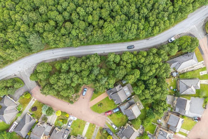
- Price
- Offers Over£60,000
- Size
- 0.5 acres
Added on 21/07/2026Building Plot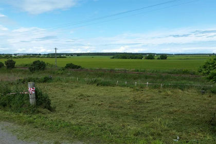
- Price
- Offers Over£60,000
East Grange Cottages, Kinloss, Forres, Moray West, Nairn and Strathspey, Moray IV36 Scotland
Added on 29/01/2026Building Plot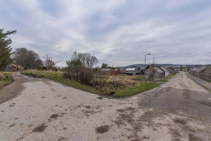
- Price
- Offers Over£49,995
Plot 1, Hill Street, Newmill, Keith, AB55, Aberdeenshire North and Moray East, Moray AB55 Scotland
Added on 29/01/2026Building Plot- Price
- Offers Over£59,995
Plot 3 Hill Street, Newmill, Keith, AB55, Aberdeenshire North and Moray East, Moray AB55 Scotland
Added on 29/01/2026Building Plot- Price
- Offers Over£49,995
Plot 2, Hill Street, Newmill, Keith, AB55, Aberdeenshire North and Moray East, Moray AB55 Scotland
Added on 28/01/2026Building Plot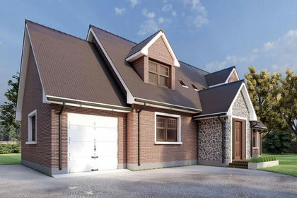
- Price
- Guide Price£35,000
- Size
- 1.2 acres
Added on 02/07/2026Building Plot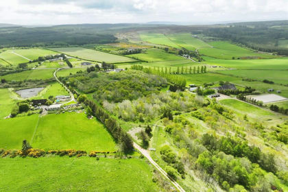
- Price
- Guide Price£25,000
- Size
- 0.4 acres
Added on 02/07/2026Building Plot
- Price
- Offers Over£60,000
39 High Street, Ardersier, Inverness, Moray West, Nairn and Strathspey, Highland IV2 Scotland
Added on 29/01/2026Self Build Plot
- Price
- Offers in Region of£50,000
Wallace Avenue, Buckie, Banffshire, Aberdeenshire North and Moray East, Moray AB56 Scotland
Added on 29/01/2026Building Plot
- Price
- Guide Price£53,000
Added on 03/07/2026Building Plot