Woodspring, Weston-Super-Mare
- Land size
- 4.31 acres
- Bedrooms
- 4
- Bathrooms
- 3
Key Features
- Approximately 4.31 acres of land
- Four-bedroom detached farmhouse
- Exceptional private coastal location
- Stunning countryside and estuary views
- Huge potential for smallholding or rural living
- Beautiful setting beside historic Woodspring Priory
Description
An exceptional and rarely available opportunity to acquire a charming 4-bedroom detached farmhouse, believed to date from the 1970s, set within approximately 4.31 acres of land in a truly remarkable private coastal location adjacent to the historic Woodspring Priory and the National Trust coastline at Sand Point.
Rich in character and surrounded by the unspoilt beauty of the North Somerset countryside, this unique smallholding enjoys far-reaching rural vistas and captivating coastal views across the surrounding landscape and estuary. With historical associations dating back to the 13th century and the existing abbey, the setting offers a wonderful blend of heritage, tranquillity and natural beauty.
The property presents an exciting opportunity for those seeking a more self-sufficient lifestyle, with the potential to create an idyllic forever family home or embrace the growing appeal of off-grid living. The accompanying pastureland provides excellent scope for a variety of smallholding pursuits, whether keeping sheep, goats or horses, cultivating a more sustainable way of life, or exploring the possibility of a future glamping enterprise, subject to the necessary planning permissions and consents.
The grounds are already well equipped for a rural lifestyle, benefiting from existing stabling, a shepherd's hut, raised vegetable beds and a greenhouse, offering an excellent foundation for those wishing to develop a more self-sufficient way of living. Of particular note is the shepherd's hut, which enjoys stunning elevated views across the estuary and presents further potential for alternative use or guest accommodation, subject to the relevant permissions.
The farmhouse itself offers a wealth of charm and traditional character, with appealing features including an original open fireplace, stone window surrounds and exposed timber flooring. These timeless details provide a wonderful starting point for a purchaser looking to sympathetically enhance and personalise the accommodation, creating a distinctive family residence that complements its extraordinary surroundings.
Combining space, privacy, historical interest and an enviable coastal setting, this is a family home with genuine individuality and considerable scope for the future. Whether your vision is to establish a lifestyle smallholding, create a sustainable rural retreat or transform the farmhouse into a truly special family home, opportunities of this nature and in such a location are seldom available.
Early viewing is highly recommended to fully appreciate the setting, outlook and exciting possibilities this unique coastal smallholding has to offer.
Disclaimer
haart Estate Agents also offer a professional, ARLA accredited Lettings and Management Service. If you are considering renting your property in order to purchase, are looking at buy to let or would like a free review of your current portfolio then please call the Lettings Branch Manager on the number shown above.
haart Estate Agents is the seller's agent for this property. Your conveyancer is legally responsible for ensuring any purchase agreement fully protects your position. We make detailed enquiries of the seller to ensure the information provided is as accurate as possible. Please inform us if you become aware of any information being inaccurate.
Map Location
Property details
- Tenure
- Freehold
- Council Tax Band
- Ask Agent
- Date Posted
- 2026-10-21
Market Value Analysis
Compared with 152 Farms & Smallholdings listings in South West England (1+ acres).
Energy Performance Certificate
Energy Efficiency Rating
Based on UK Energy Performance Certificate standards (EU Directive 2002/91/EC)
Running costs are one side. Planning activity, flood history and ground risks for this location are in the full report.
Utilities & Restrictions
Utilities
- Electricity
- Ask Agent
- Water
- Ask Agent
- Heating
- Ask Agent
- Broadband
- Ask Agent
- Sewerage
- Ask Agent
Rights & Restrictions
- Public Rights of Way
- Ask Agent
- Private Rights of Way
- Ask Agent
- Listed Property
- Ask Agent
- Restrictions
- Ask Agent
Listed status, conservation areas and planning constraints for this location are in the full report.
Property Features
- Accessibility
- Ask Agent
- Parking
- Ask Agent
- Garden
- Garden
Beyond the particulars: planning activity, flood history, heritage and ground risks, checked for this exact spot.
Connectivity
Broadband
Fastest speed available at this postcode
4 Mbps
Under 10 Mbps here
Suitable for
- Basic browsing & email
Mobile signal
Predicted 4G and 5G signal; indoor signal depends on building materials.
Ofcom Connected Nations postcode-level predictions. Speeds and signal are modelled, not measured, and vary between addresses and providers.
Signal is the easy part. Planning activity, flood history and protected designations here are in the full report.
Nearest Schools
Primary
- Kewstoke Primary School1.8 milesOfsted: Good *
- Ages
- 3 to 11
- Pupils
- 51
- Type
- Academy sponsor led
- Castle Batch Primary School1.8 milesOfsted: Good
- Ages
- 2 to 11
- Pupils
- 484
- Type
- Academy converter
- St Mark's Ecumenical Anglican/Methodist Primary School1.9 milesNo Ofsted rating
- Ages
- 4 to 11
- Pupils
- 396
- Type
- Academy converter
- Faith
- Church of England/Methodist
- Worlebury St Pauls Church School2 milesOfsted report card · Jun 2026
- Ages
- 4 to 11
- Pupils
- 175
- Type
- Academy converter
- Faith
- Church of England
- Worle Village Primary School2.1 milesOfsted report card · Jun 2026
- Ages
- 5 to 11
- Pupils
- 158
- Type
- Academy converter
Secondary
- Priory Community School2.4 milesOfsted: Good
- Ages
- 11 to 16
- Pupils
- 1,486
- Type
- Academy converter
- Worle Community School2.6 milesOfsted report card · Jun 2026
- Ages
- 11 to 16
- Pupils
- 1,244
- Type
- Academy sponsor led
- Winterstoke Hundred Academy3.4 milesOfsted: Good
- Ages
- 11 to 19
- Pupils
- 870
- Type
- Free schools
- Hans Price Academy3.7 milesNo Ofsted rating
- Ages
- 11 to 16
- Pupils
- 1,046
- Type
- Academy sponsor led
- Broadoak Academy4.5 milesOfsted: Good
- Ages
- 11 to 16
- Pupils
- 792
- Type
- Academy converter
* Latest graded judgement covers quality of education only; no overall grade was issued under the 2024-25 inspection framework.
Distances are straight-line from the advertised location. Source: the national school registers (DfE, Welsh Government, Scottish Government) and Ofsted.
Schools are just the start: sold prices nearby, planning activity and any flood history are in the full report.
Amenities
Supermarket
GP surgery
Pharmacy
Hospital
Straight-line distances from the advertised location. Sources: NHS records, Geolytix supermarket locations, OS Open Greenspace and the national trails registers.
The area stacks up? Now check the location itself: planning nearby, protected designations and past flooding.
Getting Around
Nearest station
Nearest bus stop
Typical drive times
Straight-line distances from the advertised location; drive times are typical free-flow times over OpenStreetMap road data, so allow more at peak. Public transport locations from DfT NaPTAN.
Easy to reach matters. So do planning activity, flood history and ground risks: all in the full report.
Flood Risk
Environment Agency open data, checked around the advertised map pin for the listed acreage. Long-term risk counts flood defences; the planning map's flood zones do not. Provided by LandSale, not the listing agent, and not part of the agent's particulars. Risk varies across a holding, so verify before committing.
Rivers and the sea
Not at the pin: mapped about 40 metres away.
Planning map: Flood Zone 3, about 30 metres away.
Surface water
Not at the pin: mapped about 10 metres away.
These bandings are the summary. Where this location sits on the flood maps, plus planning activity, heritage and ground risks, is in the full report.
Important notice: Information, maps and tags on this page are drawn from the advertising agent's marketing materials or generated automatically. LandSale has not verified them. Relying on these details is at your own risk, always carry out independent checks before committing to a purchase.
LandSale full disclaimer
Marketing information only - not formal particulars. The details on this website are provided for general guidance and do not constitute an offer or contract. Neither LandSale nor the advertising estate/land agent accepts responsibility for any inaccuracy.
1. Source of information
- Listing content: Core description, asking price, tenure, measurements, photographs and planning history originate from the marketing materials of the advertising estate or land agent. LandSale does not author this content and cannot guarantee its accuracy.
- Automated tags & categorisation: Property type, land-use class, acreage bands and similar labels may be applied by machine-learning models. They are intended as a helpful guide only and may not reflect the property's legal status or permitted use.
- Third-party & enriched data layers: Maps, boundary outlines, planning designations, soil reports, broadband coverage and other environmental or location-based insights are licensed from external suppliers. Such data are supplied “as is", may be incomplete or out of date and are subject to change without notice.
2. Verification required
Prospective purchasers must verify critical matters, including but not limited to planning permission, title boundaries, public rights of way, environmental constraints, acreage, services, access and VAT status, through their own inspections, specialist surveys, legal advisers and the selling agent before relying on the information or entering into any contract.
3. No warranty or liability
LandSale gives no warranty, express or implied, as to the accuracy, completeness or fitness for any particular purpose of the information displayed. LandSale shall not be liable for any loss, damage, cost or expense arising directly or indirectly from any use of or reliance on such information, save where liability may not be excluded by law.
4. Updates & feedback
If you believe any detail on this listing is inaccurate, please let us know. We will investigate and, where appropriate, update the listing or notify the agent.
© LandSale | Version 1.3 - August 2026
Similar properties for sale
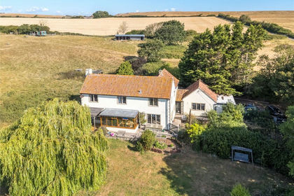
- Price
- Guide Price£1,100,000
- Size
- 4.31 acres
Kewstoke, Weston-Super-Mare, North Somerset, BS22, Kewstoke, North Somerset BS22 England
Added on 14/08/2026Smallholding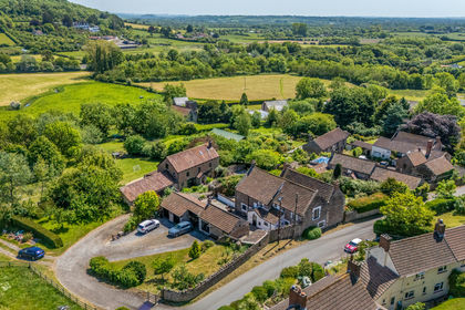
- Price
- £875,000
- Size
- 4.8 acres
Christon Road, Loxton, Axbridge, BS26, Axbridge, North Somerset BS26 England
Added on 29/01/2026Smallholding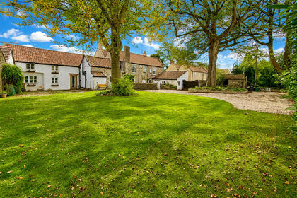
- Price
- Guide Price£1,100,000
- Size
- 5 acres
Added on 20/10/2026Country Home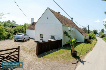
- Price
- £799,950
- Size
- 8 acres
Added on 15/10/2026Smallholding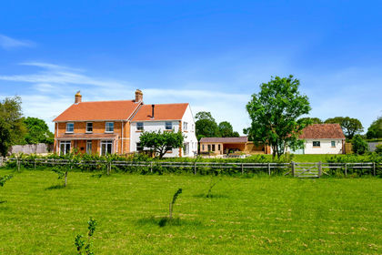
- Price
- Guide Price£1,150,000
- Size
- 6 acres
Shapwick Road, Westhay, Near Wedmore, Glastonbury, Somerset BA6 England
Added on 21/05/2026House with Land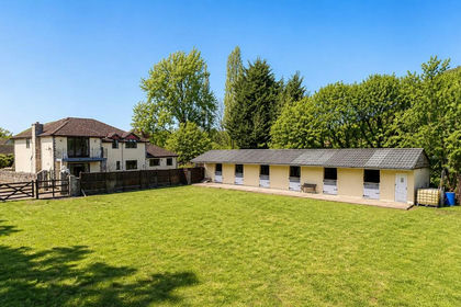
- Price
- £1,100,000
- Size
- 6 acres
The Folly, Manor Farm, Crick, Monmouthshire, Caerwent, Monmouthshire NP26 Wales
Added on 18/07/2026Equestrian property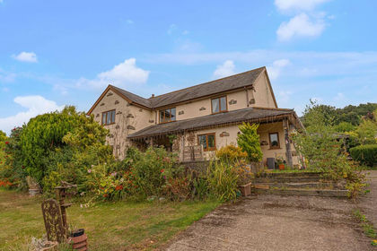
- Price
- £1,000,000
- Size
- 29 acres
Llantrisant, Usk, NP15, Llantrisant Fawr, Monmouthshire NP15 Wales
Added on 29/01/2026Small Farm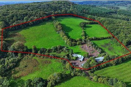
- Price
- Offers in Region of£750,000
- Size
- 20.54 acres
Llanvair Discoed, Chepstow, Monmouthshire, NP16, Caerwent, Monmouthshire NP16 Wales
Added on 06/10/2026Smallholding
- Price
- Offers in Region of£750,000
- Size
- 5 acres
Added on 17/08/2026Smallholding
- Price
- Guide Price£1,100,000
- Size
- 20.7 acres
Added on 14/10/2026Smallholding