Woodlands Vale, Ryde, Isle Of Wight, PO33
- Land size
- 19 acres
- Bedrooms
- 9
- Bathrooms
- 6
Key Features
- Historical Country House
- Carriage Porch
- Five Reception Rooms
- Nine Bedrooms
- Six Bathrooms
- Billiard Room
- Kitchen / Breakfast Room
- Utility Room
- Three Guest Cloakrooms
- Additional Wing with Self Contained Flat
Description
Woodlands Vale is situated in a superb elevated rural position between Seaview and Ryde with grounds extending within metres of the beach, the property benefits from wonderful views over listed Parkland, to the Solent and Hampshire coast beyond.
Woodlands Vale is an impressive, imposing and architecturally significant Grade II* listed country home designed by the renowned Victorian architect Teulon in the French Renaissance style for Crimean War veteran Lord Calthorpe in 1870.
The house retains virtually all its original Victorian character and features including a Minton tiled floor, plaster ceilings, architrave and cornicing and some stunning stained-glass windows.
All of the main reception rooms have breathtaking views out to sea, working original fireplaces, wooden shutters which all open out into gardens through French doors - ideal for summer entertaining.
The original conservatory with double height ceiling and cupola was converted into a billiard room in 1894.
Much of the house has been subject to modernisation in recent years, whilst part of the west wing forms self-contained staff accommodation and an office. Whilst in sound condition externally, internally some rooms are unrestored but could provide further living accommodation or office space.
In addition within the last 3 years, much of the house has been re-roofed and new twin gas fired boilers installed for efficient central heating.
The picturesque, coastal village of Seaview is 1 mile away with a Yacht Club, range of shops, restaurants and hotel. Nearby Ryde, (which can also be accessed by a beachside path overlooking Appley Beach) has a wide range of shops and restaurants.
Much of the surrounding countryside is designated as an Area of Outstanding Natural Beauty with excellent walking and riding available on the network of country and coastal paths providing
some dramatic scenery ranging from beaches and coves to rolling downland.
In addition to sailing, a range of other water sports are enjoyed on
the waters of the Solent with the beach opposite providing excellent conditions for Kitesurfing.
Formal gardens include a wealth of mature specimen trees, large terraces from which there are fine coastal views, a Japanese Terrace, a croquet lawn and two summer houses. There is also a heated swimming pool installed in 2020. In all the grounds provide a stunning and beautifully private setting.
Beyond the haha is about 19 acres of parkland extending down to Springvale Road, which runs along the sea front from which there is direct beach access. There is also a private path that runs along the western side of the land providing access to within 100m of the beach. The garden and parkland is part of a Grade II Listed Park and Garden.
There were historic planning consents for holiday units within the grounds dating from the 1950s and 1960s. The remains of around 3500 sq ft of chalets still exist.
Services include, mains water, electricity, drainage and gas fired central heating.
Part of the driveway to Woodlands Vale is shared with the neighbouring properties. Woodlands Vale owns the drive, with the neighbouring properties having a right of access.
The post code is PO33 1PR
All viewings will be strictly by prior arrangement.
Please contact Donovan Kelly on Email:
Location:
The Isle of Wight is 26 miles by 13 miles and a short sea crossing from the mainland, the Island has a unique atmosphere boasting many attributes, not least of which is
its slower pace of life and its own microclimate.
It enjoys unspoilt villages and fine seaside resorts with 57 miles of impressive & varied coastline. With safe sandy beaches, it is a place for sailing, windsurfing and swimming, with something for everyone.
There are many ways of crossing The Solent to the Island. If travelling by car there is a choice of three routes all with frequent services: including, Portsmouth to Fishbourne (45 minutes). If travelling on foot there is a fast and frequent catamaran service from Portsmouth to Ryde (15 minutes) and a similar service
from Southampton to Cowes (23 minutes), both connecting with regular mainline train services to London Waterloo. There is also a hovercraft from Southsea to Ryde, taking 10 minutes.
To the west of Bembridge there is a small private aerodrome and Southampton Airport is also within easy reach, on the mainland.
Woodland Vale benefits from a clear approach for helicopter landing and Bembridge airport is about 15 minutes drive for light/medium single and twin engine aircraft.
The Island is an international sailing mecca with many events throughout the season, the most famous is Cowes Week during August, Cowes is approximately a 25 minute drive away. In addition, there are many premier yacht and sailing clubs.
Map Location
Property details
- Tenure
- Freehold
- Council Tax Band
- TBC
- Date Posted
- 2026-10-16
Market Value Analysis
Compared with 172 Homes with Land listings in South East England (10+ acres).
Utilities & Restrictions
Utilities
- Electricity
- Ask Agent
- Water
- Ask Agent
- Heating
- Ask Agent
- Broadband
- Ask Agent
- Sewerage
- Ask Agent
Rights & Restrictions
- Public Rights of Way
- Ask Agent
- Private Rights of Way
- Ask Agent
- Listed Property
- Ask Agent
- Restrictions
- Ask Agent
Listed status, conservation areas and planning constraints for this location are in the full report.
Property Features
- Accessibility
- Ask Agent
- Parking
- Parking Available
- Garden
- Garden
Beyond the particulars: planning activity, flood history, heritage and ground risks, checked for this exact spot.
Connectivity
Broadband
Fastest speed available at this postcode
42 Mbps
Gigabit full fibre · available to 50% of premises
Suitable for
- HD streaming
- Video calls
- Web & social
Mobile signal
Predicted 4G and 5G signal; indoor signal depends on building materials.
Ofcom Connected Nations postcode-level predictions. Speeds and signal are modelled, not measured, and vary between addresses and providers.
Signal is the easy part. Planning activity, flood history and protected designations here are in the full report.
Nearest Schools
Primary
- Oakfield Church of England Aided Primary School, Ryde0.6 milesOfsted: Requires improvement
- Ages
- 2 to 11
- Pupils
- 185
- Type
- Voluntary aided school
- Faith
- Church of England
- St Mary's Catholic Primary School0.8 milesOfsted: Good *
- Ages
- 2 to 11
- Pupils
- 182
- Type
- Voluntary aided school
- Faith
- Roman Catholic
- Nettlestone Primary School0.8 milesOfsted: Good
- Ages
- 3 to 11
- Pupils
- 215
- Type
- Community school
- Dover Park Primary School1.2 milesNo Ofsted rating
- Ages
- 4 to 11
- Pupils
- 204
- Type
- Community school
- Haylands Primary School1.5 milesNo Ofsted rating
- Ages
- 2 to 11
- Pupils
- 357
- Type
- Community school
Secondary
- Lift Ryde1.8 milesOfsted: Good
- Ages
- 11 to 18
- Pupils
- 1,461
- Type
- Academy sponsor led
- The Bay Church of England School4.5 milesOfsted: Good
- Ages
- 4 to 16
- Pupils
- 1,232
- Type
- Voluntary controlled school
- Faith
- Church of England
- King's Academy Bay House4.8 milesOfsted: Good *
- Ages
- 11 to 18
- Pupils
- 2,036
- Type
- Academy converter
- Ark Charter Academy5.6 milesOfsted: Good *
- Ages
- 11 to 16
- Pupils
- 883
- Type
- Academy sponsor led
- Faith
- Church of England
- Priory School5.7 milesOfsted: Good
- Ages
- 11 to 16
- Pupils
- 1,278
- Type
- Academy sponsor led
* Latest graded judgement covers quality of education only; no overall grade was issued under the 2024-25 inspection framework.
Distances are straight-line from the advertised location. Source: the national school registers (DfE, Welsh Government, Scottish Government) and Ofsted.
Schools are just the start: sold prices nearby, planning activity and any flood history are in the full report.
Amenities
Supermarket
GP surgery
Pharmacy
Hospital
Green space
Straight-line distances from the advertised location. Sources: NHS records, Geolytix supermarket locations, OS Open Greenspace and the national trails registers.
The area stacks up? Now check the location itself: planning nearby, protected designations and past flooding.
Getting Around
Nearest station
Nearest bus stop
Typical drive times
Straight-line distances from the advertised location; drive times are typical free-flow times over OpenStreetMap road data, so allow more at peak. Public transport locations from DfT NaPTAN.
Easy to reach matters. So do planning activity, flood history and ground risks: all in the full report.
Flood Risk
Environment Agency open data, checked around the advertised map pin for the listed acreage. Long-term risk counts flood defences; the planning map's flood zones do not. Provided by LandSale, not the listing agent, and not part of the agent's particulars. Risk varies across a holding, so verify before committing.
Rivers and the sea
Not at the pin: mapped about 100 metres away.
Planning map: Flood Zone 3, about 90 metres away.
Surface water
Not at the pin: mapped about 30 metres away.
These bandings are the summary. Where this location sits on the flood maps, plus planning activity, heritage and ground risks, is in the full report.
Important notice: Information, maps and tags on this page are drawn from the advertising agent's marketing materials or generated automatically. LandSale has not verified them. Relying on these details is at your own risk, always carry out independent checks before committing to a purchase.
LandSale full disclaimer
Marketing information only - not formal particulars. The details on this website are provided for general guidance and do not constitute an offer or contract. Neither LandSale nor the advertising estate/land agent accepts responsibility for any inaccuracy.
1. Source of information
- Listing content: Core description, asking price, tenure, measurements, photographs and planning history originate from the marketing materials of the advertising estate or land agent. LandSale does not author this content and cannot guarantee its accuracy.
- Automated tags & categorisation: Property type, land-use class, acreage bands and similar labels may be applied by machine-learning models. They are intended as a helpful guide only and may not reflect the property's legal status or permitted use.
- Third-party & enriched data layers: Maps, boundary outlines, planning designations, soil reports, broadband coverage and other environmental or location-based insights are licensed from external suppliers. Such data are supplied “as is", may be incomplete or out of date and are subject to change without notice.
2. Verification required
Prospective purchasers must verify critical matters, including but not limited to planning permission, title boundaries, public rights of way, environmental constraints, acreage, services, access and VAT status, through their own inspections, specialist surveys, legal advisers and the selling agent before relying on the information or entering into any contract.
3. No warranty or liability
LandSale gives no warranty, express or implied, as to the accuracy, completeness or fitness for any particular purpose of the information displayed. LandSale shall not be liable for any loss, damage, cost or expense arising directly or indirectly from any use of or reliance on such information, save where liability may not be excluded by law.
4. Updates & feedback
If you believe any detail on this listing is inaccurate, please let us know. We will investigate and, where appropriate, update the listing or notify the agent.
© LandSale | Version 1.3 - August 2026
Listing agent
Winkworth, Barnes
2 Barnes High Street, London, SW13 9LB
Similar properties for sale
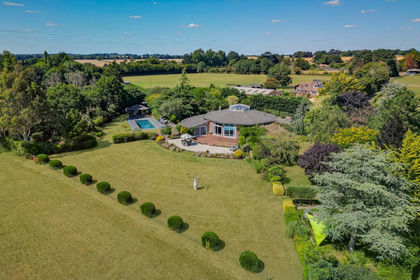
- Price
- £3,000,000
- Size
- 12.5 acres
Vernon Hill, Bishops Waltham, SO32, Bishops Waltham, Hampshire SO32 England
Added on 29/07/2026House with Land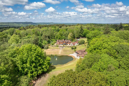
- Price
- Offers in Excess of£3,000,000
- Size
- 10.4 acres
Durford Wood, Petersfield, West Sussex, Rogate, West Sussex GU31 England
Added on 17/06/2026Country Estate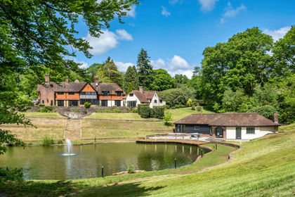
- Price
- Offers Over£3,000,000
- Size
- 10.4 acres
Durford Wood, Petersfield, GU31, Rogate, West Sussex GU31 England
Added on 29/01/2026Country Home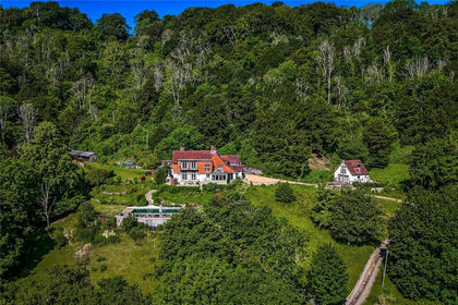
- Price
- Guide Price£2,850,000
- Size
- 25 acres
Hawkley, Liss, Hampshire, GU33, Froxfield and Privett, Hampshire GU32 England
Added on 11/09/2026Country Home
- Price
- Guide Price£3,000,000
- Size
- 24 acres
Highwood, Ringwood, Ellingham, Harbridge and Ibsley, Hampshire BH24 England
Added on 04/06/2026Country Home
- Price
- Guide Price£2,900,000
- Size
- 10 acres
Tunbridge Lane, Bramshott, Liphook, Hampshire, GU30, Bramshott and Liphook, Hampshire GU30 England
Added on 16/06/2026Mill Conversion
- Price
- Guide Price£3,995,000
- Size
- 10 acres
Woolmer Hill Road, Surrey, GU27 1, Haslemere, Surrey GU27 England
Added on 11/06/2026Country Estate
- Price
- £3,000,000
- Size
- 10 acres
Added on 01/05/2026Country Home
- Price
- Guide Price£3,000,000
- Size
- 30 acres
Added on 05/09/2026Country Estate
- Price
- Guide Price£4,500,000
- Size
- 52 acres
Added on 07/07/2026Country Estate