Development Opportunity with Planning Permission in Docking
- Bedrooms
- 3
- Bathrooms
- 2
Key Features
- Planning Permission Granted for a Detached Dwelling
- Three-Bedroom Accommodation
- Principal Bedroom with En-Suite & Dressing Area
- Kitchen Dining Room, Separate Lounge & Study
- Private Garden & Off-Road Parking
- Traditional Red Brick, Flint & Clay Pantile Design
- Conservation Area Setting with Open Fields Beyond
- Site Area Approximately 291.7 Sq. M.
Description
An individual development opportunity in Docking, with planning permission granted for a characterful three-bedroom detached home.
Designed with its Conservation Area setting in mind, the proposed house takes inspiration from traditional Norfolk architecture, combining red brick, flint detailing and natural clay pantiles with dormer detailing and carefully considered proportions. Behind the characterful exterior is a contemporary layout centred around a generous kitchen and dining room opening towards the garden, complemented by a separate lounge, study, utility room and ground-floor WC.
Upstairs, three bedrooms include a principal suite with a dressing area and en-suite, alongside a family bathroom. Outside, the proposals provide a private rear garden and off-road parking, with open fields beyond the site to the rear.
The traditional architectural approach was recognised in the successful planning appeal, with the Inspector concluding that the proposed dwelling would be sympathetic to its surroundings and would preserve the character and appearance of the Docking Conservation Area.
DOCKING
Docking is one of Norfolk’s best hideaways, just four miles from the sea and a short drive from the market towns of Fakenham and Holt.
Dating back to Saxon times, Docking is one of Norfolk’s highest points at 272 feet and was once known as ‘Dry Docking’ due to its lack of drinking water. In the 18th century, a well was sunk, and residents paid a farthing per bucket until mains water was installed in 1936. During World War II, RAF Docking airfield operated nearby, and Docking Hall housed actors Richard Burton, Robert Hardy, and Warren Mitchell.
Today, Docking boasts a strong community with a thriving nursery and primary school, filling the streets with the sound of children playing. The village is well-serviced with a GP surgery, village store with Post Office, playing field, tennis court, bowling green, popular fish and chip shop, and The Railway Inn.
Buyers have a wide range of property options, including traditional brick and flint cottages, classic Georgian houses, and quality modern homes. Four Miles is one example, named for its proximity to Thornham and Brancaster, with cottages, barns, and apartments designed to blend with the surrounding countryside.
Docking residents can enjoy growing their own produce or visit the weekly farmer’s market at Ripper Memorial Hall. Held on Wednesday mornings, shoppers come from far afield to fill their baskets with fresh produce from local smallholders and delicacies from Norfolk artisan producers.
Offering the best of coast and country, it’s easy to see why Docking is such a sought-after spot.
TENURE
Freehold.
LOCATION
What3words: ///reckoned.release.former
PLANNING INFORMATION
Site area approximately 291.7 sq. m.
Planning Reference: 25/00184/F
Appeal Reference: APP/V2635/W/25/3368328
Appeal Allowed: 10 October 2025
AGENT’S NOTE
The property is subject to a historic restriction. Please contact the selling agent for further information.
Please note CGI’s are for representative purposes only.
Disclaimer
These particulars are provided as a guide only and do not form part of any offer or contract. Sowerbys and its representatives have no authority to make or give representations or warranties. All descriptions, measurements, photographs and plans are for guidance only and should not be relied upon as statements of fact. Buyers should satisfy themselves as to the accuracy of the information through inspection or professional advice. Services, appliances and equipment have not been tested and no warranty can be given as to their condition. Planning permissions, building regulations and other consents should be verified by the buyer’s legal adviser. In accordance with Anti-Money Laundering regulations, proceeding buyers must complete a digital ID check through our compliance partner. A charge of £48 including VAT per sale or purchase applies. Leasehold buyers should confirm ground rent, service charges and lease details with their legal adviser.
Map Location
Property details
- Tenure
- Freehold
- Council Tax Band
- Ask Agent
- Date Posted
- 2026-10-09
Utilities & Restrictions
Utilities
- Electricity
- Ask Agent
- Water
- Ask Agent
- Heating
- Ask Agent
- Broadband
- Ask Agent
- Sewerage
- Ask Agent
Rights & Restrictions
- Public Rights of Way
- Ask Agent
- Private Rights of Way
- Ask Agent
- Listed Property
- Ask Agent
- Restrictions
- Ask Agent
Listed status, conservation areas and planning constraints for this location are in the full report.
Property Features
- Accessibility
- Ask Agent
- Parking
- Parking Available
- Garden
- Garden
Beyond the particulars: planning activity, flood history, heritage and ground risks, checked for this exact spot.
Connectivity
Broadband
Fastest speed available at this postcode
80 Mbps
Superfast
Suitable for
- HD streaming
- Video calls
- Web & social
Mobile signal
Predicted 4G and 5G signal; indoor signal depends on building materials.
Ofcom Connected Nations postcode-level predictions. Speeds and signal are modelled, not measured, and vary between addresses and providers.
Signal is the easy part. Planning activity, flood history and protected designations here are in the full report.
Nearest Schools
Primary
- Docking Church of England Primary Academy and Nursery624 metresNo Ofsted rating
- Ages
- 3 to 11
- Pupils
- 109
- Type
- Academy converter
- Faith
- Church of England
- Blenheim Park Academy5.3 milesOfsted: Good
- Ages
- 5 to 11
- Pupils
- 70
- Type
- Academy sponsor led
- Snettisham Primary School5.5 milesNo Ofsted rating
- Ages
- 5 to 11
- Pupils
- 80
- Type
- Academy sponsor led
- Ingoldisthorpe Church of England Voluntary Aided Primary School5.5 milesOfsted: Good *
- Ages
- 3 to 11
- Pupils
- 152
- Type
- Voluntary aided school
- Faith
- Church of England
- Burnham Market Primary and Nursery School5.7 milesOfsted: Good
- Ages
- 2 to 11
- Pupils
- 111
- Type
- Academy sponsor led
Secondary
- Smithdon High School6.2 milesOfsted: Good
- Ages
- 11 to 16
- Pupils
- 579
- Type
- Academy sponsor led
- Fakenham Academy9.7 milesNo Ofsted rating
- Ages
- 11 to 18
- Pupils
- 723
- Type
- Academy sponsor led
- Alderman Peel High School9.9 milesOfsted: Good
- Ages
- 11 to 16
- Pupils
- 606
- Type
- Academy converter
- Springwood High School13 milesNo Ofsted rating
- Ages
- 11 to 18
- Pupils
- 1,988
- Type
- Academy converter
- King Edward VII Academy13 milesOfsted: Good *
- Ages
- 11 to 18
- Pupils
- 1,172
- Type
- Academy sponsor led
* Latest graded judgement covers quality of education only; no overall grade was issued under the 2024-25 inspection framework.
Distances are straight-line from the advertised location. Source: the national school registers (DfE, Welsh Government, Scottish Government) and Ofsted.
Schools are just the start: sold prices nearby, planning activity and any flood history are in the full report.
Amenities
Supermarket
GP surgery
Pharmacy
Hospital
Green space
Straight-line distances from the advertised location. Sources: NHS records, Geolytix supermarket locations, OS Open Greenspace and the national trails registers.
The area stacks up? Now check the location itself: planning nearby, protected designations and past flooding.
Getting Around
Nearest station
Nearest bus stop
Typical drive times
Straight-line distances from the advertised location; drive times are typical free-flow times over OpenStreetMap road data, so allow more at peak. Public transport locations from DfT NaPTAN.
Easy to reach matters. So do planning activity, flood history and ground risks: all in the full report.
Flood Risk
Environment Agency open data, checked around the advertised map pin for the listed acreage. Long-term risk counts flood defences; the planning map's flood zones do not. Provided by LandSale, not the listing agent, and not part of the agent's particulars. Risk varies across a holding, so verify before committing.
Rivers and the sea
Planning map: Flood Zone 1.
Surface water
These bandings are the summary. Where this location sits on the flood maps, plus planning activity, heritage and ground risks, is in the full report.
Important notice: Information, maps and tags on this page are drawn from the advertising agent's marketing materials or generated automatically. LandSale has not verified them. Relying on these details is at your own risk, always carry out independent checks before committing to a purchase.
LandSale full disclaimer
Marketing information only - not formal particulars. The details on this website are provided for general guidance and do not constitute an offer or contract. Neither LandSale nor the advertising estate/land agent accepts responsibility for any inaccuracy.
1. Source of information
- Listing content: Core description, asking price, tenure, measurements, photographs and planning history originate from the marketing materials of the advertising estate or land agent. LandSale does not author this content and cannot guarantee its accuracy.
- Automated tags & categorisation: Property type, land-use class, acreage bands and similar labels may be applied by machine-learning models. They are intended as a helpful guide only and may not reflect the property's legal status or permitted use.
- Third-party & enriched data layers: Maps, boundary outlines, planning designations, soil reports, broadband coverage and other environmental or location-based insights are licensed from external suppliers. Such data are supplied “as is", may be incomplete or out of date and are subject to change without notice.
2. Verification required
Prospective purchasers must verify critical matters, including but not limited to planning permission, title boundaries, public rights of way, environmental constraints, acreage, services, access and VAT status, through their own inspections, specialist surveys, legal advisers and the selling agent before relying on the information or entering into any contract.
3. No warranty or liability
LandSale gives no warranty, express or implied, as to the accuracy, completeness or fitness for any particular purpose of the information displayed. LandSale shall not be liable for any loss, damage, cost or expense arising directly or indirectly from any use of or reliance on such information, save where liability may not be excluded by law.
4. Updates & feedback
If you believe any detail on this listing is inaccurate, please let us know. We will investigate and, where appropriate, update the listing or notify the agent.
© LandSale | Version 1.3 - August 2026
Listing agent
Sowerbys, Hunstanton
54 Westgate, Hunstanton, PE36 5EL
Similar properties for sale
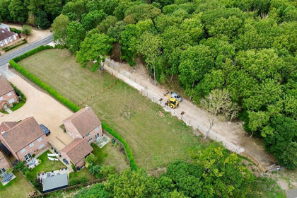 Added on 29/01/2026Building Plot
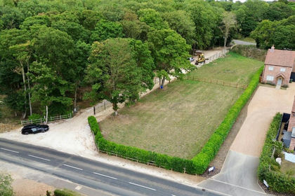 Added on 28/01/2026Building Plot
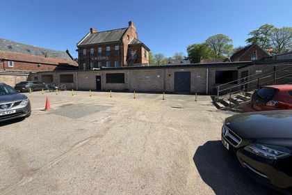
- Price
- Guide Price£200,000
Added on 02/10/2026Development Land
- Price
- Guide Price£165,000
Added on 29/01/2026Building Plot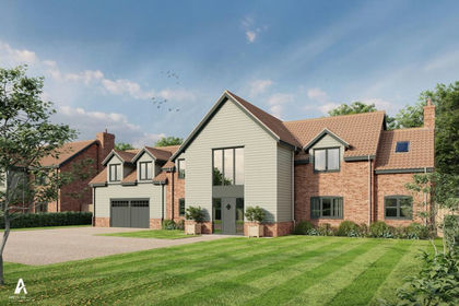 Added on 29/01/2026Building Plot
- Price
- £170,000
- Size
- 0.2 acres
Added on 11/05/2026Building Plot
- Price
- £150,000
Self Build Plots, Magdalen Road, Tilney St Lawrence, Tilney St. Lawrence, Norfolk PE34 England
Added on 29/01/2026Self Build Plot
- Price
- Guide Price£200,000
Added on 01/10/2026Building Plot
- Price
- Offers Over£200,000
Added on 09/07/2026Building Plot
- Price
- £225,000
- Size
- 2.13 acres
Chatsworth Nurseries, Friskney, Boston, Lincolnshire PE22, Friskney, Lincolnshire PE22 England
Added on 18/07/2026Vacant Land