Aish, Stoke Gabriel, Totnes, South Hams, Devon
- Bedrooms
- 4
- Bathrooms
- 2
Key Features
- Characterful Victorian stone barn conversion
- Four double bedrooms
- Spacious open-plan kitchen dining room
- Vaulted ceiling and exposed stonework
- Oak flooring and underfloor heating on ground floor
- Two modern shower rooms
- Pretty sunny walled courtyard garden
- Gated driveway with parking for three cars
- Green lanes and countryside walks from the door
- Close to Stoke Gabriel, Totnes and the River Dart
Description
Introduction
Rose Byre is a characterful four-bedroom Victorian stone barn conversion in the quiet hamlet of Aish, just outside Stoke Gabriel and around three miles from Totnes.
The original stone walls and exposed stonework give the house plenty of character, while the owners have created a comfortable, modern home around them. Oak floors, underfloor heating, vaulted ceilings and two smart shower rooms are complemented by a generous open-plan kitchen dining room, which has become the heart of the house.
Outside, things are deliberately simple. There is a gated driveway, parking for three cars and a pretty walled courtyard garden, with a stone outbuilding providing useful storage.
It's a home that works particularly well for those looking for a quieter pace of life without feeling remote. It would make a lovely full-time home, a lock-up-and-leave or a South Devon base for holidays and weekends.
The Story
Rose Byre was bought by the current owners as an unfinished project, and they have gradually turned it into the home it is today.
For them, the appeal was always the location. Peaceful and rural, but not cut off. Totnes is only around five minutes by car, while Stoke Gabriel can be reached on foot in about twenty minutes, with its pubs, shop and the River Dart.
There is very little light pollution here, so the night skies are wonderfully clear, and the sunsets are something the owners particularly enjoy. Wildlife is a big part of life too, with owls, buzzards, woodpeckers and plenty of garden birds, alongside squirrels, pheasants, deer, ducks, herons and geese. There are even alpacas just up the road.
The owners have also made the most of the house's combination of old and new. The Victorian stone walls give it character, while the open-plan kitchen and dining space has become the place for entertaining, long lunches and big family dinners. In winter, the house is warm and cosy, helped by the underfloor heating and good energy efficiency.
For anyone who enjoys being outside, green lanes lead away from the house, making it a great starting point for walking, gravel riding and mountain biking. Sandridge Barton winery and Roam restaurant are also close by, and are within walking distance when a long lunch or a glass of wine is called for.
The Entrance Level
The house opens into the kitchen and dining room, a generous vaulted space that immediately gives you a sense of the character of the property.
Roof lights bring plenty of natural light into the room, while an exposed stone wall provides a lovely contrast to the cream cabinetry and wooden worktops. There is space for a range cooker and plenty of room for a large dining table, making this a genuinely sociable part of the house.
Two double bedrooms sit off the kitchen. One has bespoke solid oak fitted wardrobes and a door leading outside, while a modern shower room completes this level.
The Lower Level
Stairs lead down to the sitting room, a comfortable room with oak flooring, underfloor heating and more of the original exposed stonework.
There are two further bedrooms on this level, along with a second modern shower room. One of the bedrooms has solid oak fitted wardrobes and is currently used as a home office, giving the house plenty of flexibility depending on how you want to use it.
Outside
Gates open onto a generous driveway with parking for three cars.
The house has a pretty walled courtyard garden which catches the sun and provides an easy outdoor space to enjoy without creating a lot of work.
A stone outbuilding provides two useful storage areas, (one of which houses the oil fired boiler), while the size of the driveway also gives you the option to create more garden if you wanted to bring a little more greenery into the outside space.
Location
Aish is a small rural hamlet just outside Stoke Gabriel, surrounded by the countryside of South Devon.
Stoke Gabriel sits at the head of a creek on the River Dart and is part of the South Devon National Landscape. The older part of the village, around the Mill Pool and river, is a conservation area and the river remains very much at the heart of village life.
The village has a church, primary school and pre-school, village hall, post office, general store and three pubs. The boating association also runs RYA sailing training for children, alongside events throughout the year.
Totnes is around five minutes by car and offers a great mix of independent shops, cafés, restaurants and weekly markets, as well as a mainline station with direct trains to London Paddington.
Dartmouth, the beaches of Torbay and the A38 are all within easy reach, making this a particularly good base for exploring South Devon.
Useful Information
Tenure: Freehold
Local Authority: South Hams District Council
Council Tax Band: E
EPC Rating: C
Services: Mains electricity and water. Private drainage via septic tank. Oil-fired central heating with underfloor heating. ADSL broadband.
Parking: Gated driveway with parking for three cars.
Approximate Gross Internal Area: 137 sq.m. (1,480 sq.ft.), plus outbuilding 9 sq.m. (97 sq.ft.). Total 146 sq.m. (1,577 sq.ft.)
Internet: 17MBPS according to the OFCOM internet speed check. Starlink is another option for those needing faster speeds.
Mobile Signal: Good Outdoor to variable Indoors - EE 79%, Vodafone 76%, Three 74%, O2 50%
Long Term Flood Risk: Very Low risk of flooding according to the government long term flood risk check service.
What3Words: blurred.financial.gaps
Map Location
Property details
- Tenure
- Freehold
- Council Tax Band
- Ask Agent
- Date Posted
- 2026-10-07
Energy Performance Certificate
Energy Efficiency Rating
Based on UK Energy Performance Certificate standards (EU Directive 2002/91/EC)
Running costs are one side. Planning activity, flood history and ground risks for this location are in the full report.
Utilities & Restrictions
Utilities
- Electricity
- Mains
- Water
- Mains
- Heating
- Oil Heating
- Broadband
- Ask Agent
- Sewerage
- Ask Agent
Rights & Restrictions
- Public Rights of Way
- Ask Agent
- Private Rights of Way
- Ask Agent
- Listed Property
- Ask Agent
- Restrictions
- Ask Agent
Listed status, conservation areas and planning constraints for this location are in the full report.
Property Features
- Accessibility
- Ask Agent
- Parking
- Private Parking
- Garden
- Rear Garden
Beyond the particulars: planning activity, flood history, heritage and ground risks, checked for this exact spot.
Connectivity
Broadband
Fastest speed available at this postcode
26 Mbps
Standard (10-30 Mbps)
Suitable for
- Web & social
- Music streaming
- Standard video calls
Fixed wireless access may also be an option here.
Mobile signal
Predicted 4G and 5G signal; indoor signal depends on building materials.
Ofcom Connected Nations postcode-level predictions. Speeds and signal are modelled, not measured, and vary between addresses and providers.
Signal is the easy part. Planning activity, flood history and protected designations here are in the full report.
Nearest Schools
Primary
- Stoke Gabriel Primary School1.1 milesNo Ofsted rating
- Ages
- 2 to 11
- Pupils
- 72
- Type
- Academy converter
- Collaton St Mary Church of England Primary School1.4 milesNo Ofsted rating
- Ages
- 4 to 11
- Pupils
- 199
- Type
- Academy converter
- Faith
- Church of England
- Berry Pomeroy Parochial CofE Primary School1.7 milesOfsted report card · Dec 2025
- Ages
- 4 to 11
- Pupils
- 87
- Type
- Academy converter
- Faith
- Church of England
- Roselands Primary School2.1 milesOfsted: Good
- Ages
- 4 to 11
- Pupils
- 315
- Type
- Academy converter
- Totnes St John's Church of England Primary School2.2 milesOfsted: Good
- Ages
- 4 to 11
- Pupils
- 163
- Type
- Academy sponsor led
- Faith
- Church of England
Secondary
- Paignton Academy2 milesOfsted: Requires improvement *
- Ages
- 11 to 16
- Pupils
- 1,568
- Type
- Academy converter
- King Edward VI Community College3.2 milesNo Ofsted rating
- Ages
- 11 to 18
- Pupils
- 940
- Type
- Academy converter
- Churston Ferrers Grammar School Academy3.5 milesOfsted: Good
- Ages
- 11 to 18
- Pupils
- 1,062
- Type
- Academy converter
- Torquay Boys' Grammar School5 milesOfsted report card · Feb 2026
- Ages
- 11 to 18
- Pupils
- 1,087
- Type
- Academy converter
- Gender
- Boys
- Torquay Girls' Grammar School5.1 milesOfsted: Outstanding
- Ages
- 11 to 18
- Pupils
- 1,058
- Type
- Academy converter
- Gender
- Girls
* Latest graded judgement covers quality of education only; no overall grade was issued under the 2024-25 inspection framework.
Distances are straight-line from the advertised location. Source: the national school registers (DfE, Welsh Government, Scottish Government) and Ofsted.
Schools are just the start: sold prices nearby, planning activity and any flood history are in the full report.
Amenities
Supermarket
GP surgery
Pharmacy
Hospital
Green space
Straight-line distances from the advertised location. Sources: NHS records, Geolytix supermarket locations, OS Open Greenspace and the national trails registers.
The area stacks up? Now check the location itself: planning nearby, protected designations and past flooding.
Getting Around
Nearest station
Nearest bus stop
Typical drive times
Straight-line distances from the advertised location; drive times are typical free-flow times over OpenStreetMap road data, so allow more at peak. Public transport locations from DfT NaPTAN.
Easy to reach matters. So do planning activity, flood history and ground risks: all in the full report.
Flood Risk
Environment Agency open data, checked around the advertised map pin for the listed acreage. Long-term risk counts flood defences; the planning map's flood zones do not. Provided by LandSale, not the listing agent, and not part of the agent's particulars. Risk varies across a holding, so verify before committing.
Rivers and the sea
Planning map: Flood Zone 1.
Surface water
These bandings are the summary. Where this location sits on the flood maps, plus planning activity, heritage and ground risks, is in the full report.
Important notice: Information, maps and tags on this page are drawn from the advertising agent's marketing materials or generated automatically. LandSale has not verified them. Relying on these details is at your own risk, always carry out independent checks before committing to a purchase.
LandSale full disclaimer
Marketing information only - not formal particulars. The details on this website are provided for general guidance and do not constitute an offer or contract. Neither LandSale nor the advertising estate/land agent accepts responsibility for any inaccuracy.
1. Source of information
- Listing content: Core description, asking price, tenure, measurements, photographs and planning history originate from the marketing materials of the advertising estate or land agent. LandSale does not author this content and cannot guarantee its accuracy.
- Automated tags & categorisation: Property type, land-use class, acreage bands and similar labels may be applied by machine-learning models. They are intended as a helpful guide only and may not reflect the property's legal status or permitted use.
- Third-party & enriched data layers: Maps, boundary outlines, planning designations, soil reports, broadband coverage and other environmental or location-based insights are licensed from external suppliers. Such data are supplied “as is", may be incomplete or out of date and are subject to change without notice.
2. Verification required
Prospective purchasers must verify critical matters, including but not limited to planning permission, title boundaries, public rights of way, environmental constraints, acreage, services, access and VAT status, through their own inspections, specialist surveys, legal advisers and the selling agent before relying on the information or entering into any contract.
3. No warranty or liability
LandSale gives no warranty, express or implied, as to the accuracy, completeness or fitness for any particular purpose of the information displayed. LandSale shall not be liable for any loss, damage, cost or expense arising directly or indirectly from any use of or reliance on such information, save where liability may not be excluded by law.
4. Updates & feedback
If you believe any detail on this listing is inaccurate, please let us know. We will investigate and, where appropriate, update the listing or notify the agent.
© LandSale | Version 1.3 - August 2026

Listing agent
By Design, covering Nationwide
12 Old Bond Street, Mayfair, London, W1S 4PW
Contact By Design, covering Nationwide
12 Old Bond Street, Mayfair, London, W1S 4PW
View agent profileSimilar properties for sale
- Price
- Guide Price£450,000
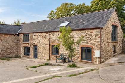
Swallow Barns, Higher Well Farm, Stoke Gabriel, Totnes, Stoke Gabriel, Devon TQ9 England
Added on 22/09/2026Barn Conversion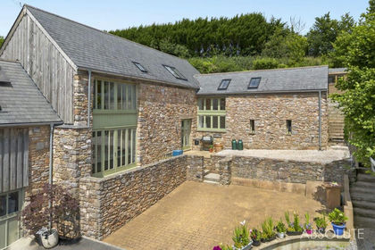
- Price
- Guide Price£675,000
Added on 13/08/2026Barn Conversion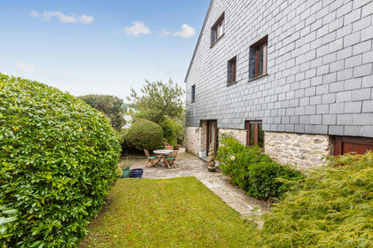
- Price
- Guide Price£575,000
Added on 29/01/2026Barn Conversion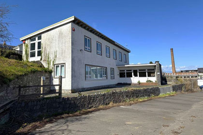
- Price
- Offers in Region of£450,000
Added on 29/01/2026Development Land
- Price
- Guide Price£675,000
Added on 16/06/2026Barn Conversion
- Price
- Guide Price£660,000
Added on 17/06/2026Barn Conversion
- Price
- Guide Price£500,000
Added on 17/07/2026Barn Conversion
- Price
- £575,000
Added on 16/05/2026Barn Conversion
- Price
- Guide Price£450,000
Added on 13/03/2026Barn Conversion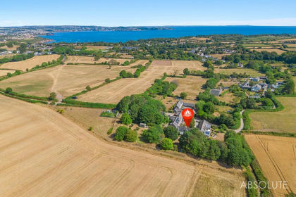
- Price
- Offers in Excess of£650,000
Alston Lane, Churston Ferrers, TQ5, South Devon, Torbay TQ5 England
Added on 03/09/2026Barn Conversion