Howgare Road, Broad Chalke, Salisbury, Wiltshire, SP5
- Land size
- 9.13 acres
- Bedrooms
- 4
- Bathrooms
- 2
Key Features
- Wonderful equestrian facility in quiet location
- On the edge of the popular village of Broad Chalke
- Spacious house of 3,500 square feet
- Split in two dwellings but could be changed back to one
- 9.13 acres, Post and rail fence manage
- Stabling for at least 6 horses
- Well fenced paddocks
- Peaceful rural setting with wonderful views
Description
A superbly located property with equestrian facilities set in 9.13 acres and located in the ever popular village of Broad Chalke.
Middleton was bought by the current owner approximately 40 years ago and was extended and improved to create a wonderful equine facility as well as being enjoyed as a family home. The property is not currently used for equine purposes but retains all the features one would hope to find including a manage, a six-bay stable and approximately 8 acres of paddocks. The property itself has been divided into two, the main house to the left and the original bungalow to the right, a currently blocked up door could be re-opened to make one large 3,500 square foot property, or continued to be used as two dwellings.
The main house is accessed into a fabulous reception hall with vaulted ceiling with glass elevations creating a superb meet and greet area which can also be used for a variety of other purposes. The kitchen is accessed from the left and has a good selection of base storage with a wooden and a granite work top with inset sink. There is a woodburner and ample space for a dining table and sofa. The sitting room is a particularly spacious room of 24ft 7in x 24ft with triple aspect, a fireplace and wooden floors. The ground floor also has a large utility room with further storage, space for white goods and the oil fired boiler. Stairs from the entrance hall lead to the first floor with a generous master bedroom with a triple aspect over looking the gardens and land to the rear. There is a dressing area and en-suite with roll top bath, WC and wash hand basin. The main house is exceptionally spacious, and well presented.
Due to the edge of village location it is a quiet spot with wonderful rural views. The view from the end of the paddock over adjoining farmland is quite breath taking.
Annexe
The highly versatile annexe has an entrance hall, sitting room with woodburner, closed up double doors could be re-opened back to the entrance hall of the main house if required. There is a family bathroom, two double bedrooms and a kitchen/ dining room. The annexe could be re-integrated back into the main house or be used as ancillary accommodation to the main house for multi-generation living purposes, guest accommodation to provide a useful source of income.
Stabling and Outbuildings
The stable block has been well positioned so that it is not only visible from the house but also easily accessible by vehicles if required. The stable block comprises six boxes with hard standing in front. There is water and power connected to the stables.
At the rear of the stable block is the post and rail fenced 60m x 20m Olympic manage with sand and rubber surface.
There is also a useful field shelter just beyond the manage, one side is closeable via stable doors, the other side is open fronted.
The land is free draining chalk pasture land divided into four manageable sized paddocks which are post and rail fenced with a central access strip running the length of the land.
Outside
Middleton is accessed via a graveled drive from a quiet village road, and leads up to the front of the property. To the front there are large lawn areas with productive flower beds. There is useful outbuilding previously used as kennels, but currently used for storage. The rear garden has an extensive patio area on two levels with brick finishing and is edged by a huge selection of mature flower beds. The gardens adjoin the paddocks which provide wonderful views.
Band E
Mains water and electricity, oil fired central heating and private drainage.
Leaving Salisbury on the A354 proceed for approximately 3 miles until reaching the village of Coombe Bissett and then turn right onto the Chalke Valley Road towards Broad Chalke and after approximately 5 miles upon reaching the village turn left at the pub, The Queen’s Head onto The Causeway, proceed for half a mile and bear left at the Church and proceed to the ‘T’ junction turning right onto Bury Lane and continue onto Howgarth Road. The road will bend to the left, property will be found after 150 meters on the right.
Middleton sits on the fringe of the ever-popular village of Broad Chalke, within the Cranborne Chase Area of Outstanding Natural Beauty. The Times named The Chalke Valley as the best place to live in the Southwest 2022. The Manor overlooks countryside and farmland, stretching to the picturesque ancient Ox Drove above the village. There are numerous country walks on the doorstep. The village itself has a good range of amenities, including a church, a pub and a primary school, currently rated Outstanding by Ofsted. In addition, there is an award-winning, community-run village hub with a cafe, shop and post office, as well as both a village hall and sports centre, with many clubs and activities on offer.The beautiful Cathedral city of Salisbury, approximately 9 miles North East, offers a wide selection of shops, restaurants, arts and recreational facilities. Trains from Salisbury to London Waterloo have a journey time of approximately 90 minutes.Racing is available at Salisbury Racecourse and Wincanton and golf at Rushmore Park, South Wilts Golf Club and High Post. This area is renowned for its fishing on the River Avon, Test and outlying chalk streams.The A303 provides access to the south west and London via the M3.There is a wide selection of both state and private schools in the area, including Clayesmore, Warminster School, Port Regis, Sandroyd, Salisbury Cathedral School, Chafyn Grove and Godolphin, as well as Bishop Wordsworth and South Wilts Grammar Schools.
Map Location
Property details
- Tenure
- Freehold
- Council Tax Band
- TBC
- Date Posted
- 2026-10-05
Market Value Analysis
Compared with 41 Equestrian listings in South West England (5+ acres).
Utilities & Restrictions
Utilities
- Electricity
- Ask Agent
- Water
- Ask Agent
- Heating
- Ask Agent
- Broadband
- Ask Agent
- Sewerage
- Ask Agent
Rights & Restrictions
- Public Rights of Way
- Ask Agent
- Private Rights of Way
- Ask Agent
- Listed Property
- Ask Agent
- Restrictions
- Ask Agent
Listed status, conservation areas and planning constraints for this location are in the full report.
Property Features
- Accessibility
- Ask Agent
- Parking
- Parking Available
- Garden
- Garden
Beyond the particulars: planning activity, flood history, heritage and ground risks, checked for this exact spot.
Connectivity
Broadband
Fastest speed available at this postcode
80 Mbps
Superfast
Suitable for
- HD streaming
- Video calls
- Web & social
Mobile signal
Predicted 4G and 5G signal; indoor signal depends on building materials.
Ofcom Connected Nations postcode-level predictions. Speeds and signal are modelled, not measured, and vary between addresses and providers.
Signal is the easy part. Planning activity, flood history and protected designations here are in the full report.
Nearest Schools
Primary
- Broad Chalke CofE Primary School483 metresOfsted: Good *
- Ages
- 4 to 11
- Pupils
- 189
- Type
- Academy converter
- Faith
- Church of England
- Dinton CofE Primary School4.4 milesNo Ofsted rating
- Ages
- 4 to 11
- Pupils
- 66
- Type
- Academy converter
- Faith
- Church of England
- Coombe Bissett Church of England Primary School4.4 milesOfsted report card · Jan 2026
- Ages
- 4 to 11
- Pupils
- 105
- Type
- Voluntary aided school
- Faith
- Church of England
- Wilton CofE Primary School4.6 milesOfsted: Good
- Ages
- 4 to 11
- Pupils
- 172
- Type
- Academy sponsor led
- Faith
- Church of England
- Sixpenny Handley First School and Nursery5.6 milesNo Ofsted rating
- Ages
- 2 to 9
- Pupils
- 73
- Type
- Academy converter
Secondary
- Sarum Academy6.4 milesNo Ofsted rating
- Ages
- 11 to 18
- Pupils
- 747
- Type
- Academy sponsor led
- Faith
- Church of England
- Cranborne Middle School7.2 milesNo Ofsted rating
- Ages
- 9 to 13
- Pupils
- 265
- Type
- Community school
- Bishop Wordsworth's Church of England Grammar School7.2 milesOfsted: Outstanding
- Ages
- 11 to 18
- Pupils
- 1,193
- Type
- Academy converter
- Faith
- Church of England
- Gender
- Boys
- South Wilts Grammar School7.4 milesOfsted: Good
- Ages
- 11 to 18
- Pupils
- 1,200
- Type
- Academy converter
- Gender
- Girls
- Wyvern St Edmund's Academy8.5 milesOfsted: Requires improvement *
- Ages
- 11 to 16
- Pupils
- 1,337
- Type
- Academy converter
- Faith
- Church of England
* Latest graded judgement covers quality of education only; no overall grade was issued under the 2024-25 inspection framework.
Distances are straight-line from the advertised location. Source: the national school registers (DfE, Welsh Government, Scottish Government) and Ofsted.
Schools are just the start: sold prices nearby, planning activity and any flood history are in the full report.
Amenities
Supermarket
GP surgery
Pharmacy
Hospital
Green space
Straight-line distances from the advertised location. Sources: NHS records, Geolytix supermarket locations, OS Open Greenspace and the national trails registers.
The area stacks up? Now check the location itself: planning nearby, protected designations and past flooding.
Getting Around
Nearest station
Nearest bus stop
Typical drive times
Straight-line distances from the advertised location; drive times are typical free-flow times over OpenStreetMap road data, so allow more at peak. Public transport locations from DfT NaPTAN.
Easy to reach matters. So do planning activity, flood history and ground risks: all in the full report.
Flood Risk
Environment Agency open data, checked around the advertised map pin for the listed acreage. Long-term risk counts flood defences; the planning map's flood zones do not. Provided by LandSale, not the listing agent, and not part of the agent's particulars. Risk varies across a holding, so verify before committing.
Rivers and the sea
Planning map: Flood Zone 1.
Surface water
These bandings are the summary. Where this location sits on the flood maps, plus planning activity, heritage and ground risks, is in the full report.
Important notice: Information, maps and tags on this page are drawn from the advertising agent's marketing materials or generated automatically. LandSale has not verified them. Relying on these details is at your own risk, always carry out independent checks before committing to a purchase.
LandSale full disclaimer
Marketing information only - not formal particulars. The details on this website are provided for general guidance and do not constitute an offer or contract. Neither LandSale nor the advertising estate/land agent accepts responsibility for any inaccuracy.
1. Source of information
- Listing content: Core description, asking price, tenure, measurements, photographs and planning history originate from the marketing materials of the advertising estate or land agent. LandSale does not author this content and cannot guarantee its accuracy.
- Automated tags & categorisation: Property type, land-use class, acreage bands and similar labels may be applied by machine-learning models. They are intended as a helpful guide only and may not reflect the property's legal status or permitted use.
- Third-party & enriched data layers: Maps, boundary outlines, planning designations, soil reports, broadband coverage and other environmental or location-based insights are licensed from external suppliers. Such data are supplied “as is", may be incomplete or out of date and are subject to change without notice.
2. Verification required
Prospective purchasers must verify critical matters, including but not limited to planning permission, title boundaries, public rights of way, environmental constraints, acreage, services, access and VAT status, through their own inspections, specialist surveys, legal advisers and the selling agent before relying on the information or entering into any contract.
3. No warranty or liability
LandSale gives no warranty, express or implied, as to the accuracy, completeness or fitness for any particular purpose of the information displayed. LandSale shall not be liable for any loss, damage, cost or expense arising directly or indirectly from any use of or reliance on such information, save where liability may not be excluded by law.
4. Updates & feedback
If you believe any detail on this listing is inaccurate, please let us know. We will investigate and, where appropriate, update the listing or notify the agent.
© LandSale | Version 1.3 - August 2026
Listing agent
Woolley & Wallis, Salisbury
51-61 Castle Street, Salisbury, SP1 3SU
Similar properties for sale
- Price
- Guide Price£1,650,000
- Size
- 8 acres
Added on 25/06/2026House with Land
- Price
- Guide Price£1,850,000
- Size
- 4.5 acres
Sandleheath, Marl Lane, Fordingbridge, Hampshire, SP6, Sandleheath, Hampshire SP6 England
Added on 03/04/2026House with Land
- Price
- Offers Over£1,750,000
- Size
- 10 acres
Langford Lane, Redlynch, SP5, Redlynch, Wiltshire SP5 England
Added on 28/03/2026Country Estate
- Price
- £1,750,000
- Size
- 8 acres
Slough Lane, Horton, Wimborne, BH21, Woodlands, Dorset BH21 England
Added on 28/08/2026House with Land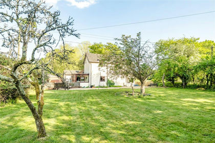
- Price
- Guide Price£1,250,000
- Size
- 8.66 acres
Ringwood Road, Three Legged Cross, Wimborne, Dorset, BH21, Verwood, Dorset BH21 England
Added on 30/05/2026Farmhouse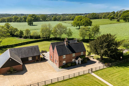
- Price
- Guide Price£1,500,000
- Size
- 11 acres
Common Road, Whiteparish, Salisbury, Wiltshire, SP5, Whiteparish, Wiltshire SP5 England
Added on 02/04/2026Cottage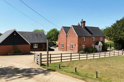
- Price
- Guide Price£1,500,000
- Size
- 11 acres
Common Road, Whiteparish, Salisbury, Wiltshire, SP5, Whiteparish, Wiltshire SP5 England
Added on 28/07/2026House with Land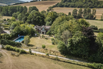
- Price
- Guide Price£1,350,000
- Size
- 4.25 acres
Stourpaine, Blandford Forum, Dorset, DT11, Stourpaine, Dorset DT11 England
Added on 01/09/2026House with Land
- Price
- Guide Price£1,200,000
- Size
- 27 acres
Eccliffe Equestrian, Gillingham, Gillingham, Dorset SP8 England
Added on 22/09/2026Equestrian property
- Price
- Guide Price£1,375,000
- Size
- 17.28 acres
Added on 14/08/2026Smallholding