
Buildings & Land At Lower Whites, North Newton, Bridgwater, TA7
- Land size
- 51.35 acres
Key Features
- Modern & Traditional Farm Buildings
- Alternative Use Potential STP
- Private Rural Setting
- Adjoining the Taunton to Bridgwater Canal
- 51.35 Acres
- Available in up to 4 Lots
Description
An adaptable range of modern and traditional farm buildings, together with a block of productive moorland. In all about 51.35 acres available as a whole or in Lots.
For sale by Informal tender. Tenders close Thursday 27th June 2024 at 12:00 noon.
A unique opportunity to acquire a range of modern and traditional farm buildings with alternative use potential (STP) on the edge of the popular village of North Newton, together with approximately 51.35 acres of pastureland. The holding is ideally suited to those with agricultural, conservation or small holding interests and enjoys a private and secluded location on the edge of the Somerset levels.
LOTTING
The property is being offered to sale by informal tender as a whole or in four convenient lots as follows;-
LOT 1—A RANGE OF MODERN AND TRADITIONAL BUILDINGS, IN ALL ABOUT 2.10 ACRES. GUIDE £150,000
This lot comprises a range of modern and traditional farm buildings set within 2.1 acres adjoining the Taunton to Bridgwater Canal. Due to the nature of the buildings there may be the opportunity of change of use to residential, subject to the necessary planning consents. The buildings can be more particularly described as follows and corresponds with the building plan on the attached plan.
1 - Cubicle shed (19.5m x 14.2m) of corrugated pole construction under a fibre cement roof with steel clad elevations.
2 - Cow stalls (7.9m x 3.8m) of timber pole barn construction under a mono-pitched roof with profile steel cladding.
3 - Calf shed (17.75m x 6.7m) of timber pole barn construction under a mono-pitched steel profile roof with profile steel cladding.
4 - Cow stalls (8.8m x 3.5m) a single storey brick and stone built barn under a pitched tiled roof.
5 - Parlour/dairy attached to building 4 (3.5m x 3.8m) of brick elevations under a pitched tiled roof. Adjoining is a workshop (3.5m x 3.5m) of block elevations under a steel mono-pitched roof.
6 - Traditional barn (5.1m x 11.2m) of cob elevations under a pitched GI clad roof with lean-to store on gable end (2.5m x 7.74m).
7 - Covered yard (9m x 22.98m) (4.7m to eaves) of steel framed construction under a profile fibre cement roof with GI cladding.
8 - Lean-to (22.98m x 11.9m)of steel framed construction under a mono-pitched roof with timber clad elevations.
9 - Lean-to(6.1m x 22.98m) of timber frame attached to building 8 with timber cladding.
The land associated with this lot adjoins the canal and has been left to natures way of late. This parcel is shown edged pink on the attached identification plan.
LOT 2 - 5.70 ACRES OF
LOT 2 - 5.70 ACRES OF PASTURE LAND GUIDE £30,000
This parcel is a single enclosure of level pastureland, perfect for agricultural, equestrian or other amenity uses. This Lot is shown edged green on the attached identification plan.
LOT 3 - 16.38 ACRES OF MOORLAND GUIDE £50,000
Located to the east of Lot 1 this block comprises three enclosures of productive pasture land suited to livestock grazing or conservation purposes. This Lot is shown edged blue on the attached identification plan.
LOT 4 - 27.17 ACRES OF PASTURE LAND GUIDE £100,000
This Lot comprises a block of level moorland divided by a number of rhynes and is ideally suited to summer livestock grazing, amenity or conservation purposes. This Lot is shown edged yellow on the attached identification plan.
DESIGNATIONS
We are not aware of any designations.
TENURE & TITLE
Freehold with vacant possession upon completion.
There is no title for filed No.9640 in Lot 4. The vendors will provide a statutory declaration and will apply for possessory title.
FLOODING
During prolonged rainfall the lower parts of Lot 2,3 and 4 flood.
RIGHTS OF WAY
A public footpath traverses Lots 1 and 2. The property is sold and as far is required by the vendors will be conveyed subject to all other rights of way, easements and wayleaves of telegraph and telephone poles, stays and wires, electricity pylons, poles and cables, water and gas pipes at present erected on the passing over or under the property and subject to the agreement effecting the same (if any).
ACCESS
Access to the property is via a hardened tack running from Church Road. There is a 50% maintenance charge for the track between point A-B-C on the plan.
LOCAL AUTHORITY
Somerset Council
SPORTING AND MINERAL RIGHTS
In hand and run with the freehold.
TOWN AND COUNTRY PLANNING
The property, notwithstanding any description contained in these particulars, is sold subject to any Development Plan, Tree Preservation Order, Town Planning Scheme, Resolution Notice, which may be or may come to be in force and also subject to any statutory provision or Bye-law without any obligation on the part of the vendor to specify them.
OVERAGE CLAUSE
It is the vendors intention to impose an overage clause on lot 1 whereby should residential planning consent be granted within a period of 20 years then the vendors or their successors in title will be entitled to 20% of any resulting uplift in value.
METHOD OF SALE
The land is being offered for sale by informal tender. Tenders to be received in writing on the attached form of tender at the agents Greenslade Taylor Hunt, 13 Hammet Street, Taunton, Somerset, TA1 1RN by 12:00 noon on Thursday 27th June 2024, marked ‘offers for Buildings and Land at Lower Whites Farm’. Offers should be made for the property as a whole or in lots as per the lotting within these sale particulars. Any tenders will be subject to contract and the vendors are not obliged to accept the highest nor any other tender.
SALE PRIOR
It is possible that the property may be withdrawn/sold prior to the Tender date. It is advisable for any interested parties to register their interest with us and it is their responsibility to check with the selling agents whether a particular Lot will be offered or if it has been withdrawn.
VIEWING
The property can be viewed at all reasonable time whilst in possession of these sale particulars.
The property is situated at the end of a long private track to the east of the popular rural village of North Newton. The Taunton to Bridgwater canal adjoins to the north providing excellent walking and fishing and the village itself hosts a pub, primary school, church, café and popular boat centre. The town of North Petherton lies approximately 2 miles to the north offering a comprehensive range of amenities along with access to the M5 motorway at Junction 24.
Directions
From Junction 24 of the M5 motorway head south on Taunton Road towards North Petherton. As you exit the town turn left before the playing fields onto Newton Road. Proceed along this road for approximately a mile passing over the motorway bridge. As you enter the village centre turn left by the Harvest Moon pub. Proceed along this road over the canal bridge and proceed right to the end of Church Road where all parcels can be found.
WHAT.3.WORDS
For the exact location download the app and enter; scrap.bongo.vegtable
Map Location
Property details
- Tenure
- Freehold
- Council Tax Band
- Ask Agent
- Date Posted
- 2026-10-03
Market Value Analysis
Compared with 31 Farmland & Pasture listings in South West England (50+ acres).
Property Brochure
Seen the details? The full report adds the independent checks: planning activity, flood history, heritage and ground.
Utilities & Restrictions
Utilities
- Electricity
- Ask Agent
- Water
- Ask Agent
- Heating
- Ask Agent
- Broadband
- Ask Agent
- Sewerage
- Ask Agent
Rights & Restrictions
- Public Rights of Way
- Ask Agent
- Private Rights of Way
- Ask Agent
- Listed Property
- Ask Agent
- Restrictions
- Ask Agent
Listed status, conservation areas and planning constraints for this location are in the full report.
Property Features
- Accessibility
- Ask Agent
- Parking
- Ask Agent
- Garden
- Ask Agent
Beyond the particulars: planning activity, flood history, heritage and ground risks, checked for this exact spot.
Connectivity
Broadband
Fastest speed available at this postcode
4 Mbps
Under 10 Mbps here
Suitable for
- Basic browsing & email
Mobile signal
Predicted 4G and 5G signal; indoor signal depends on building materials.
Ofcom Connected Nations postcode-level predictions. Speeds and signal are modelled, not measured, and vary between addresses and providers.
Signal is the easy part. Planning activity, flood history and protected designations here are in the full report.
Nearest Schools
Primary
- North Newton Community Primary School1.1 milesNo Ofsted rating
- Ages
- 4 to 11
- Pupils
- 93
- Type
- Community school
- North Petherton Primary School1.8 milesOfsted report card · Dec 2025
- Ages
- 4 to 11
- Pupils
- 409
- Type
- Community school
- Somerset Bridge Primary School2.4 milesOfsted: Good
- Ages
- 4 to 11
- Pupils
- 407
- Type
- Community school
- Hamp Academy3 milesOfsted: Good
- Ages
- 7 to 11
- Pupils
- 307
- Type
- Academy sponsor led
- Hamp Nursery and Infants' School3 milesNo Ofsted rating
- Ages
- 2 to 7
- Pupils
- 234
- Type
- Community school
Secondary
- Robert Blake Academy3.1 milesNo Ofsted rating
- Ages
- 11 to 16
- Type
- Academy converter
- Haygrove School3.6 milesOfsted: Good
- Ages
- 11 to 16
- Pupils
- 1,051
- Type
- Academy converter
- Bridgwater College Academy3.7 milesOfsted report card · Mar 2026
- Ages
- 3 to 16
- Pupils
- 1,561
- Type
- Academy sponsor led
- Chilton Trinity School4.5 milesOfsted: Good *
- Ages
- 11 to 16
- Pupils
- 990
- Type
- Academy converter
- Monkton Wood Academy4.8 milesOfsted: Inadequate
- Ages
- 11 to 18
- Pupils
- 1,267
- Type
- Academy sponsor led
* Latest graded judgement covers quality of education only; no overall grade was issued under the 2024-25 inspection framework.
Distances are straight-line from the advertised location. Source: the national school registers (DfE, Welsh Government, Scottish Government) and Ofsted.
Schools are just the start: sold prices nearby, planning activity and any flood history are in the full report.
Amenities
Supermarket
GP surgery
Pharmacy
Hospital
Straight-line distances from the advertised location. Sources: NHS records, Geolytix supermarket locations, OS Open Greenspace and the national trails registers.
The area stacks up? Now check the location itself: planning nearby, protected designations and past flooding.
Getting Around
Nearest station
Nearest bus stop
Typical drive times
Straight-line distances from the advertised location; drive times are typical free-flow times over OpenStreetMap road data, so allow more at peak. Public transport locations from DfT NaPTAN.
Easy to reach matters. So do planning activity, flood history and ground risks: all in the full report.
Flood Risk
Environment Agency open data, checked around the advertised map pin for the listed acreage. Long-term risk counts flood defences; the planning map's flood zones do not. Provided by LandSale, not the listing agent, and not part of the agent's particulars. Risk varies across a holding, so verify before committing.
Rivers and the sea
Not at the pin: mapped about 20 metres away.
Planning map: Flood Zone 3, about 10 metres away.
Surface water
Not at the pin: mapped about 40 metres away.
These bandings are the summary. Where this location sits on the flood maps, plus planning activity, heritage and ground risks, is in the full report.
Important notice: Information, maps and tags on this page are drawn from the advertising agent's marketing materials or generated automatically. LandSale has not verified them. Relying on these details is at your own risk, always carry out independent checks before committing to a purchase.
LandSale full disclaimer
Marketing information only - not formal particulars. The details on this website are provided for general guidance and do not constitute an offer or contract. Neither LandSale nor the advertising estate/land agent accepts responsibility for any inaccuracy.
1. Source of information
- Listing content: Core description, asking price, tenure, measurements, photographs and planning history originate from the marketing materials of the advertising estate or land agent. LandSale does not author this content and cannot guarantee its accuracy.
- Automated tags & categorisation: Property type, land-use class, acreage bands and similar labels may be applied by machine-learning models. They are intended as a helpful guide only and may not reflect the property's legal status or permitted use.
- Third-party & enriched data layers: Maps, boundary outlines, planning designations, soil reports, broadband coverage and other environmental or location-based insights are licensed from external suppliers. Such data are supplied “as is", may be incomplete or out of date and are subject to change without notice.
2. Verification required
Prospective purchasers must verify critical matters, including but not limited to planning permission, title boundaries, public rights of way, environmental constraints, acreage, services, access and VAT status, through their own inspections, specialist surveys, legal advisers and the selling agent before relying on the information or entering into any contract.
3. No warranty or liability
LandSale gives no warranty, express or implied, as to the accuracy, completeness or fitness for any particular purpose of the information displayed. LandSale shall not be liable for any loss, damage, cost or expense arising directly or indirectly from any use of or reliance on such information, save where liability may not be excluded by law.
4. Updates & feedback
If you believe any detail on this listing is inaccurate, please let us know. We will investigate and, where appropriate, update the listing or notify the agent.
© LandSale | Version 1.3 - August 2026
Similar properties for sale
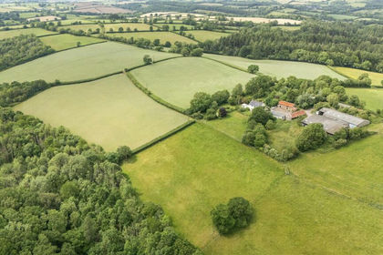
- Price
- Guide Price£295,000
- Size
- 33.03 acres
Added on 03/07/2026Farm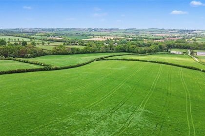
- Price
- Guide Price£265,000
- Size
- 33.17 acres
Station Farm - Lot 3, 33.17 Acres - Bow, Crediton, EX17, Crediton, Devon EX17 England
Added on 05/06/2026Agricultural Land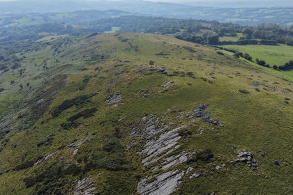
- Price
- Guide Price£300,000
- Size
- 85.62 acres
Trap, Llandeilo, SA18, Llandeilo, Carmarthenshire SA18 Wales
Added on 07/08/2026Smallholding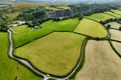
- Price
- Guide Price£300,000
- Size
- 24.27 acres
Land & Buildings at Craig Yr Odyn, Trap, Llandeilo, SA19, Llandeilo, Carmarthenshire SA19 Wales
Added on 13/07/2026Smallholding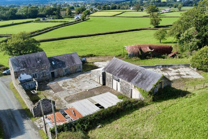
- Price
- £295,000
- Size
- 0.5 acres
Towy Valley, Close to Llangadog, Llangadog, Carmarthenshire SA19 Wales
Added on 11/10/2026Conversion Land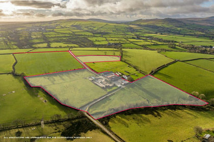
- Price
- £300,000
- Size
- 17.72 acres
Added on 29/01/2026Smallholding