Trap, Llandeilo, SA18
- Land size
- 85.62 acres
Key Features
- A rare opportunity to acquire a distinct local landmark
- Offering a mixture of upland grazing, moorland and woodland
- Situated on the western edge of Bannay Brecheiniog (Brecon Beacons) National Park
- Extending to approximately 85.62 acres (34.65 hectares)
- Popular rural location of Trap, some 4 miles from boutique market town of Llandeilo
- Breath taking views over surrounding valley
Description
An exceptional opportunity to acquire approximately 85.62 acres of upland occupying an elevated position on the western edge of Bannau Brycheiniog (Brecon Beacons) National Park with breathtaking panoramic views. Comprising a diverse mix of grazing land, woodland and open moorland, the property offers excellent potential for livestock grazing, the Sustainable Farming Scheme, conservation, biodiversity enhancement and recreational use, all within easy reach of Llandeilo and the M4 corridor.
Overview
An outstanding opportunity to acquire approximately 85.62 acres of upland occupying a commanding elevated position on the western edge of Bannau Brycheiniog (Brecon Beacons) National Park. The land enjoys breath taking panoramic views across the rolling Carmarthenshire countryside and offers an exceptional combination of natural beauty, environmental interest and agricultural appeal.
Location
Situated on the fringes of the village of Trap, approximately 4 miles from the popular market town of Llandeilo, Carreg Dwfn benefits from an enviable rural setting with the dramatic Black Mountain landscape quite literally on the doorstep. Despite its peaceful and secluded feel, the property remains highly accessible, with Junction 49 of the M4 approximately 10 miles away, providing convenient links to Swansea, Cardiff and the wider motorway network.
The land is accessed via a shared private lane identified in Brown on the attached Plan, a short distance west of the main unclassified adopted highway which travels between Trap and Llandyfan. Once you have reached 1 Carreg Dwfn Cottage and the hairpin bend, continue straight on. The track beyond this point is private with right of way in favour of 4 Carreg Dwfn Cottage. The lane around the hairpin bend is private and there is no vehicular access beyond this point.
Description
Extending to approximately 85.62 acres, the land comprises a remarkably diverse landscape, incorporating grazing land, established woodland and extensive areas of open moorland. Rising to almost 1,000 feet above sea level, the holding is distinguished by its striking rocky outcrops, historic disused gritstone quarries and an impressive east-to-west ridgeline, all of which combine to create a landscape of exceptional character and visual appeal. The elevated position affords magnificent uninterrupted views in every direction, making Carreg Dwfn a truly unique and rarely available upland holding.
The land is contained within a single parcel, accessed via a cattle grid and benefiting from established boundary fencing in part. A rich mosaic of native vegetation, grasses and mature tree species contributes to the holding's diverse landscape, whilst the varied topography incorporates areas of stone, rough grazing, rush pasture and woodland, creating both visual interest and practical versatility.
The property offers excellent potential for livestock grazing, particularly for those seeking additional land in support of the Sustainable Farming Scheme, whilst also presenting exciting opportunities for recreational pursuits, conservation management and environmental enhancement. Its varied habitats support an abundance of wildlife, including birds of prey, ground-nesting birds and a wide range of pollinating species, making it especially attractive to purchasers interested in biodiversity gain, habitat restoration or small-scale rewilding initiatives.
The combination of heathland, woodland and open upland pasture creates an important ecological resource and natural wildlife corridor within this renowned landscape, enhancing both the environmental value and long-term appeal of this exceptional landholding.
Sustainable Farming Scheme (SFS) Potential
The land is likely to be of particular interest to farmers seeking additional land to support participation in the Sustainable Farming Scheme (SFS), benefiting from its mix of habitat types, existing woodland and environmentally significant landscape features. The land may also offer potential for biodiversity enhancement and wider environmental management objectives, subject to any necessary consents and scheme requirements.
Tenure
We are advised the land is held on a Freehold basis with vacant possession upon completion.
Services
We are advised the land benefits from a natural water source only. We are advised the land does not benefit from any mains services / connections.
Wayleaves, Easements & Rights of Way
The property is sold to and with the benefit of all rights, including rights of way, whether public or private, light, support, drainage, water and electricity supplies and any other rights and obligations, easements and proposed wayleaves for masts, pylons, stays, cables, drains and water, gas and other pipes, whether referenced or not.
We understand that public footpaths adjoin the northern, western and eastern boundaries of the land.
We are advised that no. 1 and 4 Carreg Dwfn benefit from Right of Way over the the property shaded in Yellow and Forge Farm benefits from a right of way and Bryncoch benefits from rights of way for agricultural purposes only, shaded in Green.
Local Authority
Carmarthenshire County Council, County Hall, Castle Hill, Carmarthen, SA31 1JP
Tel: 01267 612021
Planning
All planning related enquiries to Carmarthenshire County Council Planning Department, County Hall, Castle Hill, Carmarthen, SA31 1JP. Tel: 01267 234567
Plans, Areas & Schedules
A copy of the plan is attached for identification purposes only. The purchasers shall be deemed to have satisfied themselves as to the description of the property. Any error or misstatement shall not annual a sale or entitle any party to compensation in respect thereof.
Postcode / What 3 Words
Post Code: SA18 2UB
Access to the land: sadly.crispier.aimless
Parking / Turning Area: beaks.supposed.flukes
Viewing
Strict by appointment with the agents Rees Richards and Partners.
Please contact Carmarthen Office for further information:
12 Spilman Street, Carmarthen, SA31 1LQ
Tel: 01267 612021 or email [email protected]
Map Location
Property details
- Tenure
- Freehold
- Council Tax Band
- Ask Agent
- Date Posted
- 2026-08-07
Market Value Analysis
Compared with 58 Farms & Smallholdings listings in Wales (75+ acres).
Property Brochure
Seen the details? The full report adds the independent checks: planning activity, flood history, heritage and ground.
Utilities & Restrictions
Utilities
- Electricity
- Ask Agent
- Water
- Ask Agent
- Heating
- Ask Agent
- Broadband
- Ask Agent
- Sewerage
- Ask Agent
Rights & Restrictions
- Public Rights of Way
- Ask Agent
- Private Rights of Way
- Ask Agent
- Listed Property
- Ask Agent
- Restrictions
- Ask Agent
Listed status, conservation areas and planning constraints for this location are in the full report.
Property Features
- Accessibility
- Ask Agent
- Parking
- Ask Agent
- Garden
- Ask Agent
Beyond the particulars: planning activity, flood history, heritage and ground risks, checked for this exact spot.
Connectivity
Broadband
Fastest speed available at this postcode
2 Mbps
Under 10 Mbps here
Suitable for
- Basic browsing & email
Fixed wireless access may also be an option here.
Mobile signal
Predicted 4G and 5G signal; indoor signal depends on building materials.
Ofcom Connected Nations postcode-level predictions. Speeds and signal are modelled, not measured, and vary between addresses and providers.
Signal is the easy part. Planning activity, flood history and protected designations here are in the full report.
Nearest Schools
Primary
- Llandybie2.7 miles
- Pupils
- 201
- Type
- Nursery, Infants & Juniors
- Language
- Welsh medium school / provision (including transitional)
- Y Bedol3.1 miles
- Pupils
- 299
- Type
- Nursery, Infants & Juniors
- Language
- Welsh medium school / provision (including transitional)
- Ffairfach3.1 miles
- Pupils
- 69
- Type
- Nursery, Infants & Juniors
- Language
- Welsh medium school / provision (including transitional)
- Bro Banw3.1 miles
- Pupils
- 441
- Type
- Infants & Juniors
- Language
- Dual language school / provision (Welsh and English) (including transitional)
- Rhydaman3.2 miles
- Pupils
- 288
- Type
- Nursery, Infants & Juniors
- Language
- Welsh medium school / provision (including transitional)
Secondary
- Ysgol Dyffryn Aman3.2 miles
- Pupils
- 1,547
- Type
- Secondary (ages 11-19)
- Language
- Dual language school / provision (Welsh and English) (including transitional)
- Ysgol Bro Dinefwr3.3 miles
- Pupils
- 1,092
- Type
- Secondary (ages 11-19)
- Language
- Dual language school / provision (Welsh and English) (including transitional)
- Ysgol Maes Y Gwendraeth6.3 miles
- Pupils
- 1,084
- Type
- Secondary (ages 11-19)
- Language
- Welsh medium school / provision (including transitional)
- Ysgol Gymraeg Ystalyfera Bro Dur8.9 miles
- Pupils
- 1,557
- Type
- Middle (ages 3-19)
- Language
- Welsh medium school / provision (including transitional)
- Pontarddulais Comprehensive School9 miles
- Pupils
- 848
- Type
- Secondary (ages 11-16)
- Language
- English medium school / provision
Distances are straight-line from the advertised location. Source: the national school registers (DfE, Welsh Government, Scottish Government) and Ofsted.
Schools are just the start: sold prices nearby, planning activity and any flood history are in the full report.
Amenities
Supermarket
GP surgery
Pharmacy
Straight-line distances from the advertised location. Sources: NHS records, Geolytix supermarket locations, OS Open Greenspace and the national trails registers.
The area stacks up? Now check the location itself: planning nearby, protected designations and past flooding.
Getting Around
Nearest station
Nearest bus stop
Typical drive times
Straight-line distances from the advertised location; drive times are typical free-flow times over OpenStreetMap road data, so allow more at peak. Public transport locations from DfT NaPTAN.
Easy to reach matters. So do planning activity, flood history and ground risks: all in the full report.
Flood Risk
Natural Resources Wales open data, checked around the advertised map pin for the listed acreage. Long-term risk counts flood defences; the planning map's flood zones do not. Provided by LandSale, not the listing agent, and not part of the agent's particulars. Risk varies across a holding, so verify before committing.
Rivers and the sea
Planning map: Flood Zone 1.
Surface water
Not at the pin: mapped about 320 metres away.
These bandings are the summary. Where this location sits on the flood maps, plus planning activity, heritage and ground risks, is in the full report.
Important notice: Information, maps and tags on this page are drawn from the advertising agent's marketing materials or generated automatically. LandSale has not verified them. Relying on these details is at your own risk, always carry out independent checks before committing to a purchase.
LandSale full disclaimer
Marketing information only - not formal particulars. The details on this website are provided for general guidance and do not constitute an offer or contract. Neither LandSale nor the advertising estate/land agent accepts responsibility for any inaccuracy.
1. Source of information
- Listing content: Core description, asking price, tenure, measurements, photographs and planning history originate from the marketing materials of the advertising estate or land agent. LandSale does not author this content and cannot guarantee its accuracy.
- Automated tags & categorisation: Property type, land-use class, acreage bands and similar labels may be applied by machine-learning models. They are intended as a helpful guide only and may not reflect the property's legal status or permitted use.
- Third-party & enriched data layers: Maps, boundary outlines, planning designations, soil reports, broadband coverage and other environmental or location-based insights are licensed from external suppliers. Such data are supplied “as is", may be incomplete or out of date and are subject to change without notice.
2. Verification required
Prospective purchasers must verify critical matters, including but not limited to planning permission, title boundaries, public rights of way, environmental constraints, acreage, services, access and VAT status, through their own inspections, specialist surveys, legal advisers and the selling agent before relying on the information or entering into any contract.
3. No warranty or liability
LandSale gives no warranty, express or implied, as to the accuracy, completeness or fitness for any particular purpose of the information displayed. LandSale shall not be liable for any loss, damage, cost or expense arising directly or indirectly from any use of or reliance on such information, save where liability may not be excluded by law.
4. Updates & feedback
If you believe any detail on this listing is inaccurate, please let us know. We will investigate and, where appropriate, update the listing or notify the agent.
© LandSale | Version 1.3 - August 2026

Listing agent
Rees Richards and Partners, Swansea
12 Spilman Street, Carmarthen, SA31 1LQ
Contact Rees Richards and Partners, Swansea
12 Spilman Street, Carmarthen, SA31 1LQ
View agent profileSimilar properties for sale
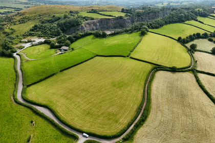
- Price
- Guide Price£300,000
- Size
- 24.27 acres
Land & Buildings at Craig Yr Odyn, Trap, Llandeilo, SA19, Llandeilo, Carmarthenshire SA19 Wales
Added on 13/07/2026Smallholding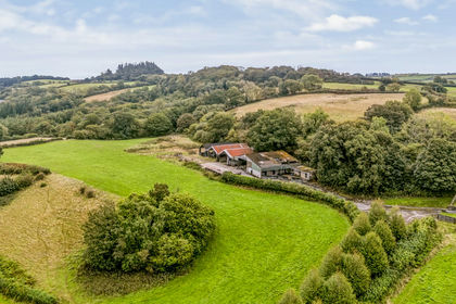
- Price
- Guide Price£195,000
- Size
- 23.06 acres
Added on 30/09/2026Smallholding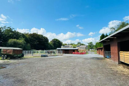
- Price
- Guide Price£250,000
- Size
- 1.3 acres
Heol Las Close, Birchgrove, Swansea, Birchgrove, Swansea SA7 Wales
Added on 26/06/2026Smallholding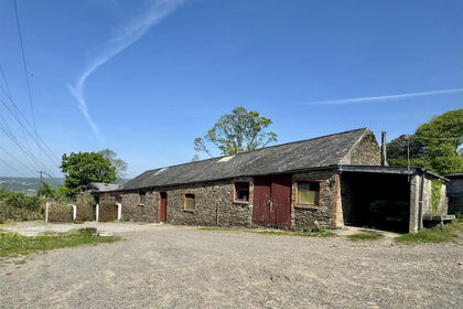
- Price
- Offers in Region of£385,000
- Size
- 10 acres
Panthowell Ddu Road, Neath, Briton Ferry, Neath Port Talbot SA11 Wales
Added on 26/06/2026Smallholding
- Price
- £300,000
- Size
- 17.72 acres
Added on 29/01/2026Smallholding
- Price
- Guide Price£300,000
- Size
- 3.16 acres
Added on 25/05/2026Smallholding
- Price
- Guide Price£295,000
- Size
- 33.03 acres
Added on 03/07/2026Farm