Wonderful Period Farmhouse with Land and Tennis Court in Hornblotton, Somerset
- Land size
- 3.12 acres
- Bedrooms
- 6
- Bathrooms
- 4
Key Features
- A beautiful Grade II listed farmhouse
- 6 bedrooms
- 5 reception rooms
- Beautiful gardens
- Outdoor entertaining area
- Tennis court
- Option of Internal two bed annexe
- Circa 3.12 acres
- Approx 5,988 sq ft of accommodation
Description
This delightful, sprawling farmhouse offers a substantial 6 bedroom house all set within extensive grounds. The property has Grade II Listed status and is believed to date from the 18th century, with parts of the home dating from much earlier.
There are three main reception rooms in the farmhouse, including the 24ft drawing room, which features dual sash windows and a handsome fireplace fitted with a log burner. There is also a comfortable sitting room with a stove, a snug which could alternatively be used as a formal dining room and a useful study for home working, while the heart of the home is the impressive 32ft kitchen and dining room. With its flagstone flooring, exposed timber beams, fireplace and French doors to the gardens, this is an ideal space for entertaining, while the kitchen itself features an Aga and fitted farmhouse-style units. The adjoining utility room provides further storage and space for home appliances. There is also a useful larder and airing cupboard.
Upstairs, the farmhouse has five well-presented bedrooms, including a well-proportioned principal bedroom with built-in storage and an en-suite bathroom. The three additional bedrooms are served by a family bathroom. The second floor provides a substantial and useful overflow accommodation or could be used as a perfect den/games room for teenage children.
There is the option to have a self-contained annexe which offers valuable ancillary accommodation arranged over two levels, with internal access to the main house. The ground floor has a sitting room and well-equipped kitchen, together with a large double bedroom with an en-suite bathroom, while upstairs is a further bedroom and bathroom. The annexe could be rented to provide an extra income or could be an ideal space for guests or a dependent relative. In doing this Middle Farm becomes a four bed property with a two bed annexe.
Outside
Outside, paved courtyard gardens form the heart of the property, with paved terracing, colourful border beds and an area of well-maintained lawn, together with access to the open-sided entertaining barn providing a superb setting for outdoor family living, al fresco dining and parties of all sizes. The wider grounds include a kitchen garden with raised beds, an enchanting grassy meadow and orchard, as well as a tennis court and outbuildings including a sheep shed, log store and garage. A gravel driveway to the front provides ample parking.
Situation
Middle Farm is situated in the peaceful hamlet of Hornblotton, surrounded by the beautiful Somerset countryside. Nearby, the pretty village of Lovington is well known for its excellent local bakery, while a selection of popular country pubs can be found within easy reach, including the Red Lion in Babcary, the Manor Inn in Ditcheat and the Alhampton Inn.
Just three miles away, Castle Cary is a thriving market town. The main street offers a good selection of independent shops, cafe´s, restaurants and delicatessens, while the weekly Tuesday market brings a range of local produce, including fish, organic vegetables and homemade bread, to the cobbles in front of the Market House. Castle Cary station also provides regular train services to London taking from 1hr 36 minutes.
The Newt in Somerset is also nearby. Its extensive gardens are open to the public, with local residents also able to access a membership scheme
The ever more popular town of Bruton is also within easy reach and is renowned for its thriving food, arts and cultural scene. Restaurants include
At The Chapel, Osip, The Old Pharmacy, The Roth Bar and Da Costa, and the internationally acclaimed Hauser & Wirth gallery. The cities of Frome, Bath, Bristol and Wells are all within reach and provide further shopping and cultural opportunities.
Directions
Postcode: BA4 6SF
What3Words : ///reefs.gathering.reap
Viewing by appointment only.
Material Information
In compliance with The Consumer Protection from Unfair Trading Regulations 2008 and National Trading Standards Estate and Letting Agency Team’s Material Information in Property Listings Guidance
Part A
• Local Authority: Somerset Council
• Council Tax Band: G
• Guide Price: £1,950,000
• Tenure: Freehold
Part B
• Property Type: Detached
• Property Construction: Brick
• Number and Types of Rooms: See Details and Plan, all measurements being maximum dimensions provided between internal walls
• Electricity Supply: Mains
• Water Supply: Mains
• Sewerage: Private - Onion Septic Tank
• Heating: Oil
• Broadband: Please refer to Ofcom website.
• Mobile Signal/Coverage: Please refer to Ofcom website.
• Parking: Private
Part C
• Building Safety: The vendor is not aware of any Building Safety issues. However, we would recommend that the purchaser’s engage the services of a Chartered Surveyor to confirm.
• Restrictions: We’re not aware of any significant/material restrictions, but we’d recommend you review the Title/deeds of the property with your solicitor.
• Rights and Easements: Paid annually for telegraph poles on land in hedges
• Flood Risk: Yearly chance of flooding for rivers and seas is very low risk.
• Coastal Erosion Risk: n/a
• Planning Permission: n/a
• Accessibility/Adaptations: n/a
• Coalfield Or Mining Area: n/a
• Energy Performance Certificate: N/A
Other Disclosures
No other Material disclosures have been made by the Vendor.
This Material Information has been compiled in good faith using the resources readily available online and by enquiry of the vendor prior to marketing. However, such information could change after compilation of the data, so Lodestone cannot be held liable for any changes post compilation or any accidental errors or omissions. Furthermore, Lodestone are not legally qualified and conveyancing documents are often complicated, necessitating judgement on our part about which parts are “Material Information” to be disclosed. If any information provided, or other matter relating to the property, is of particular importance to you please do seek verification from a legal adviser before committing to expenditure.
Map Location
Property details
- Tenure
- Freehold
- Council Tax Band
- G
- Date Posted
- 2026-09-28
Market Value Analysis
Compared with 1,673 Homes with Land listings in South West England (1+ acres).
Utilities & Restrictions
Utilities
- Electricity
- Ask Agent
- Water
- Ask Agent
- Heating
- Ask Agent
- Broadband
- Ask Agent
- Sewerage
- Ask Agent
Rights & Restrictions
- Public Rights of Way
- Ask Agent
- Private Rights of Way
- Ask Agent
- Listed Property
- Ask Agent
- Restrictions
- Ask Agent
Listed status, conservation areas and planning constraints for this location are in the full report.
Property Features
- Accessibility
- Ask Agent
- Parking
- Parking Available
- Garden
- Garden
Beyond the particulars: planning activity, flood history, heritage and ground risks, checked for this exact spot.
Connectivity
Broadband
Fastest speed available at this postcode
1 Gbps
Gigabit full fibre
Suitable for
- 4K streaming on every screen
- Full-time home working
- Online gaming & big downloads
Fixed wireless access may also be an option here.
Mobile signal
Predicted 4G and 5G signal; indoor signal depends on building materials.
Ofcom Connected Nations postcode-level predictions. Speeds and signal are modelled, not measured, and vary between addresses and providers.
Signal is the easy part. Planning activity, flood history and protected designations here are in the full report.
Nearest Schools
Primary
- Lovington Church of England Primary School1.2 milesOfsted: Inadequate
- Ages
- 4 to 11
- Pupils
- 35
- Type
- Academy sponsor led
- Faith
- Church of England
- Ditcheat Primary School2.8 milesOfsted report card · Jan 2026
- Ages
- 4 to 11
- Pupils
- 89
- Type
- Community school
- Baltonsborough Church of England VC Primary School3 milesOfsted: Requires improvement
- Ages
- 4 to 11
- Pupils
- 70
- Type
- Academy converter
- Faith
- Church of England
- Keinton Mandeville Primary School3.1 milesOfsted: Good
- Ages
- 4 to 11
- Pupils
- 149
- Type
- Community school
- Castle Cary Community Primary School3.2 milesOfsted: Requires improvement
- Ages
- 4 to 11
- Pupils
- 177
- Type
- Academy sponsor led
Secondary
- Ansford Academy3.2 milesOfsted report card · Feb 2026
- Ages
- 11 to 16
- Pupils
- 469
- Type
- Academy converter
- Sexey's School5.4 milesOfsted: Good
- Ages
- 11 to 18
- Pupils
- 633
- Type
- Academy converter
- Faith
- Church of England
- Whitstone6.6 milesOfsted: Good
- Ages
- 11 to 16
- Pupils
- 545
- Type
- Academy converter
- Crispin School Academy6.7 milesNo Ofsted rating
- Ages
- 11 to 16
- Pupils
- 978
- Type
- Academy converter
- St Dunstan's School6.8 milesOfsted: Good
- Ages
- 11 to 16
- Pupils
- 529
- Type
- Academy converter
Distances are straight-line from the advertised location. Source: the national school registers (DfE, Welsh Government, Scottish Government) and Ofsted.
Schools are just the start: sold prices nearby, planning activity and any flood history are in the full report.
Amenities
Supermarket
GP surgery
Pharmacy
Hospital
Straight-line distances from the advertised location. Sources: NHS records, Geolytix supermarket locations, OS Open Greenspace and the national trails registers.
The area stacks up? Now check the location itself: planning nearby, protected designations and past flooding.
Getting Around
Nearest station
Nearest bus stop
Typical drive times
Straight-line distances from the advertised location; drive times are typical free-flow times over OpenStreetMap road data, so allow more at peak. Public transport locations from DfT NaPTAN.
Easy to reach matters. So do planning activity, flood history and ground risks: all in the full report.
Flood Risk
Environment Agency open data, checked around the advertised map pin for the listed acreage. Long-term risk counts flood defences; the planning map's flood zones do not. Provided by LandSale, not the listing agent, and not part of the agent's particulars. Risk varies across a holding, so verify before committing.
Rivers and the sea
Planning map: Flood Zone 1.
Surface water
Not at the pin: mapped about 10 metres away.
These bandings are the summary. Where this location sits on the flood maps, plus planning activity, heritage and ground risks, is in the full report.
Important notice: Information, maps and tags on this page are drawn from the advertising agent's marketing materials or generated automatically. LandSale has not verified them. Relying on these details is at your own risk, always carry out independent checks before committing to a purchase.
LandSale full disclaimer
Marketing information only - not formal particulars. The details on this website are provided for general guidance and do not constitute an offer or contract. Neither LandSale nor the advertising estate/land agent accepts responsibility for any inaccuracy.
1. Source of information
- Listing content: Core description, asking price, tenure, measurements, photographs and planning history originate from the marketing materials of the advertising estate or land agent. LandSale does not author this content and cannot guarantee its accuracy.
- Automated tags & categorisation: Property type, land-use class, acreage bands and similar labels may be applied by machine-learning models. They are intended as a helpful guide only and may not reflect the property's legal status or permitted use.
- Third-party & enriched data layers: Maps, boundary outlines, planning designations, soil reports, broadband coverage and other environmental or location-based insights are licensed from external suppliers. Such data are supplied “as is", may be incomplete or out of date and are subject to change without notice.
2. Verification required
Prospective purchasers must verify critical matters, including but not limited to planning permission, title boundaries, public rights of way, environmental constraints, acreage, services, access and VAT status, through their own inspections, specialist surveys, legal advisers and the selling agent before relying on the information or entering into any contract.
3. No warranty or liability
LandSale gives no warranty, express or implied, as to the accuracy, completeness or fitness for any particular purpose of the information displayed. LandSale shall not be liable for any loss, damage, cost or expense arising directly or indirectly from any use of or reliance on such information, save where liability may not be excluded by law.
4. Updates & feedback
If you believe any detail on this listing is inaccurate, please let us know. We will investigate and, where appropriate, update the listing or notify the agent.
© LandSale | Version 1.3 - August 2026
Listing agent
Lodestone Property, Bruton
Bruton, Somerset
Similar properties for sale
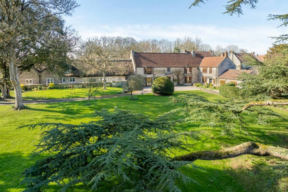
- Price
- Offers in Excess of£1,825,000
- Size
- 1.5 acres
High Street, Charlton Adam, The Charltons, Somerset TA11 England
Added on 12/03/2026House with Land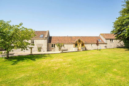
- Price
- Guide Price£2,100,000
- Size
- 5.26 acres
Lower Westholme, Pilton, Shepton Mallet, BA4, Pilton, Somerset BA4 England
Added on 20/07/2026House with Land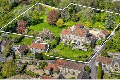
- Price
- Guide Price£2,000,000
- Size
- 2 acres
Added on 03/02/2026House with Land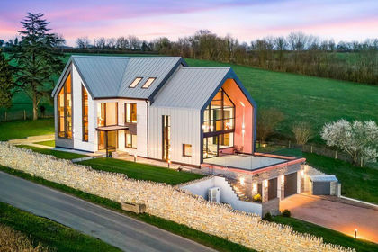
- Price
- Guide Price£2,200,000
- Size
- 1.75 acres
Stunning contemporary property in exceptional location in Pilton, Pilton, Somerset BA4 England
Added on 01/09/2026House with Land
- Price
- Guide Price£1,875,000
- Size
- 2.71 acres
Woolston, North Cadbury, Somerset, BA22, North Cadbury, Somerset BA22 England
Added on 09/09/2026Country Home
- Price
- Guide Price£1,750,000
- Size
- 2 acres
Added on 21/07/2026Development Land
- Price
- Guide Price£1,750,000
- Size
- 6 acres
Added on 15/04/2026Development Land
- Price
- Guide Price£1,500,000
- Size
- 8.6 acres
Bratton Seymour, Wincanton, Somerset, BA9, Bratton Seymour, Somerset BA9 England
Added on 09/07/2026House with Land
- Price
- Guide Price£2,250,000
- Size
- 8 acres
Discreet Listing - Georgian House close to Somerton, Somerton, Somerset TA11 England
Added on 18/09/2026House with Land
- Price
- Guide Price£1,750,000
- Size
- 2.5 acres
Added on 20/07/2026Country Home