Old Broadgate Farm, Millom, Cumbria
- Land size
- 315.03 acres
Key Features
- Excellent grass meadows
- Gentle pastures
- Hill and upland grazings
- Traditional Farm buildings
- Managed and amenity woodland
- About 315.03 acres
- LOTS 1 to 5 SOLD SUBJECT TO CONTRACT
Description
A substantial block of mixed farmland in a particularly attractive location on the edge of the Lake District National Park including traditional farm buildings, meadowland, pastures, hill grazing and managed woodland.
For sale as a whole or in Five Lots
Situation - Old Broadgate Farm lies at the southern end of The Lake District National Park, in iconic Cumbrian countryside famed for its scenery and strong agricultural tradition. It is positioned just to the east of Black Combe Fell, looking over the estuary of Wordsworth’s beloved “Majestic Duddon, over smooth flat sands gliding in silence with unfettered sweep.”
The land rises from the Black Beck to the top of Knock Fell facing southwest over the Duddon estuary about three miles from the charming market town of Broughton-in-Furness. The Green is the nearest village it offers a variety of local shops and services including a post office, village pub, baker/coffee shop and village shop. The nearby towns of Millom and Ulverston offer a wider range of services and schooling and Sedbergh School (independent boarding school) is about 43 miles away.
Junction 36 of the M6 is about 40 miles from where it is easy to reach Lancaster, Carlisle and Manchester. There is also an excellent rail service with links from The Green and Ulverston to the main West Coast rail line and London Euston (in under three hours).
The farmland is easily accessible to the A595 (Carlisle to Wigtown Road) and nearby coastal routes. Ravenglass Train Station (12 miles) on the West Coast Main Line, offers frequent services to Edinburgh, Manchester and London. The nearest airport is Leeds Bradford International (93 miles), which provides both domestic and international flights
Description - Old Broadgate Farm is an attractive and productive block of farmland set above the Duddon Estuary on the southern edge of the Lake District National Park, on the Cumbrian coast. It includes a range of Listed traditional farm buildings, woods and grassland extending in total to about 315.03 acres.
The land is managed using rolling licenses with vacant possession available on completion.
Land - The farmland at Old Broadgate extends in total to about 315.03acres (127.49ha). It is made up of approximately 36 acres of productive meadowland capable of producing good yields of conservable grass, 110 acres of permanent pastures, 128 acres of hill, upland pasture and rough grazing, and 31 acres of managed amenity woodland.
The soils are made up of a range of predominantly free draining acid loamy soils and are classified by DEFRA as being Grades 4 and 5. The land rises from about 45m above sea level to 280m at the top of Knock Fell. Fields are generally enclosed with a mixture of stone walls and post and wire fences. Some fields have access to either water troughs or natural spring or water courses.
There are sheep handling and collecting facilities beside the Swineside Lane which services the higher ground.
Natural Capital is an important asset of the estate due to its location, habitat and land use. Traditional farming methods have ensured a high degree of natural capital and bio-diverse habitats but there remains scope to develop this area further. None of the land is currently entered into a Countryside Stewardship Scheme or is receiving subsidy support under an existing Sustainable Farming incentive payment. For further details on these opportunities contact the selling agents.
Farm Buildings - The steading lies at the southern end of the farm and has direct access from Buckman Brow Road A595 along an internal farm track. It is a very attractive range of buildings including a byres and a two storey barn with dovecot. It is constructed of stone with slate roofs and is set in an L-shape with a southerly aspect. It is Listed Grade 2.
Woodland - The land includes about 30.98 acres of amenity and more commercially managed woodland. The woods are made up predominantly of native hardwoods with some significant stands of oak and sycamore. A severe storm caused wind blow in the central woodland area some 10 years ago, but this has since been cleared and replanted under a Woodland Management Plan due to complete on 19th July 2027. Details are available separately from the Selling Agents.
Viewing - Viewing is strictly by prior appointment with the selling agents. Prior to making an appointment to view the selling agent strongly recommends that you discuss any particular points which are likely to affect your interest in the property with a member of staff who has seen the property in order that you do not make a wasted journey.
Given the hazards of a working farm we ask, for your own personal safety, to be as vigilant as possible when making your inspections.
Directions (LA18 5JZ)
To reach Old Broadgate take junction 36 off the M6 and east on the A590 sign posted to Kendal and Barrow. At the Brettgarth roundabout taking the first exit to the A590. At Greenodd turn right on to the A9092, through Lowick Green and on to Grizbeck. Turn right here on to the A595 past Broughton-in-Furness towards Millom. After about 3 miles turn right sign posted to Thwaites and you have arrived on the farm.
What3words ///gather.sing.polka
Map Location
Property details
- Tenure
- Freehold
- Council Tax Band
- Ask Agent
- Date Posted
- 2026-09-21
Market Value Analysis
Compared with 4 Farmland & Pasture listings in North West England (250+ acres).
Energy Performance Certificate
Energy Efficiency Rating
Based on UK Energy Performance Certificate standards (EU Directive 2002/91/EC)
Running costs are one side. Planning activity, flood history and ground risks for this location are in the full report.
Utilities & Restrictions
Utilities
- Electricity
- Ask Agent
- Water
- Private Supply
- Heating
- Ask Agent
- Broadband
- Ask Agent
- Sewerage
- Ask Agent
Rights & Restrictions
- Public Rights of Way
- Yes
- Private Rights of Way
- Ask Agent
- Listed Property
- Ask Agent
- Restrictions
- Yes
Listed status, conservation areas and planning constraints for this location are in the full report.
Property Features
- Accessibility
- Ask Agent
- Parking
- Ask Agent
- Garden
- Ask Agent
Beyond the particulars: planning activity, flood history, heritage and ground risks, checked for this exact spot.
Connectivity
Broadband
Fastest speed available at this postcode
80 Mbps
Superfast
Suitable for
- HD streaming
- Video calls
- Web & social
Mobile signal
Outdoor predictions; indoor signal depends on building materials.
Ofcom Connected Nations postcode-level predictions. Speeds and signal are modelled, not measured, and vary between addresses and providers.
Signal is the easy part. Planning activity, flood history and protected designations here are in the full report.
Nearest Schools
Primary
- Thwaites School879 metresOfsted: Good *
- Ages
- 3 to 11
- Pupils
- 28
- Type
- Community school
- Broughton CofE Primary and Nursery School2.2 milesNo Ofsted rating
- Ages
- 2 to 11
- Pupils
- 129
- Type
- Voluntary controlled school
- Faith
- Church of England
- St James' Catholic Primary School3.8 milesNo Ofsted rating
- Ages
- 4 to 11
- Pupils
- 186
- Type
- Voluntary aided school
- Faith
- Roman Catholic
- Burlington CofE School4 milesOfsted: Good
- Ages
- 3 to 11
- Pupils
- 76
- Type
- Voluntary controlled school
- Faith
- Church of England
- Black Combe Junior School4 milesOfsted: Requires improvement
- Ages
- 7 to 11
- Pupils
- 89
- Type
- Community school
Secondary
- Millom School3.7 milesOfsted: Good
- Ages
- 11 to 18
- Pupils
- 476
- Type
- Community school
- Dowdales School8 milesNo Ofsted rating
- Ages
- 11 to 16
- Pupils
- 877
- Type
- Community school
- Ulverston Victoria High School8.6 milesOfsted: Good *
- Ages
- 11 to 18
- Pupils
- 1,319
- Type
- Community school
- Chetwynde School9.5 milesOfsted: Good
- Ages
- 3 to 16
- Pupils
- 508
- Type
- Free schools
- St Bernards Catholic High School, Barrow9.7 milesOfsted: Good
- Ages
- 11 to 16
- Pupils
- 624
- Type
- Academy converter
- Faith
- Roman Catholic
* Latest graded judgement covers quality of education only; no overall grade was issued under the 2024-25 inspection framework.
Distances are straight-line from the advertised location. Source: the national school registers (DfE, Welsh Government, Scottish Government) and Ofsted.
Schools are just the start: sold prices nearby, planning activity and any flood history are in the full report.
Amenities
Supermarket
GP surgery
Pharmacy
Hospital
Straight-line distances from the advertised location. Sources: NHS records, Geolytix supermarket locations, OS Open Greenspace and the national trails registers.
The area stacks up? Now check the location itself: planning nearby, protected designations and past flooding.
Getting Around
Nearest station
Nearest bus stop
Typical drive times
Straight-line distances from the advertised location; drive times are typical free-flow times over OpenStreetMap road data, so allow more at peak. Public transport locations from DfT NaPTAN.
Easy to reach matters. So do planning activity, flood history and ground risks: all in the full report.
Flood Risk
From Environment Agency flood map open data, checked around the advertised map pin and allowing for the listed acreage where known. This summary comes from LandSale, the advertising platform, not from the listing agent, and is not part of the agent's particulars. Risk can vary across a single holding, so verify anything critical through your own searches before committing.
Rivers and the sea
Mapped within the area searched, not at the advertised map pin itself.
Surface water
Mapped within the area searched, not at the advertised map pin itself.
These bandings are the summary. Where this location sits on the flood maps, plus planning activity, heritage and ground risks, is in the full report.
Important notice: Information, maps and tags on this page are drawn from the advertising agent's marketing materials or generated automatically. LandSale has not verified them. Relying on these details is at your own risk, always carry out independent checks before committing to a purchase.
LandSale full disclaimer
Marketing information only - not formal particulars. The details on this website are provided for general guidance and do not constitute an offer or contract. Neither LandSale nor the advertising estate/land agent accepts responsibility for any inaccuracy.
1. Source of information
- Listing content: Core description, asking price, tenure, measurements, photographs and planning history originate from the marketing materials of the advertising estate or land agent. LandSale does not author this content and cannot guarantee its accuracy.
- Automated tags & categorisation: Property type, land-use class, acreage bands and similar labels may be applied by machine-learning models. They are intended as a helpful guide only and may not reflect the property's legal status or permitted use.
- Third-party & enriched data layers: Maps, boundary outlines, planning designations, soil reports, broadband coverage and other environmental or location-based insights are licensed from external suppliers. Such data are supplied “as is", may be incomplete or out of date and are subject to change without notice.
2. Verification required
Prospective purchasers must verify critical matters, including but not limited to planning permission, title boundaries, public rights of way, environmental constraints, acreage, services, access and VAT status, through their own inspections, specialist surveys, legal advisers and the selling agent before relying on the information or entering into any contract.
3. No warranty or liability
LandSale gives no warranty, express or implied, as to the accuracy, completeness or fitness for any particular purpose of the information displayed. LandSale shall not be liable for any loss, damage, cost or expense arising directly or indirectly from any use of or reliance on such information, save where liability may not be excluded by law.
4. Updates & feedback
If you believe any detail on this listing is inaccurate, please let us know. We will investigate and, where appropriate, update the listing or notify the agent.
© LandSale | Version 1.3 - August 2026

Listing agent
GSC Grays, Farm Agency
5-6 Bailey Court, Colburn Business Park, Catterick Garrison, DL9 4QL
Contact GSC Grays, Farm Agency
5-6 Bailey Court, Colburn Business Park, Catterick Garrison, DL9 4QL
View agent profileSimilar properties for sale
- Price
- Guide Price£1,300,000
- Size
- 43.88 acres
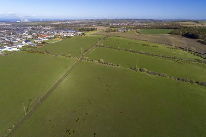
Land at Stoneyheugh, Ellerbeck Lane, Workington CA14, Workington, Cumberland CA14 England
Added on 29/01/2026Agricultural Land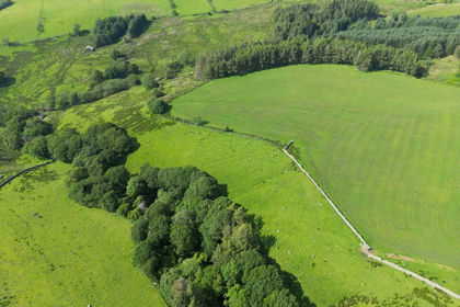
- Price
- Offers in Region of£1,150,000
- Size
- 533.4 acres
Added on 17/07/2026Agricultural Land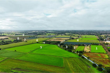
- Price
- Offers in Excess of£1,740,000
- Size
- 138.54 acres
Moss Lane, Burscough, Ormskirk, Lancashire, Burscough, Lancashire L40 England
Added on 17/09/2026Agricultural Land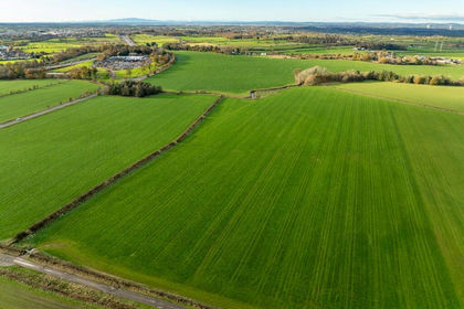
- Price
- Offers Over£1,550,000
- Size
- 136.94 acres
Land at Brunstock, Carlisle, CA6, Stanwix Rural, Cumberland CA6 England
Added on 29/01/2026Farmland
- Price
- Guide Price£950,000
- Size
- 78.92 acres
Added on 29/01/2026Farm
- Price
- Offers Over£1,200,000
- Size
- 17.79 acres
Added on 29/01/2026Development Land
- Price
- Offers Over£1,000,000
- Size
- 7.7 acres
Added on 29/01/2026Vacant Land
- Price
- Offers Over£1,175,000
- Size
- 12.19 acres
Added on 05/02/2026Development Land
- Price
- Guide Price£1,100,000
- Size
- 1.97 acres
Added on 26/08/2026Development Land
- Price
- From£900,000
South Clarewood Barns, Corbridge, Northumberland, NE45, Whittington, Northumberland NE45 England
Added on 11/03/2026Development Land