Moorwoods Lane, Holmesfield, Derbyshire
- Land size
- 23 acres
- Bedrooms
- 6
- Bathrooms
- 2
Key Features
- Early 18th Century Farmhouse In A Secluded Setting
- Extends to Approximately 23 acres (9.30 hectares) with Additional Adjoining 26.06 acres (10.54 hectares) by separate negotiation
- Potential Residential Conversion Under Class Q - Permitted Development Rights, Subject To Obtaining Any Necessary Approvals
- Range Of Outbuildings Including Stables, Machinery Store And Agricultural Buildings
- NO ONWARD CHAIN
- Six Bedrooms / Two Bathrooms
- Opportunities For Agricultural, Equestrian or Rural Business Enterprises
- Within Easy Reach Of Excellent Local Amenities and Transport Links, including Dore Train Station and M1 Motorway Network
- Located On The Edge of the Peak District National Park
- Glorious Private Views Over The Valley
Description
Moorwoods Farm presents a rare opportunity to acquire a small rural farm in a private yet highly accessible setting, ideally suited to those with agricultural, equestrian, smallholding and/or development aspirations, subject to the necessary planning consents.
The property comprises an attractive stone-built six-bedroom farmhouse dating from the 18th century, together with an extensive range of traditional and more modern agricultural buildings and stables, all set within approximately 23 acres (9.30 hectares) of adjoining grassland in a ring-fenced formation.
Despite its peaceful countryside setting, Moorwoods Farm is exceptionally well placed for commuting, being approximately 8 miles from Sheffield city centre, with Dore railway station and the M1 motorway also readily accessible.
There is also an opportunity to acquire a further adjoining 26.06 acres (10.54 hectares) or thereabouts of grassland by separate negotiation, providing the potential to create a substantially larger landholding.
Certain buildings may offer potential under Class Q - Permitted Development and prospective purchasers are advised to make their enquiries with the Local Planning Authority.
Moorwoods Farm offers an exciting opportunity to acquire a characterful small farm in a highly private setting, whilst remaining within easy commuting distance of Sheffield. At the heart of the property is an impressive stone-built 18th century farmhouse, providing six bedrooms and extensive accommodation arranged over two floors. The house retains a wealth of character and has been well maintained, whilst offering scope for modernisation and the opportunity for a purchaser to make it their own.
The farmhouse is complemented by a comprehensive range of traditional and semi-modern agricultural buildings and stabling, together with approximately 23 acres of surrounding permanent pasture. The buildings and land provide considerable versatility and will appeal to a variety of purchasers, including those with agricultural, equestrian, smallholding, workshop/storage and potential development interests, subject always to the relevant planning permissions and consents. A further adjoining 26.06 acres of grassland is available by separate negotiation for those wishing to acquire additional land.
In need of some modernisation, the farmhouse offers generously proportioned accommodation extending to six bedrooms and an excellent range of reception rooms, including a welcoming lounge, morning room, study, dining room, breakfast kitchen, utility/laundry room, cloakroom and a magnificent galleried games room with vaulted ceiling and panoramic views.
The property enjoys a peaceful rural setting approached via a long private driveway leading to a traditional courtyard with extensive parking. Despite its idyllic location, Moorwoods Farm remains conveniently positioned for Derbyshire, the Peak District, Sheffield, excellent local amenities and the M1 motorway network.
A genuinely rare opportunity to acquire a traditional farmstead combining character, privacy, extensive agricultural infrastructure and future potential in one of Derbyshire’s most desirable rural locations.
Ground Floor -
A welcoming reception hall leads to a beautifully proportioned range of reception rooms full of period charm. The morning room features exposed beams, a Minster stone fireplace and log-burning stove, whilst the study enjoys French doors opening onto the terrace and delightful valley views.
The elegant dining room benefits from exposed beams, an original gritstone fireplace and a rare Robert Thompson ("Mouseman") carved oak hearth fender.
The spacious breakfast kitchen provides a range of fitted units with adjoining dining space, ideal for family life.
The impressive lounge enjoys breathtaking countryside views together with a gritstone fireplace incorporating a multifuel stove and an extensive bespoke oak Welsh dresser.
Additional practical accommodation includes a pantry, rear lobby, utility/laundry room, boiler room, cloakroom and internal access to the integral garages.
First Floor -
The principal bedroom suite comprises a dressing area, spacious double bedroom with exposed beams and fitted wardrobes, together with a contemporary en-suite bathroom featuring both bath and separate shower.
There are five further double bedrooms, including one with an en-suite shower room, together with a separate WC.
A staircase leads to an outstanding galleried games room with exposed stone walls, vaulted ceiling and magnificent far-reaching views, currently housing a full-size snooker table.
Farmbuildings & Agricultural Structure -
One of Moorwoods Farm's defining features is its exceptional range of agricultural buildings, providing considerable flexibility for farming, equestrian use, storage, commercial operations or future diversification, subject to any necessary consents.
The buildings are currently used predominantly for agricultural and equestrian purposes, with a number offering potential for alternative uses or conversion, subject to the necessary planning permissions and consents. In particular, certain buildings may have potential for residential conversion under Class Q permitted development rights, subject to eligibility and the relevant planning requirements.
The buildings include:
Integral double garage.
Second integral garage, currently used as a tack room.
Original stable block with three loose boxes.
Traditional courtyard.
Former piggery.
Additional garage/stable building.
Four-bay Dutch barn.
Four-bay steel portal frame agricultural building incorporating four further stables.
Large open log store.
Detached machinery shed.
The combination of traditional and modern agricultural buildings is likely to be of particular interest to purchasers considering rural diversification or investigating the potential for residential conversion under current permitted development legislation, subject to obtaining all necessary approvals.
Land And Gardens -
Moorwoods Farm is approached via a sweeping driveway crossing a cattle grid before dividing into two access routes serving the farmhouse and traditional courtyard.
The mature gardens surround the property and include stone-flagged entertaining terraces, extensive lawns and beautifully established planting with rhododendrons, azaleas, acers and lilacs creating a picturesque setting throughout the seasons.
Approximately 23 acres (9.30 hectares) of land is included within the sale, arranged in a ring-fenced formation and predominantly down to permanent pasture.
The land has been well farmed and is considered to be in good heart, offering useful grazing and mowing potential for livestock and horses. The fields are divided into a number of paddocks, providing flexibility for both agricultural and equestrian use.
A small area of mature woodland lies towards the north-western boundary and incorporates a natural water supply.
For those seeking a larger landholding, there is the opportunity to purchase a further adjoining 26.06 acres (10.54 hectares) or thereabouts of grassland by separate negotiation. This additional land is shown shaded blue on the property plan.
General Information -
Planning -
The agricultural buildings may offer scope for alternative uses, including potential residential conversion under Class Q - Permitted Development Rights, subject to meeting the relevant qualifying criteria and obtaining any necessary approvals. Interested parties should rely upon their own investigations and seek independent planning advice.
Wayleave -
The property is sold subject to a wayleave relating to electricity poles and underground electricity cables crossing parts of the land.
Services -
The property benefits from mains water and electricity, private drainage via a cess pit and oil-fired central heating.
Seller Insight -
How Long Have You Lived At Moorwoods Farm? -
This has been our much loved family home for almost 50 years.
What Do You Love Most About The Property? -
Bringing our children up in a fantastic home surrounded by open countryside. My son has loved farming the land.
What Will You Miss Most About Living Here? -
The quietness and the spectacular views.
Why Have You Decided To Move? -
Now is the right time to downsize but we love the area so are staying local.
What Do You Love Most About The Location? -
I love the location, being on the edge of the Peak District yet so close to amenities.
*The comments are the personal views of the current owner and are included as an insight into life at the property.
Location -
Moorwoods Farm occupies a private and secluded position, surrounded by open countryside and enjoying attractive rural views, whilst remaining conveniently accessible to a good range of local amenities and transport links.
The nearby town of Dronfield lies approximately 4.1 miles to the east, with Chesterfield approximately 9 miles to the southeast and Bakewell approximately 10.1 miles to the south. These locations provide a comprehensive range of amenities including primary and secondary schools, doctors' surgeries, post offices, supermarkets, high street shops, public houses and fuel stations.
Sheffield city centre is approximately 8 miles to the north, providing extensive shopping, leisure and employment facilities together with excellent transport connections. Dore railway station is also conveniently accessible, as is the M1 motorway.
The combination of its rural setting and excellent accessibility makes Moorwoods Farm particularly appealing to those seeking a country lifestyle without sacrificing convenient access to Sheffield and the surrounding area.
Directions - From the centre of Holmesfield, head west along Main Road (B6054), leaving the village for approximately 1 mile. Turn right onto Moorwoods Lane and continue for approximately 0.6 miles, where the property will be found on the right-hand side.
What3Words: ///points.habit.prefer
Map Location
Property details
- Tenure
- Freehold
- Council Tax Band
- H
- Date Posted
- 2026-09-19
Market Value Analysis
Compared with 39 Farms & Smallholdings listings in East Midlands (10+ acres).
Energy Performance Certificate
Energy Efficiency Rating
Based on UK Energy Performance Certificate standards (EU Directive 2002/91/EC)
Running costs are one side. Planning activity, flood history and ground risks for this location are in the full report.
Utilities & Restrictions
Utilities
- Electricity
- Mains
- Water
- Ask Agent
- Heating
- Oil Heating
- Broadband
- Ask Agent
- Sewerage
- Septic Tank / Private
Rights & Restrictions
- Public Rights of Way
- Ask Agent
- Private Rights of Way
- Ask Agent
- Listed Property
- Ask Agent
- Restrictions
- Ask Agent
Listed status, conservation areas and planning constraints for this location are in the full report.
Property Features
- Accessibility
- Ask Agent
- Parking
- Garage, Driveway
- Garden
- Garden
Beyond the particulars: planning activity, flood history, heritage and ground risks, checked for this exact spot.
Connectivity
Broadband
Fastest speed available at this postcode
9 Mbps
Under 10 Mbps here
Suitable for
- Basic browsing & email
Mobile signal
Outdoor predictions; indoor signal depends on building materials.
Ofcom Connected Nations postcode-level predictions. Speeds and signal are modelled, not measured, and vary between addresses and providers.
Signal is the easy part. Planning activity, flood history and protected designations here are in the full report.
Nearest Schools
Primary
- Totley Primary School0.9 milesOfsted: Outstanding *
- Ages
- 4 to 11
- Pupils
- 424
- Type
- Academy converter
- Totley All Saints Church of England Voluntary Aided Primary School1 mileOfsted report card · Feb 2026
- Ages
- 4 to 11
- Pupils
- 217
- Type
- Academy converter
- Faith
- Church of England
- Penny Acres Primary School1.1 milesNo Ofsted rating
- Ages
- 4 to 11
- Pupils
- 59
- Type
- Community school
- Dore Primary School1.7 milesOfsted: Good *
- Ages
- 3 to 11
- Pupils
- 484
- Type
- Community school
- William Levick Primary School2 milesNo Ofsted rating
- Ages
- 4 to 11
- Pupils
- 207
- Type
- Community school
Secondary
- King Ecgbert School1.4 milesOfsted: Outstanding *
- Ages
- 11 to 18
- Pupils
- 1,575
- Type
- Academy converter
- Dronfield Henry Fanshawe School3.4 milesOfsted: Good
- Ages
- 11 to 18
- Pupils
- 1,810
- Type
- Voluntary controlled school
- Silverdale School3.6 milesOfsted: Good
- Ages
- 11 to 18
- Pupils
- 1,491
- Type
- Academy converter
- Meadowhead School Academy Trust3.7 milesOfsted: Good
- Ages
- 11 to 18
- Pupils
- 2,006
- Type
- Academy converter
- High Storrs School4 milesNo Ofsted rating
- Ages
- 11 to 18
- Pupils
- 1,706
- Type
- Academy converter
* Latest graded judgement covers quality of education only; no overall grade was issued under the 2024-25 inspection framework.
Distances are straight-line from the advertised location. Source: the national school registers (DfE, Welsh Government, Scottish Government) and Ofsted.
Schools are just the start: sold prices nearby, planning activity and any flood history are in the full report.
Amenities
Supermarket
GP surgery
Pharmacy
Hospital
Straight-line distances from the advertised location. Sources: NHS records, Geolytix supermarket locations, OS Open Greenspace and the national trails registers.
The area stacks up? Now check the location itself: planning nearby, protected designations and past flooding.
Getting Around
Nearest station
Nearest bus stop
Typical drive times
Straight-line distances from the advertised location; drive times are typical free-flow times over OpenStreetMap road data, so allow more at peak. Public transport locations from DfT NaPTAN.
Easy to reach matters. So do planning activity, flood history and ground risks: all in the full report.
Flood Risk
From Environment Agency flood map open data, checked around the advertised map pin and allowing for the listed acreage where known. This summary comes from LandSale, the advertising platform, not from the listing agent, and is not part of the agent's particulars. Risk can vary across a single holding, so verify anything critical through your own searches before committing.
Rivers and the sea
Surface water
Mapped within the area searched, not at the advertised map pin itself.
These bandings are the summary. Where this location sits on the flood maps, plus planning activity, heritage and ground risks, is in the full report.
Important notice: Information, maps and tags on this page are drawn from the advertising agent's marketing materials or generated automatically. LandSale has not verified them. Relying on these details is at your own risk, always carry out independent checks before committing to a purchase.
LandSale full disclaimer
Marketing information only - not formal particulars. The details on this website are provided for general guidance and do not constitute an offer or contract. Neither LandSale nor the advertising estate/land agent accepts responsibility for any inaccuracy.
1. Source of information
- Listing content: Core description, asking price, tenure, measurements, photographs and planning history originate from the marketing materials of the advertising estate or land agent. LandSale does not author this content and cannot guarantee its accuracy.
- Automated tags & categorisation: Property type, land-use class, acreage bands and similar labels may be applied by machine-learning models. They are intended as a helpful guide only and may not reflect the property's legal status or permitted use.
- Third-party & enriched data layers: Maps, boundary outlines, planning designations, soil reports, broadband coverage and other environmental or location-based insights are licensed from external suppliers. Such data are supplied “as is", may be incomplete or out of date and are subject to change without notice.
2. Verification required
Prospective purchasers must verify critical matters, including but not limited to planning permission, title boundaries, public rights of way, environmental constraints, acreage, services, access and VAT status, through their own inspections, specialist surveys, legal advisers and the selling agent before relying on the information or entering into any contract.
3. No warranty or liability
LandSale gives no warranty, express or implied, as to the accuracy, completeness or fitness for any particular purpose of the information displayed. LandSale shall not be liable for any loss, damage, cost or expense arising directly or indirectly from any use of or reliance on such information, save where liability may not be excluded by law.
4. Updates & feedback
If you believe any detail on this listing is inaccurate, please let us know. We will investigate and, where appropriate, update the listing or notify the agent.
© LandSale | Version 1.3 - August 2026
Listing agent
Saxton Mee, Sheffield
949-951 Ecclesall Road Sheffield S11 8TN
Similar properties for sale
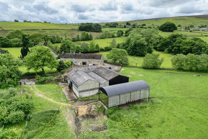
- Price
- Guide Price£1,840,000
- Size
- 23 acres
Moorwoods Farm, Moorwoods Lane, Holmesfield, Holmesfield, Derbyshire S17 England
Added on 11/09/2026Small Farm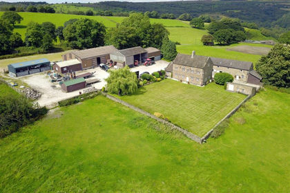
- Price
- Guide Price£2,250,000
- Size
- 35.25 acres
Fox Lane Farm, Fox Lane, Holmesfield, Dronfield, Holmesfield, Derbyshire S18 England
Added on 29/01/2026Farmhouse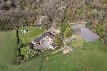
- Price
- Guide Price£1,995,000
- Size
- 73.92 acres
Monkwood Farm, Barlow, Dronfield, Barlow, Derbyshire S18 England
Added on 25/04/2026House with Land- Price
- Offers in Region of£1,750,000
- Size
- 50 acres
Monkwood Farm, Barlow, Dronfield, Barlow, Derbyshire S18 England
Added on 07/05/2026House with Land
- Price
- Offers in Region of£1,600,000
- Size
- 16.11 acres
Monkwood Farm, Barlow, Dronfield, Barlow, Derbyshire S18 England
Added on 01/07/2026House with Land
- Price
- £1,750,000
- Size
- 16 acres
Added on 07/05/2026House with Land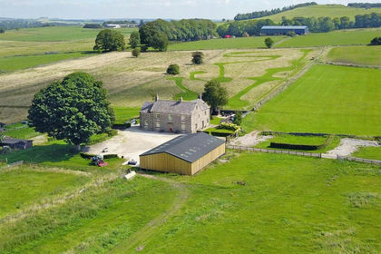
- Price
- Guide Price£1,400,000
- Size
- 17.41 acres
Added on 10/09/2026House with Land
- Price
- £1,690,000
- Size
- 26.21 acres
Mosley Hall Farm, Whaley Bridge, High Peak, Whaley Bridge, Derbyshire SK23 England
Added on 14/09/2026Smallholding
- Price
- Offers in Region of£1,550,000
- Size
- 12 acres
Crimes House Farm, Far Lane, Hepworth, Holmfirth, HD9, Holme Valley, Kirklees HD9 England
Added on 26/06/2026House with Land
- Price
- Guide Price£1,515,000
- Size
- 205.57 acres
Added on 17/07/2026Farm