Ewhurst Green, Robertsbridge, East Sussex, TN32
- Land size
- 9 acres
- Bedrooms
- 7
- Bathrooms
- 6
Key Features
- Grade II Listed
- Self-connected Annexe
- 9 acres of land
Description
Architecture & interior
Set in its own rural paradise of around 9 acres and situated within the High Weald Area of Outstanding Natural Beauty sits this beautifully restored farmhouse dating from the 14th century with later 18th century additions to the façade. Spacious and high-ceilinged rooms with impressive original features belie the contemporary lifestyle which this wonderful home exudes. Easy access to stations, shopping, schools and local amenities all contribute to making this a home for the needs of today’s families with the aesthetic of a centuries old building.
Brasses Farm is an example of a Wealden farmhouse with the attractive assets of a house of that type still in place: inglenook fireplaces, wide solid wood floorboards, structural beams and timers.
From a gravel circular drive, steps lead to a solid wood front door which leads to a generous hallway with guest bathroom to one side and access to the cellar. The ground floor is filled with light and is made up of a series of impressive reception rooms. A wonderful Dining Room with huge inglenook fireplace to one end. This leads into an elegant and very pretty Sitting Room also with a feature fireplace. Both of these rooms have views across the garden. A landing gives to the country Kitchen to one side with a range style oven, impressive runs of cupboards and storage and a stable style door opening to the garden. To the other side of the landing is a family room or snug.
At the other end of the ground floor is a beautiful Garden Room/Utility Room. This is a space which would make ironing a pleasure, but which could offer a space for a studio with a butlers sink, storage and weathered brick flooring. The Garden Room opens to a useful shower room – perfect for tidying up muddy feet and muddy paws from the garden. Door to the back garden. Also on the ground floor is a charming twin bedroom. The lobby at the foot of the stairs has floor to ceiling built in storage cupboards. Up to first floor.
Main bedroom with built in wooden wardrobes, open fireplace, views across the garden and land. Spacious en-suite bathroom with free standing bath, walk in shower. The bedrooms are linked by an airy corridor enhanced with beams but never inhibiting easy passage with no fear of bumping your head on a low ceiling. Double bedroom with en-suite shower room. Further double bedroom with dressing area and en-suite bathroom. There is a possibility subject to planning permission to utilise the capacious attic space which runs to the length of the original house and has head clearance and space for two en-suite rooms.
At the back of the house is a kitchen garden area with natural planting and a sizeable rabbit proof fenced area for vegetables and fruit growing. A former tennis court has become a natural play area with fruit trees surrounding it. From here there is a gate which opens to the approximately 8.5-acre field which could be perfect for horses or to offer to local farmers for grazing. Views to nearby Bodiam Castle.
A gravel drive leads to what would have been the wagon shed which has been beautifully converted to a three-bedroom, three-bathroom self-contained cottage which is currently used as a highly successful holiday let. The cottage has its own area of private garden at the back including a pretty pond which is fenced off for safety. There is an outbuilding which could be converted to further practical living or studio space subject to the usual necessary planning consents.
In the Neighbourhood
Brasses Farm sits at a point which gives it easy access to a range of excellent primary and secondary schools in Bodiam, Northiam and Staplecross, Robertsbridge Community College, Vinehall School, St Ronan’s and Claremont Senior School. The current owner has successfully combined schooling of children in local schools with a busy professional life in London and reports that the particular way that journeys to school work with trains makes this an entirely feasible proposition.
Ewhurst Green is nearby, home to The White Dog pub. Hawkhurst is a 15-minute drive away and has a good selection of independent shops as well as a Waitrose supermarket and a great independent cinema, The Kino. The busy seaside towns of Hastings and St Leonards are only around 25 minutes away and offer a full cultural diary of events, galleries, cinema and some notable restaurants and pubs. Closer to Ewhurst Green is the internationally lauded Great Dixter estate with its beautiful gardens which offer year round pleasure.
Transport & Connections
Robertsbridge and Etchingham stations provide services to London Bridge, Waterloo East, Charing Cross and Cannon Street with journey times of just over an hour. The A21 gives access to the M25 for Gatwick, Heathrow and Stanstead airports and to the M20 for the coastal ports.
Material Information
- Property construction: Traditional Brick
- Heating type: Oil fired central heating
- Utilities: Gas, electricity, oil, water and broadband
- Gas & Electricity Supply: Independently supplied by Octopus Energy
- Water supply: Mains connected via South East Water
- Sewerage: Private drainage.
- Broadband: Standard download speed 14Mbps, upload speed 1Mbps. Superfast available (d/s 80Mbps, u/s 20Mbps) Source: Ofcom
- Mobile signal/coverage: Likely external cover on all major networks, no internal cover with
- Vodafone & limited internal cover linked to all others. Source: Ofcom
- Restrictions: Grade II Listed (listing no 1233622)
- Flood risk: Very low to no risk of any type of flooding. Source: Government’s Flood Risk Checker
- Planning permission: Change of use refused in 2014. Souce: Rother District Council
- Coalfield or mining area: No. Source: The Coal Authority
- Flight path: Yes, albeit not necessarily directly. Source: FlightRadar24
Vodafone & limited internal cover linked to all others. Source: Ofcom
Map Location
Property details
- Tenure
- Freehold
- Council Tax Band
- G
- Date Posted
- 2026-09-15
Market Value Analysis
Compared with 471 Homes with Land listings in South East England (5+ acres).
Utilities & Restrictions
Utilities
- Electricity
- Mains
- Water
- Mains
- Heating
- Oil Heating
- Broadband
- Fibre (FTTC)
- Sewerage
- Mains
Rights & Restrictions
- Public Rights of Way
- Ask Agent
- Private Rights of Way
- Ask Agent
- Listed Property
- Ask Agent
- Restrictions
- Ask Agent
Listed status, conservation areas and planning constraints for this location are in the full report.
Property Features
- Accessibility
- Ask Agent
- Parking
- Driveway
- Garden
- Private Garden
Beyond the particulars: planning activity, flood history, heritage and ground risks, checked for this exact spot.
Connectivity
Broadband
Fastest speed available at this postcode
80 Mbps
Superfast
Suitable for
- HD streaming
- Video calls
- Web & social
Mobile signal
Outdoor predictions; indoor signal depends on building materials.
Ofcom Connected Nations postcode-level predictions. Speeds and signal are modelled, not measured, and vary between addresses and providers.
Signal is the easy part. Planning activity, flood history and protected designations here are in the full report.
Nearest Schools
Primary
- Staplecross Methodist Primary School970 metresOfsted: Good *
- Ages
- 4 to 11
- Pupils
- 88
- Type
- Voluntary controlled school
- Faith
- Methodist
- Bodiam Church of England Primary School1.4 milesOfsted: Good *
- Ages
- 4 to 11
- Pupils
- 85
- Type
- Voluntary controlled school
- Faith
- Church of England
- Salehurst Church of England Primary School2.7 milesOfsted: Good
- Ages
- 4 to 11
- Pupils
- 125
- Type
- Voluntary controlled school
- Faith
- Church of England
- Northiam Church of England Primary School and Nursery3 milesNo Ofsted rating
- Ages
- 2 to 11
- Pupils
- 159
- Type
- Academy converter
- Faith
- Church of England
- Sandhurst Primary School3.2 milesNo Ofsted rating
- Ages
- 5 to 11
- Pupils
- 179
- Type
- Community school
Secondary
- Robertsbridge Community College3.3 milesOfsted: Inadequate
- Ages
- 11 to 16
- Pupils
- 644
- Type
- Academy sponsor led
- Claverham Community College5.6 milesNo Ofsted rating
- Ages
- 11 to 16
- Pupils
- 1,147
- Type
- Community school
- Ark Alexandra Academy7.6 milesOfsted report card · Jun 2026
- Ages
- 11 to 16
- Pupils
- 1,315
- Type
- Academy sponsor led
- Faith
- Church of England
- Cranbrook School7.8 milesOfsted report card · May 2026
- Ages
- 11 to 18
- Pupils
- 958
- Type
- Academy converter
- Faith
- Christian
- Mulberry Academy Hastings7.9 milesOfsted report card · Jan 2026
- Ages
- 11 to 16
- Pupils
- 833
- Type
- Academy sponsor led
* Latest graded judgement covers quality of education only; no overall grade was issued under the 2024-25 inspection framework.
Distances are straight-line from the advertised location. Source: the national school registers (DfE, Welsh Government, Scottish Government) and Ofsted.
Schools are just the start: sold prices nearby, planning activity and any flood history are in the full report.
Amenities
Supermarket
GP surgery
Pharmacy
Hospital
Green space
Straight-line distances from the advertised location. Sources: NHS records, Geolytix supermarket locations, OS Open Greenspace and the national trails registers.
The area stacks up? Now check the location itself: planning nearby, protected designations and past flooding.
Getting Around
Nearest station
Nearest bus stop
Typical drive times
Straight-line distances from the advertised location; drive times are typical free-flow times over OpenStreetMap road data, so allow more at peak. Public transport locations from DfT NaPTAN.
Easy to reach matters. So do planning activity, flood history and ground risks: all in the full report.
Flood Risk
From Environment Agency flood map open data, checked around the advertised map pin and allowing for the listed acreage where known. This summary comes from LandSale, the advertising platform, not from the listing agent, and is not part of the agent's particulars. Risk can vary across a single holding, so verify anything critical through your own searches before committing.
Rivers and the sea
Surface water
Mapped within the area searched, not at the advertised map pin itself.
The detail behind these bandings
The full report pinpoints where this location sits on the flood maps, and runs the deeper checks that usually only surface after an offer.
- Exact flood zones & annual chances (included in the full report)
- Any recorded past flooding (included in the full report)
- Planning activity nearby (included in the full report)
- Heritage & conservation (included in the full report)
- Protected nature designations (included in the full report)
- Ground risks (included in the full report)
- Sold prices nearby (included in the full report)
£14.99 · one-off purchase
By LandSale, the platform. Not provided by the listing agent. Ready in about a minute.
Important notice: Information, maps and tags on this page are drawn from the advertising agent's marketing materials or generated automatically. LandSale has not verified them. Relying on these details is at your own risk, always carry out independent checks before committing to a purchase.
LandSale full disclaimer
Marketing information only - not formal particulars. The details on this website are provided for general guidance and do not constitute an offer or contract. Neither LandSale nor the advertising estate/land agent accepts responsibility for any inaccuracy.
1. Source of information
- Listing content: Core description, asking price, tenure, measurements, photographs and planning history originate from the marketing materials of the advertising estate or land agent. LandSale does not author this content and cannot guarantee its accuracy.
- Automated tags & categorisation: Property type, land-use class, acreage bands and similar labels may be applied by machine-learning models. They are intended as a helpful guide only and may not reflect the property's legal status or permitted use.
- Third-party & enriched data layers: Maps, boundary outlines, planning designations, soil reports, broadband coverage and other environmental or location-based insights are licensed from external suppliers. Such data are supplied “as is", may be incomplete or out of date and are subject to change without notice.
2. Verification required
Prospective purchasers must verify critical matters, including but not limited to planning permission, title boundaries, public rights of way, environmental constraints, acreage, services, access and VAT status, through their own inspections, specialist surveys, legal advisers and the selling agent before relying on the information or entering into any contract.
3. No warranty or liability
LandSale gives no warranty, express or implied, as to the accuracy, completeness or fitness for any particular purpose of the information displayed. LandSale shall not be liable for any loss, damage, cost or expense arising directly or indirectly from any use of or reliance on such information, save where liability may not be excluded by law.
4. Updates & feedback
If you believe any detail on this listing is inaccurate, please let us know. We will investigate and, where appropriate, update the listing or notify the agent.
© LandSale | Version 1.3 - August 2026
Listing agent
Unique Property Company, Unique Property Company
Unit 17 The Gransden, 39 Gransden Avenue, London E8 3QA
Contact Unique Property Company, Unique Property Company
Unit 17 The Gransden, 39 Gransden Avenue, London E8 3QA
View agent profileSimilar properties for sale
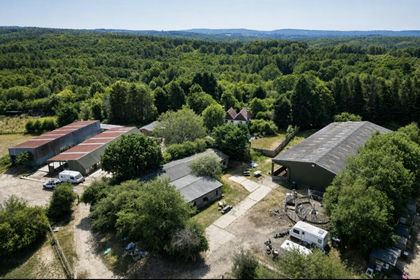
- Price
- Guide Price£1,385,000
- Size
- 33.8 acres
Ellenwhorne Lane, Staplecross, Robertsbridge, East Sussex, Ewhurst, East Sussex TN32 England
Added on 29/07/2026Equestrian property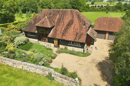
- Price
- Guide Price£1,250,000
- Size
- 11.58 acres
Bodiam, Robertsbridge, East Sussex, TN32, Salehurst and Robertsbridge, East Sussex TN32 England
Added on 28/05/2026Barn Conversion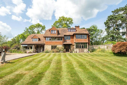
- Price
- Guide Price£1,250,000
- Size
- 7.7 acres
Silverhill, Robertsbridge, Salehurst and Robertsbridge, East Sussex TN32 England
Added on 31/08/2026House with Land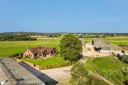
- Price
- £1,475,000
- Size
- 59.65 acres
Lomas Lane, Sandhurst, Kent, TN18, Sandhurst, Kent TN18 England
Added on 28/01/2026Livestock Farm
- Price
- Guide Price£1,700,000
- Size
- 6.5 acres
Haremere Hill, Etchingham, Hurst Green, East Sussex TN19 England
Added on 06/06/2026House with Land
- Price
- Guide Price£1,300,000
- Size
- 5.9 acres
Blackbrooks, Sedlescombe, Battle, TN33, Sedlescombe, East Sussex TN33 England
Added on 13/05/2026House with Land
- Price
- Guide Price£1,550,000
- Size
- 9.21 acres
Whitebread Lane, Beckley, Rye, East Sussex, TN31, Beckley, East Sussex TN31 England
Added on 10/06/2026Farmhouse
- Price
- Guide Price£1,300,000
- Size
- 28 acres
Kent Street, Sedlescombe, Westfield, East Sussex TN33 England
Added on 10/08/2026House with Land
- Price
- Guide Price£1,500,000
- Size
- 21 acres
Added on 17/07/2026Vineyard
- Price
- Guide Price£1,750,000
- Size
- 5.67 acres
Dingleden, Benenden, Cranbrook, Kent, TN17, Benenden, Kent TN17 England
Added on 29/01/2026House with Land