West End, Ampleforth, York
- Land size
- 1.6 acres
- Bedrooms
- 5
- Bathrooms
- 4
Key Features
- Detached mid-20th century house in 1.6 acres
- Adaptable living accommodation with east wing annexe
- Over 3600 sq ft arranged over 2 floors
- Outstanding views across the Ampleforth Valley
- Double garage, ample gated parking
- Landscaped garden to the front
- Lawns and woodland area rising behind
- Edge of village position
- Within the National Park and overlooking the Howardian Hills National Landscape
Description
Outstanding mid-20th century house in 1.6 acres, south facing and elevated with far-reaching views across the valley.
Shallowdale House is a remarkable example of mid-twentieth-century domestic architecture, conceived with a clear relationship between light, space and its hillside setting. Natural light floods the interiors through a continuous run of wide picture windows across the southern elevation, while the open-plan arrangement creates adaptable living spaces that remain well suited to modern family life.
After 65 years, the house’s bold architectural form has been softened by colourful climbers across the stone elevations and superb planting that has reached maturity, allowing the building to settle naturally into its landscape. The gardens embrace the house, rising gently into mature wooded grounds, while uninterrupted views extend across the Ampleforth Valley, encompassing rolling hills, patchwork fields and woodland.
A much-loved private home and guest house for 28 years, Shallowdale House now presents a rare opportunity for sympathetic renovation, while preserving the character, integrity and distinctive qualities of its original design.
Front porch, reception hall, cloakroom, 3 reception rooms, sun porch, kitchen breakfast room, utility/boot room,
Landing with library/reading area, 3 bedrooms, 3 bathrooms
Annexe: bedroom 4, study/living room with kitchen, bathroom, separate wc, balcony
2 attached stores
Lean-to greenhouse, potting shed, garden shed
Double garage
Landscaped garden, orchard, lightly wooded area
In all 1.6 acres
Find Out A Little More .... - Named after the small dale adjacent to the property, Shallowdale House was built in 1960 in stone and pantile to a bespoke design. Many original mid-century details remain, including the aluminium sliding picture windows carefully positioned to capture the extensive views. Other surviving features include the suspended ceiling with concealed lighting, internal glazed sliding pocket doors, oak flooring, a staircase with tubular metal spindles and turned oak handrail, handcrafted metal door furniture, retractable metal hooks and the original ducted warm air heating system with floor and wall grilles.
Two rows of south-facing picture windows provide exceptional natural light and solar gain, while a wide internal doorway light to flow between adjoining rooms. A series of front-facing reception rooms are linked by sliding doors, creating the possibility of one continuous living space – ideal for large-scale entertaining - extending to more than 50 ft, with full-height windows and doors opening onto the terrace.
The drawing room spans the depth of the house and features a recessed Baxi open fire. Expansive floor-to-ceiling windows bring in both south and west-facing light, while sliding doors open into the staircase hall, where the polished oak floorboards continue into the dining room. The broad reception hall benefits from dual aspect light, with views towards the garden from the front sun porch and a distinctive entrance door from the drive featuring a porthole window.
The dining room offers further flexibility, with double sliding doors opening into the sitting room, a dual aspect living space with a glazed door leading onto the south-facing terrace and gardens beyond.
The kitchen breakfast room has quarry tiled flooring and space for a family-sized table. The fitted country-style kitchen is arranged around a peninsula island with induction hob, while the adjoining utility/boot room provides a practical rear entrance to the drive. Fitted with a Shanks sink and built-in cupboards, the room also retains evidence of the house’s original service features, including a former laundry chute and dumb waiter, both of which could be reinstated.
A narrow doorway leads from the utility room into the eastern wing annexe, formerly the integral garage and remodelled to provide accommodation arranged over two floors, with independent access from the drive. Currently used as private owners’ accommodation, it comprises an inner hall with wine cupboard, separate cloakroom and open tread staircase, together with a ground floor bedroom with fitted wardrobes and a double aspect outlook across the garden. The first floor provides a flexible study/living space enhanced by remarkable views - and with a small kitchen and bathroom.
Stairs rise from the central hall, passing a tall window which brings natural light into the stairwell, and continue to a generous landing with library and reading area - offering perhaps the finest aspect of all. All three main bedrooms are well-proportioned doubles, positioned at the front of the house to make the most of the views, with built-in wardrobes and bathrooms located to the rear.
The principal bedroom suite forms a private area of the house with its own doorway and has access to the balcony; it comes with a fitted dressing room and en suite bathroom, equipped with shower, corner bath and heated towel rail. Bedroom 2 includes a wash basin, while bedroom 3 mirrors the generous proportions of the drawing room below and benefits from dual aspect views together with an en suite bathroom. The house bathroom is fitted with a bath and shower over.
Outside - Two five-bar gates open onto the tarmacadam drive, enclosed by planting, which sweeps across the rear of the house to the double garage. The garage is triple aspect, with timber doors, power, lighting and loft storage. A rose-clad metal arch marks the pathway to the main entrance, with steps descending, illuminated by motion-sensor lighting. Beneath two external stone staircases with metal railings are integral outbuildings, each housing a boiler. On the opposite side of the drive, steps within a retaining stone wall rise to the practical garden area with composting area, garden shed and oil tank.
The gardens wrap around the house, with the natural slope of the hillside rising behind into broad sweeping lawns, punctuated by magnificent broadleaf trees - including copper beech, weeping willow and a robinia - and a productive orchard, underplanted with seasonal carpets of snowdrops and daffodils.
The upper section forms one of the most distinctive features of the grounds, the garden gradually revealing itself as the meandering mowed path continues upwards through woodland, passing alongside borders of shrubs and beneath specimen trees, including a Handkerchief Tree. A useful tap is situated at the far boundary. The whole is enclosed by post and rail fencing, with established roadside hedging providing privacy. A further five-bar gate from High Bank gives access to the upper section of the garden.
To the front, the garden is beautifully landscaped and includes an elevated south-facing paved terrace bordered by a rose bed, with a lean-to greenhouse at the far corner and an external tap. A broad flight of steps, flanked at the top by stone posts topped with cannon balls of unknown provenance descends to a sweeping lawn enclosed by mature planting, including a fine weeping birch. A tall hedge forms the front boundary, providing privacy and shelter, and a rose arch leads around to a sunken walled barbecue area, with stone seating and an outdoor fireplace.
Environs - Helmsley 5 miles, Easingwold 9 miles, Thirsk 11 miles, York 20 miles
Shallowdale lies in an elevated position at the far western end of Ampleforth, overlooking the Howardian Hills which separate the vales of York and Pickering, and act as a bridge between the North York Moors and the Yorkshire Wolds.
Ampleforth is a large village with a strong and active community, well served by a range of amenities including a primary school, churches, village store and post office, GP practice, two pubs and a café - surrounded by well-wooded countryside with an extensive network of public footpaths. It is home to the renowned co-educational public school, Ampleforth College. Further independent schools are within comfortable reach, including Terrington Hall School, Queen Mary’s School and the leading independent schools in York.
Approximately ten minutes’ drive away is the thriving market town of Helmsley, situated on the southern edge of the North York Moors National Park. The railway station at Thirsk Railway Station, around a 30-minute drive, provides mainline services via the East Coast and TransPennine routes, while the nearby A19 offers swift access to the A1(M). The historic city of York is approximately 45 minutes’ drive to the south.
Important Information - Tenure: Freehold
EPC Rating: E
Council Tax Band: Annexe B, House exempt under small business rates
Services & Systems: Mains electricity, water and drainage. Oil central heating.
Fixtures & Fittings: All items in the written text of these particulars are included in the sale. All others are expressly excluded regardless of inclusion in any photographs. Purchasers must satisfy themselves that any equipment included in the sale of the property is in satisfactory order.
Local Authority: North Yorkshire Council North York Moors National Park
Money Laundering Regulations: Prior to a sale being agreed, prospective purchasers are required to produce identification documents in order to comply with Money Laundering regulations. Your co-operation with this is appreciated and will assist with the smooth progression of the sale.
Directions: Coming from the A19 into Ampleforth, west to east, High Bank is immediately after the 30mph sign. Shallowdale House is the first on the left.
What3words: ///loving.valuables.trophy
Viewing: Strictly by appointment
Photographs, images, brochure and property highlights video: June 2026. Some images may have been enhanced using artificial intelligence (AI); any such images will be clearly identified individually. Google map images may neither be current nor a true representation.
Map Location
Property details
- Tenure
- Freehold
- Council Tax Band
- B
- Date Posted
- 2026-09-09
Market Value Analysis
Compared with 689 Homes with Land listings in Yorkshire and The Humber (1+ acres).
Energy Performance Certificate
Energy Efficiency Rating
Based on UK Energy Performance Certificate standards (EU Directive 2002/91/EC)
Running costs are one side. Planning activity, flood history and ground risks for this location are in the full report.
Utilities & Restrictions
Utilities
- Electricity
- Ask Agent
- Water
- Ask Agent
- Heating
- Ask Agent
- Broadband
- Ask Agent
- Sewerage
- Ask Agent
Rights & Restrictions
- Public Rights of Way
- Ask Agent
- Private Rights of Way
- Ask Agent
- Listed Property
- Ask Agent
- Restrictions
- Ask Agent
Listed status, conservation areas and planning constraints for this location are in the full report.
Property Features
- Accessibility
- Ask Agent
- Parking
- Parking Available
- Garden
- Garden
Beyond the particulars: planning activity, flood history, heritage and ground risks, checked for this exact spot.
Connectivity
Broadband
Fastest speed available at this postcode
1 Gbps
Gigabit full fibre
Suitable for
- 4K streaming on every screen
- Full-time home working
- Online gaming & big downloads
Mobile signal
Outdoor predictions; indoor signal depends on building materials.
Ofcom Connected Nations postcode-level predictions. Speeds and signal are modelled, not measured, and vary between addresses and providers.
Signal is the easy part. Planning activity, flood history and protected designations here are in the full report.
Nearest Schools
Primary
- St Benedict's Catholic Primary School - a Catholic voluntary academy758 metresNo Ofsted rating
- Ages
- 3 to 11
- Pupils
- 88
- Type
- Academy converter
- Faith
- Roman Catholic
- Helmsley Community Primary School4 milesOfsted: Good
- Ages
- 2 to 11
- Pupils
- 177
- Type
- Academy converter
- Husthwaite Church of England Primary School4.6 milesOfsted: Requires improvement
- Ages
- 3 to 11
- Pupils
- 64
- Type
- Academy sponsor led
- Faith
- Church of England
- Crayke Church of England Voluntary Controlled Primary School5.3 milesOfsted: Good
- Ages
- 4 to 11
- Pupils
- 106
- Type
- Voluntary controlled school
- Faith
- Church of England
- Nawton Community Primary School6.2 milesOfsted report card · Mar 2026
- Ages
- 3 to 11
- Pupils
- 90
- Type
- Community school
Secondary
- Ryedale School5.9 milesOfsted: Outstanding
- Ages
- 11 to 16
- Pupils
- 698
- Type
- Academy converter
- Outwood Academy Easingwold6.6 milesOfsted: Outstanding
- Ages
- 11 to 18
- Pupils
- 823
- Type
- Academy sponsor led
- Thirsk School & Sixth Form College9.6 milesOfsted report card · Mar 2026
- Ages
- 11 to 18
- Pupils
- 1,029
- Type
- Community school
- Malton School13 milesOfsted: Good
- Ages
- 11 to 18
- Pupils
- 999
- Type
- Academy converter
- Lady Lumley's Academy14 milesOfsted: Good
- Ages
- 11 to 18
- Pupils
- 676
- Type
- Academy sponsor led
Distances are straight-line from the advertised location. Source: the national school registers (DfE, Welsh Government, Scottish Government) and Ofsted.
Schools are just the start: sold prices nearby, planning activity and any flood history are in the full report.
Amenities
Supermarket
GP surgery
Pharmacy
Hospital
Green space
Straight-line distances from the advertised location. Sources: NHS records, Geolytix supermarket locations, OS Open Greenspace and the national trails registers.
The area stacks up? Now check the location itself: planning nearby, protected designations and past flooding.
Getting Around
Nearest station
Nearest bus stop
Typical drive times
Straight-line distances from the advertised location; drive times are typical free-flow times over OpenStreetMap road data, so allow more at peak. Public transport locations from DfT NaPTAN.
Easy to reach matters. So do planning activity, flood history and ground risks: all in the full report.
Flood Risk
From Environment Agency flood map open data, checked around the advertised map pin and allowing for the listed acreage where known. This summary comes from LandSale, the advertising platform, not from the listing agent, and is not part of the agent's particulars. Risk can vary across a single holding, so verify anything critical through your own searches before committing.
Rivers and the sea
Surface water
The detail behind these bandings
The full report pinpoints where this location sits on the flood maps, and runs the deeper checks that usually only surface after an offer.
- Exact flood zones & annual chances (included in the full report)
- Any recorded past flooding (included in the full report)
- Planning activity nearby (included in the full report)
- Heritage & conservation (included in the full report)
- Protected nature designations (included in the full report)
- Ground risks (included in the full report)
- Sold prices nearby (included in the full report)
£14.99 · one-off purchase
By LandSale, the platform. Not provided by the listing agent. Ready in about a minute.
Important notice: Information, maps and tags on this page are drawn from the advertising agent's marketing materials or generated automatically. LandSale has not verified them. Relying on these details is at your own risk, always carry out independent checks before committing to a purchase.
LandSale full disclaimer
Marketing information only - not formal particulars. The details on this website are provided for general guidance and do not constitute an offer or contract. Neither LandSale nor the advertising estate/land agent accepts responsibility for any inaccuracy.
1. Source of information
- Listing content: Core description, asking price, tenure, measurements, photographs and planning history originate from the marketing materials of the advertising estate or land agent. LandSale does not author this content and cannot guarantee its accuracy.
- Automated tags & categorisation: Property type, land-use class, acreage bands and similar labels may be applied by machine-learning models. They are intended as a helpful guide only and may not reflect the property's legal status or permitted use.
- Third-party & enriched data layers: Maps, boundary outlines, planning designations, soil reports, broadband coverage and other environmental or location-based insights are licensed from external suppliers. Such data are supplied “as is", may be incomplete or out of date and are subject to change without notice.
2. Verification required
Prospective purchasers must verify critical matters, including but not limited to planning permission, title boundaries, public rights of way, environmental constraints, acreage, services, access and VAT status, through their own inspections, specialist surveys, legal advisers and the selling agent before relying on the information or entering into any contract.
3. No warranty or liability
LandSale gives no warranty, express or implied, as to the accuracy, completeness or fitness for any particular purpose of the information displayed. LandSale shall not be liable for any loss, damage, cost or expense arising directly or indirectly from any use of or reliance on such information, save where liability may not be excluded by law.
4. Updates & feedback
If you believe any detail on this listing is inaccurate, please let us know. We will investigate and, where appropriate, update the listing or notify the agent.
© LandSale | Version 1.3 - August 2026
Listing agent
Blenkin & Co, York
Priestley House Bootham York YO30 7BL
Similar properties for sale
- Price
- Guide Price£750,000
- Size
- 1.8 acres
The Paddocks, Gilling East, York, Grimstone, North Yorkshire YO62 England
Added on 07/05/2026Cottage
- Price
- £995,000
- Size
- 1.65 acres
Carlton Husthwaite, Carlton Husthwaite, North Yorkshire YO7 England
Added on 29/01/2026Barn Conversion
- Price
- Guide Price£1,000,000
- Size
- 2.75 acres
Main Street, Whenby, York, YO61, Whenby, North Yorkshire YO61 England
Added on 18/08/2026House with Land
- Price
- £895,000
- Size
- 2.74 acres
Main Street, Wombleton, York, Wombleton, North Yorkshire YO62 England
Added on 12/08/2026House with Land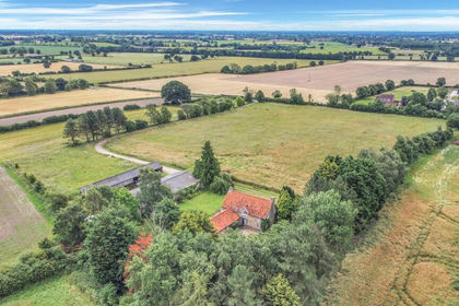
- Price
- Offers in Region of£1,250,000
- Size
- 7.55 acres
Easingwold Road, Stillington, Stillington, North Yorkshire YO61 England
Added on 28/01/2026Farmhouse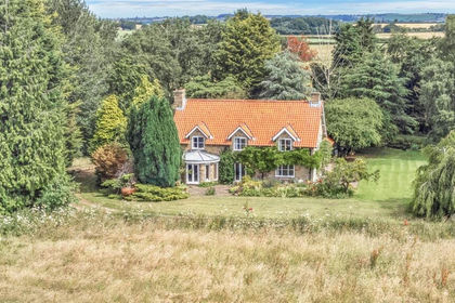
- Price
- Offers in Region of£1,250,000
- Size
- 7.55 acres
Easingwold Road, Stillington, Stillington, North Yorkshire YO61 England
Added on 07/06/2026Farmhouse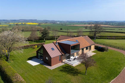
- Price
- Offers in Excess of£1,250,000
- Size
- 2.17 acres
Bonny View, Marton In The Forest, Stillington, York, Marton-cum-Moxby, North Yorkshire YO61 England
Added on 06/08/2026House with Land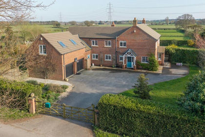
- Price
- £1,100,000
- Size
- 1.5 acres
Added on 03/05/2026House with Land
- Price
- £1,250,000
- Size
- 1.5 acres
Added on 23/05/2026House with Land
- Price
- Guide Price£1,225,000
- Size
- 3.9 acres
Burnham House, Main Street, Sessay, North Yorkshire, Sessay, North Yorkshire YO7 England
Added on 21/08/2026House with Land