Moss House Lane, Much Hoole, PR4
- Land size
- 0.5 acres
- Bedrooms
- 4
- Bathrooms
- 3
Key Features
- Four-bedroom detached eco-friendly barn conversion
- Geothermal ground source underfloor heating throughout
- Solar hot water panels
- EV charging point
- Bespoke breakfast kitchen with granite worktops
- Almost half an acre of landscaped grounds
- Whole-house ventilation with heat recovery
- Double garage with electric roller doors
- Sought after location
Description
Churcher Estates are proud to present Rothwell Barn, a truly exceptional four-bedroom detached eco-friendly barn conversion, perfectly positioned on the highly desirable Moss House Lane. Surrounded by open countryside, this location offers a wonderfully peaceful rural setting, with the convenience of charming local villages and amenities. Excellent transport links, as well as access to well-regarded local schools, Moss House Lane combines tranquility, character and practicality, making it an ideal place for family living.
Set behind electric hardwood gates and sweeping driveway, this one-of-a-kind home, with history dating back to 1840, was thoughtfully and sympathetically converted in 2009. Seamlessly blending rustic charm with an array of state-of-the-art eco technology, beautifully established private landscaped grounds, generous entertaining spaces, and far-reaching views.
From the outset, Rothwell Barn sets itself apart as an environmentally conscious property with remarkably low running costs. Features such as, geothermal ground source underfloor heating throughout, solar hot water roof panels, a 4000-litre rainwater harvesting tank servicing the WC's, washing machine and fire sprinkler system. A modern biodigester sewage system, and a whole-house ventilation system with heat recovery, ensure sustainable living without compromising on comfort. The addition of a Smart Elec meter, EV charging point, and programmable LED mood lighting make this barn conversion not only future-proof but also highly cost-efficient.
Upon stepping inside you are welcomed by an abundance of character that flows throughout, with magnificent internal oak doors, solid wood flooring, and exposed timbers.
The heart of the ground floor is the breakfast kitchen, thoughtfully designed with bespoke cabinetry, granite worktops, and a Belfast sink with Quooker boiling tap. A range-style cooker set against a brick feature wall provides a striking focal point. The adjoining dining room creates the perfect setting for formal entertaining, flowing seamlessly into the lounge where a feature fireplace with multi-fuel stove and exposed beams give this space warmth and charm, balanced beautifully with modern comforts such as a fully integrated entertainment system, from a centrally distributed audio visual and Sonos sound system. Full height glass doors flood the room with light and open directly into the Garden Room. A stunning space with high vaulted ceilings and French doors looking out to the gardens.
Further, the ground floor offers highlights to include a cloakroom with WC and flexible studio with hardwood bi-fold doors, providing the versatility for additional living accommodation, such as a home office, gym, or creative space.
Upstairs the home continues to impress, with four generously sized bedrooms, each enjoying vaulted ceilings, timber beams, and exposed brick detailing. The principal suite is a true sanctuary with dressing room, En-suite shower room and dual-aspect windows. A further guest bedroom also benefits from an En-suite, while two additional bedrooms are served by a family bathroom, complete with both bath and shower.
Set in almost half an acre of established grounds, the exterior is equally remarkable. Sweeping lawns, mature hedges and a paddock, create an idyllic setting. The far end of the paddock captures the sun until it sets during the summer months, making it the perfect spot for quiet relaxation. Large paved stone patios offer ideal areas for alfresco dining and entertaining. A detached oak-framed and clad double garage with electric roller doors provides additional secure parking and storage.
Rothwell Barn is truly one of a kind. An eco-friendly, technologically advanced, and entirely private home that balances rustic charm with modern sophistication. Rarely does a property of this quality and individuality come to the market, offering not just a home, but a complete lifestyle in a prestigious and peaceful location.
Viewings Available on request
COUNCIL TAX F
FREEHOLD
EPC Rating: C
Map Location
Property details
- Tenure
- Freehold
- Council Tax Band
- F
- Date Posted
- 2026-09-08
Energy Performance Certificate
Energy Efficiency Rating
Based on UK Energy Performance Certificate standards (EU Directive 2002/91/EC)
Running costs are one side. Planning activity, flood history and ground risks for this location are in the full report.
Utilities & Restrictions
Utilities
- Electricity
- Ask Agent
- Water
- Ask Agent
- Heating
- Ask Agent
- Broadband
- Ask Agent
- Sewerage
- Ask Agent
Rights & Restrictions
- Public Rights of Way
- Ask Agent
- Private Rights of Way
- Ask Agent
- Listed Property
- Ask Agent
- Restrictions
- Ask Agent
Listed status, conservation areas and planning constraints for this location are in the full report.
Property Features
- Accessibility
- Ask Agent
- Parking
- Parking Available
- Garden
- Garden
Beyond the particulars: planning activity, flood history, heritage and ground risks, checked for this exact spot.
Connectivity
Broadband
Fastest speed available at this postcode
1.8 Gbps
Gigabit full fibre
Suitable for
- 4K streaming on every screen
- Full-time home working
- Online gaming & big downloads
Mobile signal
Outdoor predictions; indoor signal depends on building materials.
Ofcom Connected Nations postcode-level predictions. Speeds and signal are modelled, not measured, and vary between addresses and providers.
Signal is the easy part. Planning activity, flood history and protected designations here are in the full report.
Nearest Schools
Primary
- Little Hoole Primary School0.7 milesNo Ofsted rating
- Ages
- 5 to 11
- Pupils
- 186
- Type
- Community school
- Hoole St Michael CofE Primary School1.3 milesOfsted report card · Jan 2026
- Ages
- 3 to 11
- Pupils
- 81
- Type
- Voluntary aided school
- Faith
- Church of England
- Bretherton Endowed Church of England Voluntary Aided Primary School1.6 milesOfsted: Good
- Ages
- 4 to 11
- Pupils
- 105
- Type
- Voluntary aided school
- Faith
- Church of England
- Longton Primary School1.7 milesOfsted: Good *
- Ages
- 4 to 11
- Pupils
- 213
- Type
- Foundation school
- St Oswald's Catholic Primary School, Longton1.7 milesNo Ofsted rating
- Ages
- 4 to 11
- Pupils
- 246
- Type
- Voluntary aided school
- Faith
- Roman Catholic
Secondary
- Tarleton Academy2.1 milesNo Ofsted rating
- Ages
- 11 to 16
- Pupils
- 674
- Type
- Academy converter
- Hutton Church of England Grammar School2.4 milesOfsted report card · May 2026
- Ages
- 11 to 18
- Pupils
- 807
- Type
- Voluntary aided school
- Faith
- Church of England
- Gender
- Boys
- Bishop Rawstorne Church of England Academy2.7 milesOfsted report card · Jan 2026
- Ages
- 11 to 16
- Pupils
- 958
- Type
- Academy converter
- Faith
- Church of England
- Academy@Worden3 milesOfsted: Good *
- Ages
- 11 to 16
- Pupils
- 660
- Type
- Academy converter
- St Mary's Catholic High School3.2 milesNo Ofsted rating
- Ages
- 11 to 16
- Pupils
- 813
- Type
- Voluntary aided school
- Faith
- Roman Catholic
* Latest graded judgement covers quality of education only; no overall grade was issued under the 2024-25 inspection framework.
Distances are straight-line from the advertised location. Source: the national school registers (DfE, Welsh Government, Scottish Government) and Ofsted.
Schools are just the start: sold prices nearby, planning activity and any flood history are in the full report.
Amenities
Supermarket
GP surgery
Pharmacy
Hospital
Straight-line distances from the advertised location. Sources: NHS records, Geolytix supermarket locations, OS Open Greenspace and the national trails registers.
The area stacks up? Now check the location itself: planning nearby, protected designations and past flooding.
Getting Around
Nearest station
Nearest bus stop
Typical drive times
Straight-line distances from the advertised location; drive times are typical free-flow times over OpenStreetMap road data, so allow more at peak. Public transport locations from DfT NaPTAN.
Easy to reach matters. So do planning activity, flood history and ground risks: all in the full report.
Flood Risk
From Environment Agency flood map open data, checked around the advertised map pin and allowing for the listed acreage where known. This summary comes from LandSale, the advertising platform, not from the listing agent, and is not part of the agent's particulars. Risk can vary across a single holding, so verify anything critical through your own searches before committing.
Rivers and the sea
Surface water
These bandings are the summary. Where this location sits on the flood maps, plus planning activity, heritage and ground risks, is in the full report.
Important notice: Information, maps and tags on this page are drawn from the advertising agent's marketing materials or generated automatically. LandSale has not verified them. Relying on these details is at your own risk, always carry out independent checks before committing to a purchase.
LandSale full disclaimer
Marketing information only - not formal particulars. The details on this website are provided for general guidance and do not constitute an offer or contract. Neither LandSale nor the advertising estate/land agent accepts responsibility for any inaccuracy.
1. Source of information
- Listing content: Core description, asking price, tenure, measurements, photographs and planning history originate from the marketing materials of the advertising estate or land agent. LandSale does not author this content and cannot guarantee its accuracy.
- Automated tags & categorisation: Property type, land-use class, acreage bands and similar labels may be applied by machine-learning models. They are intended as a helpful guide only and may not reflect the property's legal status or permitted use.
- Third-party & enriched data layers: Maps, boundary outlines, planning designations, soil reports, broadband coverage and other environmental or location-based insights are licensed from external suppliers. Such data are supplied “as is", may be incomplete or out of date and are subject to change without notice.
2. Verification required
Prospective purchasers must verify critical matters, including but not limited to planning permission, title boundaries, public rights of way, environmental constraints, acreage, services, access and VAT status, through their own inspections, specialist surveys, legal advisers and the selling agent before relying on the information or entering into any contract.
3. No warranty or liability
LandSale gives no warranty, express or implied, as to the accuracy, completeness or fitness for any particular purpose of the information displayed. LandSale shall not be liable for any loss, damage, cost or expense arising directly or indirectly from any use of or reliance on such information, save where liability may not be excluded by law.
4. Updates & feedback
If you believe any detail on this listing is inaccurate, please let us know. We will investigate and, where appropriate, update the listing or notify the agent.
© LandSale | Version 1.3 - August 2026
Listing agent
Churcher Estates, Ormskirk
103 County Road, Ormskirk, L39 1NL
Similar properties for sale
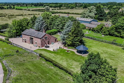
- Price
- Guide Price£1,000,000
- Size
- 0.85 acres
Ulnes Walton Lane, Leyland, PR26, Ulnes Walton, Lancashire PR26 England
Added on 20/07/2026Barn Conversion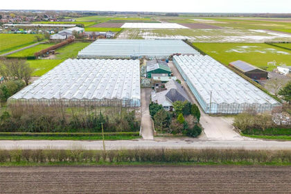
- Price
- Guide Price£900,000
- Size
- 4.06 acres
Guide Road, Hesketh Bank, Preston, Lancashire, Hesketh-with-Becconsall, Lancashire PR4 England
Added on 10/04/2026Agricultural Land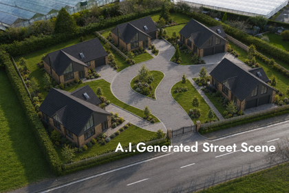
- Price
- Offers Over£700,000
- Size
- 0.77 acres
Long Moss Lane, Whitestake Garage, PR4, Longton, Lancashire PR4 England
Added on 02/04/2026Building Plot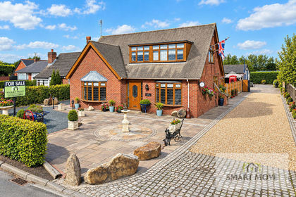
- Price
- Offers in Region of£725,000
- Size
- 1.2 acres
Moss Lane, Hesketh Bank, Preston, Hesketh-with-Becconsall, Lancashire PR4 England
Added on 11/09/2026House with Land Added on 28/01/2026Barn Conversion
- Price
- Offers in Region of£850,000
- Size
- 2.5 acres
Lowe Farm, Leyland Lane, Leyland PR26, Ulnes Walton, Lancashire PR7 England
Added on 29/01/2026Equestrian property
- Price
- £675,000
- Size
- 1 acres
Moss Lane, Banks, Southport, Lancashire, PR9, North Meols, Lancashire PR9 England
Added on 15/08/2026House with Land
- Price
- Offers Over£900,000
- Size
- 1.1 acres
Back Lane, Charnock Richard, Chorley, Lancashire, PR7, Charnock Richard, Lancashire PR7 England
Added on 12/05/2026Barn Conversion
- Price
- Offers in Region of£925,000
- Size
- 2.3 acres
Ridley Cottage, Ridley Lane, Mawdesley L40, Mawdesley, Lancashire L40 England
Added on 19/08/2026Cottage
- Price
- Offers Over£675,000
- Size
- 0.25 acres
Added on 12/07/2026Barn Conversion