The Old Vicarage, Kilburn, York
- Land size
- 1 acres
- Bedrooms
- 5
- Bathrooms
- 4
Key Features
- Detached period village (not listed) house offering exceptional privacy
- Over 5,200 sq ft of versatile, beautifully appointed accommodation
- Bespoke Plain English kitchen with state-of-the-art appliances
- Luxurious bathrooms with premium fittings throughout
- Magnificent principal bedroom suite occupying much of the first floor
- Annexe with gym, sauna, and ancillary facilities
- Private driveway with turning circle, ample parking, and garaging
- Outstanding landscaped gardens with orchard, kitchen garden, and summer house
- Within strolling distance of an acclaimed country inn
- Situated in one of North Yorkshire’s most desirable and best-connected villages
Description
Rare North Yorkshire gem - elegantly restored, beautifully appointed, privately situated and embraced by manicured gardens.
The Old Vicarage is a distinguished period residence, originally built in 1870 with stone elevations beneath a slated roof, once serving as the vicarage to the neighbouring Norman church. Set on rising ground at the edge of the village, it enjoys a south-easterly outlook across open countryside. Refurbished to an exceptional standard through a collaboration between interior designer Stephen Nealls and Woods of Harrogate Furnishings, the property combines nineteenth-century architectural integrity with bespoke contemporary interiors. The result is a rare opportunity to acquire a family home of remarkable quality, blending rural tranquillity with modern luxury.
Entrance vestibule, staircase hall, cloakroom, 2 reception rooms, study, kitchen/dining room, scullery, pantry, laundry room, boot room
Principal bedroom suite with his & her dressing rooms and bathrooms, bedroom suite with dressing room and bathroom, 3 further bedrooms, house bathroom
Annexe – gym, cloakroom, shower room, sauna, utility room, store room
Double garage, stores, summer house
Gardens and grounds
In all approximately one acre
Find Out A Little More .... - The Old Vicarage, with its elegant stone mullion windows, has been meticulously restored and enhanced to an exceptional standard, each detail showcasing the finest craftsmanship. Throughout, the modernisation programme has been carefully executed to respect and preserve its heritage and period character.
Handmade bronze casement windows and doors, underfloor heating beneath Element 7 parquet flooring, cast iron radiators, antique fireplaces, and a Stûv wood-burning stove set the tone for the interiors. Luxurious finishes abound, from Moiré wall coverings and Belgian carpets with specialist underlay, to Forbes & Lomax switches, Drummonds bathrooms, and Czech & Speake fittings with indulgent deluge showers. The bespoke Plain English kitchen is equipped with state-of-the-art Gaggenau appliances, a Quooker boiling water tap, and striking marble worktops. From bedrooms and dressing rooms to the cold room pantry, every space is a showcase of design integrity and timeless quality.
Outside - The approach to The Old Vicarage is discreet, with the property remaining hidden until its handsome south-west elevation is revealed beyond bespoke, electric timber gates. An elegantly paved turning circle leads to further parking and a detached garage block with loft storage, power, lighting, and an EV charging point. The garage has been sympathetically restored with reclaimed slate and crested ridge tiles.
A recently constructed detached annexe provides a suite of light-filled rooms, currently arranged as a gym with utility space, shower room, and sauna. With its own independent heating system, it offers excellent versatility and could be adapted for use as ancillary family or guest accommodation.
The gardens are beautifully landscaped, with sweeping York stone terraces framed by a mellow wall lined with pleached hornbeams. Stone steps lead to a main lawn, orchard, and wildflower meadow rising to a summer house, with woodland beyond including lime, horse chestnut, and ash. A contemporary kitchen garden, designed with raised Corten steel beds, is planted with asparagus, raspberries, and cut flowers. Further highlights include an avenue of cherry trees along the south-east boundary, topiarised yew and cloud trees for year-round structure, espalier pears, hydrangeas, and far-reaching views across open countryside.
Environs - Thirsk 6 miles, Helmsley 10 miles, A1 12 miles, York 20 miles, Leeds city centre 48 miles
Kilburn is known both for the famous “Mousey” Thompson furniture workshops and the iconic White Horse landmark carved into the hillside at nearby Sutton Bank. The village has a country inn, The Forresters Arms, and the surrounding area is rich in dining options, including The Abbey Inn at Byland and the Michelin-starred Black Swan at Oldstead, both owned by renowned chef Tommy Banks.
Thirsk is just 15 minutes away, providing a full range of amenities as well as a mainline railway station with direct services to London in just over two hours. The area is also well served by independent schools such as Ampleforth College and several in York. Leeds Bradford International Airport can be reached in under an hour, with Manchester Airport around two hours by road.
Important Information - Tenure: Freehold
EPC Rating: EPC ON ORDER
Services & Systems: Mains water, electricity and drainage. Zoned heating.
Fixtures & Fittings: Only those mentioned in these sales particulars are included in the sale. All others, such as fitted carpets, curtains, light fittings, garden ornaments etc., are specifically excluded but may be made available by separate negotiation.
Viewing: Strictly by appointment
Local Authority: North Yorkshire Council North York Moors National Park
Money Laundering Regulations: Prior to a sale being agreed, prospective purchasers are required to produce identification documents in order to comply with Money Laundering regulations. Your co-operation with this is appreciated and will assist with the smooth progression of the sale.
Directions: In Kilburn take the lane opposite the road signposted Bagby and Thirsk, and the house is at the top. ///diverting.miles.fame
Media: 2024 photos. Copy September 2025
NB: Google map images may neither be current nor a true representation.
Map Location
Property details
- Tenure
- Freehold
- Council Tax Band
- H
- Date Posted
- 2026-09-04
Market Value Analysis
Compared with 677 Homes with Land listings in Yorkshire and The Humber (1+ acres).
Energy Performance Certificate
Energy Efficiency Rating
Based on UK Energy Performance Certificate standards (EU Directive 2002/91/EC)
Running costs are one side. Planning activity, flood history and ground risks for this location are in the full report.
Utilities & Restrictions
Utilities
- Electricity
- Ask Agent
- Water
- Ask Agent
- Heating
- Ask Agent
- Broadband
- Ask Agent
- Sewerage
- Ask Agent
Rights & Restrictions
- Public Rights of Way
- Ask Agent
- Private Rights of Way
- Ask Agent
- Listed Property
- Ask Agent
- Restrictions
- Ask Agent
Listed status, conservation areas and planning constraints for this location are in the full report.
Property Features
- Accessibility
- Ask Agent
- Parking
- Parking Available
- Garden
- Garden
Beyond the particulars: planning activity, flood history, heritage and ground risks, checked for this exact spot.
Connectivity
Broadband
Fastest speed available at this postcode
80 Mbps
Superfast
Suitable for
- HD streaming
- Video calls
- Web & social
Mobile signal
Outdoor predictions; indoor signal depends on building materials.
Ofcom Connected Nations postcode-level predictions. Speeds and signal are modelled, not measured, and vary between addresses and providers.
Signal is the easy part. Planning activity, flood history and protected designations here are in the full report.
Nearest Schools
Primary
- Husthwaite Church of England Primary School3 milesOfsted: Requires improvement
- Ages
- 3 to 11
- Pupils
- 64
- Type
- Academy sponsor led
- Faith
- Church of England
- Sessay Church of England Primary School4.4 milesOfsted: Good
- Ages
- 5 to 11
- Pupils
- 79
- Type
- Academy converter
- Faith
- Church of England
- St Benedict's Catholic Primary School - a Catholic voluntary academy4.6 milesNo Ofsted rating
- Ages
- 3 to 11
- Pupils
- 88
- Type
- Academy converter
- Faith
- Roman Catholic
- Thirsk Community Primary School5.2 milesOfsted report card · Feb 2026
- Ages
- 4 to 11
- Pupils
- 122
- Type
- Community school
- All Saints Catholic Primary School, a Catholic Voluntary Academy5.4 milesOfsted: Good
- Ages
- 3 to 11
- Pupils
- 94
- Type
- Academy sponsor led
- Faith
- Roman Catholic
Secondary
- Thirsk School & Sixth Form College5.5 milesOfsted report card · Mar 2026
- Ages
- 11 to 18
- Pupils
- 1,029
- Type
- Community school
- Outwood Academy Easingwold6.7 milesOfsted: Outstanding
- Ages
- 11 to 18
- Pupils
- 823
- Type
- Academy sponsor led
- Ryedale School9.2 milesOfsted: Outstanding
- Ages
- 11 to 16
- Pupils
- 698
- Type
- Academy converter
- Boroughbridge High School11 milesOfsted: Requires improvement
- Ages
- 11 to 16
- Pupils
- 388
- Type
- Community school
- Northallerton School & Sixth Form College12 milesOfsted report card · Mar 2026
- Ages
- 11 to 18
- Pupils
- 1,002
- Type
- Academy sponsor led
Distances are straight-line from the advertised location. Source: the national school registers (DfE, Welsh Government, Scottish Government) and Ofsted.
Schools are just the start: sold prices nearby, planning activity and any flood history are in the full report.
Amenities
Supermarket
GP surgery
Pharmacy
Hospital
Walking trail
Straight-line distances from the advertised location. Sources: NHS records, Geolytix supermarket locations, OS Open Greenspace and the national trails registers.
The area stacks up? Now check the location itself: planning nearby, protected designations and past flooding.
Getting Around
Nearest station
Nearest bus stop
Typical drive times
Straight-line distances from the advertised location; drive times are typical free-flow times over OpenStreetMap road data, so allow more at peak. Public transport locations from DfT NaPTAN.
Easy to reach matters. So do planning activity, flood history and ground risks: all in the full report.
Flood Risk
From Environment Agency flood map open data, checked around the advertised map pin and allowing for the listed acreage where known. This summary comes from LandSale, the advertising platform, not from the listing agent, and is not part of the agent's particulars. Risk can vary across a single holding, so verify anything critical through your own searches before committing.
Rivers and the sea
Surface water
The detail behind these bandings
The full report pinpoints where this location sits on the flood maps, and runs the deeper checks that usually only surface after an offer.
- Exact flood zones & annual chances (included in the full report)
- Any recorded past flooding (included in the full report)
- Planning activity nearby (included in the full report)
- Heritage & conservation (included in the full report)
- Protected nature designations (included in the full report)
- Ground risks (included in the full report)
- Sold prices nearby (included in the full report)
£14.99 · one-off purchase
By LandSale, the platform. Not provided by the listing agent. Ready in about a minute.
Important notice: Information, maps and tags on this page are drawn from the advertising agent's marketing materials or generated automatically. LandSale has not verified them. Relying on these details is at your own risk, always carry out independent checks before committing to a purchase.
LandSale full disclaimer
Marketing information only - not formal particulars. The details on this website are provided for general guidance and do not constitute an offer or contract. Neither LandSale nor the advertising estate/land agent accepts responsibility for any inaccuracy.
1. Source of information
- Listing content: Core description, asking price, tenure, measurements, photographs and planning history originate from the marketing materials of the advertising estate or land agent. LandSale does not author this content and cannot guarantee its accuracy.
- Automated tags & categorisation: Property type, land-use class, acreage bands and similar labels may be applied by machine-learning models. They are intended as a helpful guide only and may not reflect the property's legal status or permitted use.
- Third-party & enriched data layers: Maps, boundary outlines, planning designations, soil reports, broadband coverage and other environmental or location-based insights are licensed from external suppliers. Such data are supplied “as is", may be incomplete or out of date and are subject to change without notice.
2. Verification required
Prospective purchasers must verify critical matters, including but not limited to planning permission, title boundaries, public rights of way, environmental constraints, acreage, services, access and VAT status, through their own inspections, specialist surveys, legal advisers and the selling agent before relying on the information or entering into any contract.
3. No warranty or liability
LandSale gives no warranty, express or implied, as to the accuracy, completeness or fitness for any particular purpose of the information displayed. LandSale shall not be liable for any loss, damage, cost or expense arising directly or indirectly from any use of or reliance on such information, save where liability may not be excluded by law.
4. Updates & feedback
If you believe any detail on this listing is inaccurate, please let us know. We will investigate and, where appropriate, update the listing or notify the agent.
© LandSale | Version 1.3 - August 2026
Listing agent
Blenkin & Co, York
Priestley House Bootham York YO30 7BL
Similar properties for sale
- Price
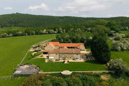
- Guide Price£3,000,000
- Size
- 11 acres
Osgoodby Cottage, Osgoodby, Thirsk, Thirkleby High and Low with Osgodby, North Yorkshire YO7 England
Added on 28/06/2026Country Home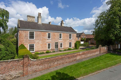
- Price
- Guide Price£2,375,000
- Size
- 9 acres
Carlton Hall, Carlton Husthwaite, Thirsk, Carlton Husthwaite, North Yorkshire YO7 England
Added on 29/01/2026Country Home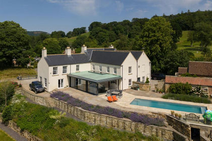
- Price
- Offers in Excess of£2,000,000
- Size
- 1.32 acres
The Old Vicarage, Felixkirk, Thirsk, Felixkirk, North Yorkshire YO7 England
Added on 04/09/2026Country Home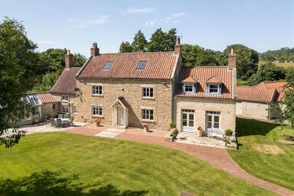
- Price
- Guide Price£1,950,000
- Size
- 5.34 acres
Watergate House, Ampleforth, Ampleforth, North Yorkshire YO62 England
Added on 24/07/2026Country Home
- Price
- Guide Price£2,000,000
- Size
- 2.5 acres
York Road, Boroughbridge, YO51, Boroughbridge, North Yorkshire YO51 England
Added on 11/06/2026House with Land
- Price
- £2,500,000
- Size
- 7 acres
Heaton house, YO51, Boroughbridge, North Yorkshire YO51 England
Added on 19/04/2026Country Home
- Price
- Offers Over£2,250,000
- Size
- 20.99 acres
Ye Old Mill House, Yafforth Road, Romanby, Northallerton, Northallerton, North Yorkshire DL7 England
Added on 29/01/2026Country Home
- Price
- Guide Price£1,900,000
- Size
- 2 acres
Added on 05/05/2026House with Land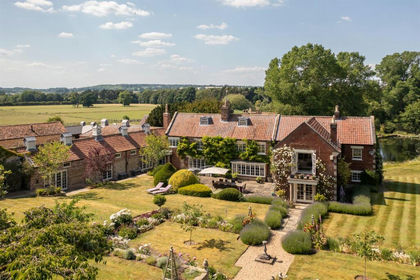
- Price
- Offers in Excess of£2,000,000
- Size
- 12 acres
Welham Hall, Norton, Malton, Norton-on-Derwent, North Yorkshire YO17 England
Added on 14/08/2026Country Home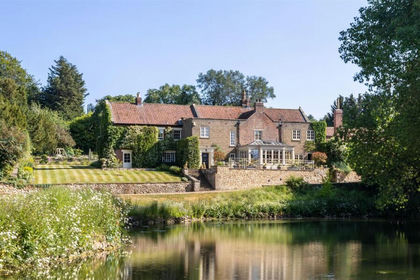
- Price
- Offers in Excess of£2,000,000
- Size
- 11.7 acres
Welham Hall, Malton, Norton-on-Derwent, North Yorkshire YO17 England
Added on 29/01/2026House with Land