Carlton Hall, Carlton Husthwaite, Thirsk
- Land size
- 9 acres
- Bedrooms
- 6
- Bathrooms
- 4
Key Features
- Georgian country house accompanied by 9 acres
- Elegant rooms and versatile living accommodation
- Range of traditional outbuildings with potential to develop
- Glorious gardens, landscaped and well-established
- Fenced paddocks, grazing and hay meadows
- Open country views to the White Horse of Kilburn from house and garden
- Idyllic village setting with country pubs nearby, 2 with Michelin Stars
- Convenient for A19, A1(M) and wider motorway network
Description
Superb family house with a walled garden, outbuildings, land and sweeping views to the White Horse of Kilburn.
Carlton Hall occupies a prime position in the heart of the attractive village of Carlton Husthwaite, enjoying fine views towards the iconic White Horse of Kilburn. An impressive and elegant family home, it offers beautifully proportioned rooms and versatile accommodation, including a recently refurbished east wing offering potential for guests or staff. Thoughtfully restored in recent years, the house retains particularly fine architectural detailing and provides an exceptional setting for family life and gatherings.
Set beside the village green and twelfth-century church, Carlton Hall stands within beautifully landscaped gardens and grounds of around nine acres, including characterful outbuildings, a fenced paddock and fields. The setting is peaceful and rural, yet just a mile from the A19 and within easy reach of Thirsk, Easingwold, York and Harrogate.
Entrance hall, cloakroom, 3 reception rooms, study, kitchen/breakfast room, pantry, laundry, boot room. Principal bedroom suite, 5 further bedrooms, 3 further bathrooms. Office, wine cellar, basement rooms
Gatehouse with independent access
Triple garage, single garage, courtyard outbuildings, stables, dovecote, 3-bay walled fold yard, pigsty
Walled garden, croquet lawn, wildflower meadows, paddock
In all some 9 acres
Find Out A Little More - A grand entrance hall leads to four classically proportioned reception rooms with beautiful architectural details, including original fireplaces, cabinetry and sash windows. The kitchen/breakfast room is a superb family space steeped in character with French windows opening onto the garden; it is accompanied by a pantry, laundry room and boot room.
An elegant Victorian staircase with polished handrail rises to a galleried landing and drawing room. This impressive room is of handsome proportions with a coffered ceiling, ornate French fireplace, tall arched windows and large French windows open to the balcony. Also on the two upper floors are six bedrooms served by three bathrooms, a dressing room and shower room: all have special architectural features and many enjoy an outlook with lovely views.
The Lower Ground Floor houses an impressive wine cellar with vaulted storage and a large room for an office, gym or cinema.
The Gatehouse on the first floor has undergone recent renovations and is now presented as a blank canvas, providing accommodation for the wider family, guests or as a source of income.
Outside - The main front gates open to a gravelled drive that sweeps in front of the house, providing a turning area and ample options for parking. A second set of gates opens to the cobbled forecourt in front of the outbuildings, continuing through integral gates to further parking and a three-bay garage at the rear of the house.
The gardens at Carlton Hall are a testament to many years of planning and management. A croquet lawn sits below the stone veranda and forms the centrepiece, flanked by herbaceous borders, wildflower areas, sweeping lawns, clipped hedges and scattered parkland trees, including a magnificent copper beech. A range of brick-built outbuildings lie to the east of the house, and these include the original dovecote, the stables, and a variety of useful stores that offer potential for future development (subject to consents). The entire garden is walled with mature trees, including fruit trees, and shrubs along much of the perimeter. A five bar gate in a low stone wall opens into a large paddock and further fields enclosed by post and rail fencing.
Environs - Thirsk and Easingwold 6 miles, Helmsley 11 miles, A1(M) 11 miles, Northallerton 14 miles, York 19 miles, Harrogate 22 miles
Carlton Husthwaite is a picturesque village resting under the Hambleton Hills, close to the North York Moors National Park. The village is extremely convenient for the coast, Moors, Howardian Hills, Dales and Lake District. The A19 lies just a mile to the west, providing swift access to York and Teesside. The A1(M) is some twelve minutes’ away giving access to the wider motorway network as well as Leeds, Durham, Newcastle and Manchester Airports. There are three private airstrips at Bagby, Husthwaite and Sutton Bank for light planes, microlights and gliders. Mainline railway stations at York, Northallerton and Thirsk offer regular services to London, Newcastle and Edinburgh. Thirsk railway station lies some thirteen minutes’ away.
Nearby traditional market towns include Easingwold, Thirsk, Helmsley, Northallerton, Ripon and Malton, all providing excellent amenities, schools and shopping. Ampleforth College and its public sports centre are also within easy reach.
Specifics - Tenure: Freehold
EPC Rating: Exempt as Grade II listed
Council Tax Band: H
Services & Systems: Mains electricity, water and drainage. Oil-fired central heating system. High speed fibre broadband.
Fixtures & Fittings: Only those mentioned in these sales particulars are included in the sale. All others, such as fitted carpets, curtains, light fittings, garden ornaments etc., are specifically excluded but may be made available by separate negotiation.
Local Authority: North Yorkshire Council –
Money Laundering Regulations: Prior to a sale being agreed, prospective purchasers are required to produce identification documents in order to comply with Money Laundering regulations. Your co-operation is appreciated and will assist with the smooth progression of the sale.
Directions: From the A19, turn east towards Carlton Husthwaite. On entering the village, follow the road through the village until reaching Carlton Hall on your left.
What3words: ///webcams.hacking.safely
Viewing: Strictly by appointment
NB: Google map images may neither be current nor a true representation.
Map Location
Property details
- Tenure
- Freehold
- Council Tax Band
- H
- Date Posted
- 2026-01-29
Market Value Analysis
Compared with 193 Homes with Land listings in Yorkshire and The Humber (5+ acres).
Utilities & Restrictions
Utilities
- Electricity
- Ask Agent
- Water
- Ask Agent
- Heating
- Ask Agent
- Broadband
- Ask Agent
- Sewerage
- Ask Agent
Rights & Restrictions
- Public Rights of Way
- Ask Agent
- Private Rights of Way
- Ask Agent
- Listed Property
- Ask Agent
- Restrictions
- Ask Agent
Listed status, conservation areas and planning constraints for this location are in the full report.
Property Features
- Accessibility
- Ask Agent
- Parking
- Parking Available
- Garden
- Garden
Beyond the particulars: planning activity, flood history, heritage and ground risks, checked for this exact spot.
Connectivity
Broadband
Fastest speed available at this postcode
1.8 Gbps
Gigabit full fibre
Suitable for
- 4K streaming on every screen
- Full-time home working
- Online gaming & big downloads
Mobile signal
Predicted 4G and 5G signal; indoor signal depends on building materials.
Ofcom Connected Nations postcode-level predictions. Speeds and signal are modelled, not measured, and vary between addresses and providers.
Signal is the easy part. Planning activity, flood history and protected designations here are in the full report.
Nearest Schools
Primary
- Husthwaite Church of England Primary School1.4 milesOfsted: Requires improvement
- Ages
- 3 to 11
- Pupils
- 64
- Type
- Academy sponsor led
- Faith
- Church of England
- Sessay Church of England Primary School2.5 milesOfsted: Good
- Ages
- 5 to 11
- Pupils
- 79
- Type
- Academy converter
- Faith
- Church of England
- Easingwold Community Primary School4.3 milesOfsted: Good
- Ages
- 4 to 11
- Pupils
- 274
- Type
- Community school
- Keeble Gateway Academy5.1 milesOfsted: Good
- Ages
- 3 to 11
- Pupils
- 204
- Type
- Free schools
- All Saints Catholic Primary School, a Catholic Voluntary Academy5.3 milesOfsted: Good
- Ages
- 3 to 11
- Pupils
- 94
- Type
- Academy sponsor led
- Faith
- Roman Catholic
Secondary
- Outwood Academy Easingwold5.1 milesOfsted: Outstanding
- Ages
- 11 to 18
- Pupils
- 823
- Type
- Academy sponsor led
- Thirsk School & Sixth Form College5.3 milesOfsted report card · Mar 2026
- Ages
- 11 to 18
- Pupils
- 1,029
- Type
- Community school
- Boroughbridge High School9.2 milesOfsted: Requires improvement
- Ages
- 11 to 16
- Pupils
- 388
- Type
- Community school
- Ryedale School11 milesOfsted: Outstanding
- Ages
- 11 to 16
- Pupils
- 698
- Type
- Academy converter
- Ripon Grammar School13 milesOfsted: Good
- Ages
- 11 to 18
- Pupils
- 957
- Type
- Community school
Distances are straight-line from the advertised location. Source: the national school registers (DfE, Welsh Government, Scottish Government) and Ofsted.
Schools are just the start: sold prices nearby, planning activity and any flood history are in the full report.
Amenities
Supermarket
GP surgery
Pharmacy
Hospital
Straight-line distances from the advertised location. Sources: NHS records, Geolytix supermarket locations, OS Open Greenspace and the national trails registers.
The area stacks up? Now check the location itself: planning nearby, protected designations and past flooding.
Getting Around
Nearest station
Nearest bus stop
Typical drive times
Straight-line distances from the advertised location; drive times are typical free-flow times over OpenStreetMap road data, so allow more at peak. Public transport locations from DfT NaPTAN.
Easy to reach matters. So do planning activity, flood history and ground risks: all in the full report.
Flood Risk
Environment Agency open data, checked around the advertised map pin for the listed acreage. Long-term risk counts flood defences; the planning map's flood zones do not. Provided by LandSale, not the listing agent, and not part of the agent's particulars. Risk varies across a holding, so verify before committing.
Rivers and the sea
Planning map: Flood Zone 1.
Surface water
Not at the pin: mapped about 90 metres away.
These bandings are the summary. Where this location sits on the flood maps, plus planning activity, heritage and ground risks, is in the full report.
Important notice: Information, maps and tags on this page are drawn from the advertising agent's marketing materials or generated automatically. LandSale has not verified them. Relying on these details is at your own risk, always carry out independent checks before committing to a purchase.
LandSale full disclaimer
Marketing information only - not formal particulars. The details on this website are provided for general guidance and do not constitute an offer or contract. Neither LandSale nor the advertising estate/land agent accepts responsibility for any inaccuracy.
1. Source of information
- Listing content: Core description, asking price, tenure, measurements, photographs and planning history originate from the marketing materials of the advertising estate or land agent. LandSale does not author this content and cannot guarantee its accuracy.
- Automated tags & categorisation: Property type, land-use class, acreage bands and similar labels may be applied by machine-learning models. They are intended as a helpful guide only and may not reflect the property's legal status or permitted use.
- Third-party & enriched data layers: Maps, boundary outlines, planning designations, soil reports, broadband coverage and other environmental or location-based insights are licensed from external suppliers. Such data are supplied “as is", may be incomplete or out of date and are subject to change without notice.
2. Verification required
Prospective purchasers must verify critical matters, including but not limited to planning permission, title boundaries, public rights of way, environmental constraints, acreage, services, access and VAT status, through their own inspections, specialist surveys, legal advisers and the selling agent before relying on the information or entering into any contract.
3. No warranty or liability
LandSale gives no warranty, express or implied, as to the accuracy, completeness or fitness for any particular purpose of the information displayed. LandSale shall not be liable for any loss, damage, cost or expense arising directly or indirectly from any use of or reliance on such information, save where liability may not be excluded by law.
4. Updates & feedback
If you believe any detail on this listing is inaccurate, please let us know. We will investigate and, where appropriate, update the listing or notify the agent.
© LandSale | Version 1.3 - August 2026
Listing agent
Blenkin & Co, York
Priestley House Bootham York YO30 7BL
Similar properties for sale
- Price
- Guide Price£1,950,000
- Size
- 5.34 acres
Watergate House, Ampleforth, Ampleforth, North Yorkshire YO62 England
Added on 24/07/2026Country Home
- Price
- Guide Price£1,950,000
- Size
- 4.5 acres
Added on 05/09/2026House with Land
- Price
- £1,795,000
- Size
- 10 acres
Ripley, Nr Harrogate, Clint cum Hamlets, North Yorkshire HG3 England
Added on 25/07/2026Equestrian property
- Price
- Offers in Excess of£2,000,000
- Size
- 12 acres
Welham Hall, Norton, Malton, Norton-on-Derwent, North Yorkshire YO17 England
Added on 14/08/2026Country Home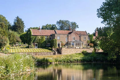
- Price
- Offers in Excess of£2,000,000
- Size
- 11.7 acres
Welham Hall, Malton, Norton-on-Derwent, North Yorkshire YO17 England
Added on 29/01/2026House with Land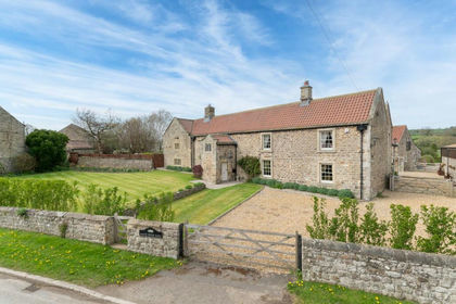
- Price
- Guide Price£2,000,000
- Size
- 9.31 acres
Manor House Farm, Hunton, Bedale, DL8, Hunton, North Yorkshire DL8 England
Added on 07/05/2026Country Home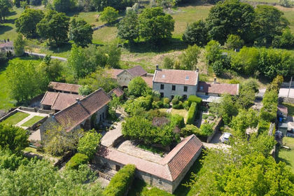
- Price
- Guide Price£1,800,000
- Size
- 5.81 acres
Red House Farm, Glaisdale, YO21, Glaisdale, North Yorkshire YO21 England
Added on 04/04/2026Farmhouse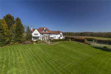
- Price
- Guide Price£2,250,000
- Size
- 6.92 acres
Farnley Lane, Farnley, Otley, North Yorkshire, LS21, Farnley, North Yorkshire LS21 England
Added on 23/04/2026House with Land
- Price
- Guide Price£1,900,000
- Size
- 7.5 acres
Newmill Farm, Seaton Ross, York, Seaton Ross, East Riding of Yorkshire YO42 England
Added on 03/05/2026Equestrian property
- Price
- Guide Price£2,250,000
- Size
- 13 acres
Carlton Lane, Guiseley, West Yorkshire, LS20, Leeds North West, Leeds LS20 England
Added on 01/07/2026Farmhouse