High Street, Ashendon, Buckinghamshire.
- Bedrooms
- 2
- Bathrooms
- 1
Key Features
- Sought after hilltop village
- Waddesdon school catchment
- Beautiful character features
- Stunning accommodation
- Private setting
- 2 bedrooms
- Attic room or studio/office
- Sitting room with woodburning stove
- Secluded terrace
- Off road parking
Description
Ashendon Barn nestles within a small close at the northeastern edge of the village. It is a stunning conversion that the owner presents absolutely beautifully and the mature plot offers the property a great deal of privacy.
Inside are a wealth of charming features, nearly all of the accommodation has floorboards and LED downlighting, the doors are latched and braced wood with wrought iron furniture and there is a handsome blend of exposed stone and brick walls and beams and timbers.
As you enter the hall you find a storage cupboard and then to the left is the kitchen and living room and right the bedrooms and bathroom and the right corridor has a part vaulted ceiling and a velux window for natural light.
The kitchen/dining room comprises solid oak units painted in Farrow & Ball dimity colour and complimenting the units are black granite worktops. Integrated are a halogen hob, double oven/grill and dishwasher and spaces provided for a washing machine and fridge/freezer. Some delightful characteristics to be noted are the vaulted ceiling, wall sconces for candles and a shelved upper alcove. In the sitting room is again a vaulted ceiling and inset into the wall stands a woodburning stove. Alongside the two front windows are doors opening to the patio.
Then main bedroom with another vaulted ceiling is an excellent double and the automatically lit walk-in wardrobe brings to mind the option of installing an ensuite. The smaller bedroom is very pretty and a pull out ladder gives an easy route up to a boarded out attic. Although we cannot describe this as a bedroom practically it could serve as such, or an office or studio. In the bathroom is a porcelain floor and a white suite of a wc, wash basin and vanity unit and a panelled bath, all have chrome fittings and there is a separate cubicle that has both handheld and overhead showers. A useful airing/linen cupboard is available and the window has a bespoke shutter.
OUTSIDE
As you enter the close 2 parking bays are provided and a patch of faux grass and hardstanding suitable for a shed.
The exterior mirrors the interior in terms of its smart and immaculate appearance. The barn hides behind a tall laurel hedge that ensures a high level of privacy to the garden. A flagstone path is down to the front door and said front door has shelter from the porch canopy. The easterly garden is attractively landscaped with grasses, shrubs and trees and a pond dotted around in the gravel, and at the far end a deep planted bed of the same alongside a variety of flowers.
South facing is a split-level terrace, the lower area with flagstones and then a dwarf stone wall and a slightly elevated seating area of composite decking from where you can glimpse the distant countryside.
COUNCIL TAX Band E 3,141.24 2026/27
LOCATION
Ashendon is a lovely hilltop village of mainly Cottages and old Farmhouses with breathtaking views over the Aylesbury plain. The Ash Tree is a charming inn at the bottom of a lane and adjacent the playing field the Church of St Mary stands at the summit of the village and holds in a long, low recess in the Chancel, an effigy of an unknown Knight.
The name Ashendon comes from Ashen-Hill, i.e. grown over with ashes. The area was once the ancient Berwood Forest and the old hunting grounds of Saxon and Norman Kings. For more information on the village visit
The nearby market towns and villages provide a wealth of historical and interesting places to visit including Waddesdon Manor, Claydon House and Quainton Steam Railway. Extensive shopping facilities are situated at Bicester, Aylesbury, Milton Keynes and Oxford and the renowned Bicester Village.
Thame Parkway Station about 5 miles away and Aylesbury (approx. 11 miles) both provide a fast convenient service reaching London Marylebone in under an hour, Thame & Haddenham Parkway actually in 35 minutes. The A41 provides easy access into Aylesbury, Bicester and the M40 network. The Aylesbury line has been extended to Aylesbury Vale Parkway station which now provides a frequent service to Marylebone from Fleet Marston.
EDUCATION
Preparatory Schools at Ashfold and Oxford.
Primary Schools at Waddesdon & Cuddington.
Waddesdon Secondary School.
Public Schools at Oxford, Berkhamsted and Stowe.
Grammar Schools at Aylesbury.
VIEWING
Strictly via the vendors agent.
SERVICES
Mains electricity, water and drainage. LPG fired central heating, the tank underground at the front of the property.
Map Location
Property details
- Tenure
- Freehold
- Council Tax Band
- Ask Agent
- Date Posted
- 2026-09-04
Energy Performance Certificate
Energy Efficiency Rating
Based on UK Energy Performance Certificate standards (EU Directive 2002/91/EC)
Running costs are one side. Planning activity, flood history and ground risks for this location are in the full report.
Utilities & Restrictions
Utilities
- Electricity
- Ask Agent
- Water
- Ask Agent
- Heating
- Ask Agent
- Broadband
- Ask Agent
- Sewerage
- Ask Agent
Rights & Restrictions
- Public Rights of Way
- Ask Agent
- Private Rights of Way
- Ask Agent
- Listed Property
- Ask Agent
- Restrictions
- Ask Agent
Listed status, conservation areas and planning constraints for this location are in the full report.
Property Features
- Accessibility
- Ask Agent
- Parking
- Parking Available
- Garden
- Garden
Beyond the particulars: planning activity, flood history, heritage and ground risks, checked for this exact spot.
Connectivity
Broadband
Fastest speed available at this postcode
80 Mbps
Superfast
Suitable for
- HD streaming
- Video calls
- Web & social
Mobile signal
Outdoor predictions; indoor signal depends on building materials.
Ofcom Connected Nations postcode-level predictions. Speeds and signal are modelled, not measured, and vary between addresses and providers.
Signal is the easy part. Planning activity, flood history and protected designations here are in the full report.
Nearest Schools
Primary
- Waddesdon Village Primary School2.7 milesNo Ofsted rating
- Ages
- 4 to 11
- Pupils
- 217
- Type
- Community school
- Cuddington and Dinton CofE School2.8 milesNo Ofsted rating
- Ages
- 4 to 11
- Pupils
- 179
- Type
- Voluntary aided school
- Faith
- Church of England
- Brill Church of England School3 milesOfsted: Good
- Ages
- 4 to 11
- Pupils
- 199
- Type
- Academy converter
- Faith
- Church of England
- Long Crendon School3.1 milesOfsted: Good *
- Ages
- 4 to 11
- Pupils
- 226
- Type
- Community school
- Haddenham Community Junior School4.1 milesOfsted: Good *
- Ages
- 7 to 11
- Pupils
- 354
- Type
- Community school
Secondary
- Waddesdon Church of England School2.7 milesOfsted report card · Feb 2026
- Ages
- 11 to 18
- Pupils
- 1,012
- Type
- Academy converter
- Faith
- Church of England
- Lord Williams's School5.3 milesOfsted: Good
- Ages
- 11 to 18
- Pupils
- 2,259
- Type
- Academy converter
- The Aylesbury Vale Academy5.4 milesNo Ofsted rating
- Ages
- 3 to 19
- Pupils
- 1,857
- Type
- Academy sponsor led
- Faith
- Church of England
- Aylesbury UTC6.5 milesOfsted: Requires improvement
- Ages
- 14 to 19
- Pupils
- 128
- Type
- University technical college
- Sir Henry Floyd Grammar School6.6 milesOfsted: Outstanding
- Ages
- 11 to 18
- Pupils
- 1,353
- Type
- Academy converter
* Latest graded judgement covers quality of education only; no overall grade was issued under the 2024-25 inspection framework.
Distances are straight-line from the advertised location. Source: the national school registers (DfE, Welsh Government, Scottish Government) and Ofsted.
Schools are just the start: sold prices nearby, planning activity and any flood history are in the full report.
Amenities
Supermarket
GP surgery
Pharmacy
Hospital
Green space
Straight-line distances from the advertised location. Sources: NHS records, Geolytix supermarket locations, OS Open Greenspace and the national trails registers.
The area stacks up? Now check the location itself: planning nearby, protected designations and past flooding.
Getting Around
Nearest station
Nearest bus stop
Typical drive times
Straight-line distances from the advertised location; drive times are typical free-flow times over OpenStreetMap road data, so allow more at peak. Public transport locations from DfT NaPTAN.
Easy to reach matters. So do planning activity, flood history and ground risks: all in the full report.
Flood Risk
From Environment Agency flood map open data, checked around the advertised map pin and allowing for the listed acreage where known. This summary comes from LandSale, the advertising platform, not from the listing agent, and is not part of the agent's particulars. Risk can vary across a single holding, so verify anything critical through your own searches before committing.
Rivers and the sea
Surface water
The detail behind these bandings
The full report pinpoints where this location sits on the flood maps, and runs the deeper checks that usually only surface after an offer.
- Exact flood zones & annual chances (included in the full report)
- Any recorded past flooding (included in the full report)
- Planning activity nearby (included in the full report)
- Heritage & conservation (included in the full report)
- Protected nature designations (included in the full report)
- Ground risks (included in the full report)
- Sold prices nearby (included in the full report)
£14.99 · one-off purchase
By LandSale, the platform. Not provided by the listing agent. Ready in about a minute.
Important notice: Information, maps and tags on this page are drawn from the advertising agent's marketing materials or generated automatically. LandSale has not verified them. Relying on these details is at your own risk, always carry out independent checks before committing to a purchase.
LandSale full disclaimer
Marketing information only - not formal particulars. The details on this website are provided for general guidance and do not constitute an offer or contract. Neither LandSale nor the advertising estate/land agent accepts responsibility for any inaccuracy.
1. Source of information
- Listing content: Core description, asking price, tenure, measurements, photographs and planning history originate from the marketing materials of the advertising estate or land agent. LandSale does not author this content and cannot guarantee its accuracy.
- Automated tags & categorisation: Property type, land-use class, acreage bands and similar labels may be applied by machine-learning models. They are intended as a helpful guide only and may not reflect the property's legal status or permitted use.
- Third-party & enriched data layers: Maps, boundary outlines, planning designations, soil reports, broadband coverage and other environmental or location-based insights are licensed from external suppliers. Such data are supplied “as is", may be incomplete or out of date and are subject to change without notice.
2. Verification required
Prospective purchasers must verify critical matters, including but not limited to planning permission, title boundaries, public rights of way, environmental constraints, acreage, services, access and VAT status, through their own inspections, specialist surveys, legal advisers and the selling agent before relying on the information or entering into any contract.
3. No warranty or liability
LandSale gives no warranty, express or implied, as to the accuracy, completeness or fitness for any particular purpose of the information displayed. LandSale shall not be liable for any loss, damage, cost or expense arising directly or indirectly from any use of or reliance on such information, save where liability may not be excluded by law.
4. Updates & feedback
If you believe any detail on this listing is inaccurate, please let us know. We will investigate and, where appropriate, update the listing or notify the agent.
© LandSale | Version 1.3 - August 2026
Listing agent
W Humphries, Waddesdon
74 High Street, Waddesdon, HP18 0JD
Similar properties for sale
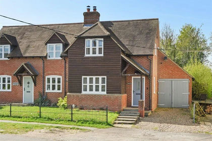
- Price
- Offers in Excess of£500,000
- Size
- 1 acres
Main Street, Grendon Underwood, Buckinghamshire., Grendon Underwood, Buckinghamshire HP18 England
Added on 19/03/2026House with Land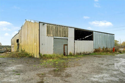
- Price
- Offers Over£450,000
- Size
- 2 acres
Added on 29/01/2026Barn Conversion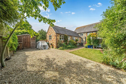
- Price
- Offers in Excess of£500,000
Priory Farm Cottages, Townsend, Bicester, Marsh Gibbon, Buckinghamshire OX27 England
Added on 14/07/2026Barn Conversion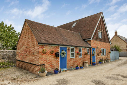
- Price
- Guide Price£525,000
Park Farm, Ambrosden, OX25, Ambrosden, Oxfordshire OX25 England
Added on 08/08/2026Barn Conversion
- Price
- £350,000
Added on 19/08/2026Development Land
- Price
- Guide Price£550,000
Church Lane, Charlton On Otmoor, Charlton-on-Otmoor, Oxfordshire OX5 England
Added on 04/05/2026Barn Conversion
- Price
- £560,000
Added on 24/03/2026Barn Conversion
- Price
- Guide Price£475,000
Land at Buckingham Street, Tingewick, Buckinghamshire, Tingewick, Buckinghamshire MK18 England
Added on 29/01/2026Development Land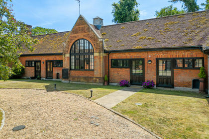
- Price
- Offers in Excess of£435,000
The Courtyard, Liscombe Park, Soulbury, LU7, Soulbury, Buckinghamshire LU7 England
Added on 18/06/2026Barn Conversion
- Price
- Guide Price£400,000
Church End, Leckhampstead, MK18, Leckhampstead, Buckinghamshire MK18 England
Added on 20/03/2026Barn Conversion