Cooks Pit Barns, Woodhey Lane, Faddiley, CW5
- Bedrooms
- 4
- Bathrooms
- 2
Description
A FINE FOUR BEDROOM BARN CONVERSION OF CONSIDERABLE CHARACTER AND APPEAL WITH A SOUTH FACING GARDEN IN A LOVELY RURAL POSITION, 4.5 MILES WEST OF NANTWICH
SUMMARY
Reception Hall, Sitting Room, Living/Dining Room open to Kitchen, Utility Room, Cloakroom, Impressive Vaulted Landing, Master Bedroom with Ensuite Bathroom, Three further Bedrooms, Bathroom, LPG central heating, Double Glazed Windows, Double Garage, Brick Store, Car parking Space, Gardens.
DESCRIPTION
Cooks Pitt Barns is an inspired development of a splendid range of barns providing five individual country homes with a wealth of features. No.2 is of mellow brick construction under a tiled roof. Requiring some refurbishment the barn combines the original character features of the historic building, which are clearly displayed, with contemporary fittings which makes this home a perfect option for those who appreciate character and tranquillity.
Outside, there is car parking spaces for a number of vehicles and a double garage.
LOCATION & AMENITIES
No. 2 Cooks Pitt Barns lies about 4.5 miles West of Nantwich in a quiet country lane and occupies an enviable setting surrounded by open countryside. Nantwich town offers a fully range of shopping and recreational facilities, together with local schooling.
Road communications to the area are well provided for, the M6 motorway (junction 16) being accessed via the A500 Barthomley link road is 10 miles to the east of Nantwich. Crewe station with its 2-hour intercity service to London Euston is 9 miles distant and both Manchester and Birmingham International Airports are readily accessible via the motorway network. Nantwich 4.5 miles, Tarporley 8 miles, Crewe Station 9 miles, Chester 17 miles, M6 motorway (Junction 16) 14 miles, Stoke-on-Trent 25 miles, Manchester Airport 35 miles, Manchester 45 miles.
DIRECTIONS
From Nantwich take the A534 Chester Road, as far as Acton, turn left by the Church onto the Wrexham Road, continue for 3 miles through Burland, turn left into Willbank Lane, proceed for .6 of a mile, bear right into Woodhey Lane and the development is located immediately on the right hand side.
EPC Rating: E
RECEPTION HALL
Inset matwell, understairs store.
DINING ROOM
Brick fireplace, open mantle and stone hearth, inset ceiling lighting, oak floor.
KITCHEN/BREAKFAST/DINING/FAMILY ROOM
An excellent range of floor standing cupboard and drawer units with granite worktops, inset double Belfast sink, island unit/breakfast bar with granite worktop, wall cupboards, Rangemaster range style cooker with extractor hood above, integrated refrigerator/freezer and dishwasher, oak and stone floor, three double glazed windows.
HALLWAY
Stone floor, stable door to side driftway.
UTILITY ROOM
Stainless steel single drainer sink unit, cupboards under, plumbing for washing machine, stone floor, Worcester LPG central heating boiler.
CLOAKROOM
White suite comprising low flush WC and hand basin, stone floor.
STAIRS FROM RECEPTION HALL TO FIRST FLOOR LANDING
Vaulted beamed ceiling, exposed wall timbers, double glazed roof light, four up lihgts.
MASTER BEDROOM
Vaulted beamed ceiling.
ENSUITE BATHROOM
White suite comprising slipper bath, vanity unit with inset handbasin, low flush W/C, tiled shower cubicle with rain head shower, shaver point, tiled floor, part tiled walls.
BEDROOM NO. 2
Track lighting, vaulted beamed ceiling.
BEDROOM NO. 3
Track lighting, vaulted beamed ceiling.
BEDROOM NO. 4
Track lighting, vaulted beamed ceiling.
BATHROOM
White suite comprising free standing bath with ball and claw feet, pedestal hand basin and low flush WC, tiled shower cubicle with Mira sport shower, tiled floor, part tiled walls, shaver point.
OUTSIDE
Communal gravel car parking and turning area. outside tap. Exterior light.
Brick built tiled roof DOUBLE GARAGE 21'0" x 18'6"- two pairs of double doors, power and light, potential roof space. Brick built garden tool Store.
GARDENS
The rear walled garden enjoys a South Westerly aspect. It is lawned with an Indian Stone flagged patio.
SERVICES
Mains water and electricity. Private drainage system.
N.B. Tests have not been made of electrical, water, gas, drainage and heating systems and associated appliances, nor confirmation obtained from the statutory bodies of the presence of these services. The information given should therefore be verified prior to a legal commitment to purchase.
TENURE
Freehold with vacant possession on completion.
COUNCIL TAX
Band F.
VIEWINGS
By appointment with BAKER, WYNNE & WILSON.
38 Pepper Street, Nantwich
Map Location
Property details
- Tenure
- Freehold
- Council Tax Band
- F
- Date Posted
- 2026-08-26
Energy Performance Certificate
Energy Efficiency Rating
Based on UK Energy Performance Certificate standards (EU Directive 2002/91/EC)
Running costs are one side. Planning activity, flood history and ground risks for this location are in the full report.
Utilities & Restrictions
Utilities
- Electricity
- Ask Agent
- Water
- Ask Agent
- Heating
- Ask Agent
- Broadband
- Ask Agent
- Sewerage
- Ask Agent
Rights & Restrictions
- Public Rights of Way
- Ask Agent
- Private Rights of Way
- Ask Agent
- Listed Property
- Ask Agent
- Restrictions
- Ask Agent
Listed status, conservation areas and planning constraints for this location are in the full report.
Property Features
- Accessibility
- Ask Agent
- Parking
- Parking Available
- Garden
- Garden
Beyond the particulars: planning activity, flood history, heritage and ground risks, checked for this exact spot.
Connectivity
Broadband
Fastest speed available at this postcode
900 Mbps
Gigabit full fibre · available to 82% of premises
Suitable for
- 4K streaming on every screen
- Full-time home working
- Online gaming & big downloads
Mobile signal
Predicted 4G and 5G signal; indoor signal depends on building materials.
Ofcom Connected Nations postcode-level predictions. Speeds and signal are modelled, not measured, and vary between addresses and providers.
Signal is the easy part. Planning activity, flood history and protected designations here are in the full report.
Nearest Schools
Primary
- Wrenbury Primary School3 milesNo Ofsted rating
- Ages
- 3 to 11
- Pupils
- 134
- Type
- Community school
- Acton Church of England Primary Academy3.1 milesOfsted: Good
- Ages
- 4 to 11
- Pupils
- 195
- Type
- Academy converter
- Faith
- Church of England
- Sound and District Primary School3.7 milesOfsted: Good
- Ages
- 4 to 11
- Pupils
- 138
- Type
- Community school
- Millfields Primary Academy3.8 milesNo Ofsted rating
- Ages
- 3 to 11
- Pupils
- 229
- Type
- Academy converter
- Bunbury Aldersey CofE Primary School3.8 milesOfsted: Good
- Ages
- 2 to 11
- Pupils
- 200
- Type
- Academy converter
- Faith
- Church of England
Secondary
- Malbank School and Sixth Form College3.7 milesOfsted: Good
- Ages
- 11 to 18
- Pupils
- 1,289
- Type
- Academy converter
- Brine Leas School4.6 milesNo Ofsted rating
- Ages
- 11 to 18
- Pupils
- 1,417
- Type
- Academy converter
- Bishop Heber High School6.2 milesOfsted: Good
- Ages
- 11 to 18
- Pupils
- 1,293
- Type
- Foundation school
- Tarporley High School and Sixth Form College6.4 milesOfsted: Good
- Ages
- 11 to 18
- Pupils
- 1,219
- Type
- Academy converter
- Shavington Academy6.9 milesNo Ofsted rating
- Ages
- 11 to 16
- Pupils
- 934
- Type
- Academy converter
Distances are straight-line from the advertised location. Source: the national school registers (DfE, Welsh Government, Scottish Government) and Ofsted.
Schools are just the start: sold prices nearby, planning activity and any flood history are in the full report.
Amenities
Supermarket
GP surgery
Pharmacy
Hospital
Straight-line distances from the advertised location. Sources: NHS records, Geolytix supermarket locations, OS Open Greenspace and the national trails registers.
The area stacks up? Now check the location itself: planning nearby, protected designations and past flooding.
Getting Around
Nearest station
Nearest bus stop
Typical drive times
Straight-line distances from the advertised location; drive times are typical free-flow times over OpenStreetMap road data, so allow more at peak. Public transport locations from DfT NaPTAN.
Easy to reach matters. So do planning activity, flood history and ground risks: all in the full report.
Flood Risk
Environment Agency open data, checked around the advertised map pin for the listed acreage. Long-term risk counts flood defences; the planning map's flood zones do not. The map pin for this listing marks the postcode area rather than the exact location, so these readings describe the surrounding area. Provided by LandSale, not the listing agent, and not part of the agent's particulars. Risk varies across a holding, so verify before committing.
Rivers and the sea
Planning map: Flood Zone 1.
Surface water
Not at the pin: mapped about 20 metres away.
These bandings are the summary. Where this location sits on the flood maps, plus planning activity, heritage and ground risks, is in the full report.
Important notice: Information, maps and tags on this page are drawn from the advertising agent's marketing materials or generated automatically. LandSale has not verified them. Relying on these details is at your own risk, always carry out independent checks before committing to a purchase.
LandSale full disclaimer
Marketing information only - not formal particulars. The details on this website are provided for general guidance and do not constitute an offer or contract. Neither LandSale nor the advertising estate/land agent accepts responsibility for any inaccuracy.
1. Source of information
- Listing content: Core description, asking price, tenure, measurements, photographs and planning history originate from the marketing materials of the advertising estate or land agent. LandSale does not author this content and cannot guarantee its accuracy.
- Automated tags & categorisation: Property type, land-use class, acreage bands and similar labels may be applied by machine-learning models. They are intended as a helpful guide only and may not reflect the property's legal status or permitted use.
- Third-party & enriched data layers: Maps, boundary outlines, planning designations, soil reports, broadband coverage and other environmental or location-based insights are licensed from external suppliers. Such data are supplied “as is", may be incomplete or out of date and are subject to change without notice.
2. Verification required
Prospective purchasers must verify critical matters, including but not limited to planning permission, title boundaries, public rights of way, environmental constraints, acreage, services, access and VAT status, through their own inspections, specialist surveys, legal advisers and the selling agent before relying on the information or entering into any contract.
3. No warranty or liability
LandSale gives no warranty, express or implied, as to the accuracy, completeness or fitness for any particular purpose of the information displayed. LandSale shall not be liable for any loss, damage, cost or expense arising directly or indirectly from any use of or reliance on such information, save where liability may not be excluded by law.
4. Updates & feedback
If you believe any detail on this listing is inaccurate, please let us know. We will investigate and, where appropriate, update the listing or notify the agent.
© LandSale | Version 1.3 - August 2026
Listing agent
Baker Wynne & Wilson, Nantwich
38 Pepper Street, Nantwich, Cheshire, CW5 5AB
Contact Baker Wynne & Wilson, Nantwich
38 Pepper Street, Nantwich, Cheshire, CW5 5AB
View agent profileSimilar properties for sale
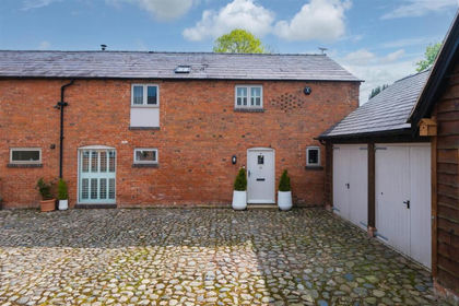
- Price
- Offers Over£500,000
Wrenbury Road, Chorley Nr. Nantwich, Cholmondeley, Cheshire East CW5 England
Added on 22/05/2026Barn Conversion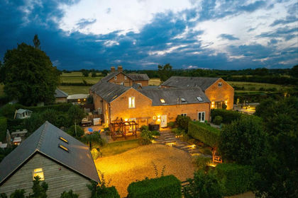
- Price
- Offers Over£575,000
2 Parkside Barns, Wrenbury Road, Chorley, Nantwich, CW5, Cholmondeley, Cheshire East CW5 England
Added on 13/08/2026Barn Conversion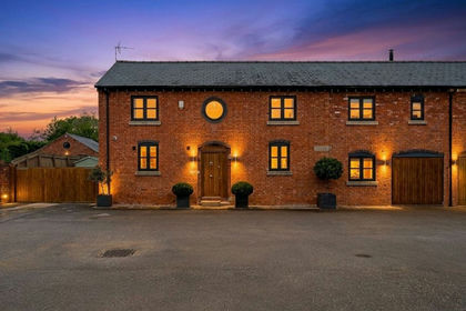
- Price
- Offers Over£550,000
Added on 15/09/2026Barn Conversion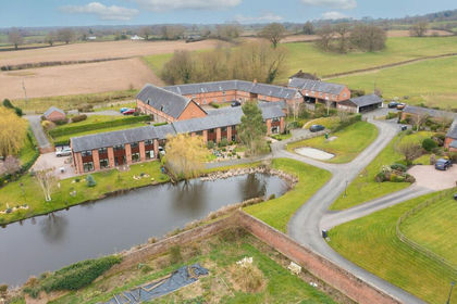
- Price
- Guide Price£500,000
Marbury, Whitchurch, SY13, Marbury and District, Cheshire East SY13 England
Added on 29/01/2026Barn ConversionLeasehold
- Price
- Offers in Region of£500,000
Marbury, Whitchurch, Marbury and District, Cheshire East SY13 England
Added on 14/10/2026Barn ConversionLeasehold Added on 30/07/2026Barn Conversion
- Price
- Guide Price£425,000
Tarporley, Cheshire, Tarporley, Cheshire West and Chester CW6 England
Added on 22/09/2026Building Plot
- Price
- Offers in Region of£450,000
- Size
- 0.36 acres
Kidnal, Nr Malpas., Malpas, Cheshire West and Chester SY14 England
Added on 12/08/2026Barn Conversion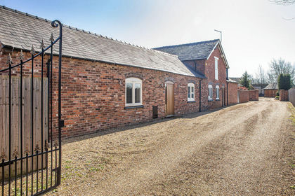
- Price
- Guide Price£559,000
"Rope Farm Barns", Rope Hall Lane, Shavington, Rope, Cheshire East CW2 England
Added on 02/04/2026Barn Conversion Added on 05/10/2026Barn Conversion