
Lads Lodge, Penton, Carlisle, CA6
- Land size
- 18.74 acres
- Dwelling size
- 1270 sqft
- Bedrooms
- 2
- Bathrooms
- 1
Key Features
- Equestrian Property
- 2 bedroom cottage with scope to extend
- Stables, outbuildings and menage
- 18.74 acres of land in a ring fence
- Located in a peaceful location
- Elevated position with good views
Description
Lads Lodge is a delightful smallholding, currently run as an equine centre. It comprises of a 2 bedroom cottage with a multitude of stables, outbuildings, yard areas and menage, with around 18.74 acres of land all in a ring fence.
Accommodation
The property is approached via a drive from the road which leads to a parking area for several vehicles at the rear of the cottage. The cottage is entered via a basic porch/storage area, with the rear door leading into the galley style kitchen. The kitchen has fitted units and cupboards and space for a range cooker, dishwasher and washing machine. The kitchen opens into a bright and airy living room with dining room beyond. Each of these areas has the benefit of a log burning stove. A door from the living room leads out into the front garden. The remaining ground floor accommodation consists of two double bedrooms and a bathroom, as well as a hallway with boot and coat storage and door to the rear yard/parking area. The bathroom has tiled walls and a bath with shower over, WC and sink.
The loft space has been converted to two rooms, but cannot be classed as accommodation as the conversion does not comply with current Building Standards.
Outside
The house and steading occupies an area of around 2.27 ac. The buildings closest to the house have various uses including housing the oil fired boiler, workshop, storage, old byre and stables. One of the buildings is currently used as gym and has electric and heating installed. There are several more buildings providing storage and stables. In all there are currently around 15 stables on the steading, with scope to develop more or change their use if required. There is a useful Office building adjacent to the 42m x 22m menage. Electricity and water are connected to most buildings. Solar panels are present on one of the outbuilding roofs. We understand that they are attracting Feed in Tariff and currently net around £1,500 per annum, but this has not been verified.
The land is in a ring fence around the steading and is split into useful paddocks closer to the steading. It totals around 18.74 acres and is of variable quality, but useful grazing land.
Location
Lads Lodge lies about 15 miles north-east of Carlisle and is surrounded by open farmland and gently rolling countryside. Penton is primarily agricultural, with scattered farmhouses rather than a central village core. The area is quiet and sparsely populated, with limited local services, and residents typically rely on Carlisle for shops, schools, and transport links. The nearby A7 road provides access south to Carlisle and north towards Langholm in Dumfries and Galloway.
What 3 words - ///intricate.sagging.control
General Remarks and Stipulations
Viewings: Strictly by appointment through the sole selling agents, C&D Rural. Tel 01228 792299
Tenure and Possession: The Freehold title is offered for sale with vacant possession upon completion.
Matters of Title: The property is sold subject to all existing easements, burdens, reservations and wayleaves, including rights of access and rights of way whether contained in the Title Deeds or informally constituted and whether referred to in the General Remarks and Stipulations or not. The Purchaser(s) will be held to have satisfied themselves as to the nature of such matters
Mines & Minerals: All mines and mineral rights are included insofar as they are owned.
Sporting rights: All sporting and fishing rights are included in so far as they are owned by the property.
EPC Rating: D
Council Tax: Cumberland Council. Council Tax Band C.
Services: Lads Lodge is served by mains water, mains electricity, private drainage and oil-fired central heating. There are solar panels on one of the barn roofs generating an annual income in the region of £1,500 (not verified). The septic tank is believed not to comply with the current General Binding Rules. Prospective purchasers should make their own enquiries and satisfy themselves as to the condition, compliance and any associated costs.
Money Laundering Obligations: In accordance with the Money Laundering Regulations 2017 the selling agents are required to verify the identity of the purchaser at the time an offer is accepted.
Website and Social Media: Further details of this property as well as all others offered by C&D Rural are available to view on our website. For updates and the latest properties like us on and Instagram on @cdrural
Referrals: C&D Rural work with preferred providers for the delivery of certain services necessary for a house sale or purchase. Our providers price their products competitively, however you are under no obligation to use their services and may wish to compare them against other providers. Should you choose to utilise them C&D Rural will receive a referral fee.
Plans, Areas and Schedules: These are based on the Ordnance Survey and are for reference only. They have been carefully checked and computed by the selling agents and the purchaser shall be deemed to have satisfied themselves as to the description of the property and any error or mis-statement shall not annul the sale nor entitle either party to compensation in respect thereof.
Map Location
Property details
- Tenure
- Freehold
- Council Tax Band
- C
- Date Posted
- 2026-08-25
Market Value Analysis
Compared with 11 Equestrian listings in North West England (10+ acres).
Energy Performance Certificate
Energy Efficiency Rating
Based on UK Energy Performance Certificate standards (EU Directive 2002/91/EC)
Running costs are one side. Planning activity, flood history and ground risks for this location are in the full report.
Utilities & Restrictions
Utilities
- Electricity
- National Grid
- Water
- Direct Main Waters
- Heating
- Oil Only
- Broadband
- ADSL
- Sewerage
- Septic Tank
Rights & Restrictions
- Public Rights of Way
- Ask Agent
- Private Rights of Way
- Ask Agent
- Listed Property
- Ask Agent
- Restrictions
- Ask Agent
Listed status, conservation areas and planning constraints for this location are in the full report.
Property Features
- Accessibility
- Ask Agent
- Parking
- Ask Agent
- Garden
- Ask Agent
Beyond the particulars: planning activity, flood history, heritage and ground risks, checked for this exact spot.
Connectivity
Broadband
Fastest speed available at this postcode
1.8 Gbps
Gigabit full fibre · available to 92% of premises
Suitable for
- 4K streaming on every screen
- Full-time home working
- Online gaming & big downloads
Mobile signal
Predicted 4G and 5G signal; indoor signal depends on building materials.
Ofcom Connected Nations postcode-level predictions. Speeds and signal are modelled, not measured, and vary between addresses and providers.
Signal is the easy part. Planning activity, flood history and protected designations here are in the full report.
Nearest Schools
Primary
- Bewcastle School3 milesOfsted: Good
- Ages
- 3 to 11
- Pupils
- 19
- Type
- Community school
- Shankhill CofE Primary School3.9 milesNo Ofsted rating
- Ages
- 3 to 11
- Pupils
- 44
- Type
- Voluntary controlled school
- Faith
- Church of England
- Longtown Primary School8 milesNo Ofsted rating
- Ages
- 3 to 11
- Pupils
- 182
- Type
- Academy sponsor led
- Walton & Lees Hill CofE School8.1 milesOfsted: Good *
- Ages
- 2 to 11
- Pupils
- 20
- Type
- Voluntary controlled school
- Faith
- Church of England
- Fir Ends Primary School8.1 milesNo Ofsted rating
- Ages
- 3 to 11
- Pupils
- 87
- Type
- Foundation school
Secondary
- William Howard School11 milesNo Ofsted rating
- Ages
- 11 to 18
- Pupils
- 1,312
- Type
- Academy converter
- Richard Rose Central Academy14 milesOfsted: Good *
- Ages
- 11 to 18
- Pupils
- 1,035
- Type
- Academy sponsor led
- Trinity School14 milesOfsted: Good *
- Ages
- 11 to 18
- Pupils
- 1,711
- Type
- Academy converter
- Faith
- Church of England
- St John Henry Newman Catholic School15 milesOfsted: Good
- Ages
- 11 to 18
- Pupils
- 703
- Type
- Voluntary aided school
- Faith
- Roman Catholic
- Richard Rose Morton Academy16 milesOfsted: Good *
- Ages
- 11 to 18
- Pupils
- 905
- Type
- Academy sponsor led
* Latest graded judgement covers quality of education only; no overall grade was issued under the 2024-25 inspection framework.
Distances are straight-line from the advertised location. Source: the national school registers (DfE, Welsh Government, Scottish Government) and Ofsted.
Schools are just the start: sold prices nearby, planning activity and any flood history are in the full report.
Amenities
Supermarket
GP surgery
Pharmacy
Hospital
Straight-line distances from the advertised location. Sources: NHS records, Geolytix supermarket locations, OS Open Greenspace and the national trails registers.
The area stacks up? Now check the location itself: planning nearby, protected designations and past flooding.
Getting Around
Nearest station
Nearest bus stop
Typical drive times
Straight-line distances from the advertised location; drive times are typical free-flow times over OpenStreetMap road data, so allow more at peak. Public transport locations from DfT NaPTAN.
Easy to reach matters. So do planning activity, flood history and ground risks: all in the full report.
Flood Risk
Environment Agency open data, checked around the advertised map pin for the listed acreage. Long-term risk counts flood defences; the planning map's flood zones do not. Provided by LandSale, not the listing agent, and not part of the agent's particulars. Risk varies across a holding, so verify before committing.
Rivers and the sea
Planning map: Flood Zone 1.
Surface water
Not at the pin: mapped about 30 metres away.
These bandings are the summary. Where this location sits on the flood maps, plus planning activity, heritage and ground risks, is in the full report.
Important notice: Information, maps and tags on this page are drawn from the advertising agent's marketing materials or generated automatically. LandSale has not verified them. Relying on these details is at your own risk, always carry out independent checks before committing to a purchase.
LandSale full disclaimer
Marketing information only - not formal particulars. The details on this website are provided for general guidance and do not constitute an offer or contract. Neither LandSale nor the advertising estate/land agent accepts responsibility for any inaccuracy.
1. Source of information
- Listing content: Core description, asking price, tenure, measurements, photographs and planning history originate from the marketing materials of the advertising estate or land agent. LandSale does not author this content and cannot guarantee its accuracy.
- Automated tags & categorisation: Property type, land-use class, acreage bands and similar labels may be applied by machine-learning models. They are intended as a helpful guide only and may not reflect the property's legal status or permitted use.
- Third-party & enriched data layers: Maps, boundary outlines, planning designations, soil reports, broadband coverage and other environmental or location-based insights are licensed from external suppliers. Such data are supplied “as is", may be incomplete or out of date and are subject to change without notice.
2. Verification required
Prospective purchasers must verify critical matters, including but not limited to planning permission, title boundaries, public rights of way, environmental constraints, acreage, services, access and VAT status, through their own inspections, specialist surveys, legal advisers and the selling agent before relying on the information or entering into any contract.
3. No warranty or liability
LandSale gives no warranty, express or implied, as to the accuracy, completeness or fitness for any particular purpose of the information displayed. LandSale shall not be liable for any loss, damage, cost or expense arising directly or indirectly from any use of or reliance on such information, save where liability may not be excluded by law.
4. Updates & feedback
If you believe any detail on this listing is inaccurate, please let us know. We will investigate and, where appropriate, update the listing or notify the agent.
© LandSale | Version 1.3 - August 2026
Listing agent
C & D Rural, Carlisle
Lakeside, Townfoot, Longtown, Carlisle, CA6 5LY
View agent profileSimilar properties for sale
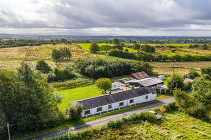
- Price
- Guide Price£495,000
- Size
- 7.5 acres
Added on 16/09/2026House with Land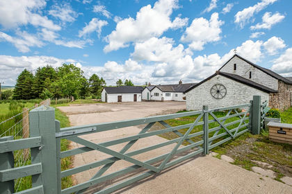
- Price
- £495,000
- Size
- 1.86 acres
Trough Farm, Roweltown, Carlisle, CA6, Carlisle, Cumberland CA6 England
Added on 24/06/2026House with Land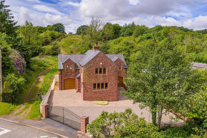
- Price
- Guide Price£495,000
- Size
- 2 acres
Waters Mill, Lyneholmeford, Carlisle, Cumbria, Stapleton, Cumberland CA6 England
Added on 24/06/2026House with Land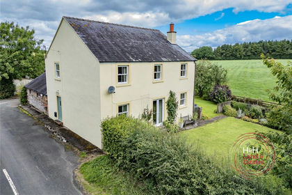
- Price
- Guide Price£625,000
- Size
- 5.29 acres
Cleugh Head, Longtown, Carlisle, Cumbria, Arthuret, Cumberland CA6 England
Added on 02/10/2026House with Land
- Price
- Offers Over£570,000
- Size
- 2.5 acres
Added on 29/01/2026House with Land Added on 29/09/2026Barn Conversion
 Added on 20/08/2026Barn Conversion
- Price
- Offers Over£370,000
- Size
- 3 acres
Waterbeck, Lockerbie, Dumfriesshire, Clydesdale and Tweeddale, Dumfries and Galloway DG11 Scotland
Added on 20/05/2026House with Land
- Price
- Guide Price£450,000
Added on 27/06/2026Barn Conversion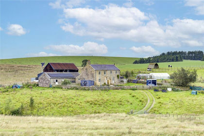
- Price
- £625,000
- Size
- 26.07 acres
High Tipalt Farm, Greenhead, Brampton, Northumberland, CA8, Greenhead, Northumberland CA8 England
Added on 22/09/2026Smallholding