Highlands, Ridgeway Cross, Cradley, Malvern, WR13
- Land size
- 1.5 acres
- Bedrooms
- 3
- Bathrooms
- 1
Key Features
- Eco- Efficient Detached Bungalow
- Elevated Position With Views
- Large Garden & Grounds Approaching 1.5 Acres
- 3 Bedrooms
- 2 Reception Rooms
- Garage With Driveway Parking
Description
Front Cover Description
An Individual Eco-Efficient Three Bedroom Detached Bungalow Conveniently Situated On The Outskirts Of The Village Of Cradley In An Elevated Position With Views To The Malvern Hills Set In Garden And Grounds In All Approaching 1.5 Acres With Driveway Parking And Attached Garage. EPC A
Property Location
The Highlands enjoys a convenient location just outside the well served village of Cradley on the Herefordshire Worcestershire border. The village has a range of local amenities including doctor's surgery, village shop, church and primary school. Further and more extensive amenities are available in the nearby Victorian hillside town of Malvern (approx. 6 miles) the market town of Ledbury (approx. 5 miles) and the riverside city of Worcester (approx. 10 miles).
Property Description
The Highlands is a unique, eco-efficient home embraces passive design principles to offer an incredibly low-carbon lifestyle. Crafted for maximum thermal efficiency, the property relies on superior external insulation and high-performance insulated window shutters to retain heat naturally. Renewable energy is generated on-site via solar panels, while a centrally positioned wood-burning stove provides cozy, low-impact warmth on colder days. By eliminating the need for a traditional central heating system, this home offers the next owner exceptional energy independence and minimal running costs.
The spacious accommodation is well suited to modern living and, while offering scope for updating and personalisation, provides excellent proportions throughout. The ground floor comprises two reception rooms, a large conservatory and kitchen with a generous adjoining utility room and interconnecting door to the garage. There are three bedrooms, one including an with en-suite shower room, together with a family bathroom.
Outside, the property is approached via a gated, block-paved driveway providing ample parking and excellent turning space, with access to the attached garage. Steps lead to a further driveway and additional garage, providing useful ancillary parking and storage.
The gardens and grounds extend to approximately 1.5 acres and enjoy a desirable southerly aspect, with far-reaching views towards the Malvern Hills. A generous paved terrace, arranged over two levels, provides an ideal setting for outdoor entertaining and enjoying the surrounding countryside. The formal garden is complemented by a large ornamental pond, decked seating area and pergola.
For those with a passion for gardening and self-sufficiency, the productive kitchen garden includes a variety of fruit trees, soft fruit and vegetable cages. Areas of paddock adjoin the property on both sides, benefiting from its own separate field gate, offering versatility for livestock or simply further enjoyment of the extensive grounds.
The Highlands presents a rare combination of generous accommodation, innovative eco-conscious design, substantial grounds and countryside views, with excellent potential for the next owner to further enhance and personalise this individual property.
Porch
Enclosed porch.
Kitchen - 3.43m x 3.3m (11'3" x 10'10")
Fitted with a range of wall and base units with countertops over. Stainless steel sink unit. Eye level double oven and ceramic hob with extractor over. Fridge freezer. Double glazed windows to front with insulated window shutters. Tiled floor. Door to:
Utility Room - 5.41m x 2.54m (17'9" x 8'4")
Tiled floor. Separate WC and wash basin. Double stainless steel sink. Plumbing for washing machine. Useful storage cupboards. Connecting door to the garage. Staircase to attic storage with power, light and three Velux windows.
Sitting Room - 5m x 3.86m (16'5" x 12'8")
With bi-fold doors opening to the conservatory. SOLID FUEL STOVE. Tiled floor. TV point . Fitted shelving.
Dining Room - 4.34m x 3.1m (14'3" x 10'2")
Enjoying views towards the Malvern Hills with rear aspect double glazed windows fitted with insulated shutters. Glazed double doors opening to the sitting room.
Conservatory - 7.62m x 4.32m (25'0" x 14'2")
Double glazed with doors opening to the garden terrace . Two ceiling fans. Tiled floor.
Inner Hall
Carpeted with doors leading to:
Bedroom 1 - 3.68m x 3.68m (12'1" x 12'1")
Rear aspect double glazed window with fitted shutters and enjoying garden views. Carpet. Telephone point.
Bedroom 2 - 3.71m x 3.71m (12'2" x 12'2")
Rear aspect double glazed windows with fitted shutters and garden views. Telephone point. Carpet.
Bedroom 3 - 3.66m x 2.77m (12'0" x 9'1")
Two front aspect double glazed windows with fitted shutters. Door to ensuite shower cubicle with electric shower, tiled floor and electric towel rail.
Bathroom
Suite comprising panelled bath, vanity unit with WC and wash basin, fitted cupboards over with mirror and lighting. Tiled walls. Carpet. Front aspect double glazed window with fitted shutter.
Garage
With attached wood store. PIR lighting.
Outside
A block paved driveway provides access to the property with ample parking and turning area giving access to the attached garage 17'5" x 9'9" with light and power. Steps lead up from the front of the property to a further driveway and additional garage with access to the paddock.
Enjoying a southerly aspect, the generous garden is arranged with a paved terrace set over two levels with far reaching views towards the Malvern Hills, a large ornamental pond with a decked seating area and pergola complement the garden. There is a productive kitchen garden with a variety of fruit trees, soft fruit and vegetable cages and polytunnel. An area of paddock with separate field gate adjoins the property on each side. The paddock and lower garden is well planted with a variety of mature trees, to the bottom of the garden is a large pond with decked terrace and gazebo. There is a bank of 16 solar panels to the rear of the garden with further panels to the rear side of the roof.
Directions
The approach from Ledbury is north on the B4220 to the village of Cradley. Proceed through the village and at the "T" junction with the Hereford/Worcester Road (A4103) turn left towards Hereford and the property will be found after a short distance on the left hand side.
Services
We have been advised that mains electricity and water are connected to the property. Drainage is to a private system. This information has not been checked with the respective service providers and interested parties may wish to make their own enquiries with the relevant authorities. No statement relating to services or appliances should be taken to infer that such items are in satisfactory working order and intending purchasers are advised to satisfy themselves where necessary.
Tenure
Freehold
We are advised (subject to legal verification) that the property is freehold.
Viewing
By appointment to be made through the Agent's Ledbury Office (Tel: )
General
Intending purchasers will be required to produce identification documentation and proof of funding in order to comply with The Money Laundering, Terrorist Financing and Transfer of Funds Regulations 2017. More information can be made available upon request.
John Goodwin FRICS has made every effort to ensure that measurements and particulars are accurate however prospective purchasers/tenants must satisfy themselves by inspection or otherwise as to the accuracy of the information provided. No information with regard to planning use, structural integrity, tenure, availability/operation, business rates, services or appliances has been formerly verified and therefore prospective purchasers/tenants are requested to seek validation of all such matters prior to submitting a formal or informal intention to purchase/lease the property or enter into any contract.
Council Tax
COUNCIL TAX BAND "D" This information may have been obtained from the local council website only and applicants are advised to consider obtaining written confirmation.
EPC
The EPC rating for this property is A (96).
Map Location
Property details
- Tenure
- Freehold
- Council Tax Band
- D
- Date Posted
- 2026-08-25
Market Value Analysis
Compared with 1,032 Homes with Land listings in West Midlands (1+ acres).
Energy Performance Certificate
Energy Efficiency Rating
Based on UK Energy Performance Certificate standards (EU Directive 2002/91/EC)
Running costs are one side. Planning activity, flood history and ground risks for this location are in the full report.
Utilities & Restrictions
Utilities
- Electricity
- Mains
- Water
- Mains
- Heating
- Double Glazing, Central Heating, Gas Central Heating
- Broadband
- Ask Agent
- Sewerage
- Septic Tank / Private
Rights & Restrictions
- Public Rights of Way
- Ask Agent
- Private Rights of Way
- Ask Agent
- Listed Property
- Ask Agent
- Restrictions
- Ask Agent
Listed status, conservation areas and planning constraints for this location are in the full report.
Property Features
- Accessibility
- Ask Agent
- Parking
- Garage, Driveway
- Garden
- Private Garden
Beyond the particulars: planning activity, flood history, heritage and ground risks, checked for this exact spot.
Connectivity
Broadband
Fastest speed available at this postcode
80 Mbps
Superfast
Suitable for
- HD streaming
- Video calls
- Web & social
Mobile signal
Predicted 4G and 5G signal; indoor signal depends on building materials.
Ofcom Connected Nations postcode-level predictions. Speeds and signal are modelled, not measured, and vary between addresses and providers.
Signal is the easy part. Planning activity, flood history and protected designations here are in the full report.
Nearest Schools
Primary
- Cradley CofE Primary School0.9 milesOfsted: Requires improvement
- Ages
- 4 to 11
- Pupils
- 73
- Type
- Voluntary aided school
- Faith
- Church of England
- Suckley Primary School2.6 milesOfsted: Outstanding *
- Ages
- 4 to 11
- Pupils
- 95
- Type
- Academy converter
- St James' CofE Primary School2.7 milesOfsted: Good
- Ages
- 4 to 11
- Pupils
- 35
- Type
- Voluntary aided school
- Faith
- Church of England
- Northleigh CofE Primary School2.9 milesOfsted: Good
- Ages
- 2 to 11
- Pupils
- 202
- Type
- Academy sponsor led
- Faith
- Church of England
- St Joseph's Catholic Primary School3.1 milesOfsted: Good
- Ages
- 4 to 11
- Pupils
- 99
- Type
- Voluntary aided school
- Faith
- Roman Catholic
Secondary
- Dyson Perrins CofE Academy3.3 milesOfsted: Good
- Ages
- 11 to 16
- Pupils
- 592
- Type
- Academy converter
- Faith
- Church of England
- The Chase4.3 milesOfsted report card · Jan 2026
- Ages
- 11 to 18
- Pupils
- 1,449
- Type
- Academy converter
- Queen Elizabeth High School6.4 milesNo Ofsted rating
- Ages
- 11 to 16
- Pupils
- 421
- Type
- Academy converter
- John Masefield High School6.5 milesNo Ofsted rating
- Ages
- 11 to 18
- Pupils
- 849
- Type
- Academy converter
- Hanley Castle High School8 milesOfsted: Good
- Ages
- 11 to 18
- Pupils
- 1,142
- Type
- Academy converter
* Latest graded judgement covers quality of education only; no overall grade was issued under the 2024-25 inspection framework.
Distances are straight-line from the advertised location. Source: the national school registers (DfE, Welsh Government, Scottish Government) and Ofsted.
Schools are just the start: sold prices nearby, planning activity and any flood history are in the full report.
Amenities
Supermarket
GP surgery
Pharmacy
Hospital
Green space
Straight-line distances from the advertised location. Sources: NHS records, Geolytix supermarket locations, OS Open Greenspace and the national trails registers.
The area stacks up? Now check the location itself: planning nearby, protected designations and past flooding.
Getting Around
Nearest station
Nearest bus stop
Typical drive times
Straight-line distances from the advertised location; drive times are typical free-flow times over OpenStreetMap road data, so allow more at peak. Public transport locations from DfT NaPTAN.
Easy to reach matters. So do planning activity, flood history and ground risks: all in the full report.
Flood Risk
Environment Agency open data, checked around the advertised map pin for the listed acreage. Long-term risk counts flood defences; the planning map's flood zones do not. Provided by LandSale, not the listing agent, and not part of the agent's particulars. Risk varies across a holding, so verify before committing.
Rivers and the sea
Planning map: Flood Zone 1.
Surface water
Not at the pin: mapped about 40 metres away.
These bandings are the summary. Where this location sits on the flood maps, plus planning activity, heritage and ground risks, is in the full report.
Important notice: Information, maps and tags on this page are drawn from the advertising agent's marketing materials or generated automatically. LandSale has not verified them. Relying on these details is at your own risk, always carry out independent checks before committing to a purchase.
LandSale full disclaimer
Marketing information only - not formal particulars. The details on this website are provided for general guidance and do not constitute an offer or contract. Neither LandSale nor the advertising estate/land agent accepts responsibility for any inaccuracy.
1. Source of information
- Listing content: Core description, asking price, tenure, measurements, photographs and planning history originate from the marketing materials of the advertising estate or land agent. LandSale does not author this content and cannot guarantee its accuracy.
- Automated tags & categorisation: Property type, land-use class, acreage bands and similar labels may be applied by machine-learning models. They are intended as a helpful guide only and may not reflect the property's legal status or permitted use.
- Third-party & enriched data layers: Maps, boundary outlines, planning designations, soil reports, broadband coverage and other environmental or location-based insights are licensed from external suppliers. Such data are supplied “as is", may be incomplete or out of date and are subject to change without notice.
2. Verification required
Prospective purchasers must verify critical matters, including but not limited to planning permission, title boundaries, public rights of way, environmental constraints, acreage, services, access and VAT status, through their own inspections, specialist surveys, legal advisers and the selling agent before relying on the information or entering into any contract.
3. No warranty or liability
LandSale gives no warranty, express or implied, as to the accuracy, completeness or fitness for any particular purpose of the information displayed. LandSale shall not be liable for any loss, damage, cost or expense arising directly or indirectly from any use of or reliance on such information, save where liability may not be excluded by law.
4. Updates & feedback
If you believe any detail on this listing is inaccurate, please let us know. We will investigate and, where appropriate, update the listing or notify the agent.
© LandSale | Version 1.3 - August 2026
Listing agent
John Goodwin FRICS, Ledbury
3 - 5, New Street, Ledbury, HR8 2DX
Similar properties for sale
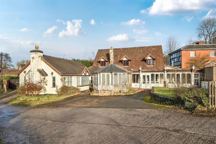
- Price
- Offers in Region of£400,000
- Size
- 1.44 acres
Stiffords Bridge, Cradley, Malvern, Cradley and Storridge, Herefordshire, County of WR13 England
Added on 29/01/2026House with Land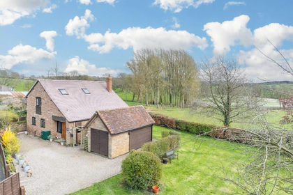
- Price
- Offers in Region of£600,000
- Size
- 1.5 acres
The Barn House, WR6, Acton Beauchamp, Herefordshire, County of WR6 England
Added on 18/06/2026Barn Conversion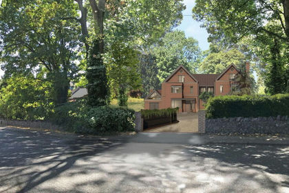
- Price
- Guide Price£500,000
- Size
- 0.5 acres
Albert Park Road, Malvern, Worcestershire, WR14, Malvern, Worcestershire WR14 England
Added on 29/01/2026Building Plot
- Price
- Offers Over£400,000
Como Road, Great Malvern, Worcestershire, WR14, Malvern, Worcestershire WR14 England
Added on 29/01/2026Building Plot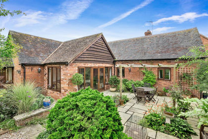
- Price
- £540,000
The Briar, Crews Hill Court, Alfrick, Worcestershire. WR6, Alfrick, Worcestershire WR6 England
Added on 22/03/2026Barn Conversion
- Price
- Guide Price£450,000
Tibberton Road, Great Malvern, Worcestershire, WR14, Malvern, Worcestershire WR14 England
Added on 14/10/2026Building Plot
- Price
- Guide Price£475,000
The Stables, Bridgend Farm, Bromyard, HR7, Much Cowarne, Herefordshire, County of HR7 England
Added on 18/09/2026Barn Conversion
- Price
- Offers in Region of£625,000
- Size
- 3.4 acres
Stoke Lacy, Bromyard, Herefordshire, HR7, Stoke Lacy, Herefordshire, County of HR7 England
Added on 24/06/2026Barn Conversion
- Price
- Offers Over£375,000
Tedstone Wafre, Bromyard, Herefordshire, Bromyard and Winslow, Herefordshire, County of HR7 England
Added on 03/07/2026Barn Conversion
- Price
- Offers Over£550,000
Stretton Grandison, Ledbury, HR8, Stretton Grandison, Herefordshire, County of HR8 England
Added on 20/02/2026Barn Conversion