Land and Buildings at Abbeywood, Chester Road, Delamere, CW8
- Land size
- 37.94 acres
Key Features
- Parcel of agricultural and forestry land with access onto Chester Road (A556) and Middlewich Road (A54).
- Large agricultural building on site, along with various ancillary buildings.
- Planning permission granted for six glamping pods/yurt, and a second agricultural/forestry building.
- No overage provision included with the sale.
- Mains electricity and mains water connected.
Description
Land at Abbeywood, Chester Road, Delamere
Guide Price - £800,000 (plus VAT)
An exciting opportunity to purchase a substantial block of agricultural, forestry and amenity land off Chester Road, Delamere. Totalling approximately 37.94 acres (15.35 ha) the land is a mixture of grassland and woodland with agricultural and forestry buildings on site and planning permission granted for six glamping pods.
The land has multiple access points including direct access off Middlewich Road (A54) and a right of access along Abbeywood Estate driveway on Chester Road (A556).
Properties of this nature do not come on the market very often and could provide a purchaser with a wealth of opportunity for commercial and recreational uses subject to obtaining the necessary planning consents.
Viewings are essential to appreciate the wealth of options that the land could provide.
LOCATION
Delamere is a village located in the authority of Cheshire West and Chester Council and within the county of Cheshire. It offers buyers the idyllic rural charm with exceptional commuter convenience being located 7 miles from Northwich and 11.4 miles from Chester. Seen as a premier location for outdoor pursuits with plenty of walking, running, cycling or horse riding routes around Delamere Forest and the surrounding areas. There is also outdoor activity centres such as Go-Ape high rope course and Wildshore Sailing and Aqua Park just a stones throw away.
INTERESTING FEATURES
Currently on the land there is a club house, poly tunnel, orchard, large steel frame agricultural/forestry building and planning permission granted for a second. There is a mains water and mains electricity supply across the site with multiple entry points.
DESCRIPTION
The land is currently used for agricultural and forestry purposes, but planning has been granted for the addition of six glamping pods with associated tracks and parking areas. There is also planning granted for another steel frame building on site.
FIELD 1
On entering the site from Abbeywood Estate driveway the first field is a mixture of grassland and sporadic trees in an orchard style. An inviting entrance with full hardcore track and gated access.
FIELD 2
Behind the screen of trees an open expanse of grassland which is currently home to the ‘club house’ building. This area also benefits from the planning permission for glamping pods/yurts. This section is flanked by trees lined boundaries on all sides providing natural screening and security. An oasis yet close to road networks. There is an electricity cable connected to 59 KVA supply up to the boundary along with a new 32mm water supply. In addition, there is an Environment Agency permit in place.
FIELD 3
Moving along the hardcore track and through a forest area, an orchard and polytunnel line the side of the land. In addition, a recently constructed steel frame building with roller shutter doors to each bay on both sides offering a multi-purpose use for any perspective
purchaser.
FIELD 4
Moving along the track towards the second access point, grassland to both sides and the continued tree lined boundaries. A large agricultural field currently used for grazing and mowing. This field has planning permission granted for a steel frame agricultural building and is currently stockproof fenced around all edges. This field also benefits from a 100 KVA transformer and 40 KVA supply. There is planning permission granted for another agricultural/forestry building of 696 m2. Please see the next page for further details.
WOODLAND
The property has a substantial amount of woodland included on all sides including more dense patches. This could be reviewed for more of a commercial opportunity subject to the
relevant planning or licences.
APPROVED PLANNING
- 25/01964/AGR – Erection of two general purpose forestry buildings – Prior approval not
required
- 25/03863/AGR - Creation of new track, track will act as a spine road, facilitating access for
heavy machinery to the wider site and also allow for transportation of timber to the
forestry buildings – Prior approval not required.
- 24/03824/FUL - Change of use of land for siting of six glamping pods with associated paths and parking area – Approved.
- 25/03957/S73 - Change of use of land for siting of six glamping pods with associated paths and parking area. - Variation of condition 2 (approved plans) and condition 3 (materials) of
planning application 24/03824/FUL- to change the type of accommodation from pods to yurts – Approved.
OUTSTANDING PLANNING
There is currently a planning application submitted under reference 25/03855/FUL for a new improved vehicular access from the A54 to serve forestry operations and replacing two
existing access points.
LAND
According to Natural England the Provisional Agricultural Land Classification the land is ‘Grade 3’.
SERVICES
Mains water and mains electricity
OVERAGE
There is no overage included with the sale.
DIRECTIONS
From Tarvin Roundabout take the A54 (Holme Street) signposted for ‘Manchester’. Continue along the A54 for approximately 4.5 miles before keeping left on to the A556 (Chester Road). Follow Chester Road for approximately 1 mile where the land will be located on the right signposted 'Abbeywood Estate'.
what3words ///become.lollipop.trickle
AML REGULATIONS
In line with UK anti-money laundering legislation, we are legally required to carry out checks on all purchasers. While the Rostons Group remains responsible for ensuring these checks and any ongoing monitoring are completed correctly, the initial anti-money laundering checks are carried out on our behalf by Movebutler. Once you have had an offer accepted on a property you wish to buy, you will receive an email from Movebutler containing a secure link to complete the required checks. The cost of these checks is £30 (incl. VAT) per buyer.
This fee covers the cost of obtaining the necessary data, along with any manual checks or monitoring that may be required. Payment is made directly to Movebutler and must be completed before we can issue a memorandum of sale. Please note that this fee is non-refundable.
ENQUIRIES & VIEWINGS
Please contact Alice Kearns at Rostons. All viewings must be made in advance.
PUBLIC RIGHTS OF WAY, WAYLEAVES & EASEMENTS
The property is sold subject to all rights of way, wayleaves and easements whether or not they are defined in this brochure.
SALE PLAN & PARTICULARS
The sale plan is based on the Ordnance Survey sheet. Prospective purchasers should check the contract documents. The purchasers shall raise no objection or query in respect of any variation between the physical boundaries and the Ordnance Survey sheet plan. The
plans are strictly for identification purposes only.
DISCLAIMER
Rostons Ltd for themselves and the vendors of the property, give notice that these particulars, do not constitute any part of an offer or contract, that all statements contained in these particulars as to the property are made without responsibility and are not to be relied upon as statements or representations of fact and that they do not make or give any
representation or warranty whatsoever in relation to this property. An intending purchaser must satisfy themselves by inspection or otherwise as to the correctness of each of the statements contained within these particulars. The Agent has not tested any apparatus, equipment, fixture, fittings or services and cannot verify that they are in working order or fit for their purpose. The buyer is advised to obtain verification from their Solicitor or Surveyor.
Map Location
Property details
- Tenure
- Freehold
- Council Tax Band
- Ask Agent
- Date Posted
- 2026-08-24
Market Value Analysis
Compared with 71 Farmland & Pasture listings in North West England (25+ acres).
Utilities & Restrictions
Utilities
- Electricity
- Mains
- Water
- Mains
- Heating
- Ask Agent
- Broadband
- Ask Agent
- Sewerage
- Ask Agent
Rights & Restrictions
- Public Rights of Way
- Ask Agent
- Private Rights of Way
- Ask Agent
- Listed Property
- Ask Agent
- Restrictions
- Ask Agent
Listed status, conservation areas and planning constraints for this location are in the full report.
Property Features
- Accessibility
- Ask Agent
- Parking
- Parking Available
- Garden
- Garden
Beyond the particulars: planning activity, flood history, heritage and ground risks, checked for this exact spot.
Connectivity
Broadband
Fastest speed available at this postcode
80 Mbps
Superfast · available to 82% of premises
Suitable for
- HD streaming
- Video calls
- Web & social
Mobile signal
Predicted 4G and 5G signal; indoor signal depends on building materials.
Ofcom Connected Nations postcode-level predictions. Speeds and signal are modelled, not measured, and vary between addresses and providers.
Signal is the easy part. Planning activity, flood history and protected designations here are in the full report.
Nearest Schools
Primary
- Delamere CofE Primary Academy732 metresOfsted: Outstanding
- Ages
- 4 to 11
- Pupils
- 177
- Type
- Academy converter
- Faith
- Church of England
- Kelsall Primary and Nursery School2.3 milesOfsted: Outstanding
- Ages
- 2 to 11
- Pupils
- 251
- Type
- Academy converter
- Norley Church of England Primary School2.6 milesOfsted: Good
- Ages
- 4 to 11
- Pupils
- 100
- Type
- Academy converter
- Faith
- Church of England
- Cuddington Primary School2.8 milesNo Ofsted rating
- Ages
- 4 to 11
- Pupils
- 190
- Type
- Academy converter
- Eaton Primary School3.2 milesOfsted: Good
- Ages
- 5 to 11
- Pupils
- 175
- Type
- Academy sponsor led
Secondary
- Tarporley High School and Sixth Form College3.9 milesOfsted: Good
- Ages
- 11 to 18
- Pupils
- 1,219
- Type
- Academy converter
- Weaverham High School4.8 milesOfsted report card · Mar 2026
- Ages
- 11 to 16
- Pupils
- 1,154
- Type
- Academy converter
- The Winsford Academy5.3 milesOfsted: Inadequate *
- Ages
- 11 to 16
- Pupils
- 945
- Type
- Academy sponsor led
- Hartford Church of England High School5.7 milesOfsted: Good
- Ages
- 11 to 16
- Pupils
- 1,102
- Type
- Voluntary aided school
- Faith
- Church of England
- St Nicholas Catholic High School6.1 milesOfsted: Good
- Ages
- 11 to 18
- Pupils
- 1,201
- Type
- Voluntary aided school
- Faith
- Roman Catholic
* Latest graded judgement covers quality of education only; no overall grade was issued under the 2024-25 inspection framework.
Distances are straight-line from the advertised location. Source: the national school registers (DfE, Welsh Government, Scottish Government) and Ofsted.
Schools are just the start: sold prices nearby, planning activity and any flood history are in the full report.
Amenities
Supermarket
GP surgery
Pharmacy
Hospital
Straight-line distances from the advertised location. Sources: NHS records, Geolytix supermarket locations, OS Open Greenspace and the national trails registers.
The area stacks up? Now check the location itself: planning nearby, protected designations and past flooding.
Getting Around
Nearest station
Nearest bus stop
Typical drive times
Straight-line distances from the advertised location; drive times are typical free-flow times over OpenStreetMap road data, so allow more at peak. Public transport locations from DfT NaPTAN.
Easy to reach matters. So do planning activity, flood history and ground risks: all in the full report.
Flood Risk
Environment Agency open data, checked around the advertised map pin for the listed acreage. Long-term risk counts flood defences; the planning map's flood zones do not. Provided by LandSale, not the listing agent, and not part of the agent's particulars. Risk varies across a holding, so verify before committing.
Rivers and the sea
Planning map: Flood Zone 1.
Surface water
Not at the pin: mapped about 80 metres away.
These bandings are the summary. Where this location sits on the flood maps, plus planning activity, heritage and ground risks, is in the full report.
Important notice: Information, maps and tags on this page are drawn from the advertising agent's marketing materials or generated automatically. LandSale has not verified them. Relying on these details is at your own risk, always carry out independent checks before committing to a purchase.
LandSale full disclaimer
Marketing information only - not formal particulars. The details on this website are provided for general guidance and do not constitute an offer or contract. Neither LandSale nor the advertising estate/land agent accepts responsibility for any inaccuracy.
1. Source of information
- Listing content: Core description, asking price, tenure, measurements, photographs and planning history originate from the marketing materials of the advertising estate or land agent. LandSale does not author this content and cannot guarantee its accuracy.
- Automated tags & categorisation: Property type, land-use class, acreage bands and similar labels may be applied by machine-learning models. They are intended as a helpful guide only and may not reflect the property's legal status or permitted use.
- Third-party & enriched data layers: Maps, boundary outlines, planning designations, soil reports, broadband coverage and other environmental or location-based insights are licensed from external suppliers. Such data are supplied “as is", may be incomplete or out of date and are subject to change without notice.
2. Verification required
Prospective purchasers must verify critical matters, including but not limited to planning permission, title boundaries, public rights of way, environmental constraints, acreage, services, access and VAT status, through their own inspections, specialist surveys, legal advisers and the selling agent before relying on the information or entering into any contract.
3. No warranty or liability
LandSale gives no warranty, express or implied, as to the accuracy, completeness or fitness for any particular purpose of the information displayed. LandSale shall not be liable for any loss, damage, cost or expense arising directly or indirectly from any use of or reliance on such information, save where liability may not be excluded by law.
4. Updates & feedback
If you believe any detail on this listing is inaccurate, please let us know. We will investigate and, where appropriate, update the listing or notify the agent.
© LandSale | Version 1.3 - August 2026

Listing agent
Rostons, Hatton Heath
West View House Whitchurch Road, Hatton Heath, CH3 9AU
Call agent
01829773000Contact Rostons, Hatton Heath
West View House Whitchurch Road, Hatton Heath, CH3 9AU
Call agent
01829773000Similar properties for sale
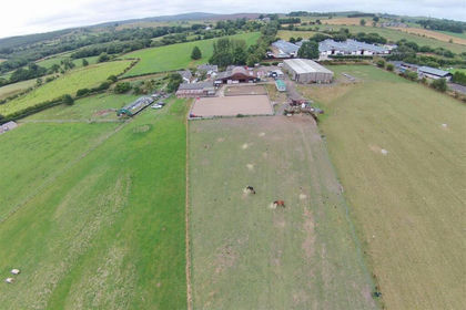
- Price
- £850,000
- Size
- 24 acres
Ffordd Y Blaenau, Treuddyn, Mold, Treuddyn, Flintshire CH7 Wales
Added on 18/06/2026Equestrian property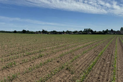
- Price
- Guide Price£875,000
- Size
- 62.3 acres
Cadney Lane, Bettisfield, Whitchurch., Maelor South, Wrexham SY13 Wales
Added on 05/06/2026Arable Land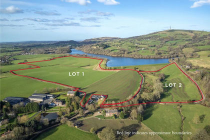
- Price
- Guide Price£700,000
- Size
- 47.9 acres
Bennetts Lane, Bosley, Macclesfield, Cheshire, SK11, Bosley, Cheshire East SK11 England
Added on 08/10/2026Agricultural Land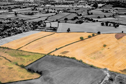
- Price
- Guide Price£800,000
- Size
- 67.78 acres
Land at Tetchill, Ellesmere Road, SY12 9AW (Lots 1 & 2), Ellesmere Rural, Shropshire SY12 England
Added on 29/01/2026Farmland- Price
- Guide Price£680,000
- Size
- 67.78 acres
Land at Tetchill (Lot 2), Ellesmere, SY12, Ellesmere Rural, Shropshire SY12 England
Added on 29/01/2026Farmland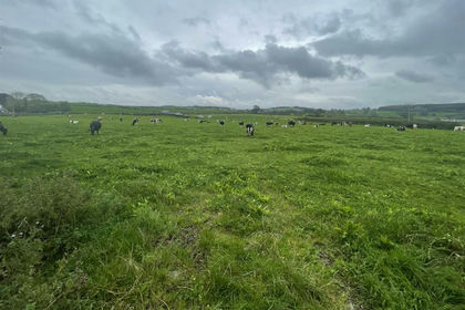
- Price
- Guide Price£650,000
- Size
- 36.2 acres
Added on 29/01/2026Agricultural Land