Land and Buildings At Nant Y Dugoed, Mallwyd, Machynlleth, Gwynedd, SY20
- Land size
- 219.49 acres
Description
A rare opportunity to acquire a substantial upland agricultural holding of a scale seldom brought to the market within this locality, extending in all to approximately 219.49 acres (88.83 hectares), together with a useful range of traditional and modern agricultural buildings.
The property is arranged in two principal blocks divided only by the A458, comprising approximately 84.88 acres (34.35 hectares) to the north of the road and 134.62 acres (54.48 hectares) to the south. Each block benefits from direct highway access, creating a practical layout for livestock management and future land-use opportunities.
The buildings comprise an attractive range of traditional stone-built structures, together with a smaller range of more modern agricultural buildings. They extend to approximately 7,212 square feet (670 square metres) in total and provide livestock housing, handling, fodder and general storage accommodation. Subject to the necessary consents, the traditional buildings may offer potential for alternative agricultural, commercial or tourism-related use.
SITUATION
Nant Y Dugoed occupies an attractive position within the upper Dyfi Valley, close to Mallwyd and Dinas Mawddwy and within the wider Eryri National Park landscape. The property lies directly alongside the A458, providing convenient access towards Machynlleth and the west Wales coast to the west, and towards Mallwyd, Dolgellau and the wider trunk-road network to the north and east. The surrounding locality is predominantly rural and characterised by upland livestock farms, forestry and open hill land.
The holding enjoys a private and scenic setting while remaining readily accessible from the public highway. The combination of extensive upland acreage, roadside access and a useful building range is unusual within this locality.
LAND
The land comprises a substantial and varied upland holding of grazing land, rough grazing, moorland and areas of wet ground, interspersed with natural features and shelter. The better and more accessible parcels are suitable for grass silage and hay production, while the wider holding is primarily suited to extensive livestock grazing, particularly sheep and hardy cattle, together with environmental management and conservation-based land uses.
The Agricultural Land Classification is predominantly Grade 5 (82.38%), with Grade 4 accounting for 14.75% and non-agricultural land accounting for approximately 2.86%.
The soils comprise predominantly slowly permeable, wet, very acid upland soils with a peaty surface (55.89%), together with freely draining acid loamy soils over rock (43.46%). Smaller areas comprise blanket bog peat soils (0.87%) and very acid loamy upland soils with a wet peaty surface (0.51%).
DIVERSIFICATION POTENTIAL
The scale, topography, roadside access and existing buildings provide scope to consider a range of complementary uses. Subject to the necessary consents, the traditional buildings may offer potential for conversion or redevelopment to provide residential dwellings, holiday lets, tourism accommodation or other commercial uses. Wider opportunities across the holding may include afforestation or woodland creation, renewable-energy and associated infrastructure, nature recovery, habitat management, carbon-related projects and tourism or recreational uses. All such uses would be subject to the existing option agreement, physical and environmental constraints, planning permission, building regulations and any other statutory or third-party consents. No representation or warranty is given that any alternative use will be permitted.
SERVICES
The land benefits from natural water supplies. The agricultural buildings are not presently connected to water or electricity; however, services are understood to be available in close proximity. Prospective purchasers must make their own enquiries regarding the availability, adequacy, quality and continuity of all services and water supplies, together with the feasibility and cost of any connections. No tests or investigations have been undertaken by the Vendor or the Selling Agents.
TENURE
The property is offered for sale freehold and is intended to be sold with vacant possession upon completion. It is registered with HM Land Registry under Title Number CYM340987.
The property is presently occupied under an agricultural tenancy. Arrangements are to be made for that tenancy to terminate so that vacant possession is available on completion. The legal position and surrender arrangements will be confirmed within the Tender Pack.
The land is also subject to an option agreement in favour of Carnedd Wen Wind Farm Limited. Further information is set out below and the relevant documents will be included within the Tender Pack.
OPTION AGREEMENT
An option agreement dated 31 January 2008, as subsequently varied, affects the land tinted blue on the copy of the Land Registry plan included within the Tender Pack. The option is currently held by Carnedd Wen Wind Farm Limited and gives the option-holder the right, during the option period, to require the owner to grant a lease of rights in connection with the Carnedd Wen Wind Farm project.
The agreement is binding upon successors in title. Any sale of the property requires the option-holder’s written consent, must be completed subject to the terms of the agreement and will require the purchaser to covenant to observe and perform the landowner’s obligations. The option also contains provisions affecting disposals, the grant of new occupational interests, competing wind-energy arrangements, development, planting and other activities which could prejudice the project.
Under the latest draft variation supplied, the option period is proposed to be extended for a further period from the date of completion of that deed, subject to further extension provisions and a long-stop date. The variation also provides for payments to the landowner during the option period. Purchasers should rely upon the final executed documentation contained within the Tender Pack and obtain their own independent legal advice as to its terms and effect.
In the event that the option is exercised and the project proceeds, the draft lease provides for various payments to the landowner in connection with the construction and operation of the project. These include payments relating to the commencement of construction works, the establishment of any construction compound, access over the land and forestry access and felling operations. Certain payments may be subject to indexation in accordance with the terms of the relevant agreement.
The above summary is provided for guidance only and is not intended to be a substitute for the full option agreement, deeds of variation and draft lease. Prospective purchasers should satisfy themselves as to the full terms, rights and obligations arising from the documentation and take appropriate legal advice.
The option and all associated rights and obligations will remain binding upon the property following completion of the sale. The treatment of any payments accrued, received or becoming due in connection with the agreement will be dealt with in accordance with the terms of the sale contract and the relevant wind farm documentation.
SUSTAINABLE FARMING SCHEME / BASIC PAYMENT SCHEME
The land is registered with Rural Payments Wales.
Prospective purchasers should make their own enquiries regarding the land’s eligibility for the Sustainable Farming Scheme, Basic Payment Scheme or any current or future agricultural, environmental or woodland support scheme. No warranty is given regarding eligibility, payment entitlement or future scheme requirements.
SPORTING RIGHTS, MINES & MINERALS
It is understood that the sporting rights are included within the sale, insofar as they are owned by the Vendor. The mines and minerals, together with ancillary powers of working, are excepted from the registered title. The Charges Register also contains notices relating to reserved manorial mineral rights and an option affecting those rights. Further details are available within the Tender Pack.
ACCESS
The property benefits from direct vehicular access in two locations from the A458, serving the land on the northern and southern sides of the road.
EASEMENTS, WAYLEAVES & RIGHTS OF WAY
The property is sold subject to, and with the benefit of, all existing easements, wayleaves, covenants and rights of way, whether public or private and whether specifically referred to within these particulars or not.
Purchasers should be aware that the owner and occupiers of the adjoining residential property known as “Nant Y Dugoed” benefit from a right of way over the access drive for the purpose of gaining access to that property. Purchasers must refer to the title documents within the Tender Pack for the precise route and terms of the right.
SOLICITORS
Jonathan Powell, Powell Davies Solicitors
Market Chambers, 27 Eastgate, Aberystwyth, SY23 2AR
Tel:
BOUNDARIES
Prospective purchasers shall be deemed to have full knowledge of all boundaries. Neither the Vendor nor the Vendor’s Agents shall be responsible for defining the ownership or maintenance responsibilities of any boundary.
There is currently no defined physical boundary between points A and B shown on the sale plan. The purchaser will be responsible, at their own expense, for erecting a stock-proof fence along this boundary following completion and will thereafter be responsible for its maintenance and renewal.
METHOD OF SALE
The property is offered for sale by Informal Tender as a whole. Offers must be submitted using the prescribed Tender Form contained within the Tender Pack and received by the Selling Agents no later than: 12 noon, Friday 2nd October 2026
Tenders should be submitted to:
Tom Davies BSc (Hons) MRICS FAAV
Morris Marshall & Poole Rural Department
Telephone:
The Vendor reserves the right not to accept the highest or any tender. The successful purchaser will be required to satisfy the Selling Agents’ anti-money laundering requirements and provide evidence of funding and solicitor details promptly
following acceptance.
GUIDE PRICE - £850,000
VIEWING
The land may be viewed at any reasonable time while in possession of a copy of these sale particulars. All inspections must be undertaken on foot. Vehicular access onto the land is not permitted without the prior
consent of the Selling Agents.
Viewers enter the property entirely at their own risk. The land is upland in character and may contain steep, wet, uneven or otherwise hazardous ground, livestock and watercourses. Gates must be left as found and dogs are not permitted.
DIRECTIONS
What3Words: ///restores.hazy.fortunes
The property is approached directly from the A458. For identification, purchasers should refer to the sale plan included within the Tender Pack and the Selling Agents’ sale boards, where erected.
AGRICULTURAL MORTGAGE CORPORATION
Morris Marshall & Poole are AMC Agents throughout Mid Wales and the Shropshire Borders. AMC have lent to rural businesses since 1928 and can offer loans on land, agricultural buildings and income-producing smallholdings. Their loans are competitive and un-callable and may offer tax advantages over a residential mortgage. For a free initial discussion, please contact Morris Marshall & Poole’s Welshpool Rural Office.
MONEY LAUNDERING REGULATIONS
When putting forward an offer, prospective purchasers will be required to provide adequate identification and evidence of address in accordance with the Money Laundering Regulations 2017. A company called ‘Coadjute’ provide reports for us, with a cost of £36 (Inc VAT) per person in order for us to complete our due-diligence.
IMPORTANT NOTICE
These particulars are intended only as a guide and must not be relied upon as statements or representations of fact. Prospective purchasers must satisfy themselves by inspection, enquiry and legal advice as to the correctness of each statement. Measurements, areas and distances are approximate only. Plans are for identification purposes only and are not to scale. Neither the Vendor nor the Selling Agents give any warranty regarding the condition, suitability or lawful use of the property, buildings, services, water supplies or any development or diversification potential.
Map Location
Property details
- Tenure
- Ask Agent
- Council Tax Band
- TBC
- Date Posted
- 2026-08-19
Utilities & Restrictions
Utilities
- Electricity
- Ask Agent
- Water
- Ask Agent
- Heating
- Ask Agent
- Broadband
- Ask Agent
- Sewerage
- Ask Agent
Rights & Restrictions
- Public Rights of Way
- Ask Agent
- Private Rights of Way
- Ask Agent
- Listed Property
- Ask Agent
- Restrictions
- Ask Agent
Listed status, conservation areas and planning constraints for this location are in the full report.
Property Features
- Accessibility
- Ask Agent
- Parking
- Parking Available
- Garden
- Ask Agent
Beyond the particulars: planning activity, flood history, heritage and ground risks, checked for this exact spot.
Connectivity
Broadband
Fastest speed available at this postcode
1.8 Gbps
Gigabit full fibre
Suitable for
- 4K streaming on every screen
- Full-time home working
- Online gaming & big downloads
Mobile signal
Outdoor predictions; indoor signal depends on building materials.
Ofcom Connected Nations postcode-level predictions. Speeds and signal are modelled, not measured, and vary between addresses and providers.
Signal is the easy part. Planning activity, flood history and protected designations here are in the full report.
Nearest Schools
Primary
- Ysgol Cwm Banwy5.6 miles
- Pupils
- 46
- Type
- Nursery, Infants & Juniors
- Language
- Welsh medium school / provision (including transitional)
- Ysgol Llanbrynmair6.7 miles
- Pupils
- 35
- Type
- Nursery, Infants & Juniors
- Language
- Welsh medium school / provision (including transitional)
- Ysgol Gynradd Glantwymyn8 miles
- Pupils
- 78
- Type
- Nursery, Infants & Juniors
- Language
- Welsh medium school / provision (including transitional)
- Ysgol Gynradd Dyffryn Dulas11 miles
- Pupils
- 33
- Type
- Nursery, Infants & Juniors
- Language
- Welsh medium school / provision (including transitional)
- Carno C.P. School11 miles
- Pupils
- 38
- Type
- Nursery, Infants & Juniors
- Language
- Welsh medium school / provision (including transitional)
Secondary
- Bro Idris12 miles
- Pupils
- 541
- Type
- Middle (ages 3-16)
- Language
- Welsh medium school / provision (including transitional)
- Ysgol Bro Caereinion12 miles
- Pupils
- 494
- Type
- Middle (ages 4-19)
- Language
- Welsh medium school / provision (including transitional)
- Ysgol Bro Hyddgen13 miles
- Pupils
- 441
- Type
- Middle (ages 4-19)
- Language
- Welsh medium school / provision (including transitional)
- YSGOL Godre'r Berwyn14 miles
- Pupils
- 571
- Type
- Middle (ages 3-19)
- Language
- Welsh medium school / provision (including transitional)
- Ysgol Llanfyllin15 miles
- Pupils
- 775
- Type
- Middle (ages 4-19)
- Language
- Dual language school / provision (Welsh and English) (including transitional)
Distances are straight-line from the advertised location. Source: the national school registers (DfE, Welsh Government, Scottish Government) and Ofsted.
Schools are just the start: sold prices nearby, planning activity and any flood history are in the full report.
Amenities
Supermarket
GP surgery
Pharmacy
Straight-line distances from the advertised location. Sources: NHS records, Geolytix supermarket locations, OS Open Greenspace and the national trails registers.
The area stacks up? Now check the location itself: planning nearby, protected designations and past flooding.
Getting Around
Nearest station
Nearest bus stop
Typical drive times
Straight-line distances from the advertised location; drive times are typical free-flow times over OpenStreetMap road data, so allow more at peak. Public transport locations from DfT NaPTAN.
Easy to reach matters. So do planning activity, flood history and ground risks: all in the full report.
Flood Risk
From Natural Resources Wales flood map open data, checked around the advertised map pin and allowing for the listed acreage where known. This summary comes from LandSale, the advertising platform, not from the listing agent, and is not part of the agent's particulars. Risk can vary across a single holding, so verify anything critical through your own searches before committing.
Rivers and the sea
Mapped within the area searched, not at the advertised map pin itself.
Surface water
Mapped within the area searched, not at the advertised map pin itself.
The detail behind these bandings
The full report pinpoints where this location sits on the flood maps, and runs the deeper checks that usually only surface after an offer.
- Exact flood zones & annual chances (included in the full report)
- Any recorded past flooding (included in the full report)
- Planning activity nearby (included in the full report)
- Heritage & conservation (included in the full report)
- Protected nature designations (included in the full report)
- Ground risks (included in the full report)
- Sold prices nearby (included in the full report)
£14.99 · one-off purchase
By LandSale, the platform. Not provided by the listing agent. Ready in about a minute.
Important notice: Information, maps and tags on this page are drawn from the advertising agent's marketing materials or generated automatically. LandSale has not verified them. Relying on these details is at your own risk, always carry out independent checks before committing to a purchase.
LandSale full disclaimer
Marketing information only - not formal particulars. The details on this website are provided for general guidance and do not constitute an offer or contract. Neither LandSale nor the advertising estate/land agent accepts responsibility for any inaccuracy.
1. Source of information
- Listing content: Core description, asking price, tenure, measurements, photographs and planning history originate from the marketing materials of the advertising estate or land agent. LandSale does not author this content and cannot guarantee its accuracy.
- Automated tags & categorisation: Property type, land-use class, acreage bands and similar labels may be applied by machine-learning models. They are intended as a helpful guide only and may not reflect the property's legal status or permitted use.
- Third-party & enriched data layers: Maps, boundary outlines, planning designations, soil reports, broadband coverage and other environmental or location-based insights are licensed from external suppliers. Such data are supplied “as is", may be incomplete or out of date and are subject to change without notice.
2. Verification required
Prospective purchasers must verify critical matters, including but not limited to planning permission, title boundaries, public rights of way, environmental constraints, acreage, services, access and VAT status, through their own inspections, specialist surveys, legal advisers and the selling agent before relying on the information or entering into any contract.
3. No warranty or liability
LandSale gives no warranty, express or implied, as to the accuracy, completeness or fitness for any particular purpose of the information displayed. LandSale shall not be liable for any loss, damage, cost or expense arising directly or indirectly from any use of or reliance on such information, save where liability may not be excluded by law.
4. Updates & feedback
If you believe any detail on this listing is inaccurate, please let us know. We will investigate and, where appropriate, update the listing or notify the agent.
© LandSale | Version 1.3 - August 2026
Listing agent
Morris Marshall & Poole, Welshpool
28 Broad Street, Welshpool, SY21 7RW
Similar properties for sale
- Price
- Offers in Excess of£700,000
- Size
- 143 acres
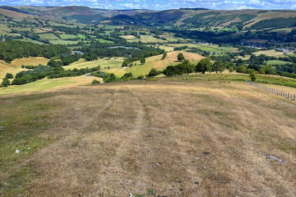
Land at Tycanol Farm, Tafolwern, Llanbrynmair, Powys, Llanbrynmair, Powys SY19 Wales
Added on 26/08/2026Farmland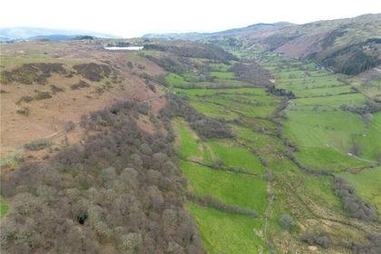
- Price
- £550,000
- Size
- 255 acres
Land At Cwm Main and Cefn Caer Euni, Llandderfel, Gwynedd, LL23, Llandderfel, Gwynedd LL21 Wales
Added on 02/05/2026Farmland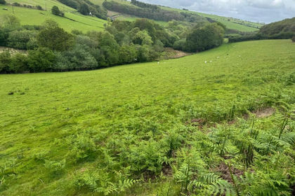
- Price
- Guide Price£770,000
- Size
- 129 acres
Bontgoch, Talybont, Aberystwyth, Trefeurig, Ceredigion SY23 Wales
Added on 29/07/2026Agricultural Land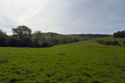
- Price
- Guide Price£675,000
- Size
- 135.39 acres
Added on 02/06/2026Farmland