Fulford Road, Dunsford
- Land size
- 0.39 acres
Key Features
- AUCTION DATE 9th September
- c. 0.39 acre plot
- Planning Permission Granted
- South facing plot
- Panoramic views of the Teign Valley
- 6 miles from Exeter City Centre
- Unique opportunity to create a dream home
Description
Description
A rare opportunity to own a remarkable building plot situated in Dartmoor National Park in the picturesque Teign Valley. This extraordinary site, a former disused reservoir, boasts a truly unique offering for those seeking to create their own bespoke dream home.
Perched in an elevated position above the village of Dunsford, this plot provides an unrivalled, South-facing, panorama of the breathtaking Devon countryside. The old reservoir building on the plot is extremely well built with internal dimensions of roughly 40ft x 40ft x 11ft with four brick pillars in the centre of the building. The plot is c.0.4 acres allowing for ample space around the proposed dwelling to create beautifully landscaped gardens that this idyllic location deserves.
Benefitting from full planning permission for the construction of a striking contemporary four-bedroom detached dwelling, this superb site enjoys outstanding panoramic views across the surrounding Devon countryside and offers purchasers the opportunity to create a bespoke family home in one of the county’s most desirable rural locations.
The approved design provides generous and thoughtfully arranged accommodation, incorporating expansive glazing to maximise the spectacular outlook, together with modern open-plan living spaces, four bedrooms, landscaped gardens and ample parking
Please note the postcode is not for the exact location but a nearby one.
Situation
Situated on the outskirts of the popular Teign Valley village, Dunsford is a particularly desirable place to live, largely due to its strong community
which supports its own primary school, pub, post office/village store, and tea rooms.
The property is well placed for access to the University and Cathedral City of Exeter (6 miles), which has an extensive range of facilities, including an excellent range of shops (including a John Lewis and Waitrose), cafes, and restaurants.
Exeter has an excellent selection of schools, both state and private.
Exeter also has direct rail links on both the Waterloo and Paddington Lines to London, with the shortest journey time from Exeter to London being under 2 hours.
The property is located just inside Dartmoor National Park which is renowned for its beauty and provides wonderful opportunities for countryside enthusiasts including walking, cycling, rock climbing and fishing.
Directions
From Exeter head out on the B3212 up Dunsford Hill. Carry on through Longdown and stay on the B3212 towards Mortenhampstead and Dunsford. Head up six miles hill and as you start to descend back down take the first right signposted to Dunsford and head up Reedy Hill. Just before you get to the village turn right onto Fulford Hill. After 0.4 miles the entrance to the site will be on your left.
PLANNING
The development site benefits from Full Planning Permission (Technical Details Consent ref: 0051/24), subject to conditions, for the conversion of the existing redundant water reservoir to a low energy detached 4 bedroom dwelling. Details Consent (ref: 0051/24) was granted the 9 September 2025 following a successful appeal (ref: W/25/3361953) which was made under section of he Town and Country Planning Act 1990. The initial Permission in Principle (ref: 0186/22) was granted on the 25 May 2023 following a successful appeal (ref: W/22/3302228). For further information and for access to the suite of supporting documentation, please contact the Auctioneers. Community Infrastructure Levy (Cil) - It is understood that Community Infrastructure Levy (CIL) is currently not applicable.
SERVICES
Purchasers must satisfy themselves as to the ability to make adequate connections for mains services that may be required
VIEWINGS
Please call to book an appointment
IMPORTANT INFORMATION
All lots are sold subject to the Common Auction Conditions and Special Conditions of Sale (unless varied by the Sellers Solicitors), together with the Addendum (if applicable), which will be available on Auction Day.
AUCTION LEGAL PACK & FINANCE
Copies of the legal pack and special conditions of sale are available online to be downloaded, via the tab on the online auction property listing page. It is the purchaser’s responsibility to make all necessary legal, planning, surveys and finance enquiries prior to the auction.
PRICE INFORMATION
Guides are provided as an indication of each Seller’s minimum expectation. They are not necessarily figures at which a property will sell for and may change at any time prior to Auction. Unless stated otherwise, each Lot will be offered subject to a reserve price (a figure below which the Auctioneer cannot sell the Lot during the Auction). This reserve figure cannot be higher than 10% above a single figure guide. Please check our website regularly at or contact us on for up to date information. Following the fall of the hammer contracts are exchanged and there is no going back!
Map Location
Property details
- Tenure
- Freehold
- Council Tax Band
- TBC
- Date Posted
- 2026-08-13
Utilities & Restrictions
Utilities
- Electricity
- Ask Agent
- Water
- Ask Agent
- Heating
- Ask Agent
- Broadband
- Ask Agent
- Sewerage
- Ask Agent
Rights & Restrictions
- Public Rights of Way
- Ask Agent
- Private Rights of Way
- Ask Agent
- Listed Property
- Ask Agent
- Restrictions
- Ask Agent
Listed status, conservation areas and planning constraints for this location are in the full report.
Property Features
- Accessibility
- Ask Agent
- Parking
- Parking Available
- Garden
- Garden
Beyond the particulars: planning activity, flood history, heritage and ground risks, checked for this exact spot.
Connectivity
Broadband
Fastest speed available at this postcode
22 Mbps
Standard (10-30 Mbps)
Suitable for
- Web & social
- Music streaming
- Standard video calls
Fixed wireless access may also be an option here.
Mobile signal
Predicted 4G and 5G signal; indoor signal depends on building materials.
Ofcom Connected Nations postcode-level predictions. Speeds and signal are modelled, not measured, and vary between addresses and providers.
Signal is the easy part. Planning activity, flood history and protected designations here are in the full report.
Nearest Schools
Primary
- Dunsford Community Academy344 metresNo Ofsted rating
- Ages
- 2 to 11
- Pupils
- 97
- Type
- Academy converter
- Tedburn St Mary School2.8 milesOfsted: Good
- Ages
- 4 to 11
- Pupils
- 86
- Type
- Academy converter
- Christow Primary School3 milesNo Ofsted rating
- Ages
- 2 to 11
- Pupils
- 100
- Type
- Academy converter
- Doddiscombsleigh Primary School3.1 milesNo Ofsted rating
- Ages
- 4 to 11
- Pupils
- 38
- Type
- Foundation school
- Cheriton Bishop Community Primary School3.5 milesOfsted report card · Feb 2026
- Ages
- 2 to 11
- Pupils
- 115
- Type
- Academy converter
Secondary
- West Exe School6.3 milesOfsted report card · Jun 2026
- Ages
- 11 to 16
- Pupils
- 1,237
- Type
- Academy sponsor led
- Queen Elizabeth's6.9 milesOfsted report card · May 2026
- Ages
- 11 to 18
- Pupils
- 1,096
- Type
- Academy converter
- Matford Brook Academy6.9 milesNo Ofsted rating
- Ages
- 2 to 16
- Pupils
- 276
- Type
- Free schools
- Thomas Hall School6.9 milesOfsted: Requires improvement
- Ages
- 4 to 16
- Pupils
- 438
- Type
- Free schools
- Isca Academy7.6 milesNo Ofsted rating
- Ages
- 11 to 16
- Pupils
- 860
- Type
- Academy sponsor led
Distances are straight-line from the advertised location. Source: the national school registers (DfE, Welsh Government, Scottish Government) and Ofsted.
Schools are just the start: sold prices nearby, planning activity and any flood history are in the full report.
Amenities
Supermarket
GP surgery
Pharmacy
Hospital
Green space
Straight-line distances from the advertised location. Sources: NHS records, Geolytix supermarket locations, OS Open Greenspace and the national trails registers.
The area stacks up? Now check the location itself: planning nearby, protected designations and past flooding.
Getting Around
Nearest station
Nearest bus stop
Typical drive times
Straight-line distances from the advertised location; drive times are typical free-flow times over OpenStreetMap road data, so allow more at peak. Public transport locations from DfT NaPTAN.
Easy to reach matters. So do planning activity, flood history and ground risks: all in the full report.
Flood Risk
Environment Agency open data, checked around the advertised map pin for the listed acreage. Long-term risk counts flood defences; the planning map's flood zones do not. Provided by LandSale, not the listing agent, and not part of the agent's particulars. Risk varies across a holding, so verify before committing.
Rivers and the sea
Planning map: Flood Zone 1.
Surface water
These bandings are the summary. Where this location sits on the flood maps, plus planning activity, heritage and ground risks, is in the full report.
Important notice: Information, maps and tags on this page are drawn from the advertising agent's marketing materials or generated automatically. LandSale has not verified them. Relying on these details is at your own risk, always carry out independent checks before committing to a purchase.
LandSale full disclaimer
Marketing information only - not formal particulars. The details on this website are provided for general guidance and do not constitute an offer or contract. Neither LandSale nor the advertising estate/land agent accepts responsibility for any inaccuracy.
1. Source of information
- Listing content: Core description, asking price, tenure, measurements, photographs and planning history originate from the marketing materials of the advertising estate or land agent. LandSale does not author this content and cannot guarantee its accuracy.
- Automated tags & categorisation: Property type, land-use class, acreage bands and similar labels may be applied by machine-learning models. They are intended as a helpful guide only and may not reflect the property's legal status or permitted use.
- Third-party & enriched data layers: Maps, boundary outlines, planning designations, soil reports, broadband coverage and other environmental or location-based insights are licensed from external suppliers. Such data are supplied “as is", may be incomplete or out of date and are subject to change without notice.
2. Verification required
Prospective purchasers must verify critical matters, including but not limited to planning permission, title boundaries, public rights of way, environmental constraints, acreage, services, access and VAT status, through their own inspections, specialist surveys, legal advisers and the selling agent before relying on the information or entering into any contract.
3. No warranty or liability
LandSale gives no warranty, express or implied, as to the accuracy, completeness or fitness for any particular purpose of the information displayed. LandSale shall not be liable for any loss, damage, cost or expense arising directly or indirectly from any use of or reliance on such information, save where liability may not be excluded by law.
4. Updates & feedback
If you believe any detail on this listing is inaccurate, please let us know. We will investigate and, where appropriate, update the listing or notify the agent.
© LandSale | Version 1.3 - August 2026
Listing agent
Wilkinson Grant & Co Land & Investment, Topsham
72 Fore Street, Topsham, EX3 0HQ
Contact Wilkinson Grant & Co Land & Investment, Topsham
72 Fore Street, Topsham, EX3 0HQ
View agent profileSimilar properties for sale
- Price
- Guide Price£350,000
Development Site, Toronto Road, Exeter, Exeter, Devon EX4 England
Added on 29/01/2026Development Land
- Price
- Guide Price£265,000
- Size
- 33.17 acres
Station Farm - Lot 3, 33.17 Acres - Bow, Crediton, EX17, Crediton, Devon EX17 England
Added on 05/06/2026Agricultural Land
- Price
- Guide Price£295,000
- Size
- 33.03 acres
Added on 03/07/2026Farm
- Price
- Guide Price£275,000
Added on 23/09/2026Development Land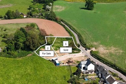
- Price
- Guide Price£375,000
- Size
- 0.18 acres
Building Plot For Detached Dwelling - East Budligh, Devon, EX9, East Budleigh, Devon EX9 England
Added on 04/08/2026Building Plot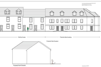
- Price
- Guide Price£300,000
Westexe South, Tiverton, Devon, Tiverton, Devon EX16 England
Added on 01/04/2026Development Land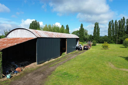
- Price
- Guide Price£300,000
Barns At Hayne Barton Farm House, Cullompton, EX15, Cullompton, Devon EX15 England
Added on 29/01/2026Conversion Land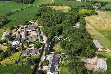
- Price
- Guide Price£275,000
- Size
- 0.5 acres
Added on 25/07/2026Building Plot
- Price
- Guide Price£300,000
- Size
- 0.34 acres
Added on 23/07/2026Conversion Land
- Price
- Guide Price£275,000
- Size
- 0.33 acres
Added on 23/07/2026Conversion Land