Pooles Lane, Stroud, GL5
- Land size
- 2.5 acres
- Bedrooms
- 11
- Bathrooms
- 10
Description
Dating from 1584, Stanley Park is one of the region’s most remarkable historic houses.
Extensively rebuilt in 1850 and enlarged in 1870 for Sir Samuel Stephens Marling, later the 1st Baronet of Stanley Park and Sedbury Park, the estate remained closely associated with the prominent Marling family for generations.
Its distinguished history includes a royal visit in 1941, when Queen Mary toured the house and gardens before taking afternoon tea with Lady Beatrice Marling.
More recently it has undergone a comprehensive eight year restoration, preserving its architectural heritage while introducing exceptional contemporary finishes throughout.
The gothic-arched porch opens into a breathtaking reception hall, where an original stone fireplace, intricately carved timberwork, ornate arches, decorative plasterwork, hardwood floors and mullioned windows immediately reveal the grandeur of the house.
Flanking the hall are the handsome library and an elegant sitting room, while the richly panelled billiard room provides another superb entertaining space.
Beyond, a beautiful stained-glass skylight illuminates the approach to the ballroom, undoubtedly one of the house’s defining features. With its remarkable proportions, intricate detailing and spectacular views across the River Severn towards the Black Mountains, this is an unforgettable setting for entertaining on a grand scale.
The west-facing drawing room is equally impressive, opening directly onto the expansive terrace and leading to the Gentleman’s spiral staircase which retains its original Victorian tiles.
Three staircases descend to the vast lower ground floor, the largest level of the house which has been transformed into an outstanding contemporary entertaining and leisure space. Underfloor heating runs beneath elegant flagstone flooring throughout.
At its heart is a magnificent entertaining kitchen with premium appliances and French doors opening onto the gardens. This level also includes an inviting sitting room with a log burner, a sophisticated dining area, a state-of-the-art cinema and the extraordinary original wine cellar, capable of accommodating approximately 4,000 bottles.
The leisure facilities include a fitness studio, sauna and shower room. A professional chef’s kitchen, together with a fully equipped utility and laundry room, allows the house to accommodate entertaining on an impressive scale. Further stairs descend to the extensive original cellars, which open directly onto the lower gardens through a wrought-iron gate.
The first floor is arranged around a sumptuous principal suite, comprising a generously proportioned bedroom, luxurious central bathroom, separate WC and an extensively fitted dressing room with a central island and atmospheric starlit ceiling. Four further substantial bedrooms, three of them en suite, enjoy far-reaching views across the surrounding countryside.
The top floor provides six additional bedrooms, four en suite, and a family bathroom, offering superb accommodation for guests, family or live-in staff.
Adding to Stanley Park’s more recent cultural history, the estate was also home to Oasis frontman Liam Gallagher, who rented the property for approximately a year in the period leading up to the band’s reunion tour.
OUTSIDE
Set within approximately 2.5 acres, the enchanting gardens create a wonderfully private setting for the house. Mature planting, sweeping lawns and a series of terraces provide inviting spaces for outdoor dining, entertaining and relaxation, while making the most of the property’s elevated position and exceptional views.
Stanley Park is an exceptional country house in every sense: historically significant, architecturally spectacular and restored with extraordinary attention to detail. Few houses combine such grandeur, character and versatility while remaining so perfectly suited to contemporary family life.
LOCATION
Stanley Park occupies an idyllic position in Selsley, surrounded by some of Gloucestershire’s most beautiful countryside yet within easy reach of excellent amenities and transport connections.
Nearby Selsley Common offers glorious panoramic views and miles of scenic walking. Stroud is a vibrant market town renowned for its independent shops, artisan cafés and restaurants, together with everyday amenities including Waitrose and its celebrated farmers’ market. The larger centres of Tetbury, Cirencester, Cheltenham and Bath provide a broader selection of shopping, dining and cultural attractions.
Communications are excellent. Junction 13 of the M5 is just over five miles away, providing convenient access to Bristol, Cribbs and Birmingham. Direct rail services from Stroud reach London Paddington in approximately one hour and 25 minutes, while Bristol Airport is around 41 miles away.
The region offers an excellent variety of sporting and recreational opportunities including sailing at the Cotswold Water Park, racing at Cheltenham, Bath and Chepstow, polo at Cirencester and golf at Minchinhampton and Cotswold Edge.
There is also a superb choice of schooling nearby, including Marling School, Stroud High School, Wycliffe College and the renowned Beaudesert Park School, while Cheltenham Ladies’ College and Cheltenham College are within reach.
PROPERTY INFORMATION
Square Footage: Approximately 17,385 sq ft
Acreage: Approximately 2.5 acres
Tenure: Freehold
Services: Mains electricity, gas, water and drainage
EPC Rating: D
Council Tax: Band H
Map Location
Property details
- Tenure
- Freehold
- Council Tax Band
- Ask Agent
- Date Posted
- 2026-08-08
Market Value Analysis
Compared with 1,628 Homes with Land listings in South West England (1+ acres).
Utilities & Restrictions
Utilities
- Electricity
- Ask Agent
- Water
- Ask Agent
- Heating
- Ask Agent
- Broadband
- Ask Agent
- Sewerage
- Ask Agent
Rights & Restrictions
- Public Rights of Way
- Ask Agent
- Private Rights of Way
- Ask Agent
- Listed Property
- Ask Agent
- Restrictions
- Ask Agent
Listed status, conservation areas and planning constraints for this location are in the full report.
Property Features
- Accessibility
- Ask Agent
- Parking
- Ask Agent
- Garden
- Garden
Beyond the particulars: planning activity, flood history, heritage and ground risks, checked for this exact spot.
Connectivity
Broadband
Fastest speed available at this postcode
53 Mbps
Superfast
Suitable for
- HD streaming
- Video calls
- Web & social
Mobile signal
Predicted 4G and 5G signal; indoor signal depends on building materials.
Ofcom Connected Nations postcode-level predictions. Speeds and signal are modelled, not measured, and vary between addresses and providers.
Signal is the easy part. Planning activity, flood history and protected designations here are in the full report.
Nearest Schools
Primary
- St Matthew's Church of England Primary School0.7 milesOfsted: Good
- Ages
- 4 to 11
- Pupils
- 195
- Type
- Academy sponsor led
- Faith
- Church of England
- Gastrells Community Primary School0.9 milesOfsted: Requires improvement *
- Ages
- 4 to 11
- Pupils
- 172
- Type
- Community school
- Foxmoor Primary School0.9 milesOfsted: Good
- Ages
- 4 to 11
- Pupils
- 257
- Type
- Community school
- Woodchester Endowed Church of England Aided Primary School1 mileNo Ofsted rating
- Ages
- 4 to 11
- Pupils
- 135
- Type
- Voluntary aided school
- Faith
- Church of England
- Rodborough Community Primary School1.1 milesNo Ofsted rating
- Ages
- 4 to 11
- Pupils
- 185
- Type
- Community school
Secondary
- Marling School1 mileOfsted: Good *
- Ages
- 11 to 18
- Pupils
- 1,082
- Type
- Academy converter
- Gender
- Boys
- Stroud High School1.1 milesOfsted: Outstanding
- Ages
- 11 to 18
- Pupils
- 1,144
- Type
- Academy converter
- Gender
- Girls
- Archway School1.3 milesOfsted report card · Apr 2026
- Ages
- 11 to 18
- Pupils
- 1,053
- Type
- Community school
- Maidenhill School1.9 milesNo Ofsted rating
- Ages
- 11 to 16
- Pupils
- 714
- Type
- Foundation school
- Thomas Keble School3.8 milesNo Ofsted rating
- Ages
- 11 to 16
- Pupils
- 718
- Type
- Academy converter
* Latest graded judgement covers quality of education only; no overall grade was issued under the 2024-25 inspection framework.
Distances are straight-line from the advertised location. Source: the national school registers (DfE, Welsh Government, Scottish Government) and Ofsted.
Schools are just the start: sold prices nearby, planning activity and any flood history are in the full report.
Amenities
Supermarket
GP surgery
Pharmacy
Hospital
Green space
Walking trail
Straight-line distances from the advertised location. Sources: NHS records, Geolytix supermarket locations, OS Open Greenspace and the national trails registers.
The area stacks up? Now check the location itself: planning nearby, protected designations and past flooding.
Getting Around
Nearest station
Nearest bus stop
Typical drive times
Straight-line distances from the advertised location; drive times are typical free-flow times over OpenStreetMap road data, so allow more at peak. Public transport locations from DfT NaPTAN.
Easy to reach matters. So do planning activity, flood history and ground risks: all in the full report.
Flood Risk
Environment Agency open data, checked around the advertised map pin for the listed acreage. Long-term risk counts flood defences; the planning map's flood zones do not. Provided by LandSale, not the listing agent, and not part of the agent's particulars. Risk varies across a holding, so verify before committing.
Rivers and the sea
Planning map: Flood Zone 1.
Surface water
These bandings are the summary. Where this location sits on the flood maps, plus planning activity, heritage and ground risks, is in the full report.
Important notice: Information, maps and tags on this page are drawn from the advertising agent's marketing materials or generated automatically. LandSale has not verified them. Relying on these details is at your own risk, always carry out independent checks before committing to a purchase.
LandSale full disclaimer
Marketing information only - not formal particulars. The details on this website are provided for general guidance and do not constitute an offer or contract. Neither LandSale nor the advertising estate/land agent accepts responsibility for any inaccuracy.
1. Source of information
- Listing content: Core description, asking price, tenure, measurements, photographs and planning history originate from the marketing materials of the advertising estate or land agent. LandSale does not author this content and cannot guarantee its accuracy.
- Automated tags & categorisation: Property type, land-use class, acreage bands and similar labels may be applied by machine-learning models. They are intended as a helpful guide only and may not reflect the property's legal status or permitted use.
- Third-party & enriched data layers: Maps, boundary outlines, planning designations, soil reports, broadband coverage and other environmental or location-based insights are licensed from external suppliers. Such data are supplied “as is", may be incomplete or out of date and are subject to change without notice.
2. Verification required
Prospective purchasers must verify critical matters, including but not limited to planning permission, title boundaries, public rights of way, environmental constraints, acreage, services, access and VAT status, through their own inspections, specialist surveys, legal advisers and the selling agent before relying on the information or entering into any contract.
3. No warranty or liability
LandSale gives no warranty, express or implied, as to the accuracy, completeness or fitness for any particular purpose of the information displayed. LandSale shall not be liable for any loss, damage, cost or expense arising directly or indirectly from any use of or reliance on such information, save where liability may not be excluded by law.
4. Updates & feedback
If you believe any detail on this listing is inaccurate, please let us know. We will investigate and, where appropriate, update the listing or notify the agent.
© LandSale | Version 1.3 - August 2026
Listing agent
DDRE.global, London
4 Devonshire Street London W1W 5DT
Similar properties for sale
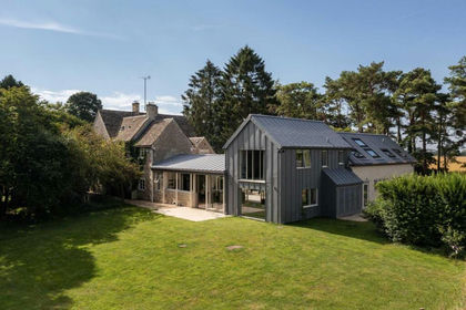
- Price
- Guide Price£3,575,000
- Size
- 17.73 acres
Nr Bibury, Gloucestershire, Bibury, Gloucestershire GL7 England
Added on 09/09/2026Country Home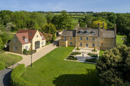
- Price
- Guide Price£4,000,000
- Size
- 5 acres
Wood Stanway, Cheltenham, Gloucestershire, GL54, Stanway, Gloucestershire GL54 England
Added on 11/09/2026Country Home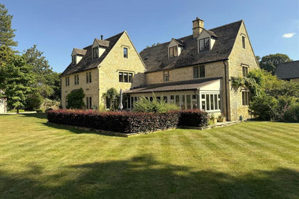
- Price
- Guide Price£4,000,000
- Size
- 9.17 acres
Lower Slaughter, Gloucestershire, Lower Slaughter, Gloucestershire GL54 England
Added on 25/05/2026Country Home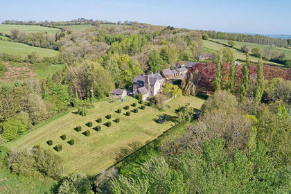
- Price
- Guide Price£4,165,000
- Size
- 294.18 acres
The Garn Fawr, Llanhennock, Monmouthshire, NP18, Llangybi, Monmouthshire NP18 Wales
Added on 11/05/2026Farm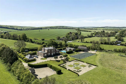
- Price
- Guide Price£3,625,000
- Size
- 12 acres
Clatford, Marlborough, Wiltshire, SN8, Preshute, Wiltshire SN8 England
Added on 02/07/2026Country Home
- Price
- £4,250,000
- Size
- 138.46 acres
Alfrick, Worcestershire, Suckley, Worcestershire WR6 England
Added on 30/09/2026Country Estate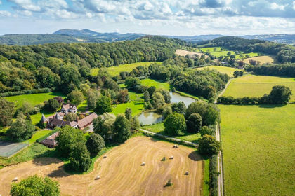
- Price
- Guide Price£4,250,000
- Size
- 138.46 acres
Alfrick, Worcester, Worcestershire, Suckley, Worcestershire WR6 England
Added on 29/01/2026Country Estate