Alfrick, Worcestershire
- Land size
- 138.46 acres
- Bedrooms
- 6
- Bathrooms
- 6
Key Features
- Grade II listed early 17th-century six-bedroom country house
- 12 bedrooms in total across the principal house and wider estate accommodation
- Exceptional private valley setting within the Malvern Hills National Landscape
- Approximately 138.46 acres in all
- Available as a whole or in lots, offering flexibility over the amount of land
- Separate two-bedroom Little Hall guest accommodation
- Additional three-bedroom guest accommodation within The Old Stables
- Lake, cascading spring-fed ponds, wildflower meadows and tennis court
- Landscaped gardens, rolling pasture and ancient woodland
- Separate estate entrance with comprehensive equestrian and agricultural buildings
Description
Overview
Baston Hall sits at the heart of its own private valley in Worcestershire, surrounded by a landscape of rolling pasture, mature and ancient woodland, water and wildflower meadows. It is an unusually complete country estate: beautiful and remarkably private, yet with a house and collection of buildings that allow it to be lived in and enjoyed in a number of different ways.
At its centre is a Grade II listed early 17th-century hall house with six bedrooms, six bathrooms and five reception rooms. Importantly, the additional accommodation is entirely separate from the principal house, with Little Hall providing a two-bedroom guest house and The Old Stables offering a further three-bedroom guest suite.
Beyond the houses are landscaped gardens, a lake and cascading spring-fed ponds, tennis court and a wider estate extending in all to approximately 138.46 acres.
For all its scale, Baston Hall is perhaps best understood not simply as a farm or rural holding, but as a country house within its own landscape. The land rises around the valley, with pasture giving way to woodland along the ridge and water running through the gardens close to the house. It creates a particularly attractive setting for the Hall and a real sense of separation from the outside world.
The property is offered for sale as a whole or in lots, providing the opportunity to acquire the principal house and its immediate setting with a smaller acreage, or the wider estate in its entirety.
Baston Hall – The Main House
Baston Hall is a Grade II listed early 17th-century hall house, arranged as a substantial but manageable family home with five reception rooms, six bedrooms and six bathrooms. The principal house extends to approximately 5,091 sq ft, in addition to a cellar of approximately 248 sq ft.
Internally, the house retains the character one would hope to find in a building of this age. Heavy exposed timbers and beams, leaded windows and substantial fireplaces give the principal rooms a strong sense of history, while later alterations have created a house that works for contemporary family life.
The accommodation provides a series of generous reception spaces rather than relying upon a single formal room. There is a particularly appealing contrast between the older, more intimate rooms and the lighter spaces overlooking the gardens, while the kitchen is arranged as an everyday family room with space for informal dining.
The current owners have undertaken a comprehensive programme of improvements to Baston Hall, including changes to the internal layout.
Little Hall – Separate Guest Accommodation
Completely separate from the bedroom accommodation within the main house, Little Hall is a substantial converted barn extending to approximately 2,691 sq ft.
It provides two bedrooms, two bathrooms and four reception rooms, together with the Oast House, creating particularly generous independent accommodation for family or guests.
The scale and separation of Little Hall give it considerable flexibility while allowing Baston Hall itself to remain very clearly a six-bedroom country house.
The Old Stables – Guest Accommodation
The Old Stables provides a further independent guest suite with three bedrooms, each with its own en suite bathroom, together with a kitchenette.
Again, this accommodation sits separately from the six bedrooms within Baston Hall and provides useful additional space for guests or extended family without increasing the scale of the principal house.
An adjoining range was developed in 2021 to create the Cloud Room, an adaptable space of approximately 979 sq ft which can serve as a gym, yoga studio, entertaining or function space.
There is also a separate estate office, extending to approximately 872 sq ft, together with garaging, workshop, plant and utility space.
Collectively, these buildings are one of Baston Hall's great strengths. They provide considerable flexibility when required, but without compromising the feel or manageability of the main house.
Gardens and Grounds
The approach to Baston Hall is particularly memorable, following a sweeping drive lined by ancient cherry trees before arriving at the house and its landscaped gardens. Mature trees, lawns, flower and rose beds surround the Hall, with the more formal gardens gradually giving way to the wider landscape.
Water is an important part of the setting. A large lake and series of cascading spring-fed ponds sit within the grounds, while beyond are wildflower meadows and woodland. A tennis court is positioned discreetly within the garden curtilage.
It is this relationship between house and landscape that gives Baston Hall much of its appeal. Rather than the gardens ending abruptly at a boundary, they sit naturally within the surrounding valley, with the wider estate forming the backdrop.
The Estate
The wider estate comprises approximately 121.43 acres, bringing the whole to approximately 138.46 acres. The land is predominantly pasture, divided into fenced and watered paddocks, together with a broad belt of semi-natural ancient woodland running along the central ridge.
The estate is currently managed as a regenerative mixed farming enterprise with native-breed cattle and sheep. Considerable investment has been made in the land, including additional water infrastructure, fencing, hedgerows and wildlife corridors.
Importantly for a purchaser wishing simply to enjoy the land, the practical workings of the estate are well provided for. A separate southern entrance serves the farmyard and two substantial agricultural buildings, keeping much of the day-to-day infrastructure away from the principal house and gardens. The buildings incorporate stabling, tack rooms, workshop and machinery storage, livestock accommodation and ancillary facilities.
The estate formerly supported a racehorse training operation, with the former gallop still visible along its western boundary, and has previously hosted a local shoot.
Keeper's Cottage, positioned close to the separate southern entrance, is presently arranged as a one-bedroom dwelling and has planning permission (Ref. M/22/00940/FUL) for its replacement with a new three-bedroom house of approximately 1,571 sq ft.
Lotting
Baston Hall is offered for sale as a whole or in lots, allowing a purchaser to consider the property with varying amounts of land depending upon their requirements.
This flexibility is particularly relevant for those drawn to the house, gardens and private valley setting but without a requirement for the entire agricultural holding. Equally, the estate as a whole provides approximately 138.46 acres together with the wider land, woodland and estate infrastructure.
Further details of the individual lots and available combinations are available from the selling agents.
Setting
Baston Hall lies within the northern reaches of the Malvern Hills National Landscape, close to Alfrick and approximately 7 miles from Great Malvern and 9 miles from Worcester. Cheltenham is approximately 32 miles away, Birmingham 40 miles and London 130 miles.
Alfrick has a community shop, post office and café, church and village hall, while Great Malvern provides a broader range of shops, restaurants and cultural amenities. Worcester provides further shopping and recreational facilities.
There is a particularly strong selection of schools in the wider area, including Malvern College, The Elms, The Downs, King's Worcester and RGS Worcester, with Cheltenham College, Cheltenham Ladies' College and Dean Close further afield.
Rail services to London and Birmingham are available from Worcestershire Parkway and Malvern Link, while the M5 and M50 provide access to the wider motorway network.
Map Location
Property details
- Tenure
- Freehold
- Council Tax Band
- H
- Date Posted
- 2026-09-30
Market Value Analysis
Compared with 5 Homes with Land listings in West Midlands (100+ acres).
Utilities & Restrictions
Utilities
- Electricity
- Mains
- Water
- Mains
- Heating
- Oil Heating
- Broadband
- Ask Agent
- Sewerage
- Septic Tank / Private
Rights & Restrictions
- Public Rights of Way
- Ask Agent
- Private Rights of Way
- Ask Agent
- Listed Property
- Yes
- Restrictions
- Ask Agent
Listed status, conservation areas and planning constraints for this location are in the full report.
Property Features
- Accessibility
- No Wheelchair Access
- Parking
- Parking Available
- Garden
- Private Garden
Beyond the particulars: planning activity, flood history, heritage and ground risks, checked for this exact spot.
Connectivity
Broadband
Fastest speed available at this postcode
1.8 Gbps
Gigabit full fibre · available to 91% of premises
Suitable for
- 4K streaming on every screen
- Full-time home working
- Online gaming & big downloads
Mobile signal
Predicted 4G and 5G signal; indoor signal depends on building materials.
Ofcom Connected Nations postcode-level predictions. Speeds and signal are modelled, not measured, and vary between addresses and providers.
Signal is the easy part. Planning activity, flood history and protected designations here are in the full report.
Nearest Schools
Primary
- Suckley Primary School1.3 milesOfsted: Outstanding *
- Ages
- 4 to 11
- Pupils
- 95
- Type
- Academy converter
- Broadwas CofE Aided Primary School2 milesOfsted report card · Feb 2026
- Ages
- 4 to 11
- Pupils
- 79
- Type
- Voluntary aided school
- Faith
- Church of England
- Leigh and Bransford Primary School3.3 milesOfsted report card · Jan 2026
- Ages
- 4 to 11
- Pupils
- 182
- Type
- Academy converter
- Cradley CofE Primary School3.5 milesOfsted: Requires improvement
- Ages
- 4 to 11
- Pupils
- 73
- Type
- Voluntary aided school
- Faith
- Church of England
- Brockhampton Primary School3.7 milesNo Ofsted rating
- Ages
- 2 to 11
- Pupils
- 191
- Type
- Academy converter
Secondary
- Dyson Perrins CofE Academy3.9 milesOfsted: Good
- Ages
- 11 to 16
- Pupils
- 592
- Type
- Academy converter
- Faith
- Church of England
- The Chantry School4.5 milesOfsted: Good
- Ages
- 11 to 16
- Pupils
- 881
- Type
- Academy converter
- Queen Elizabeth High School5.6 milesNo Ofsted rating
- Ages
- 11 to 16
- Pupils
- 421
- Type
- Academy converter
- The Chase6.1 milesOfsted report card · Jan 2026
- Ages
- 11 to 18
- Pupils
- 1,449
- Type
- Academy converter
- Christopher Whitehead Language College6.6 milesNo Ofsted rating
- Ages
- 11 to 18
- Pupils
- 1,580
- Type
- Academy converter
* Latest graded judgement covers quality of education only; no overall grade was issued under the 2024-25 inspection framework.
Distances are straight-line from the advertised location. Source: the national school registers (DfE, Welsh Government, Scottish Government) and Ofsted.
Schools are just the start: sold prices nearby, planning activity and any flood history are in the full report.
Amenities
Supermarket
GP surgery
Pharmacy
Hospital
Green space
Straight-line distances from the advertised location. Sources: NHS records, Geolytix supermarket locations, OS Open Greenspace and the national trails registers.
The area stacks up? Now check the location itself: planning nearby, protected designations and past flooding.
Getting Around
Nearest station
Nearest bus stop
Typical drive times
Straight-line distances from the advertised location; drive times are typical free-flow times over OpenStreetMap road data, so allow more at peak. Public transport locations from DfT NaPTAN.
Easy to reach matters. So do planning activity, flood history and ground risks: all in the full report.
Flood Risk
Environment Agency open data, checked around the advertised map pin for the listed acreage. Long-term risk counts flood defences; the planning map's flood zones do not. Provided by LandSale, not the listing agent, and not part of the agent's particulars. Risk varies across a holding, so verify before committing.
Rivers and the sea
Planning map: Flood Zone 3, about 410 metres away.
Surface water
Not at the pin: mapped about 300 metres away.
These bandings are the summary. Where this location sits on the flood maps, plus planning activity, heritage and ground risks, is in the full report.
Important notice: Information, maps and tags on this page are drawn from the advertising agent's marketing materials or generated automatically. LandSale has not verified them. Relying on these details is at your own risk, always carry out independent checks before committing to a purchase.
LandSale full disclaimer
Marketing information only - not formal particulars. The details on this website are provided for general guidance and do not constitute an offer or contract. Neither LandSale nor the advertising estate/land agent accepts responsibility for any inaccuracy.
1. Source of information
- Listing content: Core description, asking price, tenure, measurements, photographs and planning history originate from the marketing materials of the advertising estate or land agent. LandSale does not author this content and cannot guarantee its accuracy.
- Automated tags & categorisation: Property type, land-use class, acreage bands and similar labels may be applied by machine-learning models. They are intended as a helpful guide only and may not reflect the property's legal status or permitted use.
- Third-party & enriched data layers: Maps, boundary outlines, planning designations, soil reports, broadband coverage and other environmental or location-based insights are licensed from external suppliers. Such data are supplied “as is", may be incomplete or out of date and are subject to change without notice.
2. Verification required
Prospective purchasers must verify critical matters, including but not limited to planning permission, title boundaries, public rights of way, environmental constraints, acreage, services, access and VAT status, through their own inspections, specialist surveys, legal advisers and the selling agent before relying on the information or entering into any contract.
3. No warranty or liability
LandSale gives no warranty, express or implied, as to the accuracy, completeness or fitness for any particular purpose of the information displayed. LandSale shall not be liable for any loss, damage, cost or expense arising directly or indirectly from any use of or reliance on such information, save where liability may not be excluded by law.
4. Updates & feedback
If you believe any detail on this listing is inaccurate, please let us know. We will investigate and, where appropriate, update the listing or notify the agent.
© LandSale | Version 1.3 - August 2026
Listing agent
Tim Phillips, Country Houses
Nationwide
Similar properties for sale
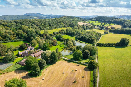
- Price
- Guide Price£4,250,000
- Size
- 138.46 acres
Alfrick, Worcester, Worcestershire, Suckley, Worcestershire WR6 England
Added on 29/01/2026Country Estate
- Price
- Guide Price£3,000,000
- Size
- 144.5 acres
Sinton Green, Hallow, WR2, Grimley, Worcestershire WR2 England
Added on 16/06/2026Farm
- Price
- £3,145,000
- Size
- 241.52 acres
Parsonage Farm, Kyre, Tenbury Wells, Worcestershire, Kyre, Worcestershire WR15 England
Added on 14/05/2026Farm
- Price
- Guide Price£3,500,000
- Size
- 34 acres
Longdon, Worcestershire, GL20, Longdon, Worcestershire GL20 England
Added on 03/09/2026Country Estate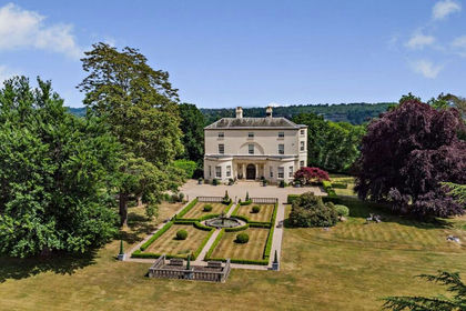
- Price
- Guide Price£3,750,000
- Size
- 30 acres
Redhill, Bewdley, DY12, Bewdley, Worcestershire DY12 England
Added on 29/01/2026Country Estate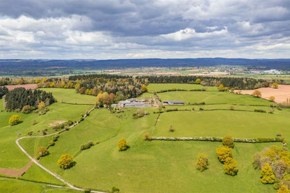
- Price
- Guide Price£3,700,000
- Size
- 286.32 acres
Pervin Farm, Hope under Dinmore, Leominster, Leominster, Herefordshire, County of HR6 England
Added on 29/01/2026Farm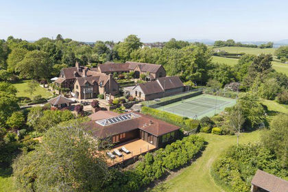
- Price
- Guide Price£2,900,000
- Size
- 17.22 acres
Owletts, Shatterford, Bewdley, Worcestershire, Upper Arley, Worcestershire DY12 England
Added on 12/04/2026Country Estate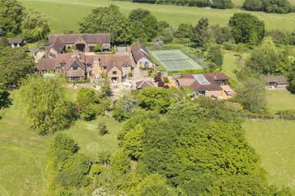
- Price
- Guide Price£2,900,000
- Size
- 17.35 acres
Bewdley, Worcestershire, Upper Arley, Worcestershire DY12 England
Added on 12/04/2026Country Home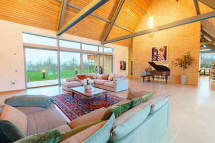
- Price
- Guide Price£5,000,000
- Size
- 4.39 acres
Buckle Street, Honeybourne, WR11, Honeybourne, Worcestershire WR11 England
Added on 04/09/2026House with Land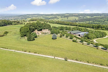
- Price
- Guide Price£5,950,000
- Size
- 230 acres
Snowshill, Broadway, Snowshill, Gloucestershire WR12 England
Added on 03/09/2026Farm