Bwthyn Celyn, Adfa, Newtown
- Land size
- 2.62 acres
- Bedrooms
- 2
- Bathrooms
- 2
Key Features
- COMPLETELY RENOVATED IN 2022
- 2 BEDROOMS
- AMERICAN BARN WITH 6 STABLES
- SOLAR PANELS AND BATTERY
- APPROX 2.62 ACRES
- EPC RATING D
Description
This 2 bedroom detached cottage was completely renovated in 2022 and sits on a plot of approximately 2.62 acres with an American Barn with 6 stables. This is a true lifestyle property with the electricity being provided by solar panels with batteries and petrol generator, LPG central heating and 2 log stoves.
Living Room - Dual aspect with uPVC double glazed French doors and side screens to the front and uPVC double glazed window to the rear, feature stone fireplace with original oak beam, inset log burner and adjacent bread oven. Door to:
Inner Hall - Staircase to the first floor and door to:
Kitchen - Belfast sink with mixer tap and cupboard below. Base cupboards, wooden work surfaces, wall mounted Worcester central heating boiler, ESSE wood fired range with oven and twin hobs, uPVC double glazed window to the front and rear and door to front.
First Floor Landing - With restricted head room and uPVC double glazed window to the front aspect with countryside views.
Bedroom One - With restricted head room, feature stone chimney breast and dual aspect with double glazed Velux style windows to front and rear.
Bedroom 2 - With restricted head room, double glazed Velux style window to rear and exposed flue.
Bathroom - With restricted head room, 'P' shaped bath with twin shower heads over, low level W.C., vanity circular wash hand basin with mixer tap and cupboard under, part tiled walls, wood effect flooring, heated towel rail and double glazed Velux style window to the front.
Outside -
Gardens - Gate to the cottage gardens that are laid to gravel with raised flower and shrub borders. The gardens surround the cottage with a gate to the track and a gate to the parking area.
Further area of sloped garden laid to rough grass with trees.
Off Road Parking - Gravel parking area for 2 cars. Area laid to grass.
Paddock 1 - Being approximately 1.3 acres (0.528 hectares) and having stock fencing and water. Gate to the track and gate to the further paddock.
Paddock 2 - Being approximately 0.37 acres (0.149 hectares) and having a HAY BARN- with plastic sheet roof and floor. Fenced vegetable bed.
AMERICAN BARN- with 6 stables.
Paddock 3 - Further area of sloped paddock laid to rough grass with trees. Approx 0.7 acre.
General Notes - TENURE
We understand the tenure is Freehold. We would recommend this is verified during pre-contract enquiries.
SERVICES
We are advised that mains water is connected. Bio waste treatment plant. LPG gas central heating. 2 log burners. Electricity via solar panels with battery storage and back up petrol generator.
We understand the Broadband Download Speed is: Superfast 42 Mbps. Mobile Service: Good. Flood risk - Very low risk. We would recommend this is verified during pre-contract enquiries.
SURVEYS
Roger Parry and Partners offer residential surveys via their surveying department. Please telephone and speak to one of our surveying team, to find out more.
REFERRAL SERVICES AND FEE DISCLAIMER
Roger Parry and Partners routinely refers vendors and purchasers to carefully selected local service companies, as we believe you may benefit from using their services. You are under no obligation to use the services of any of the recommended companies, though if you accept our recommendation the provider is expected to pay us a referral fee.
MONEY LAUNDERING REGULATIONS: When submitting an offer to purchase a property, you will be required to provide sufficient identification to verify your identity in compliance with the Money Laundering Regulations. Please note that a small fee of £24 (inclusive of VAT) per person will be charged to conduct the necessary money laundering checks. This fee is payable at the time of verification and is non refundable.
Map Location
Property details
- Tenure
- Freehold
- Council Tax Band
- C
- Date Posted
- 2026-08-05
Price history
| Date | Change | Price |
|---|---|---|
| 30 Sep 2026 | Reduced 7.1% (−£30,000) | £395,000 |
| 2 Sep 2026 | Reduced 5.6% (−£25,000) | £425,000 |
| 5 Aug 2026 | Listed | £450,000 |
Market Value Analysis
Compared with 1,041 Homes with Land listings in Wales (1+ acres).
Energy Performance Certificate
Energy Efficiency Rating
Based on UK Energy Performance Certificate standards (EU Directive 2002/91/EC)
Running costs are one side. Planning activity, flood history and ground risks for this location are in the full report.
Utilities & Restrictions
Utilities
- Electricity
- Ask Agent
- Water
- Ask Agent
- Heating
- Ask Agent
- Broadband
- Ask Agent
- Sewerage
- Ask Agent
Rights & Restrictions
- Public Rights of Way
- Ask Agent
- Private Rights of Way
- Ask Agent
- Listed Property
- Ask Agent
- Restrictions
- Ask Agent
Listed status, conservation areas and planning constraints for this location are in the full report.
Property Features
- Accessibility
- Ask Agent
- Parking
- Parking Available
- Garden
- Garden
Beyond the particulars: planning activity, flood history, heritage and ground risks, checked for this exact spot.
Connectivity
Broadband
Fastest speed available at this postcode
74 Mbps
Superfast
Suitable for
- HD streaming
- Video calls
- Web & social
Mobile signal
Predicted 4G and 5G signal; indoor signal depends on building materials.
Ofcom Connected Nations postcode-level predictions. Speeds and signal are modelled, not measured, and vary between addresses and providers.
Signal is the easy part. Planning activity, flood history and protected designations here are in the full report.
Nearest Schools
Primary
- Ysgol Rhiw Bechan2.9 miles
- Pupils
- 139
- Type
- Nursery, Infants & Juniors
- Language
- Dual language school / provision (Welsh and English) (including transitional)
- Ysgol Bro Caereinion5 miles
- Pupils
- 494
- Type
- Middle (ages 4-19)
- Language
- Welsh medium school / provision (including transitional)
- Caersws C.P. School5.2 miles
- Pupils
- 84
- Type
- Nursery, Infants & Juniors
- Language
- English medium school / provision
- Penygloddfa C.P. School6.2 miles
- Pupils
- 270
- Type
- Nursery, Infants & Juniors
- Language
- English medium school / provision
- St Mary`S R.C. (A) School6.3 miles
- Pupils
- 61
- Type
- Nursery, Infants & Juniors
- Language
- English medium school / provision
Secondary
- Ysgol Bro Caereinion5 miles
- Pupils
- 494
- Type
- Middle (ages 4-19)
- Language
- Welsh medium school / provision (including transitional)
- Newtown High School6.8 miles
- Pupils
- 896
- Type
- Secondary (ages 11-19)
- Language
- English medium school / provision
- Welshpool High School12 miles
- Pupils
- 816
- Type
- Secondary (ages 11-19)
- Language
- English medium school / provision
- Llanidloes High School12 miles
- Pupils
- 703
- Type
- Secondary (ages 11-19)
- Language
- Dual language school / provision (Welsh and English) (including transitional)
- Ysgol Llanfyllin13 miles
- Pupils
- 775
- Type
- Middle (ages 4-19)
- Language
- Dual language school / provision (Welsh and English) (including transitional)
Distances are straight-line from the advertised location. Source: the national school registers (DfE, Welsh Government, Scottish Government) and Ofsted.
Schools are just the start: sold prices nearby, planning activity and any flood history are in the full report.
Amenities
Supermarket
GP surgery
Pharmacy
Green space
Straight-line distances from the advertised location. Sources: NHS records, Geolytix supermarket locations, OS Open Greenspace and the national trails registers.
The area stacks up? Now check the location itself: planning nearby, protected designations and past flooding.
Getting Around
Nearest station
Nearest bus stop
Typical drive times
Straight-line distances from the advertised location; drive times are typical free-flow times over OpenStreetMap road data, so allow more at peak. Public transport locations from DfT NaPTAN.
Easy to reach matters. So do planning activity, flood history and ground risks: all in the full report.
Flood Risk
Natural Resources Wales open data, checked around the advertised map pin for the listed acreage. Long-term risk counts flood defences; the planning map's flood zones do not. Provided by LandSale, not the listing agent, and not part of the agent's particulars. Risk varies across a holding, so verify before committing.
Rivers and the sea
Planning map: Flood Zone 1.
Surface water
These bandings are the summary. Where this location sits on the flood maps, plus planning activity, heritage and ground risks, is in the full report.
Important notice: Information, maps and tags on this page are drawn from the advertising agent's marketing materials or generated automatically. LandSale has not verified them. Relying on these details is at your own risk, always carry out independent checks before committing to a purchase.
LandSale full disclaimer
Marketing information only - not formal particulars. The details on this website are provided for general guidance and do not constitute an offer or contract. Neither LandSale nor the advertising estate/land agent accepts responsibility for any inaccuracy.
1. Source of information
- Listing content: Core description, asking price, tenure, measurements, photographs and planning history originate from the marketing materials of the advertising estate or land agent. LandSale does not author this content and cannot guarantee its accuracy.
- Automated tags & categorisation: Property type, land-use class, acreage bands and similar labels may be applied by machine-learning models. They are intended as a helpful guide only and may not reflect the property's legal status or permitted use.
- Third-party & enriched data layers: Maps, boundary outlines, planning designations, soil reports, broadband coverage and other environmental or location-based insights are licensed from external suppliers. Such data are supplied “as is", may be incomplete or out of date and are subject to change without notice.
2. Verification required
Prospective purchasers must verify critical matters, including but not limited to planning permission, title boundaries, public rights of way, environmental constraints, acreage, services, access and VAT status, through their own inspections, specialist surveys, legal advisers and the selling agent before relying on the information or entering into any contract.
3. No warranty or liability
LandSale gives no warranty, express or implied, as to the accuracy, completeness or fitness for any particular purpose of the information displayed. LandSale shall not be liable for any loss, damage, cost or expense arising directly or indirectly from any use of or reliance on such information, save where liability may not be excluded by law.
4. Updates & feedback
If you believe any detail on this listing is inaccurate, please let us know. We will investigate and, where appropriate, update the listing or notify the agent.
© LandSale | Version 1.3 - August 2026
Listing agent
Roger Parry & Partners, Welshpool
1 Berriew Street, Welshpool, SY21 7SQ
Similar properties for sale
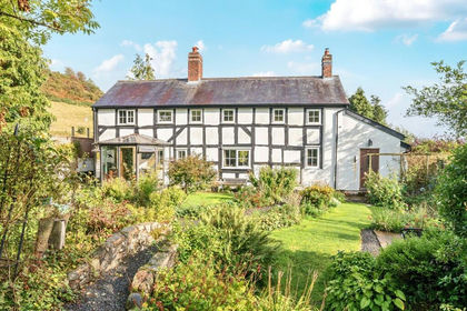
- Price
- Offers in Region of£440,000
- Size
- 2.5 acres
Added on 12/10/2026Cottage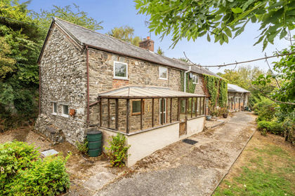
- Price
- Guide Price£475,000
- Size
- 3.3 acres
Aberhafesp, Newtown, Powys, SY16, Aberhafesp, Powys SY16 Wales
Added on 25/08/2026Cottage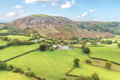
- Price
- Guide Price£450,000
- Size
- 36.14 acres
Gelli (Lot 3), Llanfair Caereinion, Welshpool, Powys, SY21, Llanfair Caereinion, Powys SY21 Wales
Added on 29/07/2026Farm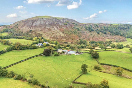
- Price
- Guide Price£300,000
- Size
- 24.45 acres
Gelli (Lot 2), Llanfair Caereinion, Welshpool, Powys, SY21, Llanfair Caereinion, Powys SY21 Wales
Added on 29/07/2026Farmland
- Price
- £325,000
- Size
- 1 acres
Canal Road, Newtown, Powys, Newtown and Llanllwchaiarn, Powys SY16 Wales
Added on 29/01/2026Redevelopment Land
- Price
- Offers in Region of£450,000
- Size
- 3.5 acres
Added on 07/07/2026House with Land
- Price
- Offers in Region of£380,000
- Size
- 1.3 acres
Added on 02/09/2026Cottage
- Price
- Guide Price£480,000
- Size
- 4.36 acres
Added on 08/09/2026House with Land
- Price
- Guide Price£450,000
- Size
- 2.5 acres
Offa Close, Forden, Welshpool, Powys, Forden with Leighton and Trelystan, Powys SY21 Wales
Added on 14/09/2026House with Land
- Price
- Guide Price£425,000
- Size
- 1 acres
Trefeglwys Road, Llanidloes, Powys, SY18, Llanidloes, Powys SY18 Wales
Added on 10/08/2026House with Land