Land at Craigview Wood, Glenlochar, Dumfries and Galloway, DG72PB
- Land size
- 2.75 acres
Key Features
- Fantastic site available approx. 2.75 acres *** Low cost site with great opportunities *** Level site with surrounding woodland and views over the countryside. Less than 5 miles from Castle Douglas.
- The current owners have made several improvements including access. New gates and fencing have been added. In addition they have added two stock or pony paddocks, with post and rail fencing.
- Incredible blank canvas to create a rich habitat of new native woodland broadleaf shrubs and woodland flowers, and also an idyllic location for camping and recreation. Freehold Sale.
- The woodland has access to a very useful small spring located adjacent to the main access track. There is a 2 birth caravan that can be refurbished or used as a wood store included in the sale.
- Craigview wood is located in prime position with level ground to the side of broadleaf woodland. There may be scope to erect a hut on the land (subject to planning consents.)
Description
** SALE BY AUCTION - 10 September 2026 - Timed Online Auction **
Land at Craigview Wood, Glenlochar, Castle Douglas, DG7 2PB. The woodland has access to a very useful small spring located adjacent to the main access track. Opportunity to purchase a piece of rural bliss. Craigview wood is located in prime position with level ground to the side of broadleaf woodland. Located around 3 miles west of Castle Douglas. The main A75 trunk route is just five minutes to the south giving easy access to Galloway and Carlisle. The wood has been planted with Sitka Spruce conifers around fifteen years ago. These have now become well established. To the north west there are wonderful panoramic views of the Galloway Hills. The site attracts a wide range of wildlife including red and roe deer, badgers, foxes and stoats. Kites, sparrow-hawks and buzzards are also resident along with a variety of songster and moorland birds. Ospreys can be viewed at nearby RSPB Nature Reserve. A red Kite feeding station is located a short distance away facilitating frequent sightings. Access to the site is via a right of way across a neighbouring field and through the surounding woodland. Rights and covenants The sporting rights are owned and included in the sale. A shared maintenance clause covers all shared rights of way with liability according to use. A covenant is in place over the land: a) that the Property shall not be used in such a way as to create a nuisance to the neighbouring owners including the Transferors and specifically the Transferees shall not: (i) use the Property for any sort of racing whether with motorcycles car or other vehicles; or (ii) use the Property as a commercial campsite; or (iii) unreasonably damage the said tracks (iv) park any motor vehicle, nor erect any gate, fence, barrier or hedge, or otherwise obstruct or allow any obstruction to any reserved track. (b) not to dispose of part or parts only of the Property whether by sale, lease, gift, charge or otherwise. An ideal location for conservation and recreation. The quiet elevation lends itself to an overnight camping stop or maybe the construction of a small cabin within the hutting framework. Craigview Wood is a beautiful and secluded woodland retreat. Local activity facilities include; canoeing at nearby Loch Ken and on the river Dee, horse riding, hillwalking and stargazing, including recent spectacular views of the northern lights: the wood is within the Galloway dark skies area. Threave Castle and Castle Douglas food town are a short walk or cycle from the site. The surrounding roads are quiet and suitable for cyclists and horse riders. Respecting privacy: Keep a reasonable distance from houses to ensure the privacy of residents. Caring for the environment: Leave no trace, take your litter home, and do not cause damage to crops or property. Dog control: Keep dogs on a short lead or under close control, especially near farm animals or during bird breeding seasons.
Craigview Wood is a beautiful and secluded woodland retreat. Local activity facilities include; canoeing at nearby Loch Ken and on the river Dee, horse riding, hillwalking and stargazing, including recent spectacular views of the northern lights: the wood is within the Galloway dark skies area. Threave Castle and Castle Douglas food town are a short walk or cycle from the site. The surrounding roads are quiet and suitable for cyclists and horse riders.
Auction Details
10 September 2026, 10am-3pm
Timed Online Auction
How to Bid Now
Submit an enquiry now or visit our website for full details on how to BID ON THIS PROPERTY.
Future Property Auctions - Scotland's Largest Land and Property Auction House. Over 700 lots available with weekly auctions including flats, houses, land & commercial.
Get a Fast Sale and a Fair Price with Future Property Auctions. Contact Us now for a FREE Auction Valuation.
Map Location
Property details
- Tenure
- Ask Agent
- Council Tax Band
- Ask Agent
- Date Posted
- 2026-08-02
Market Value Analysis
Compared with 38 Woodland listings in Scotland (1+ acres).
Utilities & Restrictions
Utilities
- Electricity
- Ask Agent
- Water
- Ask Agent
- Heating
- Ask Agent
- Broadband
- Ask Agent
- Sewerage
- Ask Agent
Rights & Restrictions
- Public Rights of Way
- Ask Agent
- Private Rights of Way
- Ask Agent
- Listed Property
- Ask Agent
- Restrictions
- Ask Agent
Listed status, conservation areas and planning constraints for this location are in the full report.
Property Features
- Accessibility
- Ask Agent
- Parking
- Ask Agent
- Garden
- Garden
Beyond the particulars: planning activity, flood history, heritage and ground risks, checked for this exact spot.
Connectivity
Broadband
Fastest speed available at this postcode
1.8 Gbps
Gigabit full fibre
Suitable for
- 4K streaming on every screen
- Full-time home working
- Online gaming & big downloads
Mobile signal
Outdoor predictions; indoor signal depends on building materials.
Ofcom Connected Nations postcode-level predictions. Speeds and signal are modelled, not measured, and vary between addresses and providers.
Signal is the easy part. Planning activity, flood history and protected designations here are in the full report.
Nearest Schools
Primary
- Crossmichael School2.4 miles
- Pupils
- 90
- Type
- Non-denominational
- Castle Douglas Primary School3.3 miles
- Pupils
- 344
- Type
- Non-denominational
- Gelston School4.2 miles
- Pupils
- 39
- Type
- Non-denominational
- Hardgate School6.2 miles
- Pupils
- 68
- Type
- Non-denominational
- Twynholm School6.5 miles
- Pupils
- 56
- Type
- Non-denominational
Secondary
- Castle Douglas High School3 miles
- Pupils
- 549
- Type
- Non-denominational
- Dalbeattie High School7 miles
- Pupils
- 347
- Type
- Non-denominational
- Kirkcudbright Academy8 miles
- Pupils
- 414
- Type
- Non-denominational
- Dalry Secondary School13 miles
- Pupils
- 21
- Type
- Non-denominational
- North West Community Campus17 miles
- Pupils
- 302
- Type
- Non-denominational
Distances are straight-line from the advertised location. Source: the national school registers (DfE, Welsh Government, Scottish Government) and Ofsted.
Schools are just the start: planning activity, heritage and any flood history here are in the full report.
Amenities
Supermarket
GP surgery
Pharmacy
Straight-line distances from the advertised location. Sources: NHS records, Geolytix supermarket locations, OS Open Greenspace and the national trails registers.
The area stacks up? Now check the location itself: planning nearby, protected designations and past flooding.
Getting Around
Nearest station
Nearest bus stop
Typical drive times
Straight-line distances from the advertised location; drive times are typical free-flow times over OpenStreetMap road data, so allow more at peak. Public transport locations from DfT NaPTAN.
Easy to reach matters. So do planning activity, flood history and ground risks: all in the full report.
Flood Risk
From SEPA flood map open data, checked around the advertised map pin and allowing for the listed acreage where known. This summary comes from LandSale, the advertising platform, not from the listing agent, and is not part of the agent's particulars. Risk can vary across a single holding, so verify anything critical through your own searches before committing.
Rivers and the sea
Surface water
The detail behind these bandings
The full report pinpoints where this location sits on the flood maps, and runs the deeper checks that usually only surface after an offer.
- Exact flood zones & annual chances (included in the full report)
- Any recorded past flooding (included in the full report)
- Planning activity nearby (included in the full report)
- Heritage & conservation (included in the full report)
- Protected nature designations (included in the full report)
- Ground risks (included in the full report)
£14.99 · one-off purchase
By LandSale, the platform. Not provided by the listing agent. Ready in about a minute.
Important notice: Information, maps and tags on this page are drawn from the advertising agent's marketing materials or generated automatically. LandSale has not verified them. Relying on these details is at your own risk, always carry out independent checks before committing to a purchase.
LandSale full disclaimer
Marketing information only - not formal particulars. The details on this website are provided for general guidance and do not constitute an offer or contract. Neither LandSale nor the advertising estate/land agent accepts responsibility for any inaccuracy.
1. Source of information
- Listing content: Core description, asking price, tenure, measurements, photographs and planning history originate from the marketing materials of the advertising estate or land agent. LandSale does not author this content and cannot guarantee its accuracy.
- Automated tags & categorisation: Property type, land-use class, acreage bands and similar labels may be applied by machine-learning models. They are intended as a helpful guide only and may not reflect the property's legal status or permitted use.
- Third-party & enriched data layers: Maps, boundary outlines, planning designations, soil reports, broadband coverage and other environmental or location-based insights are licensed from external suppliers. Such data are supplied “as is", may be incomplete or out of date and are subject to change without notice.
2. Verification required
Prospective purchasers must verify critical matters, including but not limited to planning permission, title boundaries, public rights of way, environmental constraints, acreage, services, access and VAT status, through their own inspections, specialist surveys, legal advisers and the selling agent before relying on the information or entering into any contract.
3. No warranty or liability
LandSale gives no warranty, express or implied, as to the accuracy, completeness or fitness for any particular purpose of the information displayed. LandSale shall not be liable for any loss, damage, cost or expense arising directly or indirectly from any use of or reliance on such information, save where liability may not be excluded by law.
4. Updates & feedback
If you believe any detail on this listing is inaccurate, please let us know. We will investigate and, where appropriate, update the listing or notify the agent.
© LandSale | Version 1.3 - August 2026
Listing agent
Future Property Auctions, Glasgow
241 Kilmarnock Road Glasgow G41 3JF
Similar properties for sale
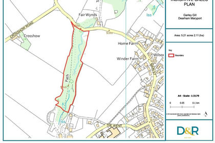
- Price
- Guide Price£20,000
- Size
- 5.21 acres
Garley Gill Woodland, Dearham, Maryport, Cumbria, CA15, Dearham, Cumberland CA15 England
Added on 21/07/2026Vacant Land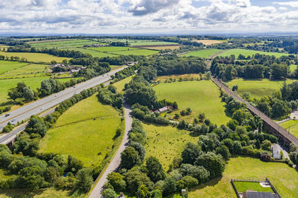
- Price
- Offers Over£35,000
- Size
- 5.52 acres
Land at Kirtlebridge, Lockerbie, DG11, Lockerbie, Dumfries and Galloway DG11 Scotland
Added on 21/08/2026Agricultural Land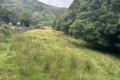
- Price
- £40,000
- Size
- 1.81 acres
Island Field, Coniston, Cumbria, Coniston, Westmorland and Furness LA21 England
Added on 08/08/2026Amenity Land
- Price
- Offers in Excess of£30,000
- Size
- 0.45 acres
Added on 20/07/2026Amenity Land
- Price
- £30,000
- Size
- 4.02 acres
Added on 20/07/2026Woodland
- Price
- £45,000
- Size
- 2.78 acres
Haltwhistle, Northumberland, NE49, Haltwhistle, Northumberland NE49 England
Added on 27/05/2026Vacant Land
- Price
- Guide Price£30,000
- Size
- 2.87 acres
Added on 16/07/2026Undeveloped Land
- Price
- £35,000
- Size
- 2.1 acres
Added on 13/06/2026Woodland
- Price
- Guide Price£30,000
- Size
- 6.86 acres
Paddocks At Gawthrop, Dent, Cumbria, Dent, Westmorland and Furness LA10 England
Added on 05/08/2026Grazing Land
- Price
- Offers Over£20,000
- Size
- 1.31 acres
At Melling, Carnforth, Lancashire, Melling-with-Wrayton, Lancashire LA6 England
Added on 24/06/2026Woodland