
Lot 7 - High Mansrigg Farm, Ulverston, Cumbria, LA12
- Land size
- 4.02 acres
- Bedrooms
- 4
- Bathrooms
- 1
Description
Ulverston 1.5 miles | Greenodd 3 miles | Barrow-in-Furness 10 miles (all distances are approximate).
Our client has instructed us to invite best and final offers no later than 12 Noon on Thursday 27th August 2026 on the following basis:
All offers are to be submitted in writing and sent via post or email clearly marked ‘SEALED BID – Land at High Mansrigg Farm, Ulverston, Cumbria, LA12 7PY' to or GSC Grays, Unit 9, Underley Business Centre, Kearstwick, Kirkby Lonsdale, LA6 2DY.
For more information, please contact the office on .
Situation - The property is situated in an attractive rural setting within easy reach of local amenities, approximately 1.5 miles from the market town of Ulverston, and 10 miles from Barrow-in-Furness. The property is located in close proximity to the A590, providing good transport links through to the M6 motorway and the Lake District National Park.
Ulverston is a historic market town with a comprehensive range of amenities, including shops, schools, healthcare and leisure facilities, together with good transport links to the wider South Lakeland and Furness region. The town is surrounded by attractive countryside, yet within easy reach of the Lake District National Park.
Barrow in Furness is a well-serviced coastal town offering a wide range of amenities, including shops, schools and leisure facilities. The town is undergoing significant investment, driven by major infrastructure and employment programmes, alongside wider regeneration initiatives, which are contributing to long term economic growth and enhanced local amenities.
Description - High Mansrigg Farm occupies an elevated position, commanding panoramic views across the rolling countryside and over Morecambe Bay. The property comprises a substantial detached farmhouse, offering spacious and versatile accommodation. The property presents an excellent opportunity for modernisation to create a family home. The holding further benefits from a range of traditional and modern farm buildings, together with productive meadow and pastureland, extending to approximately 132.46 acres (53.61 hectares).
Lot 7 - 4.02 acres of deciduous woodland, situated adjacent to Newlands Beck with roadside access and a natural water supply.
General Information -
Services - The farm is served by a mains electricity and a mains water supply. Drainage is to a private septic tank system, which is assumed to be non-compliant. The farmhouse is heated by two multi fuel stoves and a Rayburn, which also provides hot water and partial central heating.
Rights Of Way And Easements - The property is sold subject to and with the benefit of all rights of way whether public or private, rights of water, light, support, drainage, electricity, and other rights and obligations, easements, quasi-easements, restrictive covenants and all existing and proposed wayleaves whether referred to or not.
Local Authorities - Westmorland and Furness Council
Town Hall and South Lakeland House, Lowther Street, Kendal, LA9 4DQ
Tel:
Council Tax - Farmhouse – Band E
Energy Performance Certificate (Epc): - Farmhouse – Rating F
Method Of Sale - High Mansrigg Farm is offered for sale by private treaty in lots or as a whole. The Seller reserves the right to agree a sale at any point without further reference to interested parties.
The vendors reserve the right to sell the property at any time and without prior notice.
Fixtures, Fittings And Equipment - Only those items specifically mentioned in these particulars are included in the sale.
Boundaries - Neither the Seller nor the Seller’s Agent will be responsible for defining the boundaries or their ownership thereof and the Purchaser(s) shall rely on their own inspections and the information appearing in the Land Registry. Maintenance responsibilities are indicated by the T marks on the transfer plan.
Sporting Rights And Mineral Rights - The sporting and mineral rights are included in the sale so far as they are owned.
Timber - All standing and fallen timber will be included in the sale.
Vat - Any guide prices quoted or discussed are exclusive of VAT. Should any part of the sale or any rights attached to it become chargeable items for the purpose of VAT then this will be payable by the Purchaser. No election to tax has been made in respect to the property.
Viewing - Appointments will be by appointment only arranged through the Selling Agent by calling . Given the potential hazards around the farm, we ask all parties wishing to view to be as vigilant as possible particularly around the buildings, machinery and livestock.
Postcode: LA12 7PY
What3words: ///ship.factory.mixing
Conditions Of Sale -
Purchase Price & Deposit - Upon exchange of contracts, a non-refundable deposit of 10% of the purchase price shall be paid. The balance will fall due for payment on completion at a date to be agreed and whether entry is taken or not with interest accruing at the rate 5% above the bank of England base rate.
Anti-Money Laundering And Proof Of Funds - All offers to purchase the property from the UK or overseas based purchases (regardless of whether the offer is on a cash basis or subject to funding) must be accompanied by evidence of source of funds. This can be in the form of a bank statement showing the purchase price, a financial reference from a bank or funding source, or confirmation from a solicitor that the Purchaser has sufficient funds to complete the purchase. Anti-Money Laundering Regulations require us to undertake ID verification checks on all Purchasers. A charge of £37.50 plus VAT per Purchaser will apply for these checks.
Disputes - Should any discrepancy arise within these particulars of sale or the interpretation of them, the question shall be referred to the arbitration of the Selling Agency whose decision acting experts will be final.
Overseas Purchasers - Any offer by a Purchaser(s) who is resident out of the United Kingdom must be accompanied by a guarantee from a bank who is responsible for the Sellers.
Plans, Areas And Schedules - These are based on the Ordnance Survey and Rural Land Register and are there for reference only. They have been carefully checked by the Selling Agents and the Purchaser shall be deemed to have satisfied himself as to the description of the property and any error misstatement shall not annul the sale and does not entitle either party to compensation in respect of thereof.
Lotting - It is intended to offer the property for sale as described but the Seller reserves the right to divide the property into further lots, or to withdraw the property, or to exclude any property shown in these particulars.
Apportionments - The council tax and all other outgoings will be apportioned between the Seller and the Purchaser(s) as at the date of completion.
Particulars written: July 2026
Photographs taken: July 2026.
Map Location
Property details
- Tenure
- Freehold
- Council Tax Band
- E
- Date Posted
- 2026-07-20
Market Value Analysis
Compared with 21 Woodland listings in North West England (1+ acres).
Energy Performance Certificate
Energy Efficiency Rating
Based on UK Energy Performance Certificate standards (EU Directive 2002/91/EC)
Running costs are one side. Planning activity, flood history and ground risks for this location are in the full report.
Utilities & Restrictions
Utilities
- Electricity
- Mains
- Water
- Mains
- Heating
- Ask Agent
- Broadband
- Ask Agent
- Sewerage
- Septic Tank / Private
Rights & Restrictions
- Public Rights of Way
- Ask Agent
- Private Rights of Way
- Ask Agent
- Listed Property
- Ask Agent
- Restrictions
- Ask Agent
Listed status, conservation areas and planning constraints for this location are in the full report.
Property Features
- Accessibility
- Ask Agent
- Parking
- Ask Agent
- Garden
- Ask Agent
Beyond the particulars: planning activity, flood history, heritage and ground risks, checked for this exact spot.
Connectivity
Broadband
Fastest speed available at this postcode
14 Mbps
Standard (10-30 Mbps)
Suitable for
- Web & social
- Music streaming
- Standard video calls
Fixed wireless access may also be an option here.
Mobile signal
Predicted 4G and 5G signal; indoor signal depends on building materials.
Ofcom Connected Nations postcode-level predictions. Speeds and signal are modelled, not measured, and vary between addresses and providers.
Signal is the easy part. Planning activity, flood history and protected designations here are in the full report.
Nearest Schools
Primary
- Church Walk CofE Primary School1.3 milesOfsted report card · Mar 2026
- Ages
- 4 to 11
- Pupils
- 88
- Type
- Voluntary aided school
- Faith
- Church of England
- Sir John Barrow School1.7 milesOfsted: Outstanding
- Ages
- 3 to 11
- Pupils
- 235
- Type
- Community school
- Penny Bridge CofE School1.8 milesOfsted: Good
- Ages
- 4 to 11
- Pupils
- 123
- Type
- Academy converter
- Faith
- Church of England
- St Mary's Catholic Primary School, Ulverston1.9 milesOfsted report card · Mar 2026
- Ages
- 2 to 11
- Pupils
- 155
- Type
- Academy converter
- Faith
- Roman Catholic
- Croftlands Junior School2.4 milesNo Ofsted rating
- Ages
- 7 to 11
- Pupils
- 152
- Type
- Community school
Secondary
- Ulverston Victoria High School2 milesOfsted: Good *
- Ages
- 11 to 18
- Pupils
- 1,319
- Type
- Community school
- Dowdales School5.5 milesNo Ofsted rating
- Ages
- 11 to 16
- Pupils
- 877
- Type
- Community school
- Cartmel Priory CofE School5.8 milesOfsted report card · May 2026
- Ages
- 11 to 16
- Pupils
- 371
- Type
- Academy converter
- Faith
- Church of England
- Millom School7.3 milesOfsted: Good
- Ages
- 11 to 18
- Pupils
- 476
- Type
- Community school
- Chetwynde School7.5 milesOfsted: Good
- Ages
- 3 to 16
- Pupils
- 508
- Type
- Free schools
* Latest graded judgement covers quality of education only; no overall grade was issued under the 2024-25 inspection framework.
Distances are straight-line from the advertised location. Source: the national school registers (DfE, Welsh Government, Scottish Government) and Ofsted.
Schools are just the start: sold prices nearby, planning activity and any flood history are in the full report.
Amenities
Supermarket
GP surgery
Pharmacy
Hospital
Straight-line distances from the advertised location. Sources: NHS records, Geolytix supermarket locations, OS Open Greenspace and the national trails registers.
The area stacks up? Now check the location itself: planning nearby, protected designations and past flooding.
Getting Around
Nearest station
Nearest bus stop
Typical drive times
Straight-line distances from the advertised location; drive times are typical free-flow times over OpenStreetMap road data, so allow more at peak. Public transport locations from DfT NaPTAN.
Easy to reach matters. So do planning activity, flood history and ground risks: all in the full report.
Flood Risk
Environment Agency open data, checked around the advertised map pin for the listed acreage. Long-term risk counts flood defences; the planning map's flood zones do not. Provided by LandSale, not the listing agent, and not part of the agent's particulars. Risk varies across a holding, so verify before committing.
Rivers and the sea
Planning map: Flood Zone 1.
Surface water
Not at the pin: mapped about 40 metres away.
These bandings are the summary. Where this location sits on the flood maps, plus planning activity, heritage and ground risks, is in the full report.
Important notice: Information, maps and tags on this page are drawn from the advertising agent's marketing materials or generated automatically. LandSale has not verified them. Relying on these details is at your own risk, always carry out independent checks before committing to a purchase.
LandSale full disclaimer
Marketing information only - not formal particulars. The details on this website are provided for general guidance and do not constitute an offer or contract. Neither LandSale nor the advertising estate/land agent accepts responsibility for any inaccuracy.
1. Source of information
- Listing content: Core description, asking price, tenure, measurements, photographs and planning history originate from the marketing materials of the advertising estate or land agent. LandSale does not author this content and cannot guarantee its accuracy.
- Automated tags & categorisation: Property type, land-use class, acreage bands and similar labels may be applied by machine-learning models. They are intended as a helpful guide only and may not reflect the property's legal status or permitted use.
- Third-party & enriched data layers: Maps, boundary outlines, planning designations, soil reports, broadband coverage and other environmental or location-based insights are licensed from external suppliers. Such data are supplied “as is", may be incomplete or out of date and are subject to change without notice.
2. Verification required
Prospective purchasers must verify critical matters, including but not limited to planning permission, title boundaries, public rights of way, environmental constraints, acreage, services, access and VAT status, through their own inspections, specialist surveys, legal advisers and the selling agent before relying on the information or entering into any contract.
3. No warranty or liability
LandSale gives no warranty, express or implied, as to the accuracy, completeness or fitness for any particular purpose of the information displayed. LandSale shall not be liable for any loss, damage, cost or expense arising directly or indirectly from any use of or reliance on such information, save where liability may not be excluded by law.
4. Updates & feedback
If you believe any detail on this listing is inaccurate, please let us know. We will investigate and, where appropriate, update the listing or notify the agent.
© LandSale | Version 1.3 - August 2026
Listing agent
GSC Grays, Farm Agency
5-6 Bailey Court, Colburn Business Park, Catterick Garrison, DL9 4QL
View agent profileSimilar properties for sale
- Price
- Guide Price£35,000
Land at Manor Close, Ingleton, North Yorkshire, Ingleton, North Yorkshire LA6 England
Added on 01/09/2026Building Plot
- Price
- Guide Price£25,000
- Size
- 0.07 acres
Land off Foster Street, Accrington, Lancashire, BB5, Hyndburn, Lancashire BB5 England
Added on 02/10/2026Building Plot
- Price
- Offers in Excess of£25,000
- Size
- 3.66 acres
Added on 01/10/2026Agricultural Land
- Price
- Offers in Excess of£46,000
- Size
- 9.27 acres
Added on 01/10/2026Agricultural Land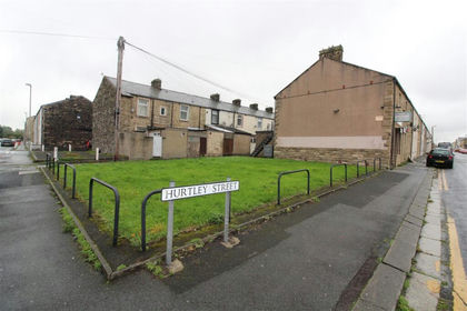
- Price
- Guide Price£50,000
Land Adjacent to 10 Hurtley Street, Burnley, Lancashire BB10, Burnley, Lancashire BB10 England
Added on 08/10/2026Building Plot
- Price
- Guide Price£46,000
- Size
- 0.1 acres
Land At, Ingrow Lane, Keighley, West Yorkshire, Keighley, Bradford BD22 England
Added on 24/09/2026Building Plot
- Price
- Offers in Excess of£40,000
FOR SALE - Land adj to 10 Broadbent Road, Oldham, Oldham East and Saddleworth, Oldham OL1 England
Added on 16/04/2026Building Plot
- Price
- Guide Price£40,000
Added on 16/05/2026Development Land
- Price
- Guide Price£25,000
Land Adjoining 3A Lumn Road, Greater Manchester, Hyde, Stalybridge and Hyde, Tameside SK14 England
Added on 13/08/2026Self Build Plot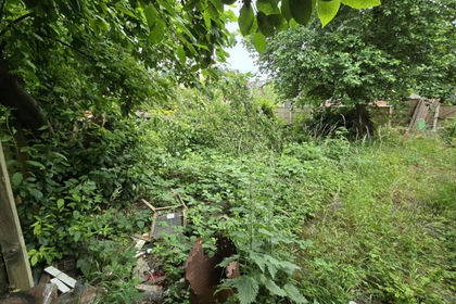 Added on 29/01/2026Allotment