Paddocks At Gawthrop, Dent, Cumbria
- Land size
- 6.86 acres
Key Features
- Productive meadow and grazing land found in a village setting.
- Located adjacent to the idyllic village of Gawthrop in the Yorkshire Dales National Park.
- The land benefits from a natural water supply and frontage to ‘Oliver Gill’.
- Expected to be of interest to neighboring property owners, farmers and those with equestrian interests.
Description
To be sold by Public Auction at Sedbergh People’s Hall, Howgill Lane, Sedbergh, LA10 5DQ on 16th September 2026 from 2.45pm. An exciting opportunity to purchase an idyllic block of productive grazing and amenity land with river frontage
found nestled adjacent to the village of Gawthrop,
within the sought-after Yorkshire Dales National Park. Extending in total to circa 6.86 acres (2.78 hectares)
Guide Range - £30,000 - £40,000
Description
Extending to approximately 6.86 acres ( 2.78 hectares) [Edged Red on the Sale Plan]
The land comprises four parcels of grazing and meadow land. The land is undulating and flat in areas. There is a natural water supply running through the land.
The boundaries consist of dry-stone walls and post and wire fencing, all of which appear to be stockproof however, we suggest all prospective buyers inspect and undertake required due diligence prior to auction as the property is sold as seen.
Access to the land is via a track off Brackensgill Lane. Please see access route shown purple on the attached plan
Fencing Obligation
The successful buyer will be obliged to install a livestock proof sheet netting boundary along the boundary marked yellow within one month of completion. Access may be taken via High House Farm for this purpose only and for the benefit of doubt this shall not grant any future access rights over High House.
Directions
Heading south out of Sedbergh following the signs for Dent & Dentdale, stay on the Loftus Hill road for approximately 1 mile. Take a slight right over the bridge and stay on Moser Hill Brow for circa 3 miles turn right over Barth Bridge and turn right onto Brackensgill Lane after approximately 0.3 miles upon entering Gawthrop take the first right into a hamlet of house the land is located on the right with the selling agents board upon entrance. Please see attached sale plan for illustrated plan showing access for the land.
What3Words: humidity.stubble.expel
Grid Reference: SD
Location
The Paddocks are found on the south western boundary of the hamlet of Gawthrop situated approximately 0.7 miles West of from the village of Dent and within the Yorkshire Dales National Park. The market town of Sedbergh lies circa 5 miles north of the land. The lot is accessible via a hardcore trackway off Brackensgill Lane.
Auction General
General Information and Stipulations
The following Stipulations where applicable shall be deemed as Special Conditions of Sale. In the event of any variance between the Stipulations and the Special Conditions of Sale then the latter will prevail. Purchasers will also be deemed to have had full notice of the Stipulations and the Special Conditions of Sale and the same will not be read out at the time of sale. The Special Conditions of Sale may be inspected at the Auctioneer’s Offices and also the offices of the Seller’s Solicitors FOURTEEN days prior to the sale.
N.B Prospective purchasers are requested to contact the Seller’s Solicitors to discuss legal matters pertinent to the Sale Contract and documentation.
Solicitors
McGarry Solicitors, 54 Main Street, Sedbergh, Cumbria, LA10 5AB
Tel No: .
Tenure
Freehold. Vacant possession upon completion. The date fixed for completion is Friday 16th October 2026 or earlier by mutual agreement.
Method of Sale
The property will be offered for sale as described in these particulars of sale.
Water Supplies
The land is noted to have natural water supplies
Planning Authority
Yorkshire Dales National Park. Tel No: .
Mines and Minerals
Included, insofar as we are aware.
Sporting Rights
Included, insofar as we are aware.
Environmental Schemes
The land is understood to be free from any environmental scheme.
Wayleave and Easements
The sale is subject to all existing rights of way, drainage, light air support and other easements whether mentioned in these particulars or not.
Boundaries
The responsibility of the boundary fences are indicated with ‘T’ marks on the sale plan where known and are from the information provided by the sellers and are believed to be correct. Please see fencing obligation referred to above in regards to the works required to the boundary coloured yellow on the attached sale plan.
Sale Plan
The Sale Plan has been prepared by the Selling Agent for the convenience of the prospective purchasers. It is deemed to be correct, but any error, omission or misstatement shall not affect the sale. Purchasers must satisfy themselves as to accuracy.
Money Laundering Regulations 2017
We are required by legislation to undertake checks on any potential purchaser prior to accepting their bid. Any interested party should either call into our Kendal Office with photographic ID, i.e., passport/driving licence and proof of address i.e., Council Tax/utility bill for copying prior to the auction or present copies at the Auctioneer’s desk prior to the commencement of the sale.
Payment of Deposit and Completion
A 10% deposit is payable by the successful purchaser and must be paid by BACS or cheque only. The balance of funds shall be due on completion being Friday 16th October or earlier by mutual agreement.
Viewings
The land may be inspected at any reasonable time by prospective buyers on foot, provided a copy of these particulars are in possession.
Map Location
Property details
- Tenure
- Freehold
- Council Tax Band
- TBC
- Date Posted
- 2026-08-05
Market Value Analysis
Compared with 120 Farmland & Pasture listings in North West England (5+ acres).
Utilities & Restrictions
Utilities
- Electricity
- Ask Agent
- Water
- Ask Agent
- Heating
- Ask Agent
- Broadband
- Ask Agent
- Sewerage
- Ask Agent
Rights & Restrictions
- Public Rights of Way
- Ask Agent
- Private Rights of Way
- Ask Agent
- Listed Property
- Ask Agent
- Restrictions
- Ask Agent
Property Features
- Accessibility
- Ask Agent
- Parking
- Ask Agent
- Garden
- Garden
Connectivity
Broadband
Fastest speed available at this postcode
1 Gbps
Gigabit full fibre · available to 91% of premises
Suitable for
- 4K streaming on every screen
- Full-time home working
- Online gaming & big downloads
Mobile signal
Outdoor predictions; indoor signal depends on building materials.
Ofcom Connected Nations postcode-level predictions. Speeds and signal are modelled, not measured, and vary between addresses and providers.
Nearest Schools
Primary
- Dent CofE Voluntary Aided Primary School0.7 milesOfsted: Good
- Ages
- 3 to 11
- Pupils
- 30
- Type
- Voluntary aided school
- Faith
- Church of England
- Sedbergh Primary School3.5 milesOfsted: Good
- Ages
- 3 to 11
- Pupils
- 168
- Type
- Community school
- Leck St Peter's Church of England Primary School7.3 milesOfsted report card · Jun 2026
- Ages
- 3 to 11
- Pupils
- 38
- Type
- Voluntary aided school
- Faith
- Church of England
- St Mary's CofE Primary School7.6 milesOfsted: Outstanding *
- Ages
- 3 to 11
- Pupils
- 220
- Type
- Voluntary aided school
- Faith
- Church of England
- Old Hutton CofE School8.3 milesOfsted: Good
- Ages
- 3 to 11
- Pupils
- 78
- Type
- Voluntary controlled school
- Faith
- Church of England
Secondary
- Settlebeck School3.5 milesOfsted: Good *
- Ages
- 11 to 16
- Pupils
- 203
- Type
- Academy converter
- Queen Elizabeth School7.6 milesOfsted: Good
- Ages
- 11 to 18
- Pupils
- 1,155
- Type
- Academy converter
- Queen Elizabeth Studio School7.6 milesOfsted report card · Jun 2026
- Ages
- 14 to 19
- Pupils
- 329
- Type
- Studio schools
- Kirkbie Kendal School11 milesNo Ofsted rating
- Ages
- 11 to 18
- Pupils
- 1,029
- Type
- Academy converter
- The Queen Katherine School11 milesOfsted report card · May 2026
- Ages
- 11 to 19
- Pupils
- 910
- Type
- Academy converter
* Latest graded judgement covers quality of education only; no overall grade was issued under the 2024-25 inspection framework.
Distances are straight-line from the advertised location. Source: the national school registers (DfE, Welsh Government, Scottish Government) and Ofsted.
Amenities
Supermarket
GP surgery
Pharmacy
Hospital
Straight-line distances from the advertised location. Sources: NHS records, Geolytix supermarket locations, OS Open Greenspace and the national trails registers.
Getting Around
Nearest station
Nearest bus stop
Typical drive times
Straight-line distances from the advertised location; drive times are typical free-flow times over OpenStreetMap road data, so allow more at peak. Public transport locations from DfT NaPTAN.
Flood Risk
From Environment Agency flood map open data, checked around the advertised map pin and allowing for the listed acreage where known. This summary comes from LandSale, the advertising platform, not from the listing agent, and is not part of the agent's particulars. Risk can vary across a single holding, so verify anything critical through your own searches before committing.
Rivers and the sea
Mapped within the area searched, not at the advertised map pin itself.
Surface water
The detail behind these bandings, including exact zones and annual chances, any recorded past flooding, plus planning, heritage, nature and ground checks, is in the .
Important notice: Information, maps and tags on this page are supplied by the advertising agent or generated automatically. LandSale has not verified them. Relying on these details is at your own risk, always carry out independent checks before committing to a purchase.
LandSale full disclaimer
Marketing information only - not formal particulars. The details on this website are provided for general guidance and do not constitute an offer or contract. Neither LandSale nor the advertising estate/land agent accepts responsibility for any inaccuracy.
1. Source of information
- Agent-supplied content: Core description, asking price, tenure, measurements, photographs and planning history are uploaded by the appointed agent, who remains solely responsible for their accuracy.
- Automated tags & categorisation: Property type, land-use class, acreage bands and similar labels may be applied by machine-learning models. They are intended as a helpful guide only and may not reflect the property's legal status or permitted use.
- Third-party & enriched data layers: Maps, boundary outlines, planning designations, soil reports, broadband coverage and other environmental or location-based insights are licensed from external suppliers. Such data are supplied “as is", may be incomplete or out of date and are subject to change without notice.
2. Verification required
Prospective purchasers must verify critical matters, including but not limited to planning permission, title boundaries, public rights of way, environmental constraints, acreage, services, access and VAT status, through their own inspections, specialist surveys, legal advisers and the selling agent before relying on the information or entering into any contract.
3. No warranty or liability
LandSale gives no warranty, express or implied, as to the accuracy, completeness or fitness for any particular purpose of the information displayed. LandSale shall not be liable for any loss, damage, cost or expense arising directly or indirectly from any use of or reliance on such information, save where liability may not be excluded by law.
4. Updates & feedback
If you believe any detail on this listing is inaccurate, please let us know. We will investigate and, where appropriate, update the listing or notify the agent.
© LandSale | Version 1.2 - January 2026
Listing agent
H&H Land & Estates, Penrith
1a St. Andrews View Penrith CA11 7YF
Similar properties for sale
- Price
- Offers Over£50,000
- Size
- 6.21 acres
Sedbergh, Cumbria, Sedbergh, Westmorland and Furness LA10 England
Added on 18/08/2026Agricultural Land
- Price
- Guide Price£20,000
- Size
- 2.3 acres
2.3 Acres of Permanent Pasture at Countersett, Hawes, Bainbridge, North Yorkshire DL8 England
Added on 17/02/2026Cheap Land
- Price
- Guide Price£35,000
- Size
- 1.89 acres
Added on 29/01/2026Grazing Land
- Price
- Guide Price£15,000
- Size
- 3.21 acres
3.21 Acres of Grassland, West Witton, Leyburn, West Witton, North Yorkshire DL8 England
Added on 18/08/2026Agricultural Land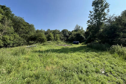
- Price
- £30,000
- Size
- 4.02 acres
Added on 20/07/2026Woodland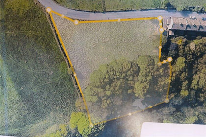
- Price
- Guide Price£20,000
- Size
- 1.3 acres
Vale Mill Lane, Haworth, Keighley, West Yorkshire, BD22, Cross Roads, Bradford BD22 England
Added on 08/07/2026Pasture
- Price
- Fixed Price£38,000
- Size
- 4.7 acres
Woodland, Alston, Cumbria, CA9, Alston Moor, Westmorland and Furness CA9 England
Added on 04/08/2026Woodland
- Price
- Offers Over£25,000
- Size
- 1.71 acres
Added on 02/04/2026Grazing Land
- Price
- Guide Price£12,000
- Size
- 1.25 acres
Added on 30/06/2026Cheap Land
- Price
- Guide Price£30,000
- Size
- 1.74 acres
Added on 21/08/2026Grazing Land