Woodway, Loosley Row, Buckinghamshire, HP27
- Land size
- 1.78 acres
- Bedrooms
- 5
- Bathrooms
- 3
Key Features
- Modern, brick and flint detached property
- Five bedrooms, two en suite bath or shower rooms
- Open plan kitchen/breakfast room
- Three reception rooms
- Utility room and cloakroom
- Double garage and off street parking
- Set on a plot of 1.78 acres of garden and meadow
- Elevated position with far reaching countryside views
Description
A modern detached property with a double garage and off street parking, set in 1.78 acres of garden and wild meadow in an AONB, in an elevated position in Loosley Row with far reaching countryside views. The property was built in 1996 and has 2,878 sq. ft. of accommodation over two floors. One of two properties, it has brick and flint walls under a clay tile roof. It benefits from a modern layout but is designed with a stylistic nod to other properties in the area. The property has underfloor heating in the kitchen, hall, conservatory and bathrooms.
The front door opens to an entrance hall with a turning staircase and a two piece cloakroom. Partially glazed doors lead to a sitting room which has a recently installed (2024) wood burning cassette stove, and double doors to a Victorian style conservatory with underfloor heating, a vent opening roof system, and two sets of French doors to a terrace in the garden. There is also a dining room, a study and a kitchen/breakfast room.
The landing gives access to all five bedrooms, and a family bathroom. Two of the bedrooms have en suites.
Kitchen/Breakfast Room
The kitchen overlooks the garden and views beyond, and has doors to the rear terrace, and a comprehensive range of handmade full height, base and wall units in maple with a walnut bead, with granite work surfaces and upstands and an inset one-and-a-half bowl sink. The island has further storage, a circular butcher block and a breakfast bar to seat two. Integrated appliances by Miele include two full height fridge/freezers, a coffee machine, a double oven with a warming drawer, and an induction hob with extractor over, and there is a Bosch dishwasher. The adjoining utility room has matching units, space for appliances and a glazed exterior door.
First Floor
Measuring over 19 ft by 11 ft, the principal bedroom has a window with a view of the rear garden and open countryside beyond. A range of built-in wardrobes spans one wall and a door leads to the en suite which has a bath and a separate shower cubicle. Bedroom two also has views to the rear, built in wardrobes and an en suite shower room. The three remaining bedrooms overlook the front garden and share a family bathroom which also has a separate shower cubicle.
Gardens and Grounds
A five bar gate opens to a partly shared drive leading to a double garage and off street parking for up to four cars. The front is screened by mature hedges and trees and has timber fencing on the front and side boundary. A paved terrace spans the width of the house and is adjacent to raised fruit and vegetable beds. Railway sleeper steps weave down through formal gardens with flower and shrub borders. There is then a lawn and a gap in a hedge to a wild meadow with fruit trees including heritage apple, pear, plum, cherry and almond. There is also a pond, a shed, compost bins, and a productive grape vine.
Situation and Schooling
Loosley Row is a hamlet to the east of Princes Risborough in the Chiltern Hills Area of Outstanding Natural Beauty. Neighbouring Lacey Green (0.6 miles) has a smock windmill (the oldest surviving one in England) and access to countryside walks. There is a village hall, primary school, public house and a village store. Princes Risborough (1.9 miles) is a market town with a variety of independent shops, supermarkets, doctor and dental surgeries, cafes, restaurants and sports and leisure facilities. There is a good choice of both state and independent primary schools and grammar schools in nearby Aylesbury and High Wycombe. Motorway links are accessible (M40 Junction 4 or 5), coupled with a commuter train service from Princes Risborough to London and Birmingham.
Map Location
Property details
- Tenure
- Freehold
- Council Tax Band
- H
- Date Posted
- 2026-08-01
Market Value Analysis
Compared with 1,937 Homes with Land listings in South East England (1+ acres).
Energy Performance Certificate
Energy Efficiency Rating
Based on UK Energy Performance Certificate standards (EU Directive 2002/91/EC)
Running costs are one side. Planning activity, flood history and ground risks for this location are in the full report.
Utilities & Restrictions
Utilities
- Electricity
- Mains
- Water
- Mains
- Heating
- Double Glazing, Gas Central Heating, Underfloor Heating
- Broadband
- Ask Agent
- Sewerage
- Mains
Rights & Restrictions
- Public Rights of Way
- Ask Agent
- Private Rights of Way
- Ask Agent
- Listed Property
- Ask Agent
- Restrictions
- Ask Agent
Listed status, conservation areas and planning constraints for this location are in the full report.
Property Features
- Accessibility
- No Wheelchair Access
- Parking
- Garage, Driveway, Off-Street Parking
- Garden
- Garden
Beyond the particulars: planning activity, flood history, heritage and ground risks, checked for this exact spot.
Connectivity
Broadband
Fastest speed available at this postcode
80 Mbps
Superfast
Suitable for
- HD streaming
- Video calls
- Web & social
Mobile signal
Outdoor predictions; indoor signal depends on building materials.
Ofcom Connected Nations postcode-level predictions. Speeds and signal are modelled, not measured, and vary between addresses and providers.
Signal is the easy part. Planning activity, flood history and protected designations here are in the full report.
Nearest Schools
Primary
- St John's Church of England Primary School, Lacey Green0.9 milesOfsted report card · Jun 2026
- Ages
- 4 to 11
- Pupils
- 215
- Type
- Academy converter
- Faith
- Church of England
- Speen CofE VA School1.7 milesNo Ofsted rating
- Ages
- 4 to 7
- Pupils
- 44
- Type
- Voluntary aided school
- Faith
- Church of England
- Princes Risborough Primary School1.9 milesOfsted: Good
- Ages
- 2 to 11
- Pupils
- 224
- Type
- Academy sponsor led
- Monks Risborough CofE Primary School2.1 milesOfsted report card · Jun 2026
- Ages
- 4 to 11
- Pupils
- 216
- Type
- Voluntary controlled school
- Faith
- Church of England
- Naphill and Walters Ash School2.2 milesOfsted: Good
- Ages
- 4 to 11
- Pupils
- 259
- Type
- Community school
Secondary
- Princes Risborough School1.3 milesOfsted: Good
- Ages
- 11 to 18
- Pupils
- 1,083
- Type
- Academy converter
- The Misbourne School5 milesOfsted report card · Apr 2026
- Ages
- 11 to 18
- Pupils
- 1,115
- Type
- Academy converter
- The Royal Grammar School, High Wycombe5.5 milesOfsted: Good
- Ages
- 11 to 18
- Pupils
- 1,451
- Type
- Academy converter
- Gender
- Boys
- John Colet School5.6 milesNo Ofsted rating
- Ages
- 11 to 18
- Pupils
- 1,014
- Type
- Academy converter
- Holmer Green Senior School5.8 milesOfsted report card · Mar 2026
- Ages
- 11 to 18
- Pupils
- 1,244
- Type
- Academy converter
Distances are straight-line from the advertised location. Source: the national school registers (DfE, Welsh Government, Scottish Government) and Ofsted.
Schools are just the start: sold prices nearby, planning activity and any flood history are in the full report.
Amenities
Supermarket
GP surgery
Pharmacy
Hospital
Green space
Walking trail
Straight-line distances from the advertised location. Sources: NHS records, Geolytix supermarket locations, OS Open Greenspace and the national trails registers.
The area stacks up? Now check the location itself: planning nearby, protected designations and past flooding.
Getting Around
Nearest station
Nearest bus stop
Typical drive times
Straight-line distances from the advertised location; drive times are typical free-flow times over OpenStreetMap road data, so allow more at peak. Public transport locations from DfT NaPTAN.
Easy to reach matters. So do planning activity, flood history and ground risks: all in the full report.
Flood Risk
From Environment Agency flood map open data, checked around the advertised map pin and allowing for the listed acreage where known. This summary comes from LandSale, the advertising platform, not from the listing agent, and is not part of the agent's particulars. Risk can vary across a single holding, so verify anything critical through your own searches before committing.
Rivers and the sea
Surface water
These bandings are the summary. Where this location sits on the flood maps, plus planning activity, heritage and ground risks, is in the full report.
Important notice: Information, maps and tags on this page are drawn from the advertising agent's marketing materials or generated automatically. LandSale has not verified them. Relying on these details is at your own risk, always carry out independent checks before committing to a purchase.
LandSale full disclaimer
Marketing information only - not formal particulars. The details on this website are provided for general guidance and do not constitute an offer or contract. Neither LandSale nor the advertising estate/land agent accepts responsibility for any inaccuracy.
1. Source of information
- Listing content: Core description, asking price, tenure, measurements, photographs and planning history originate from the marketing materials of the advertising estate or land agent. LandSale does not author this content and cannot guarantee its accuracy.
- Automated tags & categorisation: Property type, land-use class, acreage bands and similar labels may be applied by machine-learning models. They are intended as a helpful guide only and may not reflect the property's legal status or permitted use.
- Third-party & enriched data layers: Maps, boundary outlines, planning designations, soil reports, broadband coverage and other environmental or location-based insights are licensed from external suppliers. Such data are supplied “as is", may be incomplete or out of date and are subject to change without notice.
2. Verification required
Prospective purchasers must verify critical matters, including but not limited to planning permission, title boundaries, public rights of way, environmental constraints, acreage, services, access and VAT status, through their own inspections, specialist surveys, legal advisers and the selling agent before relying on the information or entering into any contract.
3. No warranty or liability
LandSale gives no warranty, express or implied, as to the accuracy, completeness or fitness for any particular purpose of the information displayed. LandSale shall not be liable for any loss, damage, cost or expense arising directly or indirectly from any use of or reliance on such information, save where liability may not be excluded by law.
4. Updates & feedback
If you believe any detail on this listing is inaccurate, please let us know. We will investigate and, where appropriate, update the listing or notify the agent.
© LandSale | Version 1.3 - August 2026
Listing agent
Michael Graham, Princes Risborough
24 Market Square, Princes Risborough, HP27 0AN
Contact Michael Graham, Princes Risborough
24 Market Square, Princes Risborough, HP27 0AN
View agent profileSimilar properties for sale
- Price
- £1,625,000
- Size
- 1.1 acres
Added on 29/01/2026House with Land
- Price
- Guide Price£1,750,000
- Size
- 1 acres
Added on 11/05/2026Country Home
- Price
- Guide Price£1,400,000
- Size
- 17.43 acres
Added on 13/05/2026House with Land
- Price
- Guide Price£1,575,000
- Size
- 1.8 acres
Added on 29/01/2026House with Land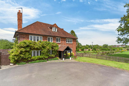
- Price
- Guide Price£1,750,000
- Size
- 3.6 acres
Longwick, Princes Risborough, HP27, Longwick-cum-Ilmer, Buckinghamshire HP27 England
Added on 03/06/2026Farmhouse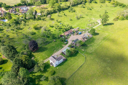
- Price
- Guide Price£1,750,000
- Size
- 47 acres
Valley Road, Hughenden Valley, Buckinghamshire, HP14, Hughenden, Buckinghamshire HP14 England
Added on 05/09/2026Farmhouse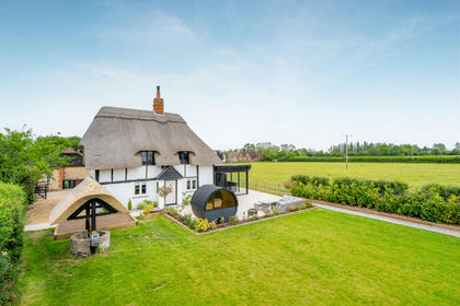
- Price
- Offers Over£1,500,000
Henton, Chinnor, Oxfordshire, OX39, Chinnor, Oxfordshire OX39 England
Added on 11/06/2026Cottage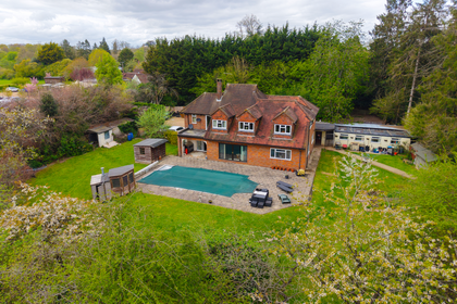
- Price
- Guide Price£1,500,000
- Size
- 2 acres
Added on 27/05/2026House with Land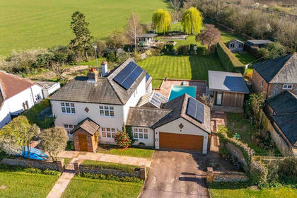
- Price
- Guide Price£1,150,000
- Size
- 1 acres
Ilmer, Princes Risborough, HP27, Longwick-cum-Ilmer, Buckinghamshire HP27 England
Added on 14/05/2026House with Land
- Price
- Guide Price£1,500,000
- Size
- 2.89 acres
Barns, Great Kingshill, Bucks HP15, Hughenden, Buckinghamshire HP15 England
Added on 28/03/2026Development Land