Characterful Barn Conversion in Gresham
- Bedrooms
- 3
- Bathrooms
- 2
Key Features
- Deceptively Spacious Period Cottage Full of Character
- Set Back From the Road in the Desirable Village of Gresham
- Offered For Sale with No Onward Chain
- Excellent Opportunity to Modernise and Personalise
- Generous Reception Room with French Doors to the Garden
- Welcoming Vaulted Entrance Hall
- Sociable Kitchen Flowing into the Garden Room/Dining Area
- Ground Floor Shower Room and Separate Utility Area
- Three Bright and Well-Proportioned First-Floor Bedrooms
- Private Rear Garden, Driveway Parking and Single Garage
Description
Offered for sale with no onward chain, The Old Stables provides a wonderful blank canvas, ready to be tailored to individual tastes and requirements.
A welcoming vaulted entrance hall immediately sets the tone, creating a sense of space and character upon arrival. The principal reception room is generously proportioned and enjoys french doors opening directly onto the rear garden, allowing natural light to flood the room and creating a seamless connection between the indoor and outdoor spaces.
The heart of the home is the sociable kitchen area, which flows effortlessly into the garden room/dining area, providing an excellent setting for everyday living and entertaining. A useful utility area adds practicality, while a ground floor shower room further enhances the flexibility of the accommodation.
The first floor comprises three bright and well-proportioned bedrooms, all served by a family bathroom, offering comfortable accommodation for families, couples or those seeking a peaceful village retreat.
Outside, the property enjoys a high degree of privacy. To the front, there is driveway parking and a single garage, while the rear garden provides a delightful and secluded outdoor space, ideal for relaxing, gardening or entertaining.
Combining period charm, generous accommodation and outstanding potential, The Old Stables represents a rare opportunity to acquire a characterful home in a sought-after village setting. With no onward chain and scope to personalise throughout, this appealing cottage
is perfectly suited to those looking to create a home of their own in the heart of North Norfolk.
GRESHAM
A small and pleasant rural village, Gresham is located south-west of Cromer.
It has an interesting church with a distinctive Victorian-remodelled exterior. Inside, however, the church is whitewashed and notably free from decoration.
The church, with its 14th-century chancel, is a magnet for church explorers because it contains one of the finest examples in the East Anglian Seven Sacrament font series. Gresham is also the ancestral home of the Gresham family, including Sir John Gresham, founder of Gresham’s School, and Sir Thomas Gresham, founder of the Royal Exchange.
Renowned for its sandy beaches, famous Cromer crab and Banksy’s Great British Spraycation artwork, the scenic coastal town of Cromer enjoys impressive views of the medieval parish church, which boasts the highest church tower in Norfolk. The town is also home to the spectacular Victorian pier, with its restaurant and Pavilion Theatre. Other attractions include a cinema, Amazona Zoo, the Cromer Museum and the Lifeboat Museum. Cromer has its own railway station with regular services to Norwich, together with a hospital, doctors’ surgeries, dental practices, a library and the Royal Cromer Golf Club.
SERVICES CONNECTED
Mains electricity and water.
COUNCIL TAX
Band D.
ENERGY EFFICIENCY RATING
D. Ref:- 8736-1828-8600-0015-5222
To retrieve the Energy Performance Certificate for this property please visit and enter in the reference number above. Alternatively, the full certificate can be obtained through Sowerbys.
TENURE
Freehold.
LOCATION
What3words: /// fastening.clattered.treatable
WEBSITE TAGS
cosy-cottages
village-spirit
bloom-blossom
historical-homes
EPC Rating: D
Parking - Garage
Parking - Driveway
Disclaimer
These particulars are provided as a guide only and do not form part of any offer or contract. Sowerbys and its representatives have no authority to make or give representations or warranties. All descriptions, measurements, photographs and plans are for guidance only and should not be relied upon as statements of fact. Buyers should satisfy themselves as to the accuracy of the information through inspection or professional advice. Services, appliances and equipment have not been tested and no warranty can be given as to their condition. Planning permissions, building regulations and other consents should be verified by the buyer’s legal adviser. In accordance with Anti-Money Laundering regulations, proceeding buyers must complete a digital ID check through our compliance partner. A charge of £48 including VAT per sale or purchase applies. Leasehold buyers should confirm ground rent, service charges and lease details with their legal adviser.
Map Location
Property details
- Tenure
- Freehold
- Council Tax Band
- D
- Date Posted
- 2026-07-23
Energy Performance Certificate
Energy Efficiency Rating
Based on UK Energy Performance Certificate standards (EU Directive 2002/91/EC)
Running costs are one side. Planning activity, flood history and ground risks for this location are in the full report.
Utilities & Restrictions
Utilities
- Electricity
- Mains
- Water
- Mains
- Heating
- Oil Heating
- Broadband
- Fibre (FTTC)
- Sewerage
- Mains
Rights & Restrictions
- Public Rights of Way
- Ask Agent
- Private Rights of Way
- Ask Agent
- Listed Property
- Ask Agent
- Restrictions
- Ask Agent
Listed status, conservation areas and planning constraints for this location are in the full report.
Property Features
- Accessibility
- Ask Agent
- Parking
- Garage, Driveway
- Garden
- Private Garden
Beyond the particulars: planning activity, flood history, heritage and ground risks, checked for this exact spot.
Connectivity
Broadband
Fastest speed available at this postcode
80 Mbps
Superfast
Suitable for
- HD streaming
- Video calls
- Web & social
Mobile signal
Outdoor predictions; indoor signal depends on building materials.
Ofcom Connected Nations postcode-level predictions. Speeds and signal are modelled, not measured, and vary between addresses and providers.
Signal is the easy part. Planning activity, flood history and protected designations here are in the full report.
Nearest Schools
Primary
- Gresham Village School and Nursery0.7 milesNo Ofsted rating
- Ages
- 3 to 11
- Pupils
- 138
- Type
- Academy converter
- Sheringham Community Primary School2.5 milesNo Ofsted rating
- Ages
- 3 to 11
- Pupils
- 398
- Type
- Community school
- Aldborough Primary School3.2 milesOfsted: Good *
- Ages
- 4 to 11
- Pupils
- 126
- Type
- Foundation school
- St Mary's Church of England Primary Academy3.8 milesNo Ofsted rating
- Ages
- 2 to 11
- Pupils
- 61
- Type
- Academy converter
- Faith
- Church of England
- Cromer Junior School4.2 milesOfsted: Good
- Ages
- 7 to 11
- Pupils
- 255
- Type
- Academy converter
Secondary
- Sheringham High School2.6 milesOfsted: Good
- Ages
- 11 to 18
- Pupils
- 630
- Type
- Academy converter
- Cromer Academy4.3 milesNo Ofsted rating
- Ages
- 11 to 16
- Pupils
- 665
- Type
- Academy converter
- Aylsham High School7.4 milesNo Ofsted rating
- Ages
- 11 to 16
- Pupils
- 1,138
- Type
- Foundation school
- North Walsham High School9.5 milesOfsted: Good
- Ages
- 11 to 16
- Pupils
- 641
- Type
- Academy converter
- Reepham High School and College11 milesOfsted: Good *
- Ages
- 11 to 18
- Pupils
- 959
- Type
- Academy converter
* Latest graded judgement covers quality of education only; no overall grade was issued under the 2024-25 inspection framework.
Distances are straight-line from the advertised location. Source: the national school registers (DfE, Welsh Government, Scottish Government) and Ofsted.
Schools are just the start: sold prices nearby, planning activity and any flood history are in the full report.
Amenities
Supermarket
GP surgery
Pharmacy
Hospital
Green space
Straight-line distances from the advertised location. Sources: NHS records, Geolytix supermarket locations, OS Open Greenspace and the national trails registers.
The area stacks up? Now check the location itself: planning nearby, protected designations and past flooding.
Getting Around
Nearest station
Nearest bus stop
Typical drive times
Straight-line distances from the advertised location; drive times are typical free-flow times over OpenStreetMap road data, so allow more at peak. Public transport locations from DfT NaPTAN.
Easy to reach matters. So do planning activity, flood history and ground risks: all in the full report.
Flood Risk
From Environment Agency flood map open data, checked around the advertised map pin and allowing for the listed acreage where known. This summary comes from LandSale, the advertising platform, not from the listing agent, and is not part of the agent's particulars. Risk can vary across a single holding, so verify anything critical through your own searches before committing.
Rivers and the sea
Surface water
These bandings are the summary. Where this location sits on the flood maps, plus planning activity, heritage and ground risks, is in the full report.
Important notice: Information, maps and tags on this page are drawn from the advertising agent's marketing materials or generated automatically. LandSale has not verified them. Relying on these details is at your own risk, always carry out independent checks before committing to a purchase.
LandSale full disclaimer
Marketing information only - not formal particulars. The details on this website are provided for general guidance and do not constitute an offer or contract. Neither LandSale nor the advertising estate/land agent accepts responsibility for any inaccuracy.
1. Source of information
- Listing content: Core description, asking price, tenure, measurements, photographs and planning history originate from the marketing materials of the advertising estate or land agent. LandSale does not author this content and cannot guarantee its accuracy.
- Automated tags & categorisation: Property type, land-use class, acreage bands and similar labels may be applied by machine-learning models. They are intended as a helpful guide only and may not reflect the property's legal status or permitted use.
- Third-party & enriched data layers: Maps, boundary outlines, planning designations, soil reports, broadband coverage and other environmental or location-based insights are licensed from external suppliers. Such data are supplied “as is", may be incomplete or out of date and are subject to change without notice.
2. Verification required
Prospective purchasers must verify critical matters, including but not limited to planning permission, title boundaries, public rights of way, environmental constraints, acreage, services, access and VAT status, through their own inspections, specialist surveys, legal advisers and the selling agent before relying on the information or entering into any contract.
3. No warranty or liability
LandSale gives no warranty, express or implied, as to the accuracy, completeness or fitness for any particular purpose of the information displayed. LandSale shall not be liable for any loss, damage, cost or expense arising directly or indirectly from any use of or reliance on such information, save where liability may not be excluded by law.
4. Updates & feedback
If you believe any detail on this listing is inaccurate, please let us know. We will investigate and, where appropriate, update the listing or notify the agent.
© LandSale | Version 1.3 - August 2026
Listing agent
Sowerbys, Holt
1 Market Place Holt NR25 6BE
Similar properties for sale
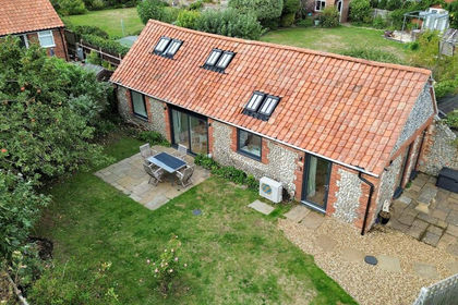
- Price
- Guide Price£375,000
Added on 16/09/2026Barn Conversion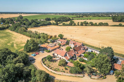
- Price
- Offers in Region of£550,000
Characterful Detached Barn Conversion in Roughton, Roughton, Norfolk NR11 England
Added on 11/08/2026Barn Conversion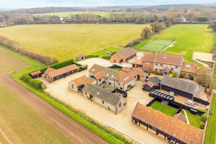
- Price
- Guide Price£399,950
Cromer Road, Roughton, Norfolk, Roughton, Norfolk NR11 England
Added on 11/06/2026Barn Conversion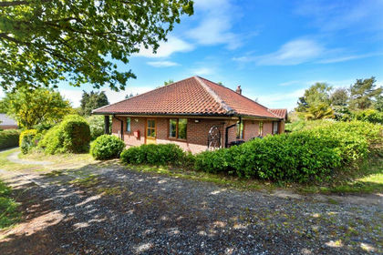
- Price
- Guide Price£575,000
- Size
- 1.25 acres
Thorpe Market Road, Roughton, Norwich, Roughton, Norfolk NR11 England
Added on 10/07/2026House with Land
- Price
- Guide Price£425,000
Exquisite Barn Conversion With Stylish Interiors, Northrepps, Norfolk NR27 England
Added on 08/08/2026Barn Conversion
- Price
- Guide Price£365,000
Added on 15/07/2026Barn Conversion
- Price
- Guide Price£500,000
Added on 26/02/2026Barn Conversion
- Price
- Offers Over£475,000
Added on 29/01/2026Barn Conversion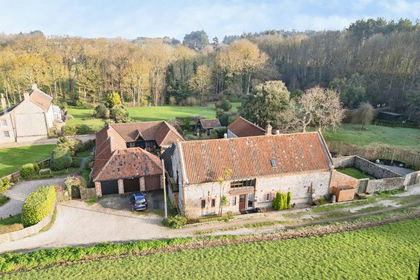
- Price
- Offers Over£375,000
Main Road, Sidestrand, Cromer, Sidestrand, Norfolk NR27 England
Added on 06/03/2026Barn Conversion
- Price
- Offers Over£525,000
- Size
- 1.1 acres
Added on 24/06/2026House with Land