Yeoford, Crediton, EX17
- Land size
- 3.1 acres
- Bedrooms
- 3
- Bathrooms
- 1
Key Features
- Stunning detached country house
- 3 bedrooms plus study
- Beautiful gardens and land to 3.1 acres
- Plenty of character throughout
- Modernised kitchen
- Utility and boot room
- Large storage barn and parking
- Fully rethatched in January 2025
- Large living/dining room with 2 wood-burners
- Gardens, meadow, woodland & pond
Description
The character and charm of this beautiful Grade II* listed house dates back hundreds of years, clearly demonstrated by the unique staircase, the cross passage hall with its original wooden screen walls and small, interesting windows whilst benefiting from a newly rethatched roof (January 2025). As well as the history, the house enjoys an open aspect to the front and is surprisingly light for a property of this type as the front of the house faces south. The principal rooms all over-look the garden and surrounding countryside. Although there are some low doorways and the odd low beam to navigate, the ceiling heights overall are of average height. There is oil fired central heating as well as wood burning stoves and the kitchen is large and recently refitted to give a light, modern twist. The living/dining room is fantastic with it’s beams and large fireplace. To the rear on the ground floor is a utility room and very useful boot room (an essential part of a country house!) plus a study and WC. On the first floor are 3 double bedrooms, all facing south overlooking the lovely front garden plus a spacious family bathroom.
Outside, the gardens lie predominantly to the south with an additional area to one side. The house sits on a plot of approx. 0.4 acres so there’s a real feeling of space. To the side garden is a useful barn providing workshop/storage space. The gardens have plenty of room to grow vegetables or to simply sit and enjoy plus there’s several seating areas from which to take in the views. Across the quiet country lane is ample off-road parking for numerous vehicles and an open fronted covered area plus a modern agricultural building split into 3 bays, each with a large door and interconnecting doors. This is suitable for storage of equipment or keeping animals (or both). The remainder of the land (approx. 2.7 acres) slopes to the stream at the bottom. There is a grassland/paddock which has been managed as a wildflower meadow that could of course be used for a number of things. There is an area of woodland that runs down to the stream on the boundary – please see land plan.
Please see the floorplan for room sizes.
Current Council Tax: Band E - Mid Devon
Utilities: Mains electric, water, telephone & broadband
Broadband within this postcode: Superfast Enabled
Drainage: Private drainage
Heating: Oil fired central heating
Listed: Yes – Grade II*
Tenure: Freehold
Please note that a compliance check fee of £25 (inc. VAT) per person is payable once your offer is accepted. This non-refundable fee covers essential ID verification and anti-money laundering checks, as required by law.
YEOFORD is a popular village with a lovely community feel, in a gentle valley, 4 miles from the market town of Crediton and linked to Exeter via the Tarka-Trainline or with access to the A30 via Cheriton Bishop. Yeoford is a busy place with yearly festivals, including “Yeofest” – described by some at the “best little beer festival in Mid Devon”. In addition, and for those that prefer apples there is “Yeocider”. The modern community hall hosts yoga, life drawing and crafting classes and the newly refurbished pub “The Duck” which serves great food is also home to the community shop. The village is a great place for families with its own Primary School, a recently renewed playground and football field, the church which runs coffee mornings and a “Messy Church” plus a nursery called Sweetpea’s, which is currently rated “outstanding across all areas”. There are lots of great countryside walks too.
DIRECTIONS
For sat-nav use EX17 5HB and the What3Words address is ///carefully.riding.repeat
but if you want the traditional directions, please read on.
From Crediton High Street head towards The Green and bear left at the traffic lights into Landscore. Continue down over Westwood Hill and onto the village of Yeoford. Go through the village, over the railway bridge and bear left up the hill. After approx. 1 mile, turn right at Woodland Cross as signed to Hittisleigh. Go down the hill and as you rise up the other side, the property will be on your right (park by the barn on the left).
Garden
Approximately 3.1 acres
Map Location
Property details
- Tenure
- Freehold
- Council Tax Band
- E
- Date Posted
- 2026-07-20
Market Value Analysis
Compared with 1,622 Homes with Land listings in South West England (1+ acres).
Utilities & Restrictions
Utilities
- Electricity
- Ask Agent
- Water
- Ask Agent
- Heating
- Oil Heating
- Broadband
- Ask Agent
- Sewerage
- Septic Tank / Private
Rights & Restrictions
- Public Rights of Way
- Ask Agent
- Private Rights of Way
- Ask Agent
- Listed Property
- Yes
- Restrictions
- Ask Agent
Listed status, conservation areas and planning constraints for this location are in the full report.
Property Features
- Accessibility
- Ask Agent
- Parking
- Parking Available
- Garden
- Private Garden
Beyond the particulars: planning activity, flood history, heritage and ground risks, checked for this exact spot.
Connectivity
Broadband
Fastest speed available at this postcode
56 Mbps
Superfast
Suitable for
- HD streaming
- Video calls
- Web & social
Fixed wireless access may also be an option here.
Mobile signal
Predicted 4G and 5G signal; indoor signal depends on building materials.
Ofcom Connected Nations postcode-level predictions. Speeds and signal are modelled, not measured, and vary between addresses and providers.
Signal is the easy part. Planning activity, flood history and protected designations here are in the full report.
Nearest Schools
Primary
- Yeoford Community Primary School1 mileNo Ofsted rating
- Ages
- 4 to 11
- Pupils
- 56
- Type
- Academy converter
- Cheriton Bishop Community Primary School2.2 milesOfsted report card · Feb 2026
- Ages
- 2 to 11
- Pupils
- 115
- Type
- Academy converter
- Tedburn St Mary School3.2 milesOfsted: Good
- Ages
- 4 to 11
- Pupils
- 86
- Type
- Academy converter
- Landscore Primary School3.6 milesOfsted: Good
- Ages
- 4 to 11
- Pupils
- 276
- Type
- Community school
- Copplestone Primary School3.6 milesOfsted: Good
- Ages
- 4 to 11
- Pupils
- 138
- Type
- Foundation school
Secondary
- Queen Elizabeth's3.9 milesOfsted report card · May 2026
- Ages
- 11 to 18
- Pupils
- 1,096
- Type
- Academy converter
- Thomas Hall School8.6 milesOfsted: Requires improvement
- Ages
- 4 to 16
- Pupils
- 438
- Type
- Free schools
- West Exe School9.5 milesOfsted report card · Jun 2026
- Ages
- 11 to 16
- Pupils
- 1,237
- Type
- Academy sponsor led
- Matford Brook Academy11 milesNo Ofsted rating
- Ages
- 2 to 16
- Pupils
- 276
- Type
- Free schools
- Isca Academy11 milesNo Ofsted rating
- Ages
- 11 to 16
- Pupils
- 860
- Type
- Academy sponsor led
Distances are straight-line from the advertised location. Source: the national school registers (DfE, Welsh Government, Scottish Government) and Ofsted.
Schools are just the start: sold prices nearby, planning activity and any flood history are in the full report.
Amenities
Supermarket
GP surgery
Pharmacy
Hospital
Straight-line distances from the advertised location. Sources: NHS records, Geolytix supermarket locations, OS Open Greenspace and the national trails registers.
The area stacks up? Now check the location itself: planning nearby, protected designations and past flooding.
Getting Around
Nearest station
Nearest bus stop
Typical drive times
Straight-line distances from the advertised location; drive times are typical free-flow times over OpenStreetMap road data, so allow more at peak. Public transport locations from DfT NaPTAN.
Easy to reach matters. So do planning activity, flood history and ground risks: all in the full report.
Flood Risk
Environment Agency open data, checked around the advertised map pin for the listed acreage. Long-term risk counts flood defences; the planning map's flood zones do not. Provided by LandSale, not the listing agent, and not part of the agent's particulars. Risk varies across a holding, so verify before committing.
Rivers and the sea
Planning map: Flood Zone 1.
Surface water
These bandings are the summary. Where this location sits on the flood maps, plus planning activity, heritage and ground risks, is in the full report.
Important notice: Information, maps and tags on this page are drawn from the advertising agent's marketing materials or generated automatically. LandSale has not verified them. Relying on these details is at your own risk, always carry out independent checks before committing to a purchase.
LandSale full disclaimer
Marketing information only - not formal particulars. The details on this website are provided for general guidance and do not constitute an offer or contract. Neither LandSale nor the advertising estate/land agent accepts responsibility for any inaccuracy.
1. Source of information
- Listing content: Core description, asking price, tenure, measurements, photographs and planning history originate from the marketing materials of the advertising estate or land agent. LandSale does not author this content and cannot guarantee its accuracy.
- Automated tags & categorisation: Property type, land-use class, acreage bands and similar labels may be applied by machine-learning models. They are intended as a helpful guide only and may not reflect the property's legal status or permitted use.
- Third-party & enriched data layers: Maps, boundary outlines, planning designations, soil reports, broadband coverage and other environmental or location-based insights are licensed from external suppliers. Such data are supplied “as is", may be incomplete or out of date and are subject to change without notice.
2. Verification required
Prospective purchasers must verify critical matters, including but not limited to planning permission, title boundaries, public rights of way, environmental constraints, acreage, services, access and VAT status, through their own inspections, specialist surveys, legal advisers and the selling agent before relying on the information or entering into any contract.
3. No warranty or liability
LandSale gives no warranty, express or implied, as to the accuracy, completeness or fitness for any particular purpose of the information displayed. LandSale shall not be liable for any loss, damage, cost or expense arising directly or indirectly from any use of or reliance on such information, save where liability may not be excluded by law.
4. Updates & feedback
If you believe any detail on this listing is inaccurate, please let us know. We will investigate and, where appropriate, update the listing or notify the agent.
© LandSale | Version 1.3 - August 2026
Listing agent
Helmores, Crediton
111-112 High Street, Crediton, Devon, EX17 3LF
Similar properties for sale
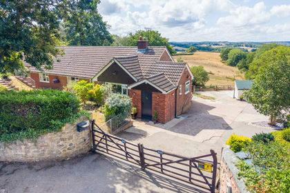
- Price
- Guide Price£675,000
- Size
- 1.25 acres
Posbury, Crediton, EX17, Crediton Hamlets, Devon EX17 England
Added on 28/08/2026House with Land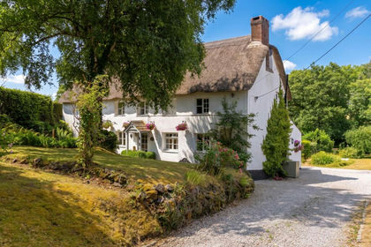
- Price
- Guide Price£675,000
- Size
- 1 acres
Cheriton Bishop, Exeter, EX6, Cheriton Bishop, Devon EX6 England
Added on 24/07/2026Cottage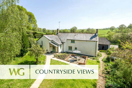
- Price
- Guide Price£670,000
- Size
- 9.5 acres
Tedburn St. Mary, Exeter, Tedburn St. Mary, Devon EX6 England
Added on 28/07/2026House with Land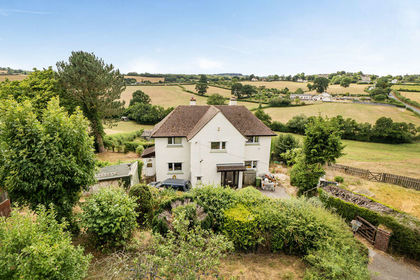
- Price
- £750,000
- Size
- 3.5 acres
Tedburn St. Mary, Exeter, Tedburn St. Mary, Devon EX6 England
Added on 29/07/2026House with Land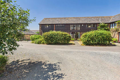
- Price
- Guide Price£550,000
- Size
- 1.08 acres
Copplestone, Crediton, Devon, EX17, Copplestone, Devon EX17 England
Added on 12/03/2026Barn Conversion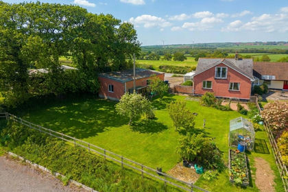
- Price
- Guide Price£495,000
- Size
- 2 acres
Added on 11/05/2026House with Land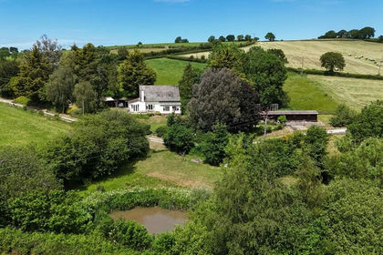
- Price
- £785,000
- Size
- 6 acres
Added on 15/05/2026House with Land
- Price
- Guide Price£750,000
- Size
- 2 acres
Added on 11/03/2026Farmhouse
- Price
- Offers in Excess of£800,000
- Size
- 1.6 acres
Morchard Bishop, Crediton, Devon, EX17, Morchard Bishop, Devon EX17 England
Added on 01/05/2026House with Land
- Price
- £699,950
- Size
- 3.5 acres
Hollydown, Venton, Drewsteignton, Drewsteignton, Devon EX6 England
Added on 06/05/2026House with Land