Manor Road, South Wingfield, Alfreton, DE55
- Land size
- 1.87 acres
- Bedrooms
- 4
- Bathrooms
- 2
Key Features
- An exceptional 4 bedroom detached lifestyle property with endless potential
- Approximately 1.87 acres of gardens and paddock
- Breathtaking countryside views and spectacular sunsets
- 1,603 sqft of accommodation
- Triple stone-built garage with additional outbuildings
- Peaceful village setting in sought-after South Wingfield
- Long private driveway with extensive off-road parking
- Excellent access to Derby, Nottingham, Matlock and Chesterfield
- A truly unique home presenting a once-in-a-lifetime opportunity to personalise, within this stunning setting
- EPC rating - D. Council tax band - F. Tenure - Freehold
Description
£650,000 (Offers over) Some homes are bought for what they are. Others are bought for what they could become. Set within approximately 1.87 acres of beautifully established grounds in the sought-after village of South Wingfield, this attractive stone-built bungalow is firmly the latter. Offering four bedrooms, a generous driveway, a detached triple garage and breath-taking countryside views, it presents a rare opportunity to create a remarkable family home, tailored entirely to your own vision, in one of Derbyshire's most idyllic village settings.
Offering 1,603 sq ft of well-balanced accommodation, the home provides the perfect foundations for transformation. Four generous bedrooms are complemented by a spacious dining kitchen overlooking the gardens, a separate formal dining room, a welcoming family lounge and two bathrooms, including an en-suite to the principal bedroom. The layout lends itself beautifully to modernisation, creating an exciting opportunity to craft a home that is entirely your own.
The Grounds - Occupying approximately 1.87 acres, the grounds are every bit as impressive as the home itself. Approached via a long private driveway with extensive parking, the property unfolds into beautifully established gardens extending to approximately 0.62 acres, where expansive lawns, mature planting and a wonderful sense of privacy create an idyllic setting. Beyond the garden, a gateway leads into a further 1.25-acre paddock, offering endless possibilities for equestrian use, recreation or simply enjoying the space. Elevated just enough to capture breathtaking far-reaching views towards the Peak District, the west-facing gardens provide a spectacular backdrop to everyday life, where long summer evenings and unforgettable sunsets become part of the home's charm.
Outbuildings - Complementing the home is an exceptional range of outbuildings, adding both versatility and practicality. A substantial stone-built triple garage is accompanied by an adjoining timber lean-to garage, providing excellent storage, workshop space or secure parking. Beyond, a traditional timber barn and adjoining open-fronted hay barn offer further flexibility, perfectly suited to equestrian use, hobbies, machinery storage or those seeking space to pursue a rural lifestyle.
Why South Wingfield? - South Wingfield is one of those villages that quietly captures everything people love about Derbyshire. Surrounded by rolling countryside and steeped in history, it offers a wonderfully peaceful setting without ever feeling isolated. The village is home to a welcoming community, a popular village pub, local primary school and everyday amenities, while neighbouring Crich, Oakerthorpe and Alfreton provide a wider selection of independent cafés, shops, restaurants and supermarkets. For commuters, the location is exceptionally well connected, with easy access to the A38 and M1, placing Derby, Nottingham, Chesterfield and Matlock all within comfortable reach. Whether it's a morning walk across open countryside, weekends exploring the Peak District or a straightforward journey into the city, South Wingfield offers a lifestyle that effortlessly balances rural tranquillity with modern convenience.
Dales & Peaks Forwardmove Please Read - Dales & Peaks is marketing this Property with the benefit of ForwardMove. Dales & Peaks has introduced ForwardMove to help speed up the sales process, minimise sale fall-throughs and give more certainty to both the Seller and the Buyer.
Purchasers will benefit from the Buyer Information Pack (BIP), which we have created with our legal partners, to give buyers more information before they agree to purchase.
The pack includes:
Fixtures and contents form (TA10)
Official Copy of the Register (OC1)
Title Plan (OC2)
Local Search*
Water and Drainage Search*
Coal and Mining Search*
Homescreen / Environmental Search*
(Dales & Peaks has ordered the local, drainage, coal and homescreen / environmental searches; we will add these to the BIP as they become available)
ForwardMove allows the sale process to be completed significantly quicker than a ‘normal sale’. This is because the legal work, usually done in the first four to eight weeks after the sale is agreed, has already been completed. The searches, which can take up to five weeks, are ordered on the day the listing goes live and are transferable to the successful Buyer as part of their legal due diligence.
Additionally, and on behalf of the Seller, Dales & Peaks requests that the successful Buyer enters into a Reservation Agreement and pays the Reservation Agreement Fee of £595 (including VAT). This includes payment for the Buyer Information Pack and all the searches (which a buyer typically purchases separately after the sale is agreed).
Upon receipt of the signed Reservation Agreement, payment of the Reservation Agreement Fee, completion of ID and AML checks and the issuing of the Memorandum of Sale, the Seller will agree to take the Property off the market and market it as Sold Subject To Contract (SSTC).
During the Reservation Agreement period, the Seller will reject all offers and not enter into another agreement with any other buyer. The reservation period is agreed upon at the time of sale but is usually between 60 and 120 days.
The Reservation Fee is non-refundable except where the Seller withdraws from the sale. A copy of the Reservation Agreement is available on request, and Dales & Peaks advises potential buyers to seek legal advice before entering into the Reservation Agreement.
If you have any questions about the process or want to know how selling or buying with Dales & Peaks ForwardMove could benefit you, please speak to a member of the Dales & Peaks team.
Map Location
Property details
- Tenure
- Freehold
- Council Tax Band
- F
- Date Posted
- 2026-07-10
Market Value Analysis
Compared with 708 Homes with Land listings in East Midlands (1+ acres).
Energy Performance Certificate
Energy Efficiency Rating
Based on UK Energy Performance Certificate standards (EU Directive 2002/91/EC)
Running costs are one side. Planning activity, flood history and ground risks for this location are in the full report.
Utilities & Restrictions
Utilities
- Electricity
- Mains
- Water
- Mains
- Heating
- Gas Central Heating
- Broadband
- No Internet Connection
- Sewerage
- Mains
Rights & Restrictions
- Public Rights of Way
- Ask Agent
- Private Rights of Way
- Ask Agent
- Listed Property
- Ask Agent
- Restrictions
- Yes
Listed status, conservation areas and planning constraints for this location are in the full report.
Property Features
- Accessibility
- Ask Agent
- Parking
- Garage, Driveway
- Garden
- Garden
Beyond the particulars: planning activity, flood history, heritage and ground risks, checked for this exact spot.
Connectivity
Broadband
Fastest speed available at this postcode
63 Mbps
Superfast
Suitable for
- HD streaming
- Video calls
- Web & social
Mobile signal
Predicted 4G and 5G signal; indoor signal depends on building materials.
Ofcom Connected Nations postcode-level predictions. Speeds and signal are modelled, not measured, and vary between addresses and providers.
Signal is the easy part. Planning activity, flood history and protected designations here are in the full report.
Nearest Schools
Primary
- South Wingfield Primary School435 metresOfsted report card · Mar 2026
- Ages
- 5 to 11
- Pupils
- 133
- Type
- Community school
- Wessington Primary School1.6 milesNo Ofsted rating
- Ages
- 3 to 11
- Pupils
- 96
- Type
- Community school
- Crich Junior School1.6 milesOfsted: Good *
- Ages
- 7 to 11
- Pupils
- 87
- Type
- Community school
- Crich Church of England Infant School1.6 milesOfsted: Good
- Ages
- 4 to 7
- Pupils
- 43
- Type
- Voluntary controlled school
- Faith
- Church of England
- Fritchley CofE (Aided) Primary & Nursery School1.9 milesNo Ofsted rating
- Ages
- 3 to 11
- Pupils
- 108
- Type
- Voluntary aided school
- Faith
- Church of England
Secondary
- Swanwick Hall School2.3 milesOfsted: Good
- Ages
- 11 to 18
- Pupils
- 1,025
- Type
- Academy converter
- David Nieper Academy2.4 milesOfsted: Good
- Ages
- 11 to 18
- Pupils
- 810
- Type
- Academy sponsor led
- The Ripley Academy3.9 milesOfsted: Good
- Ages
- 11 to 18
- Pupils
- 920
- Type
- Academy converter
- Frederick Gent School4.6 milesOfsted report card · Nov 2025
- Ages
- 11 to 16
- Pupils
- 801
- Type
- Academy sponsor led
- Belper School and Sixth Form Centre4.7 milesOfsted: Good *
- Ages
- 11 to 18
- Pupils
- 1,212
- Type
- Foundation school
* Latest graded judgement covers quality of education only; no overall grade was issued under the 2024-25 inspection framework.
Distances are straight-line from the advertised location. Source: the national school registers (DfE, Welsh Government, Scottish Government) and Ofsted.
Schools are just the start: sold prices nearby, planning activity and any flood history are in the full report.
Amenities
Supermarket
GP surgery
Pharmacy
Hospital
Green space
Straight-line distances from the advertised location. Sources: NHS records, Geolytix supermarket locations, OS Open Greenspace and the national trails registers.
The area stacks up? Now check the location itself: planning nearby, protected designations and past flooding.
Getting Around
Nearest station
Nearest bus stop
Typical drive times
Straight-line distances from the advertised location; drive times are typical free-flow times over OpenStreetMap road data, so allow more at peak. Public transport locations from DfT NaPTAN.
Easy to reach matters. So do planning activity, flood history and ground risks: all in the full report.
Flood Risk
Environment Agency open data, checked around the advertised map pin for the listed acreage. Long-term risk counts flood defences; the planning map's flood zones do not. Provided by LandSale, not the listing agent, and not part of the agent's particulars. Risk varies across a holding, so verify before committing.
Rivers and the sea
Planning map: Flood Zone 1.
Surface water
These bandings are the summary. Where this location sits on the flood maps, plus planning activity, heritage and ground risks, is in the full report.
Important notice: Information, maps and tags on this page are drawn from the advertising agent's marketing materials or generated automatically. LandSale has not verified them. Relying on these details is at your own risk, always carry out independent checks before committing to a purchase.
LandSale full disclaimer
Marketing information only - not formal particulars. The details on this website are provided for general guidance and do not constitute an offer or contract. Neither LandSale nor the advertising estate/land agent accepts responsibility for any inaccuracy.
1. Source of information
- Listing content: Core description, asking price, tenure, measurements, photographs and planning history originate from the marketing materials of the advertising estate or land agent. LandSale does not author this content and cannot guarantee its accuracy.
- Automated tags & categorisation: Property type, land-use class, acreage bands and similar labels may be applied by machine-learning models. They are intended as a helpful guide only and may not reflect the property's legal status or permitted use.
- Third-party & enriched data layers: Maps, boundary outlines, planning designations, soil reports, broadband coverage and other environmental or location-based insights are licensed from external suppliers. Such data are supplied “as is", may be incomplete or out of date and are subject to change without notice.
2. Verification required
Prospective purchasers must verify critical matters, including but not limited to planning permission, title boundaries, public rights of way, environmental constraints, acreage, services, access and VAT status, through their own inspections, specialist surveys, legal advisers and the selling agent before relying on the information or entering into any contract.
3. No warranty or liability
LandSale gives no warranty, express or implied, as to the accuracy, completeness or fitness for any particular purpose of the information displayed. LandSale shall not be liable for any loss, damage, cost or expense arising directly or indirectly from any use of or reliance on such information, save where liability may not be excluded by law.
4. Updates & feedback
If you believe any detail on this listing is inaccurate, please let us know. We will investigate and, where appropriate, update the listing or notify the agent.
© LandSale | Version 1.3 - August 2026
Similar properties for sale
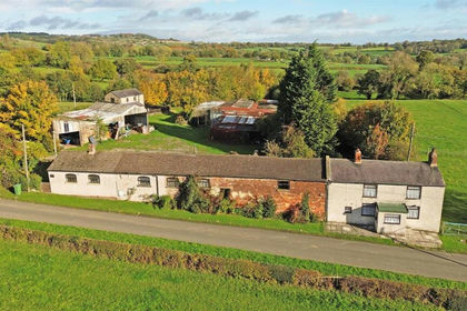
- Price
- Guide Price£680,000
- Size
- 11.9 acres
Added on 20/07/2026House with Land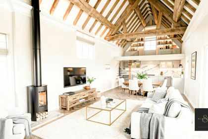
- Price
- £725,000
- Size
- 1.6 acres
Dethick, Matlock, Dethick, Lea and Holloway, Derbyshire DE4 England
Added on 25/04/2026Barn Conversion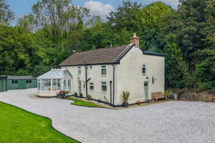
- Price
- Guide Price£700,000
- Size
- 1.16 acres
Temperance Hill, Woolley Moor, Stretton, Derbyshire DE55 England
Added on 15/09/2026Cottage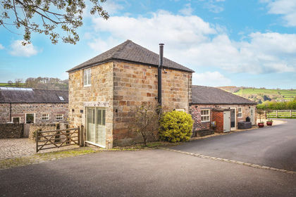
- Price
- £575,000
Added on 16/05/2026Barn Conversion
- Price
- Offers Over£750,000
- Size
- 1.4 acres
Handley House, Handley Lane, Handley, Derbyshire, S45, Stretton, Derbyshire S45 England
Added on 29/01/2026House with Land
- Price
- £795,000
- Size
- 0.5 acres
Heritage Farm, Straw Lane, Stretton, Derbyshire, DE55, Stretton, Derbyshire DE55 England
Added on 23/07/2026Barn Conversion
- Price
- Guide Price£550,000
- Size
- 5.5 acres
Mill Meadow Farm, Pye Bridge, Somercotes, Derbyshire DE55 England
Added on 10/08/2026House with Land
- Price
- Offers Over£750,000
- Size
- 1.5 acres
Shottle, Belper, Derbyshire, Ashleyhay, Derbyshire DE56 England
Added on 28/04/2026Cottage Added on 29/01/2026Barn Conversion
- Price
- £575,000
- Size
- 1.09 acres
Derby Road, Matlock Bath, Matlock, Matlock Bath, Derbyshire DE4 England
Added on 25/09/2026House with Land