Claypits Hall, Foxearth, Essex
- Land size
- 2.3 acres
- Bedrooms
- 5
- Bathrooms
- 5
Description
This distinguished five-bedroom home sits in over two acres of land in Foxearth, a pretty village near the Essex/Suffolk border. Grade II listed, over 3,600 sq ft of space extends over three storeys, including a versatile series of living spaces and a bright kitchen with folding doors onto the garden. There are several useful outbuildings, including a large barn rendered in a striking ochre finish. A paved terrace is apt for outdoor dining, while a pontoon on the duck pond is an excellent spot for reclining. The market town of Sudbury is a short drive away; its rail station provides regular connections to London.
Setting the Scene
Foxearth is a small village with a long agricultural history. The area became notable for its art in the 18th century; Sudbury is the birthplace of Thomas Gainsborough, whose landscapes offered inspiration to John Constable, another Suffolk painter of the surrounding Stour Valley area.
This fine timber-framed house, once a farm, dates from the 17th century. Period features have been carefully retained, including leaded windows, inglenook fireplaces and an 18th-century corner cupboard.
The Grand Tour
A tree-lined private lane shared with one neighbour leads up to the house. The main entrance is to the side, underneath a red-tiled porch. Entry is to a large boot room with flagstone flooring and exposed timber beams. The house can also be entered at the front; here, an original plank and muntin door opens onto a vast dining room; at one end, an inglenook fireplace has a timber mantel.
It leads to a bright sitting room, an original leaded window framing views of the field beyond. There is fitted alcove shelving, and a fireplace with carved stone mantelpiece is perfect for hunkering down on cooler evenings.
A Shaker-style kitchen sits to the rear. Folding doors extend across its length, opening onto the garden and outdoor dining terrace. Smart cabinetry is topped with granite work surfaces, and appliances include a black-painted Aga, a Miele oven and a Bosch induction hob. It has underfloor heating, and a separate pantry provides additional storage space.
There is also a second sitting room, currently used a study. It has an original oak ledged door, an inglenook fireplace and a corner cupboard dating from the 18th century.
The principal bedroom lies on the first floor, tucked away at the end of a long landing. Its walls and ceiling are criss-crossed by timber beams, and a pretty casement window frames treetop views. There are two further double bedrooms on this floor, each with far-reaching views of the surrounding countryside, as well as two large shared bathrooms. One has a large bathtub framed by casement windows, as well as a walk-in shower and a dressing room, while the other has a shower.
The second floor is home to an expansive sitting area, two large double bedrooms - one with bath and basin - and a large bathroom; here, a bathtub is perfectly positioned below a casement window with bucolic views.
A large barn rendered in a warm ochre hue is currently used for entertaining, along with providing substantial storage space, and would also be suitable as an annexe (with the correct planning permissions). There are also several additional barns and sheds, currently used as a tool shed, a workshop and a temperature-controlled wine store.
The Great Outdoors
The house sits in around 2.3 acres of glorious gardens, peppered with ancient oak trees and a variety of flora and fauna. A paved dining terrace is framed by a trellis intertwined with hessian roses; it overlooks a duck pond with a decked pontoon.
There is a wildflower garden and an orchard, as well as a gravelled area with parking for at least eight cars. The house is surrounded by open farmland, affording spectacular views across the landscape.
Out and About
Foxearth is a small rural village close to the River Stour. It has a church and a thriving community; the village hall runs popular pub nights every fortnight.
The nearby town of Sudbury offers excellent amenities, including a twice-weekly market and a Waitrose. Local favourites include Cradle, an independent plant-based bakery and restaurant, and The Mill Hotel for drinks and dinner beside the river. The village of Long Melford is a short drive away, with its excellent antique shops, pubs and restaurants, including The Swan, The Black Lion and Nethergate Brewery. Bury St Edmunds is around a 30-minute drive away. Along with an array of delicious place to dine, including the Michelin starred Pea Porridge, it has a thriving theatre scene at both The Theatre Royal and The Arc, together with an Everyman cinema and the very popular independent Abbeygate. Further and more extensive amenities, restaurants and shops are found in Colchester, approximately a 40-minute drive away.
Long Melford and Lavenham, both within 20 minutes of the house, have stunning Tudor houses, pubs, and, in Long Melford’s case, two excellent stately homes – Melford Hall and Kentwell Hall. Closer to home, several idyllic walking and cycling routes are available directly from the house, and there is also a wild swimming spot close by.
This part of the country inspired many artists and writers, including Thomas Gainsborough, who spent his early life sketching in its woods and fields surrounding. His house can be visited in Sudbury, and has a large collection of his oil paintings.
Schooling options in the area include Old Buckenham Hall prep school, Thomas Gainsborough in Sudbury and Stour Valley Community School in nearby Clare.
Sudbury rail station is a 13-minute drive from the house. Connections can be made to London Liverpool Street via Marks Tey, with a total journey time of around an hour and 15 minutes.
Council Tax Band: G
Map Location
Property details
- Tenure
- Freehold
- Council Tax Band
- G
- Date Posted
- 2026-07-09
Market Value Analysis
Compared with 1,144 Homes with Land listings in East Anglia (1+ acres).
Energy Performance Certificate
Energy Efficiency Rating
Based on UK Energy Performance Certificate standards (EU Directive 2002/91/EC)
Running costs are one side. Planning activity, flood history and ground risks for this location are in the full report.
Utilities & Restrictions
Utilities
- Electricity
- Mains
- Water
- Private Supply
- Heating
- Oil Heating
- Broadband
- Ask Agent
- Sewerage
- Septic Tank / Private
Rights & Restrictions
- Public Rights of Way
- Ask Agent
- Private Rights of Way
- Yes
- Listed Property
- Yes
- Restrictions
- Yes
Listed status, conservation areas and planning constraints for this location are in the full report.
Property Features
- Accessibility
- Ask Agent
- Parking
- Garage
- Garden
- Garden
Beyond the particulars: planning activity, flood history, heritage and ground risks, checked for this exact spot.
Connectivity
Broadband
Fastest speed available at this postcode
1.8 Gbps
Gigabit full fibre
Suitable for
- 4K streaming on every screen
- Full-time home working
- Online gaming & big downloads
Fixed wireless access may also be an option here.
Mobile signal
Predicted 4G and 5G signal; indoor signal depends on building materials.
Ofcom Connected Nations postcode-level predictions. Speeds and signal are modelled, not measured, and vary between addresses and providers.
Signal is the easy part. Planning activity, flood history and protected designations here are in the full report.
Nearest Schools
Primary
- Long Melford Church of England Primary School2.1 milesNo Ofsted rating
- Ages
- 3 to 11
- Pupils
- 207
- Type
- Academy sponsor led
- Faith
- Church of England
- Cavendish Church of England Primary School2.5 milesOfsted: Inadequate
- Ages
- 4 to 11
- Pupils
- 52
- Type
- Academy sponsor led
- Faith
- Church of England
- St Joseph's Roman Catholic Primary School2.7 milesNo Ofsted rating
- Ages
- 4 to 11
- Pupils
- 137
- Type
- Voluntary aided school
- Faith
- Roman Catholic
- Glemsford Primary Academy2.7 milesNo Ofsted rating
- Ages
- 2 to 11
- Pupils
- 243
- Type
- Academy sponsor led
- Woodhall Primary School2.7 milesOfsted: Good
- Ages
- 3 to 11
- Pupils
- 448
- Type
- Academy sponsor led
Secondary
- Ormiston Sudbury Academy2.8 milesOfsted report card · Feb 2026
- Ages
- 11 to 19
- Pupils
- 710
- Type
- Academy sponsor led
- Stour Valley Community School3.8 milesOfsted: Good
- Ages
- 11 to 16
- Pupils
- 569
- Type
- Free schools
- Thomas Gainsborough School4.3 milesOfsted: Good *
- Ages
- 11 to 18
- Pupils
- 1,603
- Type
- Academy converter
- Hedingham School and Sixth Form6.5 milesNo Ofsted rating
- Ages
- 11 to 18
- Pupils
- 1,177
- Type
- Academy converter
- The Ramsey Academy, Halstead8.1 milesOfsted: Good *
- Ages
- 11 to 16
- Pupils
- 702
- Type
- Academy sponsor led
* Latest graded judgement covers quality of education only; no overall grade was issued under the 2024-25 inspection framework.
Distances are straight-line from the advertised location. Source: the national school registers (DfE, Welsh Government, Scottish Government) and Ofsted.
Schools are just the start: sold prices nearby, planning activity and any flood history are in the full report.
Amenities
Supermarket
GP surgery
Pharmacy
Hospital
Green space
Straight-line distances from the advertised location. Sources: NHS records, Geolytix supermarket locations, OS Open Greenspace and the national trails registers.
The area stacks up? Now check the location itself: planning nearby, protected designations and past flooding.
Getting Around
Nearest station
Nearest bus stop
Typical drive times
Straight-line distances from the advertised location; drive times are typical free-flow times over OpenStreetMap road data, so allow more at peak. Public transport locations from DfT NaPTAN.
Easy to reach matters. So do planning activity, flood history and ground risks: all in the full report.
Flood Risk
Environment Agency open data, checked around the advertised map pin for the listed acreage. Long-term risk counts flood defences; the planning map's flood zones do not. Provided by LandSale, not the listing agent, and not part of the agent's particulars. Risk varies across a holding, so verify before committing.
Rivers and the sea
Planning map: Flood Zone 1.
Surface water
Not at the pin: mapped about 20 metres away.
These bandings are the summary. Where this location sits on the flood maps, plus planning activity, heritage and ground risks, is in the full report.
Important notice: Information, maps and tags on this page are drawn from the advertising agent's marketing materials or generated automatically. LandSale has not verified them. Relying on these details is at your own risk, always carry out independent checks before committing to a purchase.
LandSale full disclaimer
Marketing information only - not formal particulars. The details on this website are provided for general guidance and do not constitute an offer or contract. Neither LandSale nor the advertising estate/land agent accepts responsibility for any inaccuracy.
1. Source of information
- Listing content: Core description, asking price, tenure, measurements, photographs and planning history originate from the marketing materials of the advertising estate or land agent. LandSale does not author this content and cannot guarantee its accuracy.
- Automated tags & categorisation: Property type, land-use class, acreage bands and similar labels may be applied by machine-learning models. They are intended as a helpful guide only and may not reflect the property's legal status or permitted use.
- Third-party & enriched data layers: Maps, boundary outlines, planning designations, soil reports, broadband coverage and other environmental or location-based insights are licensed from external suppliers. Such data are supplied “as is", may be incomplete or out of date and are subject to change without notice.
2. Verification required
Prospective purchasers must verify critical matters, including but not limited to planning permission, title boundaries, public rights of way, environmental constraints, acreage, services, access and VAT status, through their own inspections, specialist surveys, legal advisers and the selling agent before relying on the information or entering into any contract.
3. No warranty or liability
LandSale gives no warranty, express or implied, as to the accuracy, completeness or fitness for any particular purpose of the information displayed. LandSale shall not be liable for any loss, damage, cost or expense arising directly or indirectly from any use of or reliance on such information, save where liability may not be excluded by law.
4. Updates & feedback
If you believe any detail on this listing is inaccurate, please let us know. We will investigate and, where appropriate, update the listing or notify the agent.
© LandSale | Version 1.3 - August 2026
Listing agent
Inigo, London
St Alphege Hall Kings Bench Street, London, SE1 0QX
Similar properties for sale
- Price
- Guide Price£1,200,000
- Size
- 2 acres
Added on 22/06/2026Country Home
- Price
- Guide Price£995,000
- Size
- 1.66 acres
Belchamp Walter Road, Borley, Sudbury, Suffolk, CO10, Borley, Essex CO10 England
Added on 11/06/2026House with Land
- Price
- Guide Price£1,500,000
- Size
- 1.7 acres
Belchamp Otten, Suffolk/Essex Border, Belchamp Otten, Essex CO10 England
Added on 03/06/2026Country Home
- Price
- Guide Price£1,500,000
- Size
- 1.95 acres
Great Cornard, Sudbury, Suffolk, Great Cornard, Suffolk CO10 England
Added on 05/09/2026Development Land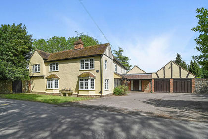
- Price
- Guide Price£1,175,000
- Size
- 5 acres
Gestingthorpe, Halstead, Essex, Gestingthorpe, Essex CO9 England
Added on 29/05/2026House with Land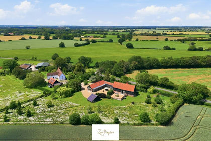
- Price
- Offers in Excess of£1,175,000
- Size
- 1.6 acres
Added on 02/05/2026Barn Conversion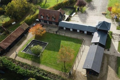
- Price
- £1,350,000
- Size
- 8 acres
The Street, Stoke By Clare, Suffolk, Stoke-by-Clare, Suffolk CO10 England
Added on 22/07/2026Equestrian property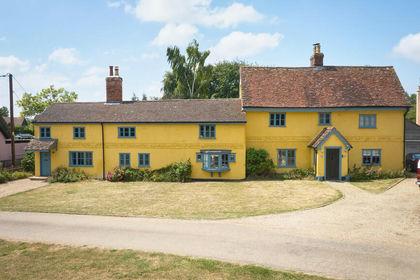
- Price
- Guide Price£1,150,000
- Size
- 1.15 acres
Stoke By Clare, Sudbury, Suffolk, Stoke-by-Clare, Suffolk CO10 England
Added on 01/09/2026House with Land
- Price
- £1,350,000
- Size
- 8 acres
The Street, Stoke By Clare, Stoke-by-Clare, Suffolk CO10 England
Added on 29/01/2026Equestrian property
- Price
- Guide Price£1,400,000
- Size
- 5 acres
Little Waldingfield, Little Waldingfield, Suffolk CO10 England
Added on 09/09/2026House with Land