Rockford Farm, Rockford, Hampshire
- Land size
- 10 acres
- Bedrooms
- 4
- Bathrooms
- 4
Description
This handsome late 18th-century Grade II-listed farmhouse sits surrounded by idyllic grounds of some 10 acres and overlooks Blashford Lakes Nature Reserve. Inside, a wealth of period features remain, including exposed timbers, textured brickwork and broad fireplaces. The principal plan spans some 2,520 sq ft and has four serene bedrooms; additional space is provided by a series of outbuildings, including a converted barn and separately Grade-II listed cart shed. Positioned on the edge of the New Forest National Park, Rockford Farm is within easy distance of a near-endless offering of walks and the sandy shores of the south coast.
Setting the Scene
Rockford Farm in its current form is thought to have been constructed between 1768 and 1772, possibly on the site of an older smallholding. Developed during a period of agricultural growth and innovation in late 18th-century England, the farm was initially focused on arable farming with some grazing. By the late 19th century, under the nearby Somerley Estate, its farming operation had developed into pastoral use, particularly dairy cattle.
The Georgian farmhouse was later extended in the 19th century and was carefully restored in 2024 under the current ownership, bringing together traditional building methods, exceptional craftsmanship and high-quality finishes, including bespoke joinery and hand-plastered lime walls. Some of its outbuildings have been reused or adapted, including a fantastic games barn.
The Grand Tour
Set back from the quiet country road in front, Rockford Farm’s picturesque silhouette peeks through mature tree canopies. Its driveway snakes around the back of the house to a generous parking area with space for several cars. A path cuts through the front garden to the front door, which opens to a porch and the sitting room beyond.
The first of several living spaces, the sitting room is wonderfully atmospheric, with its log-burning stove set within an exposed brick inglenook fireplace. Terracotta tiles run underfoot, and soft white walls provide the perfect backdrop for art and furniture. A door from this room opens to the snug, finished with jute carpeted floors and burgundy detailing around alcove-set shelving. The paints here and throughout are by Little Greene and Print & Paper Library in conjunction with Bauwerk limewash paints to ensure compatibility with the house's fabric.
A door at the rear of the sitting room provides access to the well-equipped boot room, a WC and a charming tiled porch with a door opening to the garden. Another door to one side opens to a central lobby area, which in turn connects to the kitchen.
Finished with a delectably rustic approach, the traditionally styled farmhouse kitchen has fine oak joinery and rustic flagstone floors. A large Brazilian granite-topped island sits centrally, while built-in units provide ample storage space. An electric Aga oven is housed within a large brick-built former fireplace; other appliances include a Bosch fridge and Miele dishwasher.
An opening provides free-flowing passage into the dining room, a generous space with the same flagstone floors and windows on three sides framing idyllic garden views. The room can accommodate a large table and plenty of chairs, making it a sublime space for hosting gatherings and celebrations.
There are four bedrooms upstairs, all spacious with carpets by Crucial Trading, and each with a unique feel created by thoughtfully differentiated decorative schemes. The principal bedroom has a wonderful olive-green ceiling and windows on two sides draw in an abundance of natural light.
Two of the other bedrooms have walls finished in a rich ochre lime plaster. There are also two bathrooms, both with bathtubs and showers: one has a deep green scheme, while the other has a copper bathtub and whimsical wallpaper.
The largest of the home’s several outbuildings, the games barn is a brilliantly renovated space. A strong sense of its period integrity has been preserved while preparing it for flexible contemporary use. It has a wonderful kitchenette/laundry with timber units and a farmhouse sink, along with a bright walk-in wet room adorned with earth-toned tiles.
The Great Outdoors
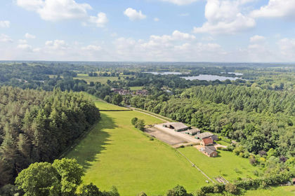
10 acres of private land surround Rockford Farm, creating a true sense of seclusion. Closest to the house is a wonderful dining patio equipped with festoon lighting that allows the space to be enjoyed well into the evening. Idyllic nooks have been designed as places to gather or seek solitude with a good book. Mature trees stud the grounds, casting pockets of shade on the hottest days.
The grounds also encompass divided paddocks, resplendent wildflower meadows and two wildlife-rich ponds. Additional outbuildings include a stable and barn structure, a granary and a large shed for storing equipment and the like.
Out and About
Rockford Farm sits in a quiet yet spectacular location on the fringes of the New Forest National Park. The park itself is known for its picturesque walking and cycling routes, and for the ponies, donkeys, deer, pigs and cattle that roam freely. Blashford Lakes Nature Reserve is moments from the house and is known for its birdwatching, wildlife habitats and scenic walking trails.
A branch of Waitrose, extensive shopping facilities, cafés and restaurants are available in the market town of Ringwood, around two and a half miles away. There are plenty of excellent eateries nearby, including the Alice Lisle pub, High Corner Inn, Limewood Hotel, Chewton Glen and the award-winning THE PIG.
The coast is around half an hour’s drive away. There is a choice of excellent beaches close by, including Hengistbury Head, Mudeford with its colourful beach huts, Bournemouth and Poole Harbour.
There are excellent schools in the area, including Canford School, Bryanston and Walhampton Prep, as well as King Edward School, Bishop Wordsworth's School and Godolphin School.
Direct rail services from Salisbury or Southampton Airport Parkway connect to London Waterloo in under 90 minutes. With easy access to the M27 and M3, London is reachable in around two hours by car. Airports in Southampton and Bournemouth provide regular flights across the UK and to continental Europe.
Council Tax Band: N/A - Business rates currently apply.
Map Location
Property details
- Tenure
- Freehold
- Council Tax Band
- Ask Agent
- Date Posted
- 2026-07-09
Price history
| Date | Change | Price |
|---|---|---|
| 29 Jul 2026 | Reduced 17% (−£450,000) | £2,200,000 |
| Until 29 Jul 2026 | Asking price | £2,650,000 |
Market Value Analysis
Compared with 172 Homes with Land listings in South East England (10+ acres).
Energy Performance Certificate
Energy Efficiency Rating
Based on UK Energy Performance Certificate standards (EU Directive 2002/91/EC)
Running costs are one side. Planning activity, flood history and ground risks for this location are in the full report.
Utilities & Restrictions
Utilities
- Electricity
- Ask Agent
- Water
- Ask Agent
- Heating
- Ask Agent
- Broadband
- Ask Agent
- Sewerage
- Ask Agent
Rights & Restrictions
- Public Rights of Way
- Ask Agent
- Private Rights of Way
- Ask Agent
- Listed Property
- Ask Agent
- Restrictions
- Ask Agent
Listed status, conservation areas and planning constraints for this location are in the full report.
Property Features
- Accessibility
- Ask Agent
- Parking
- Parking Available
- Garden
- Garden
Beyond the particulars: planning activity, flood history, heritage and ground risks, checked for this exact spot.
Connectivity
Broadband
Fastest speed available at this postcode
1.8 Gbps
Gigabit full fibre
Suitable for
- 4K streaming on every screen
- Full-time home working
- Online gaming & big downloads
Mobile signal
Predicted 4G and 5G signal; indoor signal depends on building materials.
Ofcom Connected Nations postcode-level predictions. Speeds and signal are modelled, not measured, and vary between addresses and providers.
Signal is the easy part. Planning activity, flood history and protected designations here are in the full report.
Nearest Schools
Primary
- Poulner Junior School0.7 milesNo Ofsted rating
- Ages
- 7 to 11
- Pupils
- 265
- Type
- Community school
- Poulner Infant School and Nursery0.7 milesNo Ofsted rating
- Ages
- 2 to 7
- Pupils
- 207
- Type
- Community school
- Ringwood Church of England Infant School1.7 milesOfsted report card · Apr 2026
- Ages
- 5 to 7
- Pupils
- 239
- Type
- Voluntary controlled school
- Faith
- Church of England
- Ringwood Junior School1.8 milesNo Ofsted rating
- Ages
- 7 to 11
- Pupils
- 353
- Type
- Community school
- Hyde Church of England Primary School3 milesOfsted: Good
- Ages
- 4 to 11
- Pupils
- 33
- Type
- Voluntary controlled school
- Faith
- Church of England
Secondary
- Ringwood School Academy1.5 milesNo Ofsted rating
- Ages
- 11 to 18
- Pupils
- 1,592
- Type
- Academy converter
- The Burgate School and Sixth Form4.8 milesNo Ofsted rating
- Ages
- 11 to 18
- Pupils
- 1,073
- Type
- Academy converter
- Emmanuel Church of England Middle School5 milesOfsted: Good
- Ages
- 9 to 13
- Pupils
- 434
- Type
- Academy sponsor led
- Faith
- Church of England
- West Moors Middle School5.7 milesOfsted report card · Jun 2026
- Ages
- 9 to 13
- Pupils
- 240
- Type
- Community school
- Ferndown Upper School7.2 milesOfsted report card · Mar 2026
- Ages
- 13 to 19
- Pupils
- 1,134
- Type
- Community school
Distances are straight-line from the advertised location. Source: the national school registers (DfE, Welsh Government, Scottish Government) and Ofsted.
Schools are just the start: sold prices nearby, planning activity and any flood history are in the full report.
Amenities
Supermarket
GP surgery
Pharmacy
Hospital
Green space
Straight-line distances from the advertised location. Sources: NHS records, Geolytix supermarket locations, OS Open Greenspace and the national trails registers.
The area stacks up? Now check the location itself: planning nearby, protected designations and past flooding.
Getting Around
Nearest station
Nearest bus stop
Typical drive times
Straight-line distances from the advertised location; drive times are typical free-flow times over OpenStreetMap road data, so allow more at peak. Public transport locations from DfT NaPTAN.
Easy to reach matters. So do planning activity, flood history and ground risks: all in the full report.
Flood Risk
Environment Agency open data, checked around the advertised map pin for the listed acreage. Long-term risk counts flood defences; the planning map's flood zones do not. Provided by LandSale, not the listing agent, and not part of the agent's particulars. Risk varies across a holding, so verify before committing.
Rivers and the sea
Planning map: Flood Zone 1.
Surface water
Not at the pin: mapped about 40 metres away.
These bandings are the summary. Where this location sits on the flood maps, plus planning activity, heritage and ground risks, is in the full report.
Important notice: Information, maps and tags on this page are drawn from the advertising agent's marketing materials or generated automatically. LandSale has not verified them. Relying on these details is at your own risk, always carry out independent checks before committing to a purchase.
LandSale full disclaimer
Marketing information only - not formal particulars. The details on this website are provided for general guidance and do not constitute an offer or contract. Neither LandSale nor the advertising estate/land agent accepts responsibility for any inaccuracy.
1. Source of information
- Listing content: Core description, asking price, tenure, measurements, photographs and planning history originate from the marketing materials of the advertising estate or land agent. LandSale does not author this content and cannot guarantee its accuracy.
- Automated tags & categorisation: Property type, land-use class, acreage bands and similar labels may be applied by machine-learning models. They are intended as a helpful guide only and may not reflect the property's legal status or permitted use.
- Third-party & enriched data layers: Maps, boundary outlines, planning designations, soil reports, broadband coverage and other environmental or location-based insights are licensed from external suppliers. Such data are supplied “as is", may be incomplete or out of date and are subject to change without notice.
2. Verification required
Prospective purchasers must verify critical matters, including but not limited to planning permission, title boundaries, public rights of way, environmental constraints, acreage, services, access and VAT status, through their own inspections, specialist surveys, legal advisers and the selling agent before relying on the information or entering into any contract.
3. No warranty or liability
LandSale gives no warranty, express or implied, as to the accuracy, completeness or fitness for any particular purpose of the information displayed. LandSale shall not be liable for any loss, damage, cost or expense arising directly or indirectly from any use of or reliance on such information, save where liability may not be excluded by law.
4. Updates & feedback
If you believe any detail on this listing is inaccurate, please let us know. We will investigate and, where appropriate, update the listing or notify the agent.
© LandSale | Version 1.3 - August 2026
Listing agent
Inigo, London
St Alphege Hall Kings Bench Street, London, SE1 0QX
Similar properties for sale
- Price
- Guide Price£2,200,000
- Size
- 24 acres
Added on 16/02/2026Equestrian property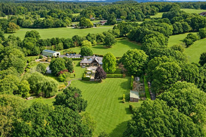
- Price
- £1,750,000
- Size
- 8 acres
Slough Lane, Horton, Wimborne, BH21, Woodlands, Dorset BH21 England
Added on 28/08/2026House with Land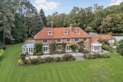
- Price
- £2,000,000
- Size
- 5 acres
School Lane, Minstead, Lyndhurst, Hampshire, SO43, Minstead, Hampshire SO43 England
Added on 10/08/2026Country Home
- Price
- £2,400,000
- Size
- 5 acres
Bramshaw, Lyndhurst, Hampshire, SO43, Bramshaw, Hampshire SO43 England
Added on 07/10/2026House with Land
- Price
- £1,995,000
- Size
- 6.5 acres
Lower Mead End Road, Sway, Lymington, SO41, Sway, Hampshire SO41 England
Added on 05/03/2026Farmhouse
- Price
- Offers Over£1,750,000
- Size
- 10 acres
Langford Lane, Redlynch, SP5, Redlynch, Wiltshire SP5 England
Added on 28/03/2026Country Estate
- Price
- £2,500,000
- Size
- 7 acres
Setley, Brockenhurst, SO42, Brockenhurst, Hampshire SO42 England
Added on 25/05/2026House with Land
- Price
- £1,850,000
- Size
- 8.7 acres
Boldre Grange, Boldre, Lymington, SO41, Boldre, Hampshire SO41 England
Added on 31/07/2026House with Land
- Price
- £2,450,000
- Size
- 8.55 acres
Rope Hill, Boldre, Lymington, SO41, Boldre, Hampshire SO41 England
Added on 16/10/2026House with Land
- Price
- £2,100,000
- Size
- 5.35 acres
Sherfield English Lane, Plaitford, Romsey, SO51, Melchet Park and Plaitford, Hampshire SO51 England
Added on 24/09/2026House with Land