
Land At Silverton, Exeter, EX5
- Land size
- 2.97 acres
Key Features
- 2.97 acres
- Potentially Strategic Location
- Edge of VIllage
- Amenity Appeal
- Productive Agricultural Land
- Direct Road Access
- Mains Water
Description
An attractively situated enclosure of pasture land benefitting from direct road access. Extending in total to approximately 2.97 acres, occupying a potentially strategic edge of village position.
For sale by Informal tender - tenders to be received in writing by 1pm Friday 7th August 2026.
DESCRIPTION
A rare opportunity to purchase an attractive parcel of land abutting the edge of the popular village of Silverton in Mid Devon, which lies approximately equidistant between the City of Exeter and the town of Tiverton. The parcel extends in total to approximately 2.97 acres or thereabouts, and benefits from direct gated road access from the Council highway (Tiverton Road) to the east.
The field is gently sloping in nature with a gradual, even westerly gradient, bounded internally by stock proof fencing with interspersed mature treed banks and hedgerows, and some sections of masonry walling. The road side boundary is delineated by a timber post and rail fence, complete with a large gated field entrance affording direct public highway access.
The land affords significant appeal to those with agricultural, equestrian, environmental, horticultural or general amenity interests (subject to any necessary planning permissions where applicable), and may also be deemed to occupy a potentially “strategic” location in terms of possible longer term future alternative development (STP), given its position abutting the edge of the defined settlement limit of Silverton. Prospective purchasers should make and rely upon their own independent enquiries regarding any potential alternative uses that may require planning approval.
SITUATION
The property occupies a delightful village position on the outskirts of Silverton, with its shop, post office, two pubs, Church and Primary School. The town of Cullompton lies around 5.7 miles north-east, affording a more extensive range of retail, recreational and scholastic facilities, and which also provides access to the M5 motorway via Junction 28.
Whilst the land presently falls outside of the defined settlement limit of Silverton in accordance with the Mid Devon Local Plan, and is therefore regarded as lying within open countryside in planning terms, with a general presumption against most forms of development, it may nonetheless be considered to occupy a strategic edge-of-settlement position. As such, there may be longer-term opportunities to promote that land’s inclusion within future plan iterations or for alternative forms of development, subject to the prevailing planning policies at the relevant time.
COMMUNICATIONS
Road - The village is primarily accessed via local roads linking it to the A396 (Exeter to Tiverton) route, which runs nearby and provides a key connection to both the A361 North Devon Link Road and Junction 27 of the M5 motorway. This allows relatively straightforward travel to major regional centres such as Exeter, Tiverton, and further afield toward Bristol and the Midlands.
Rail—Exeter St Davids, approximately 7.7 miles to the south, which is a major regional hub on the Great Western Main Line. From here, there are frequent direct services to destinations including London Paddington, Bristol, Plymouth, and further into the South West.
Air—Silverton benefits from good access to air travel through its proximity to Exeter Airport, located approximately 7.8 miles to the south-east of the village. The airport offers a range of domestic and European flights, with connections to destinations such as Dublin, Edinburgh, and various seasonal holiday locations.
SERVICES & OUTGOINGS
We understand that the land has a mains water supply, currently serving a livestock drinking trough adjacent to the southern boundary.
OVERAGE
The seller’s preference is for an overage provision to be contained within the sale contract. The details of the overage provision are subject to further discussion.
VALUE ADDED TAX
The seller will not be opting to tax; therefore, VAT will not be payable in addition to the purchase price. All interested parties should make their own enquiries with HMRC.
DIRECTIONS
What3words:///health.dignify.else
From Exeter, proceed north on the A396 (Cowley Bridge Road) towards Tiverton for approximately five miles, passing through Stoke Canon. On approaching Silverton, take the right-hand turning signposted for the village onto Upexe Lane, then take the first left onto Tiverton Road. Continue along this road, where the land parcel will be seen on the left-hand side.
ADDITIONAL INFORMATION
Tenure and Occupation: Freehold, registered under Title Number DN598987. The land is currently occupied by a grazier on a short-term grasskeep licence basis ending on 15th December, when vacant possession will be available, or earlier by agreement.
Mobile Coverage: Available via EE, O2, THREE and VODAFONE. For an indication of specific speeds and supply or coverage in the area we recommend contacting your own provider.
Flooding: The property is in an area at a VERY LOW RISK from River/Sea and Surface Water flooding (defined as the chance of flooding each year as less than 0.1%).
Rights of Way, Easements, Wayleaves etc: The property is offered for sale subject to and with the benefit of all matters contained in or referred to in the property charges register of the registered title together with all public and private rights of way, wayleaves, easements and other rights of way whether these are specifically referred to or not.
Local Authority: Mid Devon District Council (MDDC).
Method of Sale: The land will be offered for sale by Informal Tender, with tenders to be submitted in writing by 1pm on Friday 7th August 2026, whether via email to [email protected] or by post to Greenslade Taylor Hunt, 5 Fore Street, Tiverton, Devon EX16 6LN.
Tender forms are available by request from the Agent.
IMPORTANT NOTICE AND HEALTH & SAFETY POLICY
All persons wishing to view the property do so entirely at their own risk. Neither the Vendors or their Agents will be held liable for any damage or injury that may occur when interested parties are visiting the property. Land and buildings are a potentially hazardous environment and for prospective purchasers own personal safety, please be vigilant when viewing, particularly around buildings and in fields containing stock. All persons viewing the property are asked to observe the country code and close all gates.
Greenslade Taylor Hunt, their clients and any joint agents give notice that:
1. They are not authorised to make or give any representations or warranties in relation to the property either here or elsewhere, either on their own behalf or on behalf of their client or otherwise. They assume no responsibility for any statement that may be made in these particulars. These particulars do not form part of any offer or contract and must not be relied upon as statements or representations of fact.
2. Any areas, measurements or distances are approximate. The text, photographs and plans are for guidance only and are not necessarily comprehensive. It should not be assumed that the property has all necessary planning, building regulation or other consents and Greenslade Taylor Hunt has not tested any services, equipment or facilities. Purchasers must satisfy themselves by inspection or otherwise.
3. We have not made any investigations into the existence or otherwise of any issues concerning pollution of land, air or water contamination and the purchaser is responsible for making his own enquiries in this regard.
4. No responsibility can be accepted for any expenses incurred by any intending purchasers inspecting properties that have been sold, let or withdrawn.
Photos Taken June 2026
Sales Brochure Updated 07/07/2026—v.4.1
Property Reference Number: TIV260159
Map Location
Property details
- Tenure
- Freehold
- Council Tax Band
- TBC
- Date Posted
- 2026-07-09
Market Value Analysis
Compared with 121 Bare & Undeveloped Land listings in South West England (1+ acres).
Property Brochure
Seen the details? The full report adds the independent checks: planning activity, flood history, heritage and ground.
Utilities & Restrictions
Utilities
- Electricity
- Ask Agent
- Water
- Ask Agent
- Heating
- Ask Agent
- Broadband
- Ask Agent
- Sewerage
- Ask Agent
Rights & Restrictions
- Public Rights of Way
- Ask Agent
- Private Rights of Way
- Ask Agent
- Listed Property
- Ask Agent
- Restrictions
- Ask Agent
Listed status, conservation areas and planning constraints for this location are in the full report.
Property Features
- Accessibility
- Ask Agent
- Parking
- Ask Agent
- Garden
- Ask Agent
Beyond the particulars: planning activity, flood history, heritage and ground risks, checked for this exact spot.
Connectivity
Broadband
Fastest speed available at this postcode
1.8 Gbps
Gigabit full fibre
Suitable for
- 4K streaming on every screen
- Full-time home working
- Online gaming & big downloads
Mobile signal
Predicted 4G and 5G signal; indoor signal depends on building materials.
Ofcom Connected Nations postcode-level predictions. Speeds and signal are modelled, not measured, and vary between addresses and providers.
Signal is the easy part. Planning activity, flood history and protected designations here are in the full report.
Nearest Schools
Primary
- Silverton Church of England Primary School547 metresOfsted: Good *
- Ages
- 2 to 11
- Pupils
- 105
- Type
- Voluntary controlled school
- Faith
- Church of England
- Thorverton Church of England Primary School1.9 milesNo Ofsted rating
- Ages
- 4 to 11
- Pupils
- 110
- Type
- Voluntary controlled school
- Faith
- Church of England
- The Duchy School Bradninch2.5 milesOfsted: Outstanding *
- Ages
- 4 to 11
- Pupils
- 207
- Type
- Academy converter
- Bickleigh on Exe Church of England Primary School2.7 milesOfsted report card · Jun 2026
- Ages
- 2 to 11
- Pupils
- 159
- Type
- Academy converter
- Faith
- Church of England
- Stoke Canon Church of England Primary School and Pre-School3.2 milesOfsted: Good
- Ages
- 2 to 11
- Pupils
- 85
- Type
- Voluntary controlled school
- Faith
- Church of England
Secondary
- Clyst Vale Community College4.5 milesOfsted: Good
- Ages
- 11 to 18
- Pupils
- 944
- Type
- Academy converter
- Cullompton Community College4.7 milesOfsted: Good
- Ages
- 11 to 16
- Pupils
- 746
- Type
- Academy converter
- St James School5.4 milesNo Ofsted rating
- Ages
- 11 to 16
- Pupils
- 985
- Type
- Academy converter
- Cranbrook Education Campus5.7 milesOfsted: Good
- Ages
- 2 to 16
- Pupils
- 1,066
- Type
- Academy sponsor led
- Thomas Hall School5.8 milesOfsted: Requires improvement
- Ages
- 4 to 16
- Pupils
- 438
- Type
- Free schools
* Latest graded judgement covers quality of education only; no overall grade was issued under the 2024-25 inspection framework.
Distances are straight-line from the advertised location. Source: the national school registers (DfE, Welsh Government, Scottish Government) and Ofsted.
Schools are just the start: sold prices nearby, planning activity and any flood history are in the full report.
Amenities
Supermarket
GP surgery
Pharmacy
Hospital
Green space
Straight-line distances from the advertised location. Sources: NHS records, Geolytix supermarket locations, OS Open Greenspace and the national trails registers.
The area stacks up? Now check the location itself: planning nearby, protected designations and past flooding.
Getting Around
Nearest station
Nearest bus stop
Typical drive times
Straight-line distances from the advertised location; drive times are typical free-flow times over OpenStreetMap road data, so allow more at peak. Public transport locations from DfT NaPTAN.
Easy to reach matters. So do planning activity, flood history and ground risks: all in the full report.
Flood Risk
Environment Agency open data, checked around the advertised map pin for the listed acreage. Long-term risk counts flood defences; the planning map's flood zones do not. Provided by LandSale, not the listing agent, and not part of the agent's particulars. Risk varies across a holding, so verify before committing.
Rivers and the sea
Planning map: Flood Zone 1.
Surface water
Not at the pin: mapped about 10 metres away.
These bandings are the summary. Where this location sits on the flood maps, plus planning activity, heritage and ground risks, is in the full report.
Important notice: Information, maps and tags on this page are drawn from the advertising agent's marketing materials or generated automatically. LandSale has not verified them. Relying on these details is at your own risk, always carry out independent checks before committing to a purchase.
LandSale full disclaimer
Marketing information only - not formal particulars. The details on this website are provided for general guidance and do not constitute an offer or contract. Neither LandSale nor the advertising estate/land agent accepts responsibility for any inaccuracy.
1. Source of information
- Listing content: Core description, asking price, tenure, measurements, photographs and planning history originate from the marketing materials of the advertising estate or land agent. LandSale does not author this content and cannot guarantee its accuracy.
- Automated tags & categorisation: Property type, land-use class, acreage bands and similar labels may be applied by machine-learning models. They are intended as a helpful guide only and may not reflect the property's legal status or permitted use.
- Third-party & enriched data layers: Maps, boundary outlines, planning designations, soil reports, broadband coverage and other environmental or location-based insights are licensed from external suppliers. Such data are supplied “as is", may be incomplete or out of date and are subject to change without notice.
2. Verification required
Prospective purchasers must verify critical matters, including but not limited to planning permission, title boundaries, public rights of way, environmental constraints, acreage, services, access and VAT status, through their own inspections, specialist surveys, legal advisers and the selling agent before relying on the information or entering into any contract.
3. No warranty or liability
LandSale gives no warranty, express or implied, as to the accuracy, completeness or fitness for any particular purpose of the information displayed. LandSale shall not be liable for any loss, damage, cost or expense arising directly or indirectly from any use of or reliance on such information, save where liability may not be excluded by law.
4. Updates & feedback
If you believe any detail on this listing is inaccurate, please let us know. We will investigate and, where appropriate, update the listing or notify the agent.
© LandSale | Version 1.3 - August 2026
Similar properties for sale
- Price
- £120,000
- Size
- 1.15 acres
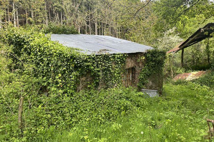
Lot 3: Keepers Cottage & Land at Bolsters Wood, Exeter, Exeter, Devon EX4 England
Added on 29/01/2026Agricultural Land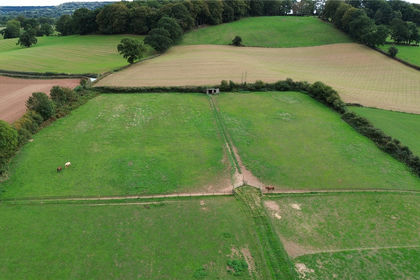
- Price
- Guide Price£70,000
- Size
- 3 acres
Land To Edge Of Village, Uffculme, Cullompton, EX15, Cullompton, Devon EX15 England
Added on 13/08/2026Grazing Land
- Price
- £100,000
- Size
- 9.69 acres
Added on 29/09/2026Undeveloped Land
- Price
- Offers in Excess of£55,000
- Size
- 2.2 acres
Added on 14/10/2026Farmland
- Price
- Guide Price£100,000
- Size
- 29.81 acres
Shillingford, Tiverton, Devon, EX16, Bampton, Devon EX16 England
Added on 20/05/2026Grazing Land
- Price
- Guide Price£70,000
- Size
- 5.86 acres
Lot 4: Land At Perry Farm, Dulverton, Somerset, TA22, Brushford, Somerset TA22 England
Added on 17/09/2026Undeveloped Land
- Price
- Guide Price£55,000
- Size
- 3.45 acres
Lot 6: Land At Perry Farm, Dulverton, Somerset, TA22, Brushford, Somerset TA22 England
Added on 17/09/2026Pasture
- Price
- Guide Price£120,000
- Size
- 10.28 acres
Lot 5: Land At Perry Farm, Dulverton, Somerset, TA22, Brushford, Somerset TA22 England
Added on 17/09/2026Pasture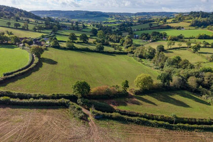
- Price
- Guide Price£90,000
- Size
- 7.86 acres
Lot 4, Land At Stockers Farm, Northleigh, Colyton, Devon, EX24, Colyton, Devon EX24 England
Added on 25/09/2026Pasture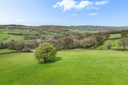
- Price
- Guide Price£110,000
- Size
- 11.12 acres
Whitestaunton, Chard, Somerset, Whitestaunton, Somerset TA20 England
Added on 22/06/2026Pasture