Tibridge Farm, Tibridge Farm, Lewdown, Devon
- Land size
- 37 acres
- Bedrooms
- 4
- Bathrooms
- 3
Description
Spanning over 3,000 sq ft, this remarkable four-bedroom house in Devon was reimagined by its former owner, Sir Kenneth Grange - one of 20th-century Britain’s best-known industrial designers. Its upside-down configuration carves out a series of spectacular, interconnected living spaces upstairs, united by exposed stone walls, oak joinery and a dramatic pitched roof. Grounds of around 37 acres emanate from the house and are a mix of gardens, pasture and woodland; there are also a series of characterful agrarian outbuildings that include Grange's former workshop/studio.
The Designer
Sir Kenneth Grange is among the 20th century’s best-known industrial designers. His user-centric work is celebrated for its breadth, from designs for Kenwood and Kodak to British Rail. He co-founded the design consultancy, Pentagram, in 1972, and was knighted in 2013.
Thought to have been built around 1900, Tibridge Farm was thoroughly reimagined by Grange in the 1990s, turning the stone barn into a spacious, bright and tactile home.
The House
Embedded into its site, Tibridge Farm is surrounded by a patchwork of mature trees. It is approached along a private, gravel-laid driveway, with space to park several cars.
The front door is set almost centrally in its façade and opens to a hallway with seagrass carpet underfoot. Immediately, the home’s predominant material palette of exposed stone and oak is introduced, and a sculptural spiral staircase beckons upstairs.
Bright, airy and with immersive views, the upper level is an exceptionally remarkable space. A dramatic pitched roof creates volume and has a series of exposed oak trusses and veneered ply-lined ceilings. Exposed brick walls and oak floorboards span the length of the room, adding continuity and texture. The middle section of the space, presently used as a sitting and dining area, is wonderfully versatile with its generous proportions.
Beyond is the kitchen, only gently delineated by bespoke units that provide plenty of storage. An opening ensures that lines of sight are unbroken and that the different ‘zones’ remain in dialogue with one another. Inside the kitchen is an oil-fired black Aga below a neat squared-tile splashback; other appliances include an electric oven/grill, LPG gas hob and integrated dishwasher. There is space for a second dining area here, and clever cut-outs ensure an even distribution of light and unobstructed views. A door at the far end opens to a corridor, from which a utility, WC and pantry are accessed.
At the opposite section of the upper level is a sitting room, partly open to the space before with an opening in the dividing stone wall. The finish here is much the same as the rest of the space: more oak is used to create plenty of shelves and a built-in desk area. Triple-aspect windows ensure an unfaltering connection with the outdoors.
Downstairs, a long corridor with plenty of storage space behind Japanese-style shoji doors connects to four double bedrooms. All are bright and serene, and have bespoke joinery and views of the grounds. Two share a smart Jack-and-Jill bathroom, while a third is served by an en suite shower room.
The largest bedroom is at the easterly end; it has a particularly generous bank of storage and a door to the grounds. It sits next to a brilliant modular Japanese bathroom designed by Grange for INAX and gifted to him. Finished in light-blue tiles, there is a luxurious bath, a walk-in shower and storage on either side.
A nexus of outbuildings can be found in the grounds, including a wonderful workshop/office. Grange’s studio has been preserved downstairs, while upstairs was previously used as his archive, though would now serve well as a home office.
Outdoor Space
Spanning some 37 acres, the grounds that surround Tibridge Farm are expansive and varied. A rolling backdrop creates a feel of total seclusion and remove.
Closest to the house are gardens, planted with a mix of shrubs, trees and herbaceous plants, and landscaped up to the streams that meander nearby. Beyond are swathes of pasture, along with woodland - a section of which was planted around a decade ago.
There is also a fruit and vegetable garden greenhouse, where the current owner has grown blackcurrants, gooseberries and strawberries. In addition to the workshop/office, there is an original farmhouse, re-roofed under current ownership with re-development potential, and a separate modern barn.
The Area
Lewdown is a peaceful hamlet in the heart of west Devon, just a 16-minute drive from the wonderful Dartmoor National Park – an area characterised by its majestic uplands and tors, dramatic moors and secret wooded valleys. Lydford Gorge and its stunning waterfall sits on the edge of the moors, and Cotehele in the Tamar Valley is an atmospheric Tudor house with a fascinating history. The captivating coastal town of Bude is a 50-minute drive away, while Plymouth lies to the south.
There are some excellent dining and drinking options within easy driving distance of the house, including the Fox and Grapes pub, The Arundel Arms and the Alex Polizzi owned Hotel Endsleigh in the most delightful setting. For essentials, the Strawberry Fields Farm Shop stocks a range of homemade and seasonal products. There are a number of larger supermarkets nearby, including an M&S Foodhall in Launceston and a Waitrose in Okehampton.
The cities of Exeter and Plymouth are both around a 45-minute drive, offering an extensive array of amenities.
The Lew Trenchard Co E Primary School is a six-minute drive from the house, and there are a number of other schools in the area, including the Mary Tavy and Brentor Community Primary School and Launceston College secondary school. Independent options include Mount Kelly Prep and Mount Kelly College in nearby Tavistock, a 20-minute drive.
Exeter St David’s rail station is approximately a 50-minute drive from the house and provides services to London in approximately two hours and 15 minutes.
Council Tax Band: A
Map Location
Property details
- Tenure
- Freehold
- Council Tax Band
- A
- Date Posted
- 2026-07-09
Market Value Analysis
Compared with 72 Homes with Land listings in South West England (25+ acres).
Energy Performance Certificate
Energy Efficiency Rating
Based on UK Energy Performance Certificate standards (EU Directive 2002/91/EC)
Running costs are one side. Planning activity, flood history and ground risks for this location are in the full report.
Utilities & Restrictions
Utilities
- Electricity
- Ask Agent
- Water
- Ask Agent
- Heating
- Ask Agent
- Broadband
- Ask Agent
- Sewerage
- Ask Agent
Rights & Restrictions
- Public Rights of Way
- Ask Agent
- Private Rights of Way
- Ask Agent
- Listed Property
- Ask Agent
- Restrictions
- Ask Agent
Listed status, conservation areas and planning constraints for this location are in the full report.
Property Features
- Accessibility
- Ask Agent
- Parking
- Parking Available
- Garden
- Garden
Beyond the particulars: planning activity, flood history, heritage and ground risks, checked for this exact spot.
Connectivity
Broadband
Fastest speed available at this postcode
8 Mbps
Under 10 Mbps here
Suitable for
- Basic browsing & email
Fixed wireless access may also be an option here.
Mobile signal
Outdoor predictions; indoor signal depends on building materials.
Ofcom Connected Nations postcode-level predictions. Speeds and signal are modelled, not measured, and vary between addresses and providers.
Signal is the easy part. Planning activity, flood history and protected designations here are in the full report.
Nearest Schools
Primary
- Lew Trenchard Church of England Primary School2.4 milesOfsted: Good
- Ages
- 2 to 11
- Pupils
- 78
- Type
- Academy converter
- Faith
- Church of England
- Lifton Community Academy3.1 milesNo Ofsted rating
- Ages
- 2 to 11
- Pupils
- 131
- Type
- Academy converter
- Milton Abbot Primary School3.2 milesOfsted: Good
- Ages
- 2 to 11
- Pupils
- 82
- Type
- Academy converter
- Lamerton CofE Primary Academy4.2 milesOfsted report card · Jun 2026
- Ages
- 4 to 11
- Pupils
- 47
- Type
- Academy converter
- Faith
- Church of England
- Lydford Primary School5 milesOfsted: Good
- Ages
- 2 to 11
- Pupils
- 32
- Type
- Academy converter
Secondary
- Launceston College6.2 milesOfsted: Good
- Ages
- 11 to 18
- Pupils
- 1,205
- Type
- Academy converter
- Tavistock College6.7 milesOfsted: Requires improvement
- Ages
- 11 to 18
- Pupils
- 1,200
- Type
- Academy converter
- Callington Community College9.6 milesOfsted: Good
- Ages
- 11 to 18
- Pupils
- 887
- Type
- Academy converter
- Okehampton College12 milesOfsted report card · Jan 2026
- Ages
- 11 to 18
- Pupils
- 1,066
- Type
- Academy converter
- Holsworthy Community College14 milesNo Ofsted rating
- Ages
- 11 to 16
- Pupils
- 551
- Type
- Academy converter
Distances are straight-line from the advertised location. Source: the national school registers (DfE, Welsh Government, Scottish Government) and Ofsted.
Schools are just the start: sold prices nearby, planning activity and any flood history are in the full report.
Amenities
Supermarket
GP surgery
Pharmacy
Hospital
Straight-line distances from the advertised location. Sources: NHS records, Geolytix supermarket locations, OS Open Greenspace and the national trails registers.
The area stacks up? Now check the location itself: planning nearby, protected designations and past flooding.
Getting Around
Nearest station
Nearest bus stop
Typical drive times
Straight-line distances from the advertised location; drive times are typical free-flow times over OpenStreetMap road data, so allow more at peak. Public transport locations from DfT NaPTAN.
Easy to reach matters. So do planning activity, flood history and ground risks: all in the full report.
Flood Risk
From Environment Agency flood map open data, checked around the advertised map pin and allowing for the listed acreage where known. This summary comes from LandSale, the advertising platform, not from the listing agent, and is not part of the agent's particulars. Risk can vary across a single holding, so verify anything critical through your own searches before committing.
Rivers and the sea
Mapped within the area searched, not at the advertised map pin itself.
Surface water
Mapped within the area searched, not at the advertised map pin itself.
The detail behind these bandings
The full report pinpoints where this location sits on the flood maps, and runs the deeper checks that usually only surface after an offer.
- Exact flood zones & annual chances (included in the full report)
- Any recorded past flooding (included in the full report)
- Planning activity nearby (included in the full report)
- Heritage & conservation (included in the full report)
- Protected nature designations (included in the full report)
- Ground risks (included in the full report)
- Sold prices nearby (included in the full report)
£14.99 · one-off purchase
By LandSale, the platform. Not provided by the listing agent. Ready in about a minute.
Important notice: Information, maps and tags on this page are drawn from the advertising agent's marketing materials or generated automatically. LandSale has not verified them. Relying on these details is at your own risk, always carry out independent checks before committing to a purchase.
LandSale full disclaimer
Marketing information only - not formal particulars. The details on this website are provided for general guidance and do not constitute an offer or contract. Neither LandSale nor the advertising estate/land agent accepts responsibility for any inaccuracy.
1. Source of information
- Listing content: Core description, asking price, tenure, measurements, photographs and planning history originate from the marketing materials of the advertising estate or land agent. LandSale does not author this content and cannot guarantee its accuracy.
- Automated tags & categorisation: Property type, land-use class, acreage bands and similar labels may be applied by machine-learning models. They are intended as a helpful guide only and may not reflect the property's legal status or permitted use.
- Third-party & enriched data layers: Maps, boundary outlines, planning designations, soil reports, broadband coverage and other environmental or location-based insights are licensed from external suppliers. Such data are supplied “as is", may be incomplete or out of date and are subject to change without notice.
2. Verification required
Prospective purchasers must verify critical matters, including but not limited to planning permission, title boundaries, public rights of way, environmental constraints, acreage, services, access and VAT status, through their own inspections, specialist surveys, legal advisers and the selling agent before relying on the information or entering into any contract.
3. No warranty or liability
LandSale gives no warranty, express or implied, as to the accuracy, completeness or fitness for any particular purpose of the information displayed. LandSale shall not be liable for any loss, damage, cost or expense arising directly or indirectly from any use of or reliance on such information, save where liability may not be excluded by law.
4. Updates & feedback
If you believe any detail on this listing is inaccurate, please let us know. We will investigate and, where appropriate, update the listing or notify the agent.
© LandSale | Version 1.3 - August 2026
Listing agent
The Modern House, London
St Alphege Hall Kings Bench Street London SE1 0QX
Contact The Modern House, London
St Alphege Hall Kings Bench Street London SE1 0QX
View agent profileSimilar properties for sale
- Price
- Guide Price£1,500,000
- Size
- 58.74 acres
Added on 23/07/2026House with Land
- Price
- Offers in Excess of£1,500,000
- Size
- 30 acres
Launceston, Cornwall, PL15, Launceston, Cornwall PL15 England
Added on 06/05/2026Equestrian property
- Price
- Guide Price£1,550,000
- Size
- 40 acres
Added on 02/06/2026Country Estate
- Price
- Guide Price£2,000,000
- Size
- 47.28 acres
Hurdon Farm, Launceston, Cornwall, PL15, Launceston, Cornwall PL15 England
Added on 02/06/2026Country Estate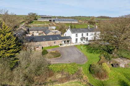
- Price
- £1,595,000
- Size
- 19.5 acres
Added on 03/07/2026Farmhouse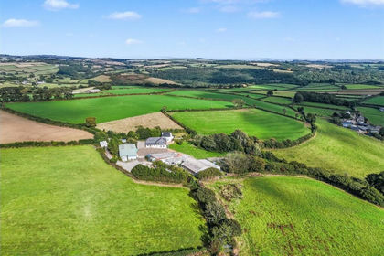
- Price
- £1,595,000
- Size
- 53 acres
St Ive, Liskeard - Cornwall, St. Ive and Pensilva, Cornwall PL14 England
Added on 21/08/2026Farm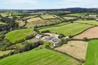
- Price
- £1,595,000
- Size
- 53 acres
St Ive, Liskeard - Cornwall, St. Ive and Pensilva, Cornwall PL14 England
Added on 25/07/2026Farm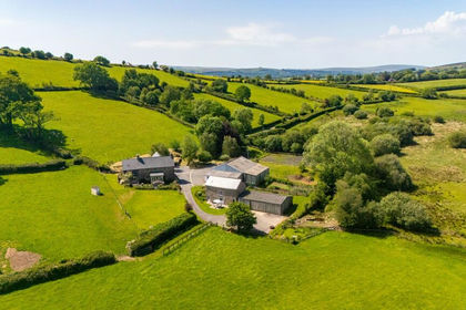
- Price
- Guide Price£1,695,000
- Size
- 32.35 acres
North Bovey, Newton Abbot, TQ13, North Bovey, Devon TQ13 England
Added on 28/04/2026Farm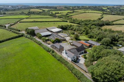
- Price
- Guide Price£1,995,000
- Size
- 68 acres
Added on 28/04/2026Farm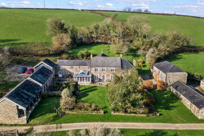
- Price
- Guide Price£1,950,000
- Size
- 33.08 acres
Added on 28/08/2026House with Land