Evesbatch, Bishops Frome, Worcester, WR6
- Bedrooms
- 5
- Bathrooms
- 5
Key Features
- 5 Bathrooms
- 5 Bedrooms
- 3 Reception Rooms
- Barn Conversion
- Detached
- Garden
- Land/Paddock
- Conservatory
- Period
- 7500 Approx Sq Ft
Description
Superb, spacious barn conversion with extensive grounds, pasture, and fishing lake in a peaceful rural spot.
///cowboy.sprinkler.holly
Summary of Features
* Fabulous, individual barn conversion (7,561 sq ft) * 5 en-suite double bedrooms, plus an internal annexe * 3 spacious reception rooms, conservatory & annexe * Generous Aga kitchen/breakfast room & large conservatory * Integral double garage with adjacent home office * Orangery, with garden WC (637 sq ft) * Beautifully landscaped gardens & grounds * Attractive water features and ornamental pond
Acreage
In all 3.43 Acres.
Location
Bishops Frome 2 miles, Bromyard 7 miles, Malvern 8 miles, Ledbury 9½, Worcester 14 miles, Hereford 15 miles, Cheltenham 25 miles, Birmingham 39 miles, Bristol 60 miles & London 136 miles.
Situation
Evesbatch is a pretty rural hamlet on the Worcestershire/Herefordshire border and is noted as the smallest parish in the Frome Valley, originating around the original Manor House, Evesbatch Court, with the village Church believed to date from c. 1300’s. The surrounding landscape is defined by undulating countryside, orchards and hop fields. The property enjoys a peaceful and tranquil setting yet is very accessible for the local towns with the larger cities of Worcester and Hereford only a short drive away.
Longbarns
* Longbarns was historically a cluster of traditional farm buildings, part of a farmstead tied to the Evesbatch Court Estate Manor House, formerly owned by the Cadbury family. Converted into a dwelling during the 1980's, this fabulous property provides a wonderfully spacious home with very flexible accommodation. * The entrance is via a central courtyard with attractive box-hedging, cobbled pathways, and a lovely urn-style water feature, around which most of the property is situated. A pair of attractively carved wooden front doors open to the spacious reception/dining hall, with its vaulted ceiling, exposed stone walls and inglenook fireplace inset with wood-burning stove. Attractive, re-claimed maple flooring complements this fabulous space which is perfect for more formal entertaining or for special occasions. * Leading off the dining hall is the split-level drawing room, also with inglenook fireplace with a wood-burner set on a stone hearth. This very comfortable, (truncated)
Longbarns (Continued)
* Adjacent is the informal sitting room, with wood-burner, which opens to the spacious conservatory, with direct access to the garden. The country-style kitchen/breakfast room is next to these rooms. * The welcoming Aga kitchen is the heart of this lovely home and is complemented by hand-painted, fitted cupboards, providing ample storage, and attractive granite work-surfaces. The kitchen benefits from a large central island, 4-oven Aga with attached electric module and integrated appliances. * A fully-glazed gable elevation affords super views over the garden, paddock and lake, with distant views of The Malvern Hills. * The very generously proportioned main bedroom suite is situated on the ground floor and is accessed off the sitting room. This super room has a vaulted ceiling, built-in wardrobes, and a separate dressing room with built-in storage. A spacious en-suite with free-standing bath and walk-in shower complement this fine room.
Longbarns (Continued)
* The “West Wing” leads off the dining hall and hosts four large, double bedroom suites, all with recently fitted en-suite bathrooms. Also located in this Wing is a self-contained annexe with open plan kitchen/living room and double bedroom/- with bathroom on the mezzanine floor. A great space for dependent or independent family or friends. * The property has a wealth of attractive features, including exposed beams and trusses, stone walls, and wooden floorboards. Many of the rooms benefit from vaulted ceilings which add to the feeling of space and airiness throughout this super home
The Outside
* Longbarns is situated in a picturesque and quiet village location, surrounded by its own gardens and grounds, which provide a secluded and private setting. * Accessed off a quiet village lane, a pair of wrought-iron gates lead to a generous parking area in front of the garages. A second, rear entrance provides access to the “West Wing”, garden and land. * The beautifully presented gardens and grounds are very well established and provide a wealth of interest, from an interestingly planted, quite architectural avenue of ornamental plum trees to attractive and calming water features. An ornamental pond with foot bridge extends beyond the large patio and gravelled terrace, located South-West of the property with the lawned gardens beyond.
The Outside (Continued)
* The gardens have been very well laid out and are interspersed with a variety of established specimen trees, rose gardens, vegetable garden and decked walkways, with several seating areas located throughout. There is a new discovery around each corner of this enticing outdoor space. * An attractive Orangery is located by the entrance courtyard and lends itself to a variety of uses and has been re-roofed in the recent past. * From the rear drive there is access to a detached double car port with ample external parking. This entrance gives vehicular access to the garden and links to the front entrance and stables.
Material Information
Services
Mains electricity and water, private drainage to a septic tank (believed to be compliant). Oil fired central heating (2 boilers), underfloor heating throughout.
Broadband
Fibre broadband connected via Gigaclear, +500 mbps d/l.
Mobile Phone Signal
Good connection to O2/EE/Vodafone.
Local Authority
Herefordshire Council: .
Council Tax
Band “H” (£5087.78 for 2026/27).
Tenure
Freehold.
Construction
Brick and stone under a clay tile.
Listing
This property is not Listed.
Planning Permission
No relevant live or lapsed consents applicable to this property.
EPC
Rated “E”, potential for “D”.
Flood Risk
There is no obvious flooding risk to this property.
Access
Available from the public highway in 2 places, plus a right of access for the land.
Rights of Way
No public rights of way or access. A neighbouring farmer has a right of access over the side track.
Covenants
Not aware of any conditions.
National Landscape
The property is not within a National Landscape (formerly AONB).
Conservation Area
The property is not within a Conservation Area.
Buyers Purchase Fee
Please note that buyers are required to pay a Purchase Fee of £300 (inc. of VAT) to Grant & Co on offer acceptance, to process a new transaction.
General Information
Schools
Primary
Burley Gate, Bromyard and Bosbury. Further information is available at: and
Secondary
Queen Elizabeth High School, Bromyard, John Masefield, Ledbury. For further information, please visit the above websites.
Indpendent
Hereford, Malvern, Colwall & Worcester. Further information is available at:
Local
The nearby village of Bishops Frome has two public houses and the The Hop Pocket Shopping Village is just 3 miles away, providing a collection of independent shops including crafts, food hall, gifts, and country store. There is also a garden centre and café with a restaurant. The market town of Bromyard offers a good range of facilities for most domestic needs, including a supermarket, baker, acclaimed butcher & farm shop, doctor's surgery, Post Office, and community hospital. Ledbury and Malvern are only a short drive away and also offer a wide range of local amenities with many independent shops, restaurants, and pubs. Malvern also hosts a well-known theatre, cinema and 2 rail stations. Further retail & cultural amenities are available in Hereford and Worcester, with more extensive facilities in Cheltenham and Birmingham, which are all within easy travelling distance
Recreational
Many fine walks and cycle routes in the area and along the Frome Valley, Bromyard Downs and through the Brockhampton Estate (National Trust), with the Malvern Hills only a short distance away. The area also offers a range of outdoor pursuits and sports clubs, and there are numerous local festivals, arts, crafts, and farmers' markets held in and around the neighbouring villages and towns. The Three Counties Showground hosts a wide variety of year-round events from national gardens shows, concerts & antique fairs to agricultural & equestrian events. An active theatre programme can also be found in Ledbury and Malvern.
Postcode
WR6 5BD.
Directions
From Ledbury: Head north on the B4214 Bromyard Rd. After 3.2 miles fork left before Bosbury, staying on B4214. Continue to T junction with A4103 (Hereford/Worcester Rd). Turn right and pass over Fromes Hill for 1.3 miles, take the first left turning to Evesbatch. Continue 0.9 miles and take the first left into Green Lane. Travel up the hill, passing the church on your right, this property is next on your left side, shortly after the church.
What3Words
///cowboy.sprinkler.holly
Viewings
By prior appointment only via Grant & Co Estate Agents on .
Joint Agents
Chartwell Noble, Worcester. FAO George Pickard
Agents Notes
Grant & Co and their clients give notice that: 1. They have no authority to make or give any representations or warranties in relation to the property. 2. These particulars have been prepared in good faith to give a fair overall view of the property, do not form any part of an offer or contract and must not be relied upon as statements or representations of fact. 3. Any areas, measurements or distances are approximate. The text, photographs and plans are for guidance only and are not necessarily comprehensive. It should not be assumed that the property has all necessary planning, building regulation or other consents. The Agents have not tested any services, equipment or facilities. Purchasers must satisfy themselves by inspection or otherwise. Fixtures & Fittings Unless mentioned specifically all fixtures & fittings are excluded from the sale.
Map Location
Property details
- Tenure
- Freehold
- Council Tax Band
- TBC
- Date Posted
- 2026-07-05
Energy Performance Certificate
Energy Efficiency Rating
Based on UK Energy Performance Certificate standards (EU Directive 2002/91/EC)
Running costs are one side. Planning activity, flood history and ground risks for this location are in the full report.
Utilities & Restrictions
Utilities
- Electricity
- Ask Agent
- Water
- Ask Agent
- Heating
- Ask Agent
- Broadband
- Ask Agent
- Sewerage
- Ask Agent
Rights & Restrictions
- Public Rights of Way
- Ask Agent
- Private Rights of Way
- Ask Agent
- Listed Property
- Ask Agent
- Restrictions
- Ask Agent
Listed status, conservation areas and planning constraints for this location are in the full report.
Property Features
- Accessibility
- Ask Agent
- Parking
- Parking Available
- Garden
- Garden
Beyond the particulars: planning activity, flood history, heritage and ground risks, checked for this exact spot.
Connectivity
Broadband
Fastest speed available at this postcode
1 Gbps
Gigabit full fibre
Suitable for
- 4K streaming on every screen
- Full-time home working
- Online gaming & big downloads
Fixed wireless access may also be an option here.
Mobile signal
Outdoor predictions; indoor signal depends on building materials.
Ofcom Connected Nations postcode-level predictions. Speeds and signal are modelled, not measured, and vary between addresses and providers.
Signal is the easy part. Planning activity, flood history and protected designations here are in the full report.
Nearest Schools
Primary
- Bosbury CofE Primary School3 milesOfsted: Good *
- Ages
- 4 to 11
- Pupils
- 112
- Type
- Voluntary controlled school
- Faith
- Church of England
- Suckley Primary School3.1 milesOfsted: Outstanding *
- Ages
- 4 to 11
- Pupils
- 95
- Type
- Academy converter
- Cradley CofE Primary School3.2 milesOfsted: Requires improvement
- Ages
- 4 to 11
- Pupils
- 73
- Type
- Voluntary aided school
- Faith
- Church of England
- Brockhampton Primary School4 milesNo Ofsted rating
- Ages
- 2 to 11
- Pupils
- 191
- Type
- Academy converter
- Ashperton Primary Academy4.8 milesOfsted: Good
- Ages
- 4 to 11
- Pupils
- 202
- Type
- Academy converter
Secondary
- Queen Elizabeth High School4.5 milesNo Ofsted rating
- Ages
- 11 to 16
- Pupils
- 421
- Type
- Academy converter
- Dyson Perrins CofE Academy5.6 milesOfsted: Good
- Ages
- 11 to 16
- Pupils
- 592
- Type
- Academy converter
- Faith
- Church of England
- The Chase6.7 milesOfsted report card · Jan 2026
- Ages
- 11 to 18
- Pupils
- 1,449
- Type
- Academy converter
- John Masefield High School7 milesNo Ofsted rating
- Ages
- 11 to 18
- Pupils
- 849
- Type
- Academy converter
- The Chantry School8.6 milesOfsted: Good
- Ages
- 11 to 16
- Pupils
- 881
- Type
- Academy converter
* Latest graded judgement covers quality of education only; no overall grade was issued under the 2024-25 inspection framework.
Distances are straight-line from the advertised location. Source: the national school registers (DfE, Welsh Government, Scottish Government) and Ofsted.
Schools are just the start: sold prices nearby, planning activity and any flood history are in the full report.
Amenities
Supermarket
GP surgery
Pharmacy
Hospital
Straight-line distances from the advertised location. Sources: NHS records, Geolytix supermarket locations, OS Open Greenspace and the national trails registers.
The area stacks up? Now check the location itself: planning nearby, protected designations and past flooding.
Getting Around
Nearest station
Nearest bus stop
Typical drive times
Straight-line distances from the advertised location; drive times are typical free-flow times over OpenStreetMap road data, so allow more at peak. Public transport locations from DfT NaPTAN.
Easy to reach matters. So do planning activity, flood history and ground risks: all in the full report.
Flood Risk
From Environment Agency flood map open data, checked around the advertised map pin and allowing for the listed acreage where known. This summary comes from LandSale, the advertising platform, not from the listing agent, and is not part of the agent's particulars. Risk can vary across a single holding, so verify anything critical through your own searches before committing.
Rivers and the sea
Surface water
The detail behind these bandings
The full report pinpoints where this location sits on the flood maps, and runs the deeper checks that usually only surface after an offer.
- Exact flood zones & annual chances (included in the full report)
- Any recorded past flooding (included in the full report)
- Planning activity nearby (included in the full report)
- Heritage & conservation (included in the full report)
- Protected nature designations (included in the full report)
- Ground risks (included in the full report)
- Sold prices nearby (included in the full report)
£14.99 · one-off purchase
By LandSale, the platform. Not provided by the listing agent. Ready in about a minute.
Important notice: Information, maps and tags on this page are drawn from the advertising agent's marketing materials or generated automatically. LandSale has not verified them. Relying on these details is at your own risk, always carry out independent checks before committing to a purchase.
LandSale full disclaimer
Marketing information only - not formal particulars. The details on this website are provided for general guidance and do not constitute an offer or contract. Neither LandSale nor the advertising estate/land agent accepts responsibility for any inaccuracy.
1. Source of information
- Listing content: Core description, asking price, tenure, measurements, photographs and planning history originate from the marketing materials of the advertising estate or land agent. LandSale does not author this content and cannot guarantee its accuracy.
- Automated tags & categorisation: Property type, land-use class, acreage bands and similar labels may be applied by machine-learning models. They are intended as a helpful guide only and may not reflect the property's legal status or permitted use.
- Third-party & enriched data layers: Maps, boundary outlines, planning designations, soil reports, broadband coverage and other environmental or location-based insights are licensed from external suppliers. Such data are supplied “as is", may be incomplete or out of date and are subject to change without notice.
2. Verification required
Prospective purchasers must verify critical matters, including but not limited to planning permission, title boundaries, public rights of way, environmental constraints, acreage, services, access and VAT status, through their own inspections, specialist surveys, legal advisers and the selling agent before relying on the information or entering into any contract.
3. No warranty or liability
LandSale gives no warranty, express or implied, as to the accuracy, completeness or fitness for any particular purpose of the information displayed. LandSale shall not be liable for any loss, damage, cost or expense arising directly or indirectly from any use of or reliance on such information, save where liability may not be excluded by law.
4. Updates & feedback
If you believe any detail on this listing is inaccurate, please let us know. We will investigate and, where appropriate, update the listing or notify the agent.
© LandSale | Version 1.3 - August 2026

Listing agent
Grant & Co, Ledbury
Bank Chambers, 24 High Street, Ledbury, Herefordshire, HR8 1DS
Contact Grant & Co, Ledbury
Bank Chambers, 24 High Street, Ledbury, Herefordshire, HR8 1DS
View agent profileSimilar properties for sale
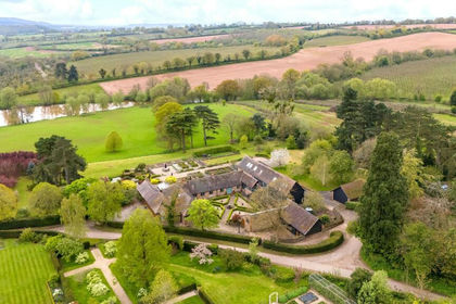
- Price
- Guide Price£1,500,000
- Size
- 3.4 acres
Bishops Frome, Worcester, WR6, Evesbatch, Herefordshire, County of WR6 England
Added on 18/04/2026Barn Conversion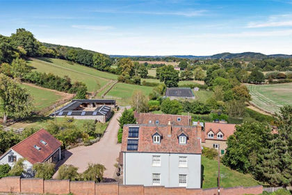
- Price
- Offers Over£1,150,000
- Size
- 12 acres
Ridgeway Cross, Cradley, Malvern, WR13, Cradley and Storridge, Herefordshire, County of WR13 England
Added on 14/04/2026Equestrian property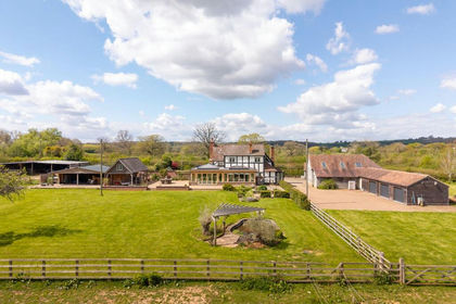
- Price
- Guide Price£1,150,000
- Size
- 9 acres
Bosbury, near Ledbury, Bosbury, Herefordshire, County of HR8 England
Added on 12/05/2026House with Land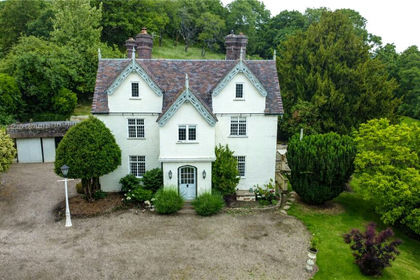
- Price
- Offers Over£1,500,000
- Size
- 4 acres
Blackhouse Lane, Suckley, Worcester, Worcestershire, WR6, Suckley, Worcestershire WR6 England
Added on 26/06/2026Country Home
- Price
- Guide Price£1,300,000
- Size
- 6 acres
Stoke Lacy, Bromyard, Herefordshire, HR7, Stoke Lacy, Herefordshire, County of HR7 England
Added on 21/07/2026House with Land
- Price
- Guide Price£1,350,000
- Size
- 2 acres
Suckley, Worcestershire, Suckley, Worcestershire WR6 England
Added on 25/02/2026Country Home
- Price
- Guide Price£1,600,000
- Size
- 4 acres
West Malvern Road, Mathon, Malvern, WR13, Mathon, Herefordshire, County of WR13 England
Added on 08/07/2026House with Land
- Price
- Guide Price£1,500,000
- Size
- 11 acres
Suckley, Worcester, Worcestershire, WR6, Suckley, Worcestershire WR6 England
Added on 17/06/2026Cottage
- Price
- Guide Price£1,150,000
- Size
- 2.2 acres
Coddington, Ledbury, Herefordshire, HR8, Coddington, Herefordshire, County of HR8 England
Added on 16/07/2026House with Land
- Price
- Guide Price£1,500,000
- Size
- 1.3 acres
West Malvern - Stunning views!, West Malvern, Worcestershire WR14 England
Added on 28/04/2026House with Land