Off Fair-Green Road, Baldwins Gate, ST5
- Land size
- 0.29 acres
- Bedrooms
- 5
- Bathrooms
- 3
Key Features
- First Self-Build And Custom Plot Now Available Within An Exclusive Development Of Up To 8 Luxury Dwellings
- Full Planning For A Bespoke Home Of Approximately 4,000 sqft Sitting On A Plot Size Of 0.29 Acres
- Each Plot Has Private And Tranquil Countryside Views Over Neighbouring Woodland
- Rare Opportunity To Create A Custom-Designed Residence In A Desirable Village Location
- Early Enquiries Are Strongly Recommended As Opportunities Of This Exclusivity And Setting Are Few And Far Between.
Description
A Home of Your Own, in a Setting Apart
An exceptional 0.29-acre self-build or custom-build plot in central Baldwins Gate, with full planning approval for the house design shown. Enjoy a beautiful woodland outlook, the reassurance of a commitment to no further development on the land behind, and the freedom to create a home around the way you want to live.
This is a rare opportunity to combine the convenience of village life with the space, privacy and natural beauty of a countryside setting. The plot offers a generous setting for a substantial family residence in one of the area’s most sought-after villages.
Your Home, Your Choice
The plot benefits from full planning approval for the impressive house design illustrated, extending to approximately 4,000 sq ft and providing a clear starting point for purchasers wishing to progress with an approved scheme.
For those with a different vision, there is also the opportunity to redesign the house completely, subject to obtaining the necessary planning approval. Whether your preference is traditional architecture, a contemporary home or a blend of both, you have the opportunity to shape the layout, appearance and specification around your lifestyle, priorities and budget.
The plot is available for self-build or custom-build, allowing you to manage your own project or work with experienced professionals to deliver a home designed specifically for you.
For purchasers who would welcome support, introductions can be made to specialist architects, designers and experienced housebuilders familiar with delivering high-quality bespoke homes. Alternatively, purchasers are free to appoint their own architect, builder and professional team, choosing as much or as little assistance as they wish.
Whether you already have a clear vision or would prefer guidance from the outset, you can choose the approach that suits you.
An Outlook with Reassurance
The neighbouring woodland, known locally as Chorlton Moss, provides a beautiful backdrop and a welcome sense of seclusion. To give purchasers lasting peace of mind, the landowner will provide a guarantee against further development on the land they own behind the plot, protecting the outlook from future building on that land.
Access and Services
The access roadway will be completed by the landowner, and all services are conveniently located at the site entrance for purchasers to arrange connections to the plot.
The Best of Village and Country Living
Situated in central Baldwins Gate, the plot enjoys convenient access to village amenities, well-regarded schools, restaurants, recreational facilities and transport links. Yet the surrounding open countryside and woodland give the setting a distinctly rural feel.
It is this combination that makes the opportunity so appealing: everyday convenience close at hand, with the space, privacy and outlook to enjoy a quieter pace at home.
Contact the selling agent to arrange a viewing and discuss the approved plans, plot details and the options available for creating your own individual home.
Location
Baldwins Gate sits just minutes drive from Newcastle-Under-Lyme and within easy access of junction 15 off the M6 motorway making it a rural village with excellent commuter links. The village is equipped with a pub and post office/shop and has a range of country restaurants/pubs, local farm shop and beautiful walking routes near by. The A53 runs through the centre of the village giving connections to Shropshire and to the A51 leading to into Cheshire.
AGENT NOTE
Please note a full planning application has been approved for Plot 1, further information can be found on the Newcastle Under Lyme planning portal using reference: 26/00359/FUL
CGI IMAGES
Please note the CGI images used are AI generated and for illustration purposes only.
Map Location
Property details
- Tenure
- Freehold
- Council Tax Band
- Ask Agent
- Date Posted
- 2026-07-01
Utilities & Restrictions
Utilities
- Electricity
- Ask Agent
- Water
- Ask Agent
- Heating
- Ask Agent
- Broadband
- Ask Agent
- Sewerage
- Ask Agent
Rights & Restrictions
- Public Rights of Way
- Ask Agent
- Private Rights of Way
- Ask Agent
- Listed Property
- Ask Agent
- Restrictions
- Ask Agent
Listed status, conservation areas and planning constraints for this location are in the full report.
Property Features
- Accessibility
- Ask Agent
- Parking
- Ask Agent
- Garden
- Garden
Beyond the particulars: planning activity, flood history, heritage and ground risks, checked for this exact spot.
Connectivity
Broadband
Fastest speed available at this postcode
80 Mbps
Superfast
Suitable for
- HD streaming
- Video calls
- Web & social
Mobile signal
Predicted 4G and 5G signal; indoor signal depends on building materials.
Ofcom Connected Nations postcode-level predictions. Speeds and signal are modelled, not measured, and vary between addresses and providers.
Signal is the easy part. Planning activity, flood history and protected designations here are in the full report.
Nearest Schools
Primary
- Baldwins Gate CofE(VC) Primary School357 metresNo Ofsted rating
- Ages
- 3 to 11
- Pupils
- 188
- Type
- Voluntary controlled school
- Faith
- Church of England
- Sir John Offley CofE (VC) Primary School3.2 milesOfsted: Good
- Ages
- 3 to 11
- Pupils
- 143
- Type
- Voluntary controlled school
- Faith
- Church of England
- St John's CofE Primary Academy3.3 milesOfsted: Requires improvement
- Ages
- 3 to 11
- Pupils
- 155
- Type
- Academy converter
- Faith
- Church of England
- All Saints CofE (C) First School3.4 milesOfsted: Good
- Ages
- 5 to 9
- Pupils
- 41
- Type
- Voluntary controlled school
- Faith
- Church of England
- Seabridge Primary School3.5 milesOfsted report card · Mar 2026
- Ages
- 3 to 11
- Pupils
- 436
- Type
- Academy converter
Secondary
- Madeley High School3.4 milesNo Ofsted rating
- Ages
- 11 to 16
- Pupils
- 779
- Type
- Academy converter
- Newcastle Academy3.8 milesOfsted: Good
- Ages
- 11 to 16
- Pupils
- 441
- Type
- Academy converter
- Clayton Hall Academy4 milesOfsted: Good
- Ages
- 11 to 16
- Pupils
- 828
- Type
- Academy converter
- Trentham Academy4.5 milesOfsted report card · Feb 2026
- Ages
- 11 to 16
- Pupils
- 794
- Type
- Academy converter
- St Joseph's College4.7 milesOfsted: Outstanding *
- Ages
- 11 to 18
- Pupils
- 1,104
- Type
- Academy converter
- Faith
- Roman Catholic
* Latest graded judgement covers quality of education only; no overall grade was issued under the 2024-25 inspection framework.
Distances are straight-line from the advertised location. Source: the national school registers (DfE, Welsh Government, Scottish Government) and Ofsted.
Schools are just the start: sold prices nearby, planning activity and any flood history are in the full report.
Amenities
Supermarket
GP surgery
Pharmacy
Hospital
Green space
Straight-line distances from the advertised location. Sources: NHS records, Geolytix supermarket locations, OS Open Greenspace and the national trails registers.
The area stacks up? Now check the location itself: planning nearby, protected designations and past flooding.
Getting Around
Nearest station
Nearest bus stop
Typical drive times
Straight-line distances from the advertised location; drive times are typical free-flow times over OpenStreetMap road data, so allow more at peak. Public transport locations from DfT NaPTAN.
Easy to reach matters. So do planning activity, flood history and ground risks: all in the full report.
Flood Risk
Environment Agency open data, checked around the advertised map pin for the listed acreage. Long-term risk counts flood defences; the planning map's flood zones do not. The map pin for this listing marks the postcode area rather than the exact location, so these readings describe the surrounding area. Provided by LandSale, not the listing agent, and not part of the agent's particulars. Risk varies across a holding, so verify before committing.
Rivers and the sea
Planning map: Flood Zone 1.
Surface water
These bandings are the summary. Where this location sits on the flood maps, plus planning activity, heritage and ground risks, is in the full report.
Important notice: Information, maps and tags on this page are drawn from the advertising agent's marketing materials or generated automatically. LandSale has not verified them. Relying on these details is at your own risk, always carry out independent checks before committing to a purchase.
LandSale full disclaimer
Marketing information only - not formal particulars. The details on this website are provided for general guidance and do not constitute an offer or contract. Neither LandSale nor the advertising estate/land agent accepts responsibility for any inaccuracy.
1. Source of information
- Listing content: Core description, asking price, tenure, measurements, photographs and planning history originate from the marketing materials of the advertising estate or land agent. LandSale does not author this content and cannot guarantee its accuracy.
- Automated tags & categorisation: Property type, land-use class, acreage bands and similar labels may be applied by machine-learning models. They are intended as a helpful guide only and may not reflect the property's legal status or permitted use.
- Third-party & enriched data layers: Maps, boundary outlines, planning designations, soil reports, broadband coverage and other environmental or location-based insights are licensed from external suppliers. Such data are supplied “as is", may be incomplete or out of date and are subject to change without notice.
2. Verification required
Prospective purchasers must verify critical matters, including but not limited to planning permission, title boundaries, public rights of way, environmental constraints, acreage, services, access and VAT status, through their own inspections, specialist surveys, legal advisers and the selling agent before relying on the information or entering into any contract.
3. No warranty or liability
LandSale gives no warranty, express or implied, as to the accuracy, completeness or fitness for any particular purpose of the information displayed. LandSale shall not be liable for any loss, damage, cost or expense arising directly or indirectly from any use of or reliance on such information, save where liability may not be excluded by law.
4. Updates & feedback
If you believe any detail on this listing is inaccurate, please let us know. We will investigate and, where appropriate, update the listing or notify the agent.
© LandSale | Version 1.3 - August 2026
Listing agent
James Du Pavey, Eccleshall
16 Stafford Street Eccleshall ST21 6BH
Similar properties for sale
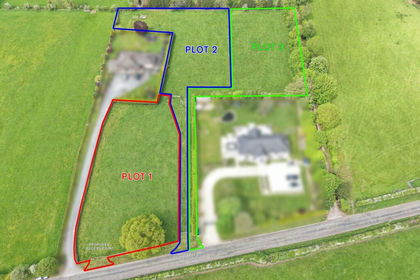
- Price
- Offers Over£300,000
Plot 3, Manor Road, Baldwins Gate, ST5, Whitmore, Staffordshire ST5 England
Added on 15/07/2026Building Plot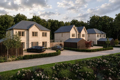 Added on 30/07/2026Self Build Plot
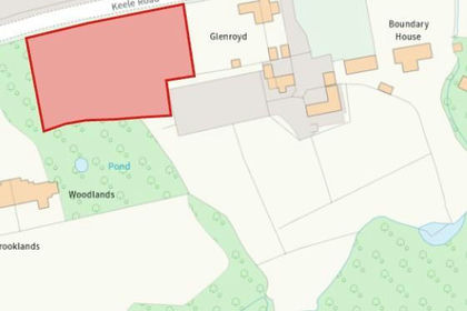
- Price
- Guide Price£230,000
Plot 2. Keele Road, Madeley Heath, Newcastle-under-Lyme, Madeley, Staffordshire CW3 England
Added on 22/09/2026Development Land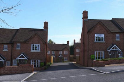 Added on 11/03/2026Development Land
- Price
- Guide Price£200,000
- Size
- 2.41 acres
Added on 29/09/2026Redevelopment Land
- Price
- Offers Over£300,000
- Size
- 1.3 acres
Great Oak Road, Bignall End, ST7, Audley Rural, Staffordshire ST7 England
Added on 28/05/2026Development Land Added on 06/06/2026Redevelopment Land
- Price
- Offers in Region of£200,000
Added on 20/08/2026Building Plot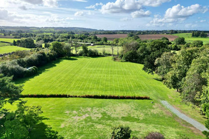 Added on 29/01/2026Self Build Plot
- Price
- Guide Price£200,000
Congleton Road, Meadow Way By-Pass, Biddulph, Biddulph, Staffordshire ST8 England
Added on 10/05/2026Development Land