Linley Green Road, Whitbourne, Worcester, WR6
- Bedrooms
- 4
- Bathrooms
- 2
Key Features
- 2 Bathrooms
- 4 Bedrooms
- 3 Reception Rooms
- Barn Conversion
- Detached
- Garden
- Period
- 2928 Approx Sq Ft
- Freehold
Description
Spacious period barn conversion with annexe in an attractive rural location.
rebounded.given.having
Summary of Features
* Large 3-bedroom period barn conversion (2,928 sq ft) * Attached 1 bedroom annexe (657 Sq ft) * Energy efficient renewable heating (ASHP & PV Panels) * 5 Acre paddock available separately * Private driveway with ample parking
Location
* Mileages: Bromyard, Brockhampton & Suckley 3 miles, Malvern 10 miles, Colwall 11 miles, Worcester 12½ miles, Ledbury 13 miles, Hereford 17 miles, Birmingham 44 miles * Road: M5 (Jct 7) 15 miles, M50 (Jct 4) 21 miles * Railway: Great Malvern & Malvern Link, Colwall, Worcester & Parkway * Airport: Birmingham (49 miles), Bristol (84 miles)
Situation
The property is situated within the attractive rural hamlet of Linley Green, equidistant within the triangle of Bromyard, Suckley and Brockhampton. This part of Worcestershire lies close to the Herefordshire border with Bringsty Common, and its hacking and walking opportunities to the North and the Suckley and Malvern Hills to the southeast. The surrounding countryside is renowned for its scenic and unspoilt rural appeal, characterised by traditional farms and wooded hills. The property benefits from a rural quality of life yet has great accessibility.
Littleton Grange
* An impressive and spacious period barn conversion providing generous accommodation. This timber framed building has lots of exposed beams on show, with attractive timber and flag stone flooring. Good sized windows provide plenty of natural light to all rooms. * The vaulted entrance hall with feature glazed elevation leads to three large reception rooms. The main living room has an impressive brick and slate fireplace inset with wood burning stove. * The fitted kitchen opens to the dinning room and has an adjoining utility/plant room with external access to the rear courtyard. The kitchen features a two oven Aga (LPG fuelled), two electric ovens and a double Belfast sink.
Littleton Grange (continued)
* Another reception room links the hall with the dining room and provides flexible use, currently a games room. * Stairs to the first floor open to a large landing area which overlooks the vaulted hall. Three bedrooms lead off the landing with two being en-suite, the main with a large en-suite dressing room.
The Outside
* A shared entrance splay off the small country lane leads to the private front gravelled driveway. A concrete road leads past the property to large parking area and the rear courtyard. * An open fronted lean to barn at the back of the courtyard provides external storage and overlooks a small lawn. * A patio behind the house provides a sheltered alfresco space with easy access to the kitchen and overlooks the lawn area. * Behind the kitchen is the attached annexe, with a side entrance door which is approached form the rear parking area. Whilst independent to the main house, services are shared.
The Outside (continued)
* The annexe provides a spacious open plan kitchen and living area leading to a double bedroom with ensuite bathroom. * Two air source heat pumps provide hot water and heating to these properties and are supplemented by an array of photovoltaic panels (PV).
Land
* An adjacent paddock is available by separate negotiation, any amount up to 11 acres. * The land lies adjacent to this property, not immediately bordering but just 60 metres from the drive.
Material Information
Services
Mains water and electricity. Private drainage to a septic tank. ASHP central heating with PV panels. Hardwood double glazed windows all round.
Annexe
All services are shared with the main house.
Renewables
An 8 kw array of PV panels supplements the twin air source heat pumps which heat the water and provide central heating to both properties. The net running cost is estimated to average £250 pcm.
Broadband
Fibre connected via Gigaclear, up to 900 Mbps available.
Mobile Phone Signal
Good reception with mainstream providers.
Local Authority
Herefordshire Council: .
Council Tax
Band “F” (c.£3,295 for 2026/27).
Tenure
Freehold.
Construction
Timber frame inset with panels, red brick rear extension, all under a clay tile roof.
Planning Permissions
No current or relevant permissions.
EPC
Rated “B” (86%).
Flood Risk
There is no flood risk to this property.
Access
Directly off a public road.
Public Access
There are no Rights of Way or Public Footpaths over this property.
Covenants
None of which the Vendor or Agent are aware.
National Landscape
The property is not within a National Landscape or a Conservation Area.
Buyers Purchase Fee
Please note that buyers are required to pay a Purchase Fee of £300 (inc. of VAT) to Grant & Co on offer acceptance, to process a new transaction.
Schools
* Primary: Suckley, Brockhampton & Bromyard. Further information at: Secondary: Bromyard & Malvern. Further information at: Independent: Malvern, Worcester, Cheltenham, Gloucester & Hereford: Further information at:
Local
The thriving market town of Bromyard offers a good range of facilities to meet most day-to-day requirements; including a supermarket, baker, acclaimed butcher & farm shop, theatre, leisure centre, doctor's surgery, Post Office and community hospital. Nearby Suckley offers a good range of local amenities including a village hall, church, a village store & post office at Longley Green (2 miles), nursery and primary schools, a pub, and a destination garden, home & lifestyle store, Holloways, which also serves brunch, lunch and afternoon tea. Further retail & cultural amenities are available in Malvern and Ledbury, with more extensive facilities in Worcester, Hereford, Cheltenham and Birmingham, all within easy travelling distance.
Recreational
Many fine walks and off-road hacking through the Brockhampton Estate (National Trust), Bromyard Downs, Bringsty Common and along the Frome Valley, with the Malvern Hills only a short distance away. The area offers a variety of outdoor pursuits and sports clubs, including Bromyard Rugby, Cricket and Archery Clubs. There are also a range of festivals and events held regularly within the locality and surrounding areas, including the acclaimed Ludlow Food Festival.
Directions - WR6 5RE
From Worcester (9 miles): From the Bromyard Road, join the A44 Leominster Road and continue 7¼ miles. After passing Knightwick and the Suckley turning, take the next let turning after ½ mile, turn by the Herefordshire County sign. Follow this lane uphill for 1¾ miles and the property will be found on your left-hand side, see the For Sale board.
What3Words
/// rebounded.given.having
Viewings
By prior appointment only via Grant & Co Estate Agents on .
Agents Notes
Grant & Co and their clients give notice that: 1. They have no authority to make or give any representations or warranties in relation to the property. 2. These particulars have been prepared in good faith to give a fair overall view of the property, do not form any part of an offer or contract and must not be relied upon as statements or representations of fact. 3. Any areas, measurements or distances are approximate. The text, photographs and plans are for guidance only and are not necessarily comprehensive. It should not be assumed that the property has all necessary planning, building regulation or other consents. The Agents have not tested any services, equipment or facilities. Purchasers must satisfy themselves by inspection or otherwise. Fixtures & Fittings Unless mentioned specifically all fixtures & fittings are excluded from the sale.
Map Location
Property details
- Tenure
- Freehold
- Council Tax Band
- TBC
- Date Posted
- 2026-06-27
Energy Performance Certificate
Energy Efficiency Rating
Based on UK Energy Performance Certificate standards (EU Directive 2002/91/EC)
Running costs are one side. Planning activity, flood history and ground risks for this location are in the full report.
Utilities & Restrictions
Utilities
- Electricity
- Ask Agent
- Water
- Ask Agent
- Heating
- Ask Agent
- Broadband
- Ask Agent
- Sewerage
- Ask Agent
Rights & Restrictions
- Public Rights of Way
- Ask Agent
- Private Rights of Way
- Ask Agent
- Listed Property
- Ask Agent
- Restrictions
- Ask Agent
Listed status, conservation areas and planning constraints for this location are in the full report.
Property Features
- Accessibility
- Ask Agent
- Parking
- Parking Available
- Garden
- Garden
Beyond the particulars: planning activity, flood history, heritage and ground risks, checked for this exact spot.
Connectivity
Broadband
Fastest speed available at this postcode
1 Gbps
Gigabit full fibre · available to 90% of premises
Suitable for
- 4K streaming on every screen
- Full-time home working
- Online gaming & big downloads
Mobile signal
Predicted 4G and 5G signal; indoor signal depends on building materials.
Ofcom Connected Nations postcode-level predictions. Speeds and signal are modelled, not measured, and vary between addresses and providers.
Signal is the easy part. Planning activity, flood history and protected designations here are in the full report.
Nearest Schools
Primary
- Brockhampton Primary School1.7 milesNo Ofsted rating
- Ages
- 2 to 11
- Pupils
- 191
- Type
- Academy converter
- Suckley Primary School2 milesOfsted: Outstanding *
- Ages
- 4 to 11
- Pupils
- 95
- Type
- Academy converter
- Broadwas CofE Aided Primary School3.4 milesOfsted report card · Feb 2026
- Ages
- 4 to 11
- Pupils
- 79
- Type
- Voluntary aided school
- Faith
- Church of England
- St Peter's Primary School3.7 milesNo Ofsted rating
- Ages
- 3 to 11
- Pupils
- 201
- Type
- Academy converter
- Clifton upon Teme Primary School4.5 milesNo Ofsted rating
- Ages
- 4 to 11
- Pupils
- 72
- Type
- Community school
Secondary
- Queen Elizabeth High School3.7 milesNo Ofsted rating
- Ages
- 11 to 16
- Pupils
- 421
- Type
- Academy converter
- The Chantry School4.8 milesOfsted: Good
- Ages
- 11 to 16
- Pupils
- 881
- Type
- Academy converter
- Dyson Perrins CofE Academy5.8 milesOfsted: Good
- Ages
- 11 to 16
- Pupils
- 592
- Type
- Academy converter
- Faith
- Church of England
- The Chase7.8 milesOfsted report card · Jan 2026
- Ages
- 11 to 18
- Pupils
- 1,449
- Type
- Academy converter
- Christopher Whitehead Language College8.5 milesNo Ofsted rating
- Ages
- 11 to 18
- Pupils
- 1,580
- Type
- Academy converter
* Latest graded judgement covers quality of education only; no overall grade was issued under the 2024-25 inspection framework.
Distances are straight-line from the advertised location. Source: the national school registers (DfE, Welsh Government, Scottish Government) and Ofsted.
Schools are just the start: sold prices nearby, planning activity and any flood history are in the full report.
Amenities
Supermarket
GP surgery
Pharmacy
Hospital
Straight-line distances from the advertised location. Sources: NHS records, Geolytix supermarket locations, OS Open Greenspace and the national trails registers.
The area stacks up? Now check the location itself: planning nearby, protected designations and past flooding.
Getting Around
Nearest station
Nearest bus stop
Typical drive times
Straight-line distances from the advertised location; drive times are typical free-flow times over OpenStreetMap road data, so allow more at peak. Public transport locations from DfT NaPTAN.
Easy to reach matters. So do planning activity, flood history and ground risks: all in the full report.
Flood Risk
Environment Agency open data, checked around the advertised map pin for the listed acreage. Long-term risk counts flood defences; the planning map's flood zones do not. Provided by LandSale, not the listing agent, and not part of the agent's particulars. Risk varies across a holding, so verify before committing.
Rivers and the sea
Planning map: Flood Zone 1.
Surface water
These bandings are the summary. Where this location sits on the flood maps, plus planning activity, heritage and ground risks, is in the full report.
Important notice: Information, maps and tags on this page are drawn from the advertising agent's marketing materials or generated automatically. LandSale has not verified them. Relying on these details is at your own risk, always carry out independent checks before committing to a purchase.
LandSale full disclaimer
Marketing information only - not formal particulars. The details on this website are provided for general guidance and do not constitute an offer or contract. Neither LandSale nor the advertising estate/land agent accepts responsibility for any inaccuracy.
1. Source of information
- Listing content: Core description, asking price, tenure, measurements, photographs and planning history originate from the marketing materials of the advertising estate or land agent. LandSale does not author this content and cannot guarantee its accuracy.
- Automated tags & categorisation: Property type, land-use class, acreage bands and similar labels may be applied by machine-learning models. They are intended as a helpful guide only and may not reflect the property's legal status or permitted use.
- Third-party & enriched data layers: Maps, boundary outlines, planning designations, soil reports, broadband coverage and other environmental or location-based insights are licensed from external suppliers. Such data are supplied “as is", may be incomplete or out of date and are subject to change without notice.
2. Verification required
Prospective purchasers must verify critical matters, including but not limited to planning permission, title boundaries, public rights of way, environmental constraints, acreage, services, access and VAT status, through their own inspections, specialist surveys, legal advisers and the selling agent before relying on the information or entering into any contract.
3. No warranty or liability
LandSale gives no warranty, express or implied, as to the accuracy, completeness or fitness for any particular purpose of the information displayed. LandSale shall not be liable for any loss, damage, cost or expense arising directly or indirectly from any use of or reliance on such information, save where liability may not be excluded by law.
4. Updates & feedback
If you believe any detail on this listing is inaccurate, please let us know. We will investigate and, where appropriate, update the listing or notify the agent.
© LandSale | Version 1.3 - August 2026

Listing agent
Grant & Co, Ledbury
Bank Chambers, 24 High Street, Ledbury, Herefordshire, HR8 1DS
Contact Grant & Co, Ledbury
Bank Chambers, 24 High Street, Ledbury, Herefordshire, HR8 1DS
View agent profileSimilar properties for sale
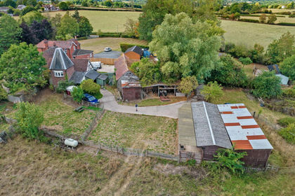
- Price
- £675,000
- Size
- 2.4 acres
Kilncroft, Whitbourne, Worcestershire. WR6, Whitbourne, Herefordshire, County of WR6 England
Added on 29/01/2026Equestrian property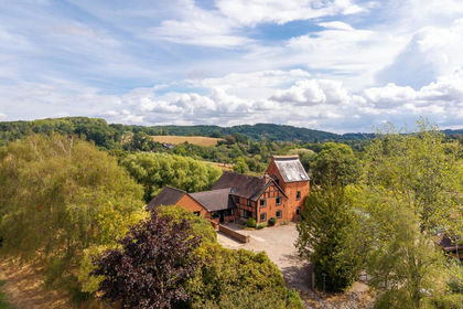
- Price
- Guide Price£895,000
- Size
- 4 acres
Whitbourne, Worcestershire/Herefordshire border, Whitbourne, Herefordshire, County of WR6 England
Added on 09/09/2026House with Land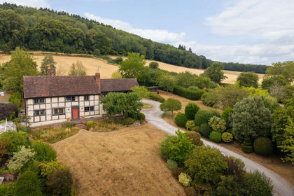
- Price
- Guide Price£895,000
- Size
- 2.6 acres
Alfrick Pound, Worcestershire, Suckley, Worcestershire WR6 England
Added on 20/08/2026House with Land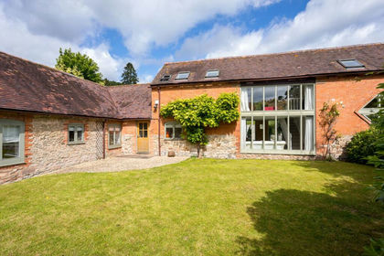
- Price
- Guide Price£725,000
Suckley, Worcestershire, Suckley, Worcestershire WR6 England
Added on 28/04/2026Barn Conversion
- Price
- Offers in Excess of£800,000
- Size
- 2.3 acres
Tedstone Delamere, Bromyard, Tedstone Delamere, Herefordshire, County of HR7 England
Added on 29/01/2026Barn Conversion
- Price
- Offers in Region of£600,000
- Size
- 1.5 acres
The Barn House, WR6, Acton Beauchamp, Herefordshire, County of WR6 England
Added on 18/06/2026Barn Conversion
- Price
- Guide Price£900,000
Bromyard Road, Cradley, WR13, Evesbatch, Herefordshire, County of WR13 England
Added on 16/09/2026Barn Conversion
- Price
- From£595,000
Mistletoe Way, Worcester, WR6, Martley, Worcestershire WR6 England
Added on 29/01/2026Self Build Plot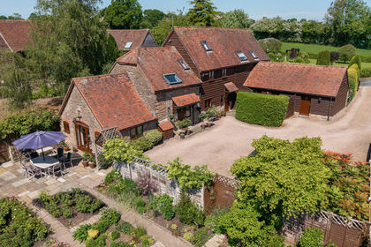
- Price
- Guide Price£600,000
Harpley, Clifton Upon Teme, Worcester, Lower Sapey, Worcestershire WR6 England
Added on 16/07/2026Barn Conversion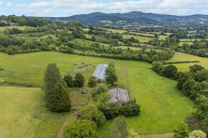
- Price
- £800,000
- Size
- 2.95 acres
Added on 29/01/2026Development Land