Morville Heath, Bridgnorth, WV16
- Land size
- 4.92 acres
- Bedrooms
- 13
- Bathrooms
- 5
Key Features
- 4.92 acres (1.99 hectares) Rural Estate
- Development and investment opportunities
- Multiple residential properties
- Land and buildings
- Offered as a whole or in up to five lots
- Accessible rural Shropshire location
Description
Morville Heath Estate comprises a number of residential properties in need of modernisation and improvement, traditional buildings with scope for conversion, range of modern buildings including Farm Shop and Pastureland extending to 4.92 acres in all.
Offered as a whole or in 5 lots.
Description
An exciting investment and development opportunity in rural surroundings on the outskirts of Bridgnorth, Shropshire. Morville Heath Estate comprises a number of residential properties in need of modernisation and improvement including period farmhouse, former coaching inn converted into three maisonettes, farm cottage, traditional buildings with scope for conversion, range of modern buildings, including farm shop and areas of pasture land extending to approximately 4.92 acres (1.99 ha) in all. Offered for sale as a whole or in up to 5 lots. Lot 1 - Morville Heath Farmhouse 0.33 acres (0.13ha) Lot2 - The Boars Head 0.65 acres (0.26 ha) Lot3 - 20 Morville Heath 0.53 acres (0.22 ha) Lot4 - Farm Shop 0.19acres (0.08 ha) Lot 5 - Buildings and Pasture Land 3.22 acres (1.30 ha)
Situation
The Morville Heath Estate is situated in an attractive rural position within the Shropshire countryside, close to the village of Morville and within convenient reach of the market town of Bridgnorth in the picturesque Severn Valley. Morville is centred around the National Trust owned Elizabethan Morville Hall and has a small Ofsted rated ‘Good’ primary school in rural surroundings with Bridgnorth having a range of primary, secondary and pre-school educational provisions as well as a good range of local shops, restaurants and leisure facilities. Natural and cultural heritage are on the doorstep, with an escape to the Shropshire Hills National Landscape Area and the UNESCO World Heritage Site of Ironbridge Gorge just a short drive away. Telford, Kidderminster, Wolverhampton and the County town of Shrewsbury, all lie within a 16-mile radius, with mainline rail links. The M54 and access to the wider motorway network is just a 20-minutes’ drive, and Birmingham airport (truncated)
Farmhouse
A traditional former farmhouse with garden and grounds including garage and outbuilding. Set in a third of an acre of grounds, this period farmhouse requires a full scheme of renovation and modernisation, currently providing 4 bedrooms, 3 reception rooms, 1 bathroom, kitchen and utility over two floors with scope for further accommodation in the attic space, this property offers the opportunity to create a substantial single dwelling in a rural setting. Outside is a garage and a dilapidated outbuilding with generous lawned gardens bounded by a mature hedge. A right of access will be given over the initial section of drive to Lot 3.
Boars Head
Former Boars Head Coaching Inn, now arranged as three self-contained residential maisonettes, together with a range of traditional farm buildings , previously used as a farm office and hatchery and small orchard. Converted into three, 2-bedroom, 2-storey flats this former coaching inn provides potential for continued rental investment income or alternatively, conversion into a substantial single dwelling and smallholding together Lot 5. The traditional building offers scope for alternative uses or conversion to residential subject to obtaining all the relevant consents. Flat 1 is currently tenanted on an APT however vacant possession will be given on completion.
20 Morville Heath
A redundant cottage with associated outbuildings. This two-storey property offers potential for renovation, replacement or redevelopment, subject to obtaining the necessary planning permissions. The plot provides private garden and grounds extending to about half an acre. Outside is a brick-built garage, range of timber and corrugated iron outbuildings and timber chalet building. A Prohibition Order served by Shropshire Council currently restricts sleeping and living accommodation. A right of access will be granted over the initial section of drive forming part of Lot 1.
Farm Shop
Former Farm Shop building, fronting the main A458 Bridgnorth – Shrewsbury road. A brick and block wall building with concrete floor and timber weather boarding under corrugate sheet roof. Access is directly off the A458 with a small yard and parking area to the front, and area of trees, perfect for associated outside seating subject to the necessary consents. The access drive will be subject to rights of access to Lot 5 and adjoining land.
Buildings and Pasture Land
A parcel of land comprising modern buildings together with approximately 2.75 acres of pasture. A range of modern buildings of steel frame, block wall, and timber pole barn construction, including Dutch barn and lean-to, various pitched roofed buildings, some with roller shutter doors and utilised as workshops and storage. The buildings are suitable for agricultural use, storage or may convert to stabling subject to the usual consents. The land would lend itself to agricultural or equestrian grazing, market gardening or woodland creation. A right of access will be granted over Lot 4.
Land Grade and Soil Type
The land is classified as grade 3 on the provisional Agricultural Land Classification maps for England. The soil type is predominantly a slowly permeable seasonally wet, slightly acid but base rich loamy and clayey soil of moderate fertility.
Agri-Environment Schemes
The land is not currently entered into any agri-environment schemes.
Designations
The land is outside of the Nitrate Vulnerable Zone (NVZ) designation and none of the buildings are known to be Heritage Listed.
Buildings LOT 2
1 - Farm office and hatchery 185m2 Single storey, brick walls under pitched tile roof with concrete floor 2 – Storage building 63m2 Timber building on concrete pad divided into three bays with timber doors under felt roof.
Buildings LOT 3
6 – Chalet. 80m2 Timber building, box profile sheet roof, small timber lean-to shed 7 – Garage 32m2 Brick built open front garage, concrete floor, pitched tile roof 8 - Shed/workshop 37.31m2 Timber frame building, corrugate sheet walls and roof
Buildings LOT 4
3 - Farm Shop 42.3m2 Brick and block walls with timber weather boarding under corrugate sheet roof with concrete floor
Buildings LOT 5
4 – Lock-up and Storage Building 385m2 Steel frame, asbestos cement pitched roof over lattice trusses, concrete floor, internal block wall division creating lockup unit with loft over and two roller shutter doors. Lean-to of similar construction with mono-pitched roof and concrete floor. Adjoining steel framed building asbestos cement pitched roof over lattice trusses, stoned floor, timber hay racks, part brick, part block gable end walls and corrugated sheet cladding. 5 - Dutch Barn 105m2 Timber and steel framed barn enclosed by corrugated sheet roof, open ended with timber sleepers forming side walls, earth floor.
Services
The property benefits from mains water and electricity with private drainage. If sold in lots, some separation of services and/or new connections will be required.
Council Tax and Business Rates
Morville Heath Farmhouse - D Flat 1 The Boars Head - A Flat 2 The Boars Head - A Flat 3 The Boars Head - not rated 20 Morville Heath not - rated Farm Shop - RV £3,100
EPC
Morville Heath Farmhouse - 1 G Flat 1 The Boars Head - 40 E Flat 2 The Boars Head - 2 G Flat 3 The Boars Head - 24 F 20 Morville Heath – N/A
Wayleaves, Easements, Rights of Way
A public footpath crosses the property between the A458 and Telegraph Lane, affecting Lot 3.
Sporting, Timber & Mineral Rights
Insofar as they are owned, the sporting and timber rights are included in the sale.
Method of Sale
The Morville Heath Estate is offered for sale by Private Treaty, as a whole or in up to five separate lots.
Tenure
Freehold with vacant possession on completion.
Planning
The estate offers a number of development opportunities from renovation, modernisation, extension and reconfiguration of existing residential units to conversion of former agricultural structures to new residential, commercial or alternative uses subject to obtaining the relevant planning and building regulation consents. The farm shop could be reinstated and begin trading without planning consent. Interested parties should make enquiries of the Local Planning Authority. Land adjoining and in close proximity to the estate has been represented through previous Development Plan Reviews and includes land allocated within the Shropshire Allocations and Management of Development (SAMDev) Plan for employment use and mineral extraction during the current plan period to 2038.
Local Authority
Shropshire Council The Guildhall Frankwell Quay Tel: .
Viewings
Strictly by prior appointment with the selling agents.
Directions
What3words ///chitchat.gifted.closed From the roundabout at the top of Bridgnorth bypass, take the A458 towards Shrewsbury and the property can be found on the left hand side after approximately 1.2 miles. For Sat Nav use WV16 5NA
Map Location
Property details
- Tenure
- Ask Agent
- Council Tax Band
- TBC
- Date Posted
- 2026-06-25
Market Value Analysis
Compared with 1,032 Homes with Land listings in West Midlands (1+ acres).
Utilities & Restrictions
Utilities
- Electricity
- Ask Agent
- Water
- Ask Agent
- Heating
- Ask Agent
- Broadband
- Ask Agent
- Sewerage
- Ask Agent
Rights & Restrictions
- Public Rights of Way
- Ask Agent
- Private Rights of Way
- Ask Agent
- Listed Property
- Ask Agent
- Restrictions
- Ask Agent
Listed status, conservation areas and planning constraints for this location are in the full report.
Property Features
- Accessibility
- Ask Agent
- Parking
- Parking Available
- Garden
- Garden
Beyond the particulars: planning activity, flood history, heritage and ground risks, checked for this exact spot.
Connectivity
Broadband
Fastest speed available at this postcode
25 Mbps
Standard (10-30 Mbps)
Suitable for
- Web & social
- Music streaming
- Standard video calls
Fixed wireless access may also be an option here.
Mobile signal
Predicted 4G and 5G signal; indoor signal depends on building materials.
Ofcom Connected Nations postcode-level predictions. Speeds and signal are modelled, not measured, and vary between addresses and providers.
Signal is the easy part. Planning activity, flood history and protected designations here are in the full report.
Nearest Schools
Primary
- Morville CofE (Controlled) Primary School0.9 milesOfsted: Good
- Ages
- 5 to 11
- Pupils
- 59
- Type
- Academy sponsor led
- Faith
- Church of England
- Castlefields Primary School1.6 milesOfsted report card · May 2026
- Ages
- 3 to 11
- Pupils
- 226
- Type
- Academy converter
- St John's Catholic Primary School, A Voluntary Academy1.7 milesOfsted: Requires improvement
- Ages
- 4 to 11
- Pupils
- 193
- Type
- Academy converter
- Faith
- Catholic
- St Leonard's CofE Primary School1.8 milesOfsted report card · Mar 2026
- Ages
- 3 to 11
- Pupils
- 261
- Type
- Academy converter
- Faith
- Church of England
- St. Mary's Bluecoat Church of England Primary School2.5 milesOfsted: Good
- Ages
- 3 to 11
- Pupils
- 188
- Type
- Academy converter
- Faith
- Church of England
Secondary
- Oldbury Wells School1.7 milesNo Ofsted rating
- Ages
- 11 to 16
- Pupils
- 740
- Type
- Academy converter
- Bridgnorth Endowed School1.9 milesOfsted: Good
- Ages
- 11 to 16
- Pupils
- 601
- Type
- Academy converter
- William Brookes School5.8 milesOfsted: Requires improvement
- Ages
- 11 to 16
- Pupils
- 748
- Type
- Academy converter
- Haberdashers' Abraham Darby6.5 milesOfsted report card · Feb 2026
- Ages
- 11 to 18
- Pupils
- 1,084
- Type
- Academy sponsor led
- Madeley Academy7.2 milesOfsted: Good
- Ages
- 11 to 18
- Pupils
- 1,220
- Type
- Academy sponsor led
Distances are straight-line from the advertised location. Source: the national school registers (DfE, Welsh Government, Scottish Government) and Ofsted.
Schools are just the start: sold prices nearby, planning activity and any flood history are in the full report.
Amenities
Supermarket
GP surgery
Pharmacy
Hospital
Straight-line distances from the advertised location. Sources: NHS records, Geolytix supermarket locations, OS Open Greenspace and the national trails registers.
The area stacks up? Now check the location itself: planning nearby, protected designations and past flooding.
Getting Around
Nearest station
Nearest bus stop
Typical drive times
Straight-line distances from the advertised location; drive times are typical free-flow times over OpenStreetMap road data, so allow more at peak. Public transport locations from DfT NaPTAN.
Easy to reach matters. So do planning activity, flood history and ground risks: all in the full report.
Flood Risk
Environment Agency open data, checked around the advertised map pin for the listed acreage. Long-term risk counts flood defences; the planning map's flood zones do not. Provided by LandSale, not the listing agent, and not part of the agent's particulars. Risk varies across a holding, so verify before committing.
Rivers and the sea
Planning map: Flood Zone 1.
Surface water
Not at the pin: mapped about 10 metres away.
These bandings are the summary. Where this location sits on the flood maps, plus planning activity, heritage and ground risks, is in the full report.
Important notice: Information, maps and tags on this page are drawn from the advertising agent's marketing materials or generated automatically. LandSale has not verified them. Relying on these details is at your own risk, always carry out independent checks before committing to a purchase.
LandSale full disclaimer
Marketing information only - not formal particulars. The details on this website are provided for general guidance and do not constitute an offer or contract. Neither LandSale nor the advertising estate/land agent accepts responsibility for any inaccuracy.
1. Source of information
- Listing content: Core description, asking price, tenure, measurements, photographs and planning history originate from the marketing materials of the advertising estate or land agent. LandSale does not author this content and cannot guarantee its accuracy.
- Automated tags & categorisation: Property type, land-use class, acreage bands and similar labels may be applied by machine-learning models. They are intended as a helpful guide only and may not reflect the property's legal status or permitted use.
- Third-party & enriched data layers: Maps, boundary outlines, planning designations, soil reports, broadband coverage and other environmental or location-based insights are licensed from external suppliers. Such data are supplied “as is", may be incomplete or out of date and are subject to change without notice.
2. Verification required
Prospective purchasers must verify critical matters, including but not limited to planning permission, title boundaries, public rights of way, environmental constraints, acreage, services, access and VAT status, through their own inspections, specialist surveys, legal advisers and the selling agent before relying on the information or entering into any contract.
3. No warranty or liability
LandSale gives no warranty, express or implied, as to the accuracy, completeness or fitness for any particular purpose of the information displayed. LandSale shall not be liable for any loss, damage, cost or expense arising directly or indirectly from any use of or reliance on such information, save where liability may not be excluded by law.
4. Updates & feedback
If you believe any detail on this listing is inaccurate, please let us know. We will investigate and, where appropriate, update the listing or notify the agent.
© LandSale | Version 1.3 - August 2026
Similar properties for sale
- Price
- Offers in Region of£1,100,000
- Size
- 3 acres
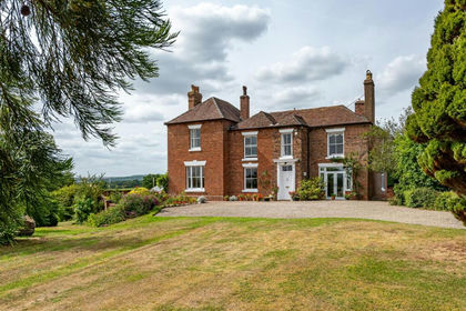
The Old Rectory, Cross Lane Head, Bridgnorth, Astley Abbotts, Shropshire WV16 England
Added on 27/03/2026House with Land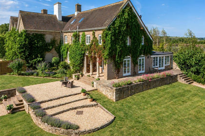
- Price
- £875,000
- Size
- 4 acres
Lower Glazeley Manor, Glazeley, Bridgnorth, Glazeley, Shropshire WV16 England
Added on 10/09/2026House with Land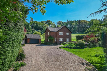
- Price
- Offers in Region of£850,000
- Size
- 6.8 acres
Quatford Grange, Sandyburn Lane, Quatford, Bridgnorth, Bridgnorth, Shropshire WV15 England
Added on 01/03/2026House with Land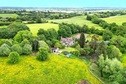
- Price
- £850,000
- Size
- 4 acres
Middleton Scriven, Bridgnorth, WV16, Middleton Scriven, Shropshire WV16 England
Added on 07/05/2026Cottage
- Price
- Offers in Region of£995,000
- Size
- 4 acres
Little Orchard, Roughton, Nr Bridgnorth, WV15, Worfield, Shropshire WV15 England
Added on 02/08/2026Barn Conversion
- Price
- Offers in Region of£800,000
- Size
- 4.5 acres
Added on 04/02/2026House with Land
- Price
- Offers in Region of£750,000
- Size
- 2.56 acres
Ladywood, Ironbridge, TF8, The Gorge, Telford and Wrekin TF8 England
Added on 01/08/2026House with Land
- Price
- £750,000
- Size
- 10 acres
Added on 22/06/2026House with Land
- Price
- £900,000
- Size
- 13 acres
Lincoln Hill, Ironbridge, TF8, The Gorge, Telford and Wrekin TF8 England
Added on 23/09/2026House with Land
- Price
- Guide Price£975,000
- Size
- 5.47 acres
Home Farm, Hughley, Shrewsbury, Hughley, Shropshire SY5 England
Added on 29/01/2026Barn Conversion