Moor Lane, Leasingham Moor, Sleaford
- Land size
- 6.97 acres
- Bedrooms
- 5
- Bathrooms
- 4
Key Features
- Picturesque Small-Holding
- 5 Bedroom Farmhouse
- Open-Plan Kitchen
- Three Reception Rooms
- Utility, Pantry & Laundry
- Four Bath/Shower Rooms
- Two Dressing Rooms
- Double Garage
- Gym
- Woodland & Paddocks
Description
GUIDE PRICE: £700,000 - £750,000. A tranquil and diverse small holding, enjoying seven acres of unspoilt countryside, dominated by a spacious and easy-living principal residence. **NO ONWARD CHAIN**
Description - Tucked away in a private and rural position, yet within close proximity to local amenities, this stunning small holding offers the discerning buyer a little of everything; a prominent farmhouse, gorgeous gardens, a bountiful orchard, a woodland haven and versatile paddock land. Set within 6.97 acres, this splendid residence enjoys accommodation that briefly includes a large entrance hall, an extended open-plan country kitchen, a formal dining room, a main lounge and a large home-office or family room. The ground floor further benefits from a utility room, a shower room, a walk-in pantry and a separate laundry room. Upstairs there are five double bedrooms and three bathrooms, with the master enjoying both a large walk-in wardrobe and an additional dressing area.
Outside - The property is approached through large gates onto an extensive private gravel driveway with parking for multiple vehicles. There are lawns to the front with a charming summerhouse and pagoda providing an ideal space for outdoor dining and entertaining. There is a large double garage that is alarmed and a detached gym. To the rear of the property is another lawn and an additional entertaining space. The side garden is beautifully landscaped with beds and shrubs together with a water feature running the width of this elegantly enclosed space. Tucked away in the copse closest to the house is a vegetable patch and a polytunnel.
At the bottom of the front lawn is another gate that leads out to a well-stocked orchard providing a wide range of fruits and conveniently benefits from an independent access through a gate onto the lane. The paddocks are fenced into different sections and are complemented by a large field shelter. A pretty and diverse woodland is located at the bottom of the paddocks which have a wide range of mature species with paths and seating areas, together with an additional gated access off the highway.
Location - Leasingham is a typical Lincolnshire village situated about 3 miles north of Sleaford. There is a post office/general store, primary school, a farm shop with cafe, a pub and a church. Approximately three miles away is the larger village of Ruskington which provides a wider range of facilities including a doctors surgery and a railway station.
Sleaford (2.5 miles) is an attractive, busy market town promoting traditional village values whilst encouraging a thriving community. The River Slea and Sleaford Canal run through the heart of the town centre creating a pleasant retailing environment. The town centre provides a wide range of amenities with plenty of shops, banks, pubs and cafes. Supermarkets in Sleaford include Tesco, Sainsbury, Lidl and Aldi. The thrice weekly market offers a range of stalls selling fresh produce, flowers and clothes. Buses operate regularly to the town centre. There is a popular leisure centre with large swimming pool and separate children's pool with water activities. There are many historic buildings in the town with St Denys Church having one of the oldest broach spires in England. Other visitor attractions in the local area include Cogglesford Watermill, Heckington Windmill and Belton House.
There are plenty of activities and events on offer for all members of the family. The Charity Raft Race and The Water Festival are held annually with music and entertainment. There is an indoor play centre in Sleaford for younger family members and nearby Ancaster offers more adventurous activities of karting, quad biking, paintballing, bowling and lasertag.
Schools - The village has it's own primary school, The Leasingham St Andrew's Church of England Primary School, which is Ofsted rated 'Good'. Sleaford's well respected secondary schools – Kesteven and Sleaford High School and St George’s Academy and Carre’s Grammar School - have all been rated ‘Good’ by Ofsted. There are also numerous primary schools located in both Helpringham and Heckington.
Services - The dwelling is centrally heated throughout (oil) and is connected to mains water and electricity. Private drainage is also connected.
Energy Performance - Rating: D
Council Tax - Band: D
Method Of Sale - The property is offered for sale by Private Treaty.
Tenure - Freehold with vacant possession on completion.
Viewing - Strictly by prior arrangement with the Agents ).
Additional Information - For further details, please contact Mount & Minster, Grantham:
T:
@:
Please note that prior to communicating any offer, Mount & Minster are required to verify the identity of the buyer to comply with the requirements of the Money Laundering, Terrorist Financing and Transfer of Funds (Information on the Payer) Regulations 2017. Some images may have been digitally enhanced to add furniture for illustrative purposes and not included in the sale or enhanced for seasonal presentation. No structural or permanent features offered for sale have been altered. Estate agents are required to perform Anti-Money Laundering (AML) checks on both buyers and sellers under the Money Laundering, Terrorist Financing and Transfer of Funds Regulations 2017. In the event an offer is accepted, the buyer is required to complete a Credas Smart Search before instructing solicitors to verify identity under AML legislation at a cost of £75 per name acquiring the property.
Map Location
Property details
- Tenure
- Freehold
- Council Tax Band
- Ask Agent
- Date Posted
- 2026-06-22
Market Value Analysis
Compared with 185 Homes with Land listings in East Midlands (5+ acres).
Energy Performance Certificate
Energy Efficiency Rating
Based on UK Energy Performance Certificate standards (EU Directive 2002/91/EC)
Running costs are one side. Planning activity, flood history and ground risks for this location are in the full report.
Utilities & Restrictions
Utilities
- Electricity
- Ask Agent
- Water
- Ask Agent
- Heating
- Ask Agent
- Broadband
- Ask Agent
- Sewerage
- Ask Agent
Rights & Restrictions
- Public Rights of Way
- Ask Agent
- Private Rights of Way
- Ask Agent
- Listed Property
- Ask Agent
- Restrictions
- Ask Agent
Listed status, conservation areas and planning constraints for this location are in the full report.
Property Features
- Accessibility
- Ask Agent
- Parking
- Parking Available
- Garden
- Garden
Beyond the particulars: planning activity, flood history, heritage and ground risks, checked for this exact spot.
Connectivity
Broadband
Fastest speed available at this postcode
12 Mbps
Standard (10-30 Mbps)
Suitable for
- Web & social
- Music streaming
- Standard video calls
Fixed wireless access may also be an option here.
Mobile signal
Outdoor predictions; indoor signal depends on building materials.
Ofcom Connected Nations postcode-level predictions. Speeds and signal are modelled, not measured, and vary between addresses and providers.
Signal is the easy part. Planning activity, flood history and protected designations here are in the full report.
Nearest Schools
Primary
- Winchelsea Primary School Ruskington1.1 milesOfsted: Good
- Ages
- 3 to 11
- Pupils
- 212
- Type
- Community school
- Ruskington Chestnut Street Church of England Academy1.2 milesOfsted: Good
- Ages
- 3 to 11
- Pupils
- 154
- Type
- Academy converter
- Faith
- Church of England
- The Leasingham St Andrew's Church of England Primary School1.8 milesNo Ofsted rating
- Ages
- 4 to 11
- Pupils
- 190
- Type
- Voluntary controlled school
- Faith
- Church of England
- William Alvey School1.9 milesOfsted: Good
- Ages
- 3 to 11
- Pupils
- 570
- Type
- Academy converter
- Faith
- Church of England
- Church Lane Primary School & Nursery2 milesOfsted: Outstanding *
- Ages
- 3 to 11
- Pupils
- 218
- Type
- Community school
Secondary
- Carre's Grammar School2 milesOfsted: Good
- Ages
- 11 to 18
- Pupils
- 810
- Type
- Academy converter
- St George's Academy2.1 milesOfsted: Good
- Ages
- 11 to 18
- Pupils
- 2,281
- Type
- Academy sponsor led
- Kesteven and Sleaford High School Selective Academy2.3 milesOfsted: Outstanding *
- Ages
- 11 to 18
- Pupils
- 747
- Type
- Academy converter
- Gender
- Girls
- Sir William Robertson Academy, Welbourn8 milesNo Ofsted rating
- Ages
- 11 to 18
- Pupils
- 1,015
- Type
- Academy converter
- The Barnes Wallis Academy10 milesNo Ofsted rating
- Ages
- 11 to 16
- Pupils
- 483
- Type
- Academy sponsor led
* Latest graded judgement covers quality of education only; no overall grade was issued under the 2024-25 inspection framework.
Distances are straight-line from the advertised location. Source: the national school registers (DfE, Welsh Government, Scottish Government) and Ofsted.
Schools are just the start: sold prices nearby, planning activity and any flood history are in the full report.
Amenities
Supermarket
GP surgery
Pharmacy
Hospital
Straight-line distances from the advertised location. Sources: NHS records, Geolytix supermarket locations, OS Open Greenspace and the national trails registers.
The area stacks up? Now check the location itself: planning nearby, protected designations and past flooding.
Getting Around
Nearest station
Nearest bus stop
Typical drive times
Straight-line distances from the advertised location; drive times are typical free-flow times over OpenStreetMap road data, so allow more at peak. Public transport locations from DfT NaPTAN.
Easy to reach matters. So do planning activity, flood history and ground risks: all in the full report.
Flood Risk
From Environment Agency flood map open data, checked around the advertised map pin and allowing for the listed acreage where known. This summary comes from LandSale, the advertising platform, not from the listing agent, and is not part of the agent's particulars. Risk can vary across a single holding, so verify anything critical through your own searches before committing.
Rivers and the sea
Surface water
Mapped within the area searched, not at the advertised map pin itself.
The detail behind these bandings
The full report pinpoints where this location sits on the flood maps, and runs the deeper checks that usually only surface after an offer.
- Exact flood zones & annual chances (included in the full report)
- Any recorded past flooding (included in the full report)
- Planning activity nearby (included in the full report)
- Heritage & conservation (included in the full report)
- Protected nature designations (included in the full report)
- Ground risks (included in the full report)
- Sold prices nearby (included in the full report)
£14.99 · one-off purchase
By LandSale, the platform. Not provided by the listing agent. Ready in about a minute.
Important notice: Information, maps and tags on this page are drawn from the advertising agent's marketing materials or generated automatically. LandSale has not verified them. Relying on these details is at your own risk, always carry out independent checks before committing to a purchase.
LandSale full disclaimer
Marketing information only - not formal particulars. The details on this website are provided for general guidance and do not constitute an offer or contract. Neither LandSale nor the advertising estate/land agent accepts responsibility for any inaccuracy.
1. Source of information
- Listing content: Core description, asking price, tenure, measurements, photographs and planning history originate from the marketing materials of the advertising estate or land agent. LandSale does not author this content and cannot guarantee its accuracy.
- Automated tags & categorisation: Property type, land-use class, acreage bands and similar labels may be applied by machine-learning models. They are intended as a helpful guide only and may not reflect the property's legal status or permitted use.
- Third-party & enriched data layers: Maps, boundary outlines, planning designations, soil reports, broadband coverage and other environmental or location-based insights are licensed from external suppliers. Such data are supplied “as is", may be incomplete or out of date and are subject to change without notice.
2. Verification required
Prospective purchasers must verify critical matters, including but not limited to planning permission, title boundaries, public rights of way, environmental constraints, acreage, services, access and VAT status, through their own inspections, specialist surveys, legal advisers and the selling agent before relying on the information or entering into any contract.
3. No warranty or liability
LandSale gives no warranty, express or implied, as to the accuracy, completeness or fitness for any particular purpose of the information displayed. LandSale shall not be liable for any loss, damage, cost or expense arising directly or indirectly from any use of or reliance on such information, save where liability may not be excluded by law.
4. Updates & feedback
If you believe any detail on this listing is inaccurate, please let us know. We will investigate and, where appropriate, update the listing or notify the agent.
© LandSale | Version 1.3 - August 2026
Similar properties for sale
- Price
- £700,000
- Size
- 3 acres
Westcliffe, Sleaford, Lincolnshire, NG34, Ruskington, Lincolnshire NG34 England
Added on 25/06/2026House with Land
- Price
- Offers Over£585,000
- Size
- 3 acres
Ferry Lane, North Kyme, Lincoln, Lincolnshire, LN4, North Kyme, Lincolnshire LN4 England
Added on 04/06/2026House with Land
- Price
- £675,000
- Size
- 5.5 acres
Added on 15/07/2026Barn Conversion
- Price
- Guide Price£670,000
- Size
- 12.28 acres
Added on 16/06/2026Equestrian property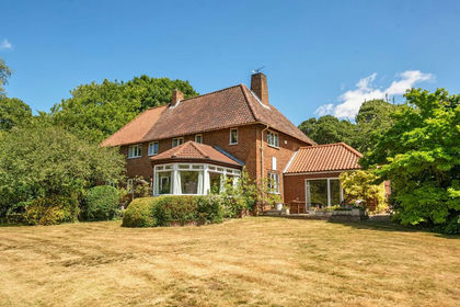
- Price
- Guide Price£749,950
- Size
- 3 acres
Lincoln Road, Boothby Graffoe, LN5, Boothby Graffoe, Lincolnshire LN5 England
Added on 05/07/2026Country Home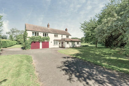
- Price
- £825,000
- Size
- 4.9 acres
Lincoln Road, Frieston, Grantham, Caythorpe, Lincolnshire NG32 England
Added on 10/09/2026House with Land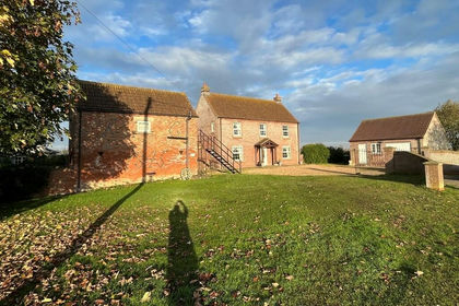
- Price
- Guide Price£720,000
- Size
- 15.86 acres
Catlins Farm, Swineshead Bridge, Swineshead, Lincolnshire PE20 England
Added on 11/02/2026Agricultural Land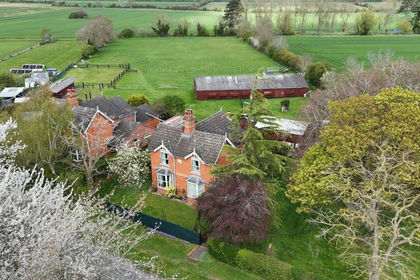
- Price
- £625,000
- Size
- 3 acres
Brookfield House, Billingborough, Billingborough, Lincolnshire NG34 England
Added on 16/07/2026Country Home
- Price
- Guide Price£720,000
- Size
- 5.12 acres
Blacksmith Lane, Welby, NG32, Welby, Lincolnshire NG32 England
Added on 21/07/2026House with Land
- Price
- £850,000
- Size
- 8 acres
Abbey Lane, Woodhall Spa, Woodhall Spa, Lincolnshire LN10 England
Added on 18/06/2026House with Land