Reynalton, Kilgetty, SA68
- Land size
- 12 acres
- Bedrooms
- 4
- Bathrooms
- 1
Key Features
- Charming traditional Pembrokeshire farmstead set in 12 acres
- 4-bedroom detached Pembrokeshire farmhouse
- A range of traditional and modern farm buildings, some in need of repairs
- Popular edge of rural village location
- Convenient location 4-miles equidistance from popular market town of Narberth and village of Kilgetty
Description
Clover Hill is a delightful traditional Pembrokeshire homestead extending to approximately 12 acres, occupying an enviable semi-rural position on the edge of the sought-after village of Reynalton. Enjoying a wonderful sense of peace and privacy, the property is perfectly located just 4 miles from both the thriving market town of Narberth and the popular village of Kilgetty, providing an exceptional combination of idyllic countryside living and excellent access to local amenities and the Pembrokeshire coastline.
Location
A delightful traditional Pembrokeshire homestead extending to approximately 12 acres, occupying an enviable semi-rural position on the edge of the sought-after village of Reynalton. Enjoying a wonderful sense of peace and privacy, the property is perfectly located just 4 miles from both the thriving market town of Narberth and the popular village of Kilgetty, providing an exceptional combination of idyllic countryside living and excellent access to local amenities and the Pembrokeshire coastline.
Clover Hill offers the most decerning buyer an opportunity to acquire a country small holding / lifestyle / equestrian holding, with excellent scope for a range of uses, subject to obtaining the necessary planning consents.
Farmhouse
At the heart of the holding lies a characterful traditional Welsh farmhouse, arranged over two storeys and offering flexible three-bedroom accommodation, including two useful box rooms. Brimming with charm and retaining a wealth of original period features, the property presents a rare opportunity to create a truly impressive country residence. While now requiring a degree of updating, the farmhouse enjoys beautifully landscaped grounds and an idyllic rural setting.
Hallway
6.3m x 1.39m (20' 8" x 4' 7")
Living Room
5.94m x 3.74m (19' 6" x 12' 3")
Kitchen
6.26m x 3.02m (20' 6" x 9' 11")
Bedroom 1
3.72m x 5.43m (12' 2" x 17' 10")
Utility Room
2.37m x 2.13m (7' 9" x 7' 0")
FIRST FLOOR
Landing
4.21m x 2.36m (13' 10" x 7' 9")
Bedroom 2
4.02m x 3.88m (13' 2" x 12' 9")
Bedroom 3
2.5m x 3.71m (8' 2" x 12' 2")
Bedroom 4
4.14m x 3.13m (13' 7" x 10' 3")
Bathroom
2.54m x 2.95m (8' 4" x 9' 8")
Bedroom / Dressing Room
2.35m x 2.14m (7' 9" x 7' 0")
Bedroom / Office
2.33m x 1.88m (7' 8" x 6' 2")
Outbuildings
Forming an attractive feature of the holding, a charming courtyard range of traditional stone outbuildings adjoins the homestead and offers immense character and exciting potential. Currently utilised for storage and livestock housing, the buildings present an excellent opportunity for conversion into additional accommodation, holiday cottages or lifestyle amenities, subject to the necessary planning consents. Complementing the range are further stabling, loose boxes and a tack room, ideally suited to equestrian, hobby farming or rural lifestyle pursuits.
Set beyond the courtyard is a substantial modern general purpose / loose housing farm building, offering excellent versatility for agricultural, storage or livestock use.
Land
The land extends predominantly to the east of the homestead and presents an excellent block of productive pastureland, comprising level to gently undulating ground ideally suited to both grazing and mowing. Divided into a number of well-sized, easily managed enclosures, the land offers versatility for a range of agricultural and equestrian uses.
Access is both convenient and practical, available directly via the homestead, together with the added advantage of gated access onto unclassified highways along the western and northern boundaries.
The land benefits from freely draining, slightly acidic loamy soils and is classified as Grade 3a on the predictive Agricultural Land Classification.
Tenure
We understand the property is held on a freehold basis.
Services
We understand that the property benefits from mains water and electricity, private drainage and air source heating. None of the services have been tested.
Energy Performance Certificate
EPC Rating C (72).
Council Tax Band
We understand that the Pembrokeshire County Council Tax Band is E - approx £2,111.95 for 2026/2027.
Wayleaves, Easements and Right of Way
The property is sold to and with the benefit of all rights, including rights of way, whether public or private, light, support, drainage, water and electricity supplies and any other rights and obligations, easements and proposed wayleaves for masts, pylons, stays, cables, drains and water, gas and other pipes, whether referenced or not.
Planning
Please direct all planning related enquiries to Carmarthenshire County Council Planning Department - 2D County Hall Haverfordwest Pembrokeshire SA61 1TP.
Telephone: 01437 775361.
E-mail: [email protected]
Local Authority
Pembrokeshire County Council, County Hall, Haverfordwest SA61 1TP
Phone: 01437 764551
Viewing
Strict by appointment with the Joint Selling Agents Rees Richards & Partners & Black Bear, Tenby
Please contact us on 01834 526126 or email [email protected] for further information.
Map Location
Property details
- Tenure
- Freehold
- Council Tax Band
- Ask Agent
- Date Posted
- 2026-06-18
Price history
| Date | Change | Price |
|---|---|---|
| 25 Aug 2026 | Reduced 5.9% (−£40,000) | £635,000 |
| Until 25 Aug 2026 | Asking price | £675,000 |
Market Value Analysis
Compared with 203 Homes with Land listings in Wales (10+ acres).
Property Brochure
Seen the details? The full report adds the independent checks: planning activity, flood history, heritage and ground.
Utilities & Restrictions
Utilities
- Electricity
- Ask Agent
- Water
- Ask Agent
- Heating
- Ask Agent
- Broadband
- Ask Agent
- Sewerage
- Ask Agent
Rights & Restrictions
- Public Rights of Way
- Ask Agent
- Private Rights of Way
- Ask Agent
- Listed Property
- Ask Agent
- Restrictions
- Ask Agent
Listed status, conservation areas and planning constraints for this location are in the full report.
Property Features
- Accessibility
- Ask Agent
- Parking
- Ask Agent
- Garden
- 1 garden
Beyond the particulars: planning activity, flood history, heritage and ground risks, checked for this exact spot.
Connectivity
Broadband
Fastest speed available at this postcode
1.8 Gbps
Gigabit full fibre · available to 90% of premises
Suitable for
- 4K streaming on every screen
- Full-time home working
- Online gaming & big downloads
Mobile signal
Outdoor predictions; indoor signal depends on building materials.
Ofcom Connected Nations postcode-level predictions. Speeds and signal are modelled, not measured, and vary between addresses and providers.
Signal is the easy part. Planning activity, flood history and protected designations here are in the full report.
Nearest Schools
Primary
- St Oswalds Church in Wales VA School1.9 miles
- Pupils
- 135
- Type
- Nursery, Infants & Juniors
- Language
- English medium school / provision
- Templeton Community Primary School2.4 miles
- Pupils
- 126
- Type
- Nursery, Infants & Juniors
- Language
- English medium school / provision
- Stepaside Community Primary School2.5 miles
- Pupils
- 119
- Type
- Nursery, Infants & Juniors
- Language
- English medium school / provision
- Saundersfoot Community Primary School3.6 miles
- Pupils
- 172
- Type
- Nursery, Infants & Juniors
- Language
- English medium school / provision
- Narberth Community Primary School4 miles
- Pupils
- 281
- Type
- Nursery, Infants & Juniors
- Language
- Dual language school / provision (Welsh and English) (including transitional)
Secondary
- Ysgol Greenhill School5.6 miles
- Pupils
- 877
- Type
- Secondary (ages 11-19)
- Language
- English medium school / provision
- Ysgol Harri Tudur / Henry Tudor School8 miles
- Pupils
- 1,152
- Type
- Secondary (ages 11-19)
- Language
- English medium school / provision
- Dyffryn Taf8.2 miles
- Pupils
- 890
- Type
- Secondary (ages 11-19)
- Language
- Dual language school / provision (Welsh and English) (including transitional)
- Ysgol Caer Elen9.7 miles
- Pupils
- 907
- Type
- Middle (ages 3-16)
- Language
- Welsh medium school / provision (including transitional)
- Haverfordwest High VC School9.9 miles
- Pupils
- 1,699
- Type
- Secondary (ages 11-19)
- Language
- English medium school / provision
Distances are straight-line from the advertised location. Source: the national school registers (DfE, Welsh Government, Scottish Government) and Ofsted.
Schools are just the start: sold prices nearby, planning activity and any flood history are in the full report.
Amenities
Supermarket
GP surgery
Pharmacy
Straight-line distances from the advertised location. Sources: NHS records, Geolytix supermarket locations, OS Open Greenspace and the national trails registers.
The area stacks up? Now check the location itself: planning nearby, protected designations and past flooding.
Getting Around
Nearest station
Nearest bus stop
Typical drive times
Straight-line distances from the advertised location; drive times are typical free-flow times over OpenStreetMap road data, so allow more at peak. Public transport locations from DfT NaPTAN.
Easy to reach matters. So do planning activity, flood history and ground risks: all in the full report.
Flood Risk
From Natural Resources Wales flood map open data, checked around the advertised map pin and allowing for the listed acreage where known. This summary comes from LandSale, the advertising platform, not from the listing agent, and is not part of the agent's particulars. Risk can vary across a single holding, so verify anything critical through your own searches before committing.
Rivers and the sea
Surface water
Mapped within the area searched, not at the advertised map pin itself.
These bandings are the summary. Where this location sits on the flood maps, plus planning activity, heritage and ground risks, is in the full report.
Important notice: Information, maps and tags on this page are drawn from the advertising agent's marketing materials or generated automatically. LandSale has not verified them. Relying on these details is at your own risk, always carry out independent checks before committing to a purchase.
LandSale full disclaimer
Marketing information only - not formal particulars. The details on this website are provided for general guidance and do not constitute an offer or contract. Neither LandSale nor the advertising estate/land agent accepts responsibility for any inaccuracy.
1. Source of information
- Listing content: Core description, asking price, tenure, measurements, photographs and planning history originate from the marketing materials of the advertising estate or land agent. LandSale does not author this content and cannot guarantee its accuracy.
- Automated tags & categorisation: Property type, land-use class, acreage bands and similar labels may be applied by machine-learning models. They are intended as a helpful guide only and may not reflect the property's legal status or permitted use.
- Third-party & enriched data layers: Maps, boundary outlines, planning designations, soil reports, broadband coverage and other environmental or location-based insights are licensed from external suppliers. Such data are supplied “as is", may be incomplete or out of date and are subject to change without notice.
2. Verification required
Prospective purchasers must verify critical matters, including but not limited to planning permission, title boundaries, public rights of way, environmental constraints, acreage, services, access and VAT status, through their own inspections, specialist surveys, legal advisers and the selling agent before relying on the information or entering into any contract.
3. No warranty or liability
LandSale gives no warranty, express or implied, as to the accuracy, completeness or fitness for any particular purpose of the information displayed. LandSale shall not be liable for any loss, damage, cost or expense arising directly or indirectly from any use of or reliance on such information, save where liability may not be excluded by law.
4. Updates & feedback
If you believe any detail on this listing is inaccurate, please let us know. We will investigate and, where appropriate, update the listing or notify the agent.
© LandSale | Version 1.3 - August 2026

Listing agent
Rees Richards and Partners, Swansea
12 Spilman Street, Carmarthen, SA31 1LQ
Contact Rees Richards and Partners, Swansea
12 Spilman Street, Carmarthen, SA31 1LQ
View agent profileSimilar properties for sale
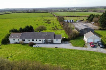
- Price
- Offers in Region of£675,000
- Size
- 7.98 acres
Yerbeston, Kilgetty, SA68, Jeffreyston, Pembrokeshire SA68 Wales
Added on 09/04/2026Smallholding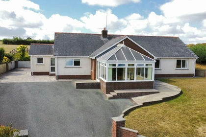
- Price
- Offers in Region of£599,950
- Size
- 9 acres
Princes Gate, Narberth, SA67, Lampeter Velfrey, Pembrokeshire SA67 Wales
Added on 26/08/2026Smallholding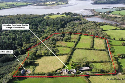
- Price
- Offers in Region of£720,000
- Size
- 15 acres
Landshipping, Narberth, SA67, Martletwy, Pembrokeshire SA67 Wales
Added on 29/01/2026Smallholding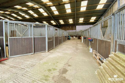
- Price
- £700,000
- Size
- 25 acres
Tavernspite, Whitland, Eglwyscummin, Carmarthenshire SA34 Wales
Added on 29/01/2026Smallholding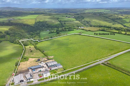
- Price
- £650,000
- Size
- 16 acres
Maenclochog, Clynderwen, SA66, Maenclochog, Pembrokeshire SA66 Wales
Added on 04/07/2026Smallholding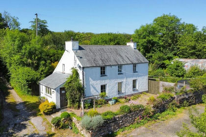
- Price
- Offers in Region of£695,000
- Size
- 28 acres
Llanycefn, Clynderwen, SA66, Maenclochog, Pembrokeshire SA66 Wales
Added on 05/06/2026Smallholding
- Price
- Offers in Region of£699,950
- Size
- 17 acres
Laugharne, Carmarthen, SA33, Laugharne Township, Carmarthenshire SA33 Wales
Added on 02/05/2026Smallholding
- Price
- Offers in Region of£760,000
- Size
- 15 acres
St. Clears, Carmarthen, SA33, Llangynin, Carmarthenshire SA33 Wales
Added on 23/05/2026Smallholding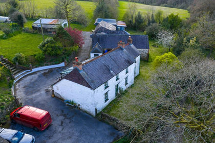
- Price
- Offers in Region of£725,000
- Size
- 15.67 acres
Penbontbren, Login, Whitland, SA34, Whitland, Carmarthenshire SA34 Wales
Added on 18/04/2026Smallholding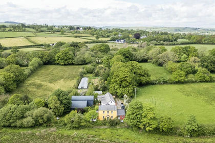
- Price
- Guide Price£745,000
- Size
- 42 acres
St Clears CARMARTHENSHIRE, St. Clears, Carmarthenshire SA33 Wales
Added on 23/05/2026Farmhouse