
The Coach House
- Land size
- 7.8 acres
- Bedrooms
- 4
- Bathrooms
- 2
Key Features
- FEATURE RECEPTION HALL
- SITTING ROOM
- KITCHEN/DINER & UTILITY
- STUDY/BEDROOM 4
- 3/4 DOUBLE BEDROOMS
- 2 BATHROOMS/WCS & 3RD WC
- FORMER STABLES/SHED & YARD/AMPLE PARKING
- GARDENS & ORCHARD + AGRICULTURAL LAND
Description
NO CHAIN
AN IMPOSING AND TASTEFULLY CONVERTED EARLY 19TH CENTURY COACH HOUSE WITH APPROX 7.8 ACRES IN A DELIGHTFUL RURAL BUT NOT REMOTE SETTING.
GENERAL
The Coach House stands proudly in a south-facing position within the beautiful Pembrokeshire countryside. It is under a mile from Lamphey which has an excellent range of amenities and under two miles from the centre of historic Pembroke with its well known 12th Century Castle etc. The sandy beach at Freshwater East is less than three miles.
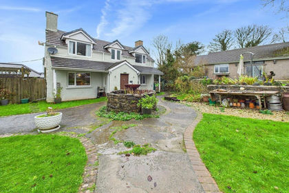
The Coach House (also known as North Down Coach House) is a historic Grade II Listed Building and has several character features including ashlar quoins and an elliptical arched entrance etc. The Residential Smallholding would be ideal for a family - possibly one with an interest in horses.
There is ample space for someone wishing to run a business from home and the Coachmans Cottage has development possibilities. The Land is south-facing and Callan Dyke (part of Pembroke River) forms the south boundary.
With approximate dimensions, the accommodation briefly comprises ...
GROUND FLOOR
Approx 10 ft (3.05m) high ceilings.
Hall 7.19m (23'7") x 4.57m (15'0")
23'7" x 15' (7.19m x 4.57m) max, access via arched double entrance doors, feature ash staircase, Travertine flooring, access to ...
Cloakroom/WC
Suite comprising wash hand basin and WC.
Sitting Room
17'9" x 16'4" (5.41m x 4.98m) an impressive double aspect room with south-facing window and stable door to front plus another window to rear, featuring brick fireplace with multi-fuel burner, arched brick recesses/niches. Approx 10 ft (3.05m) high ceilings.
Kitchen/Diner
20'3" x 16'3" (6.17m x 4.95m) dual aspect with south-facing window and stable door to front plus a second window to rear, attractive range of units having granite work tops - most of which are free standing and consequently movable, Belfast sink, feature electric Rangemaster cooking range, integrated dishwasher, Travertine flooring, featuring arched brick recesses/niche, door to ...
Utility Room
12'10" x 6'8" (3.91m x 2.03m) part glazed door to rear, stainless steel sink, wall cupboards, plumbing for washing machine, hot water storage etc.
Bedroom 4/Study
11'2" x 11' (3.40m x 3.35m) rear window.
Galleried Landing
20'6" x 17' (6.25m x 5.18m) overlooking the Hall and having ash balustrade, featuring circular/porthole window plus exposed A frames, shelved cupboard.
Master Suite
Access via both Dressing Room and Bathroom/WC to ...
Bedroom 1
16'7" x 13'5" (5.05m x 4.09m) south facing with extensive rural views, plus part glazed door to side, external steps leading down to Garden, exposed "A" frames.
Dressing Room
10'10" x 6'9" (3.30m x 2.06m) skylight to rear.
Bathroom/WC
10'11" x 10' (3.33m x 3.05m) a "Jack and Jill" arrangement with doors to both the Landing and Bedroom 1, attractive four piece suite comprising free standing bath, separate shower, wash hand basin and WC, part tiled, feature radiator, south facing window.
Bedroom 2
17'5" x 10'8" (5.31m x 3.25m) two south-facing windows with countryside views, exposed "A" frame, access to ...
En-suite Shower Room/WC & Dressing Area
13'6" x 5' (4.11m x 1.52m) overall, incorporating shower cubicle, wash hand basing and WC, fully tiled.
Bedroom 3
12'8" x 11'5" (3.86m x 3.48m) skylight to rear, exposed "A" frame.
OUTSIDE
Driveway provides access to a sizeable concrete parking area/hardstanding which has the capacity for several vehicles together with a boat and/or a caravan etc. To the front of the Coach House is a full width gravelled sun trap patio with rural views. The Rear Gardens incorporate lawns, fruit trees and vegetable/cultivation beds, hen enclosure and small animal Paddock with Shelter etc.
The Outbuildings include the remains of a Former Coachman's Cottage which is incorporated into an approx 720 sq ft (67 sq metres) newly roofed/covred Barn, a Barn/Stables approx 35' x 18'11" (10.67m x 5.77m), Field Stables approx 20'6" x 18' (6.25m x 5.49m) together with several other smaller but useful Sheds and Stores etc. Some of these Outbuildings have power and light.
The Land is "L" shaped. In all it extends to approx 7.5 Acres and comprises several Paddocks/Fields. It generally slopes gently southwards and is laid to pasture. The Land has frontage of around 1000 ft (305 metres) to Callans Dyke (part of Pembroke River).
SERVICES Etc
Mains water and electricity. Private drainage - septic tank(s). External oil fired Worcester boiler- radiators throughout. A previously used heat pump installation consisting of ground floor underfloor heating and a solar fence remains in situ and could be reactivated by installing a new heat pump - details to be confirmed.
TENURE
We understand that this is Freehold.
DIRECTIONS
From Pembroke proceed eastwards along the A4139. Before reaching the village of Lamphey, take the last turning on the left hand side into Sixth Lane. The Coach House will be found after about half a mile or so on the right hand side.
Map Location
Property details
- Tenure
- Freehold
- Council Tax Band
- Ask Agent
- Date Posted
- 2026-06-24
Market Value Analysis
Compared with 366 Homes with Land listings in Wales (5+ acres).
Utilities & Restrictions
Utilities
- Electricity
- Ask Agent
- Water
- Ask Agent
- Heating
- Ask Agent
- Broadband
- Ask Agent
- Sewerage
- Ask Agent
Rights & Restrictions
- Public Rights of Way
- Ask Agent
- Private Rights of Way
- Ask Agent
- Listed Property
- Ask Agent
- Restrictions
- Ask Agent
Listed status, conservation areas and planning constraints for this location are in the full report.
Property Features
- Accessibility
- Ask Agent
- Parking
- Parking Available
- Garden
- Private Garden
Beyond the particulars: planning activity, flood history, heritage and ground risks, checked for this exact spot.
Connectivity
Broadband
Fastest speed available at this postcode
1.8 Gbps
Gigabit full fibre
Suitable for
- 4K streaming on every screen
- Full-time home working
- Online gaming & big downloads
Mobile signal
Predicted 4G and 5G signal; indoor signal depends on building materials.
Ofcom Connected Nations postcode-level predictions. Speeds and signal are modelled, not measured, and vary between addresses and providers.
Signal is the easy part. Planning activity, flood history and protected designations here are in the full report.
Nearest Schools
Primary
- Lamphey CP School0.9 miles
- Pupils
- 181
- Type
- Nursery, Infants & Juniors
- Language
- English medium school / provision
- Golden Grove CP School1.1 miles
- Pupils
- 261
- Type
- Nursery, Infants & Juniors
- Language
- English medium school / provision
- Cosheston VC School1.5 miles
- Pupils
- 63
- Type
- Nursery, Infants & Juniors
- Language
- English medium school / provision
- Monkton Priory Community Primary School1.8 miles
- Pupils
- 200
- Type
- Nursery, Infants & Juniors
- Language
- English medium school / provision
- Ysgol Bro Penfro1.9 miles
- Pupils
- 149
- Type
- Nursery, Infants & Juniors
- Language
- Welsh medium school / provision (including transitional)
Secondary
- Ysgol Harri Tudur / Henry Tudor School1.8 miles
- Pupils
- 1,152
- Type
- Secondary (ages 11-19)
- Language
- English medium school / provision
- Milford Haven School6.9 miles
- Pupils
- 1,045
- Type
- Secondary (ages 11-16)
- Language
- English medium school / provision
- Ysgol Greenhill School7.4 miles
- Pupils
- 877
- Type
- Secondary (ages 11-19)
- Language
- English medium school / provision
- Haverfordwest High VC School9.4 miles
- Pupils
- 1,699
- Type
- Secondary (ages 11-19)
- Language
- English medium school / provision
- Ysgol Caer Elen10 miles
- Pupils
- 907
- Type
- Middle (ages 3-16)
- Language
- Welsh medium school / provision (including transitional)
Distances are straight-line from the advertised location. Source: the national school registers (DfE, Welsh Government, Scottish Government) and Ofsted.
Schools are just the start: sold prices nearby, planning activity and any flood history are in the full report.
Amenities
Supermarket
GP surgery
Pharmacy
Green space
Straight-line distances from the advertised location. Sources: NHS records, Geolytix supermarket locations, OS Open Greenspace and the national trails registers.
The area stacks up? Now check the location itself: planning nearby, protected designations and past flooding.
Getting Around
Nearest station
Nearest bus stop
Typical drive times
Straight-line distances from the advertised location; drive times are typical free-flow times over OpenStreetMap road data, so allow more at peak. Public transport locations from DfT NaPTAN.
Easy to reach matters. So do planning activity, flood history and ground risks: all in the full report.
Flood Risk
Natural Resources Wales open data, checked around the advertised map pin for the listed acreage. Long-term risk counts flood defences; the planning map's flood zones do not. Provided by LandSale, not the listing agent, and not part of the agent's particulars. Risk varies across a holding, so verify before committing.
Rivers and the sea
Not at the pin: mapped about 30 metres away.
Planning map: Flood Zone 3, about 20 metres away.
Surface water
These bandings are the summary. Where this location sits on the flood maps, plus planning activity, heritage and ground risks, is in the full report.
Important notice: Information, maps and tags on this page are drawn from the advertising agent's marketing materials or generated automatically. LandSale has not verified them. Relying on these details is at your own risk, always carry out independent checks before committing to a purchase.
LandSale full disclaimer
Marketing information only - not formal particulars. The details on this website are provided for general guidance and do not constitute an offer or contract. Neither LandSale nor the advertising estate/land agent accepts responsibility for any inaccuracy.
1. Source of information
- Listing content: Core description, asking price, tenure, measurements, photographs and planning history originate from the marketing materials of the advertising estate or land agent. LandSale does not author this content and cannot guarantee its accuracy.
- Automated tags & categorisation: Property type, land-use class, acreage bands and similar labels may be applied by machine-learning models. They are intended as a helpful guide only and may not reflect the property's legal status or permitted use.
- Third-party & enriched data layers: Maps, boundary outlines, planning designations, soil reports, broadband coverage and other environmental or location-based insights are licensed from external suppliers. Such data are supplied “as is", may be incomplete or out of date and are subject to change without notice.
2. Verification required
Prospective purchasers must verify critical matters, including but not limited to planning permission, title boundaries, public rights of way, environmental constraints, acreage, services, access and VAT status, through their own inspections, specialist surveys, legal advisers and the selling agent before relying on the information or entering into any contract.
3. No warranty or liability
LandSale gives no warranty, express or implied, as to the accuracy, completeness or fitness for any particular purpose of the information displayed. LandSale shall not be liable for any loss, damage, cost or expense arising directly or indirectly from any use of or reliance on such information, save where liability may not be excluded by law.
4. Updates & feedback
If you believe any detail on this listing is inaccurate, please let us know. We will investigate and, where appropriate, update the listing or notify the agent.
© LandSale | Version 1.3 - August 2026
Listing agent
Guy Thomas & Co, Pembroke
33 Main Street, Pembroke, Pembrokeshire, SA71 4JS
View agent profileSimilar properties for sale
- Price
- Offers in Excess of£700,000
- Size
- 3 acres
Lamphey, Pembroke, SA71, Cosheston, Pembrokeshire SA71 Wales
Added on 29/01/2026House with Land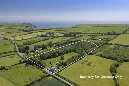
- Price
- £650,000
- Size
- 6 acres
Jameston, Tenby, Pembrokeshire, SA70, Manorbier, Pembrokeshire SA70 Wales
Added on 29/05/2026Farmhouse
- Price
- £560,000
- Size
- 6.5 acres
Leonardston Road, Llanstadwell, Milford Haven, Llanstadwell, Pembrokeshire SA73 Wales
Added on 28/01/2026House with Land
- Price
- £745,000
- Size
- 3.5 acres
Leonardston Road, Llanstadwell, SA73, Milford Haven, Pembrokeshire SA73 Wales
Added on 30/08/2026House with Land
- Price
- Offers in Region of£725,000
- Size
- 6.5 acres
Added on 06/07/2026Estate
- Price
- Offers in Region of£720,000
- Size
- 15 acres
Landshipping, Narberth, SA67, Martletwy, Pembrokeshire SA67 Wales
Added on 29/01/2026Smallholding
- Price
- Offers in Region of£750,000
- Size
- 5.73 acres
Woodhouse, Landshipping, Near Narberth, Narberth, Martletwy, Pembrokeshire SA67 Wales
Added on 12/08/2026House with Land
- Price
- Offers Over£650,000
- Size
- 3 acres
East Williamston, Tenby, SA70, East Williamston, Pembrokeshire SA70 Wales
Added on 27/08/2026House with Land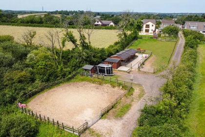
- Price
- Offers in Region of£625,000
- Size
- 3 acres
Cold Inn, Kilgetty, SA68, East Williamston, Pembrokeshire SA68 Wales
Added on 25/06/2026Equestrian property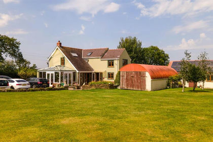
- Price
- Offers in Excess of£700,000
- Size
- 8 acres
Begelly, Kilgetty, Kilgetty/Begelly, Pembrokeshire SA68 Wales
Added on 29/01/2026House with Land