Penbontbren, Login, Whitland, SA34
- Land size
- 15.67 acres
- Dwelling size
- 1335 sqft
- Bedrooms
- 4
- Bathrooms
- 3
Key Features
- Smallholding
- Land
- Grade two listed
- Equestrian
- Pond
- Outbuildings
- Character
- Multi generational living
- Home Office / Studio - Annexe Potential
Description
Set within approximately 15.67 acres of enchanting Carmarthenshire countryside, Penbontbren is a place where history, nature and quiet magic intertwine. Approached via a driveway that gently weaves through the landscape, the sense of arrival is both peaceful and evocative, hinting at the story that unfolds beyond. A public footpath runs only along the initial driveway approach and does not cross the land itself, ensuring the privacy and seclusion of the property are beautifully preserved.
Dating back to 1838 and Grade II listed (with the listing applied to the main house in 2001), the farmhouse is rich in original character. Inside, the home feels warm, grounded and deeply connected to its heritage, with exposed beams, traditional sash windows, and a layout that reflects its evolution over time. There are four bedrooms, including one that leads from another, creating a slightly whimsical, cottage-like flow, alongside two reception rooms, one bathroom, and two WCs. The living room centres around a wood-burning stove, while a second stove in bedroom four adds a sense of comfort and retreat. At the heart of the home, a traditional Rayburn, which has been regularly serviced, not only serves a practical purpose but anchors the kitchen in timeless country living.
Beyond the house, the land unfolds in layers, each with its own character and potential. The gardens are beautifully varied, from more formal spaces to a separate three-acre field, and on to a further, more natural garden area where a stream winds its way past two ponds, creating a haven for wildlife. In total, the grounds extend to 15.67 acres, dotted with mature and specimen trees that lend both structure and seasonal beauty. For those seeking a more self-sufficient lifestyle, there are polytunnels to the front and rear, a greenhouse, and even a charming grapevine.
The outbuildings add another dimension to the property’s appeal. There are two stables and a tack room, all with electricity, along with five additional outbuildings—again, mostly with power—offering flexibility for equestrian use, workshops, or creative pursuits. Tucked within the landscape is a particularly special addition: a two-bedroom cabin, crafted with care and imagination by the current owners and benefitting from full planning permission. With its log burner and balcony overlooking the Preseli Hills, it feels like a private retreat, perfectly positioned to take in the far-reaching views.
The setting itself is steeped in history and folklore. A short woodland walk leads to Gwal-y-Filiast (Bwrdd Arthur), a mysterious Neolithic chambered tomb, long associated with the legend of King Arthur and said to mark the resting place of his faithful greyhound. It is this sense of ancient landscape and story that makes Penbontbren feel so unique—deeply rooted, yet full of possibility.
Whether envisioned as a family home, a smallholding, or a lifestyle venture with income potential, Penbontbren offers something increasingly rare: space, history, and a tangible connection to the land, all wrapped in the quiet beauty of West Wales.
DISCLAIMER: Some images have been AI-generated to illustrate the potential of the cabin space. These images are clearly marked with the wording: “Fine & Country AI Generated”
Ground Floor
Entrance Hall
Living Room
Bathroom
Kitchen/Dining Area
Utility Room
Bedroom Four
First Floor
Landing
Master Bedroom
Bedroom Three
Bedroom Four
Main Outbuilding
Main Outbulding - Workshop One
Main Outbuilding - Workshop Two
Main Outbuilding - Room One
Main Outbuilding - Room Two
Outbuilding Room One
Outbuilding Room Two
Outbuilding Room Three
Map Location
Property details
- Tenure
- Freehold
- Council Tax Band
- Ask Agent
- Date Posted
- 2026-04-18
Market Value Analysis
Compared with 221 Farms & Smallholdings listings in Wales (10+ acres).
Utilities & Restrictions
Utilities
- Electricity
- Ask Agent
- Water
- Ask Agent
- Heating
- Ask Agent
- Broadband
- Ask Agent
- Sewerage
- Ask Agent
Rights & Restrictions
- Public Rights of Way
- Ask Agent
- Private Rights of Way
- Ask Agent
- Listed Property
- Ask Agent
- Restrictions
- Ask Agent
Listed status, conservation areas and planning constraints for this location are in the full report.
Property Features
- Accessibility
- Ask Agent
- Parking
- 9.04 x 5.95m (29'8" x 19'6")
- Garden
- Garden
Beyond the particulars: planning activity, flood history, heritage and ground risks, checked for this exact spot.
Connectivity
Broadband
Fastest speed available at this postcode
18 Mbps
Standard (10-30 Mbps)
Suitable for
- Web & social
- Music streaming
- Standard video calls
Fixed wireless access may also be an option here.
Mobile signal
Predicted 4G and 5G signal; indoor signal depends on building materials.
Ofcom Connected Nations postcode-level predictions. Speeds and signal are modelled, not measured, and vary between addresses and providers.
Signal is the easy part. Planning activity, flood history and protected designations here are in the full report.
Nearest Schools
Primary
- Beca2.6 miles
- Pupils
- 46
- Type
- Infants & Juniors
- Language
- Welsh medium school / provision (including transitional)
- Bro Brynach2.9 miles
- Pupils
- 90
- Type
- Nursery, Infants & Juniors
- Language
- Welsh medium school / provision (including transitional)
- Ysgol Gymunedol Brynconin4.5 miles
- Pupils
- 71
- Type
- Nursery, Infants & Juniors
- Language
- Welsh medium school / provision (including transitional)
- Ysgol Bro Preseli4.7 miles
- Pupils
- 932
- Type
- Middle (ages 3-19)
- Language
- Welsh medium school / provision (including transitional)
- Ysgol Clydau5.6 miles
- Pupils
- 35
- Type
- Infants & Juniors
- Language
- Welsh medium school / provision (including transitional)
Secondary
- Ysgol Bro Preseli4.7 miles
- Pupils
- 932
- Type
- Middle (ages 3-19)
- Language
- Welsh medium school / provision (including transitional)
- Dyffryn Taf5.7 miles
- Pupils
- 890
- Type
- Secondary (ages 11-19)
- Language
- Dual language school / provision (Welsh and English) (including transitional)
- Ysgol Gyfun Emlyn12 miles
- Pupils
- 502
- Type
- Secondary (ages 11-19)
- Language
- Dual language school / provision (Welsh and English) (including transitional)
- Ysgol Uwchradd Aberteifi13 miles
- Pupils
- 614
- Type
- Secondary (ages 11-19)
- Language
- Welsh medium school / provision (including transitional)
- Ysgol Caer Elen14 miles
- Pupils
- 907
- Type
- Middle (ages 3-16)
- Language
- Welsh medium school / provision (including transitional)
Distances are straight-line from the advertised location. Source: the national school registers (DfE, Welsh Government, Scottish Government) and Ofsted.
Schools are just the start: sold prices nearby, planning activity and any flood history are in the full report.
Amenities
Supermarket
GP surgery
Pharmacy
Green space
Straight-line distances from the advertised location. Sources: NHS records, Geolytix supermarket locations, OS Open Greenspace and the national trails registers.
The area stacks up? Now check the location itself: planning nearby, protected designations and past flooding.
Getting Around
Nearest station
Nearest bus stop
Typical drive times
Straight-line distances from the advertised location; drive times are typical free-flow times over OpenStreetMap road data, so allow more at peak. Public transport locations from DfT NaPTAN.
Easy to reach matters. So do planning activity, flood history and ground risks: all in the full report.
Flood Risk
Natural Resources Wales open data, checked around the advertised map pin for the listed acreage. Long-term risk counts flood defences; the planning map's flood zones do not. Provided by LandSale, not the listing agent, and not part of the agent's particulars. Risk varies across a holding, so verify before committing.
Rivers and the sea
Planning map: Flood Zone 1.
Surface water
Not at the pin: mapped about 110 metres away.
These bandings are the summary. Where this location sits on the flood maps, plus planning activity, heritage and ground risks, is in the full report.
Important notice: Information, maps and tags on this page are drawn from the advertising agent's marketing materials or generated automatically. LandSale has not verified them. Relying on these details is at your own risk, always carry out independent checks before committing to a purchase.
LandSale full disclaimer
Marketing information only - not formal particulars. The details on this website are provided for general guidance and do not constitute an offer or contract. Neither LandSale nor the advertising estate/land agent accepts responsibility for any inaccuracy.
1. Source of information
- Listing content: Core description, asking price, tenure, measurements, photographs and planning history originate from the marketing materials of the advertising estate or land agent. LandSale does not author this content and cannot guarantee its accuracy.
- Automated tags & categorisation: Property type, land-use class, acreage bands and similar labels may be applied by machine-learning models. They are intended as a helpful guide only and may not reflect the property's legal status or permitted use.
- Third-party & enriched data layers: Maps, boundary outlines, planning designations, soil reports, broadband coverage and other environmental or location-based insights are licensed from external suppliers. Such data are supplied “as is", may be incomplete or out of date and are subject to change without notice.
2. Verification required
Prospective purchasers must verify critical matters, including but not limited to planning permission, title boundaries, public rights of way, environmental constraints, acreage, services, access and VAT status, through their own inspections, specialist surveys, legal advisers and the selling agent before relying on the information or entering into any contract.
3. No warranty or liability
LandSale gives no warranty, express or implied, as to the accuracy, completeness or fitness for any particular purpose of the information displayed. LandSale shall not be liable for any loss, damage, cost or expense arising directly or indirectly from any use of or reliance on such information, save where liability may not be excluded by law.
4. Updates & feedback
If you believe any detail on this listing is inaccurate, please let us know. We will investigate and, where appropriate, update the listing or notify the agent.
© LandSale | Version 1.3 - August 2026

Listing agent
Fine and Country West Wales, Aberystwyth
Second Floor Suites 8 Great Darkgate Street Aberystwyth, SY23 1DE
Contact Fine and Country West Wales, Aberystwyth
Second Floor Suites 8 Great Darkgate Street Aberystwyth, SY23 1DE
View agent profileSimilar properties for sale
- Price
- £800,000
- Size
- 9 acres
Mynachlogddu, Clynderwen, SA66, Mynachlog-Ddu, Pembrokeshire SA66 Wales
Added on 29/01/2026Smallholding
- Price
- Offers in Region of£795,000
- Size
- 20 acres
Llandissilio, Clynderwen, SA66, Clynderwen, Pembrokeshire SA66 Wales
Added on 20/05/2026Smallholding
- Price
- £575,000
- Size
- 13 acres
Blaenwaun, Whitland, SA34, Llanwinio, Carmarthenshire SA34 Wales
Added on 11/04/2026Smallholding
- Price
- Offers in Region of£695,000
- Size
- 28 acres
Llanycefn, Clynderwen, SA66, Maenclochog, Pembrokeshire SA66 Wales
Added on 05/06/2026Smallholding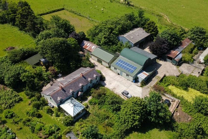
- Price
- Guide Price£795,000
- Size
- 30.59 acres
Ty Canol, Rhosfach, Clunderwen, Mynachlog-Ddu, Pembrokeshire SA66 Wales
Added on 16/07/2026Smallholding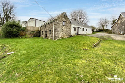
- Price
- Offers in Excess of£575,000
- Size
- 22.68 acres
Llanycefn, Clynderwen, Maenclochog, Pembrokeshire SA66 Wales
Added on 05/03/2026Barn Conversion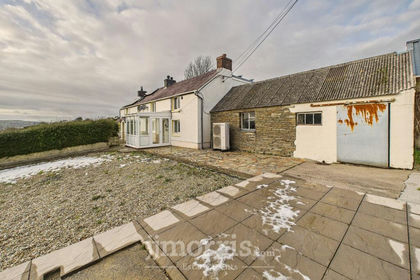
- Price
- Guide Price£730,000
- Size
- 11 acres
Added on 13/06/2026Smallholding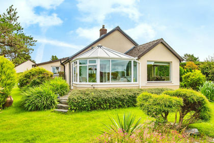
- Price
- Offers in Region of£900,000
- Size
- 47 acres
Tegryn, Llanfyrnach CARDIGAN SA35, Clydau, Pembrokeshire SA35 Wales
Added on 29/01/2026Smallholding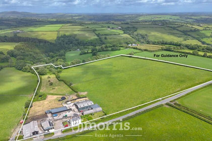
- Price
- £650,000
- Size
- 16 acres
Maenclochog, Clynderwen, SA66, Maenclochog, Pembrokeshire SA66 Wales
Added on 04/07/2026Smallholding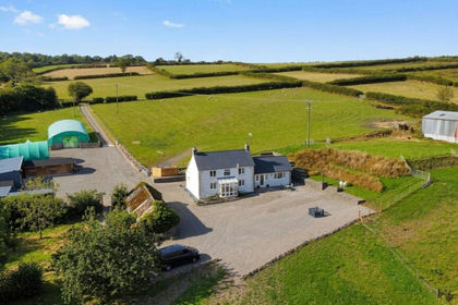
- Price
- Offers in Region of£799,950
- Size
- 18.67 acres
Llanycefn, Clynderwen, SA66, Maenclochog, Pembrokeshire SA66 Wales
Added on 11/09/2026Smallholding